
First look: How 2019's Atlantic hurricane season is brewing

Researchers at Colorado State University foresee a below-average season
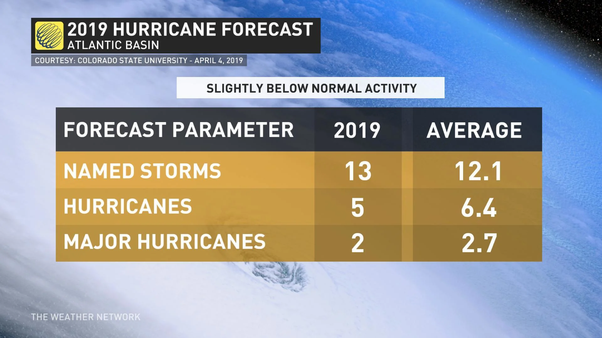
The 2019 Atlantic hurricane season will be slightly below average, according to a report published April 4th by hurricane researchers at Colorado State University (CSU).
The tropical meteorology team announced the main factor hampering the coming season's activity will be a weak El Niño (the warming of waters in the central and eastern tropical Pacific), which is expected to linger throughout most of the summer months.
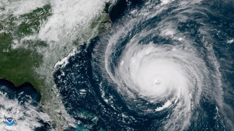
Image: Hurricane Florence/NASA
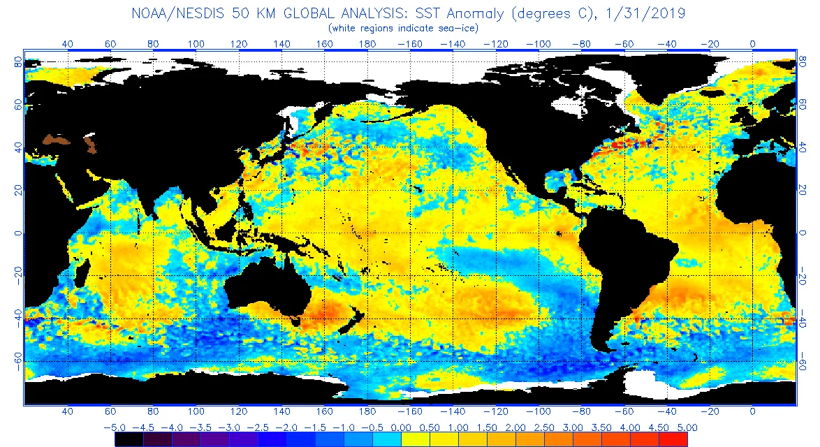
Looking at the tropical Atlantic waters, where tropical cyclones usually develop and intensify into powerful hurricanes, sea surface temperatures (SST) are currently slightly cooler than the normal values.
With colder-than-average surface water temperatures in the region, cyclones have less energy for formation and gradual intensification. The cooler waters also mean a more stable and dry environment capable of suppressing the development of organized thunderstorms which initiate cyclone development.
READ MORE: After deadly Hurricane Maria, an ancient tree blooms again
The second half of 2018 and the early months of 2019 have been influenced by a weak El Niño in the equatorial tropical Pacific, although it is expected to gradually weaken as we move into summer.
Despite the weaker El Niño, CSU predicts that the presence of warmer than usual equatorial Pacific waters will still influence how active the Atlantic hurricane season turns out to be. Every El Niño episode can be different, varying in terms of how it impacts the tropics, but this Atlantic hurricane season will most likely be marked by above-average days of strong upper-level westerly winds and stronger lower-level easterly trade winds.
This dynamic atmospheric setup will increase vertical wind shear (the change in wind direction and speed with height in the atmosphere) and suppress thunderstorm development, which will also be influenced negatively by a more stable atmosphere, as sinking motion is amplified across the region.
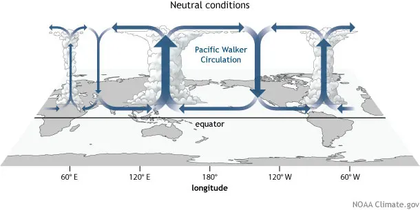
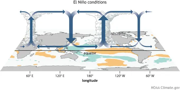
Images: NOAA
With these ocean-atmosphere conditions in mind, the CSU forecast calls for 13 named storms during the Atlantic Hurricane season, which runs from June 1 to November 30. They also predict five of those will become hurricanes, and two will reach at least category 3 on the Saffir-Simpson scale.
The team bases its forecasts on a statistical model, as well as a new model that uses a combination of statistical information and forecasts from a dynamical model. Both of these models are built on about 40 years of historical data and evaluating conditions including: Atlantic sea surface temperatures, sea level pressures, vertical wind shear levels, El Niño, and other factors.
According to lead scientist Phil Klotzbach, this upcoming season shares some characteristics with the 1969, 1987, 1991, 2002 and 2009 seasons. Klotzbach also expects hurricane activity to be 75 per cent of the average season, while in 2018, hurricane activity was up to 120 percent of the average season.
The report (which you can access here) also includes information on the probability of major hurricanes making landfall along the entire U.S. coastline.
This year, the probability of that occurring is 48 per cent, down from the average for the last century which is 52 per cent.
Below are all the numbers for the 2019 Atlantic Hurricane season (figures in brackets are the 1981-2010 average):
Named storms: 13 (12.1)
Named storm days: 50 (59.4)
Hurricanes: 5 (6.4)
Hurricane days: 16 (24.2)
Major Hurricanes: 2 (2.7)
Major hurricane days: 4 (6.2)
Accumulated cyclone energy: 80 (106)
Net tropical cyclone activity: 90 (116 per cent)