Trouble may lurk beyond hurricane season’s very quiet start

We’ve gotten off easy with a slow start to the hurricane season, but there’s a long way to go before the coasts are clear
A remarkably quiet Atlantic basin continues snoozing this week as the busiest stretch of hurricane season rapidly approaches.
The statistics behind the exceptionally slow start to the year are downright impressive, and conditions remain unfavourable for much activity to kick off the peak of the season.
DON'T MISS: Destructive Atlantic hurricanes can still happen during El Niño
Three weak Atlantic storms so far this summer
Each month this summer has seen just one named storm.
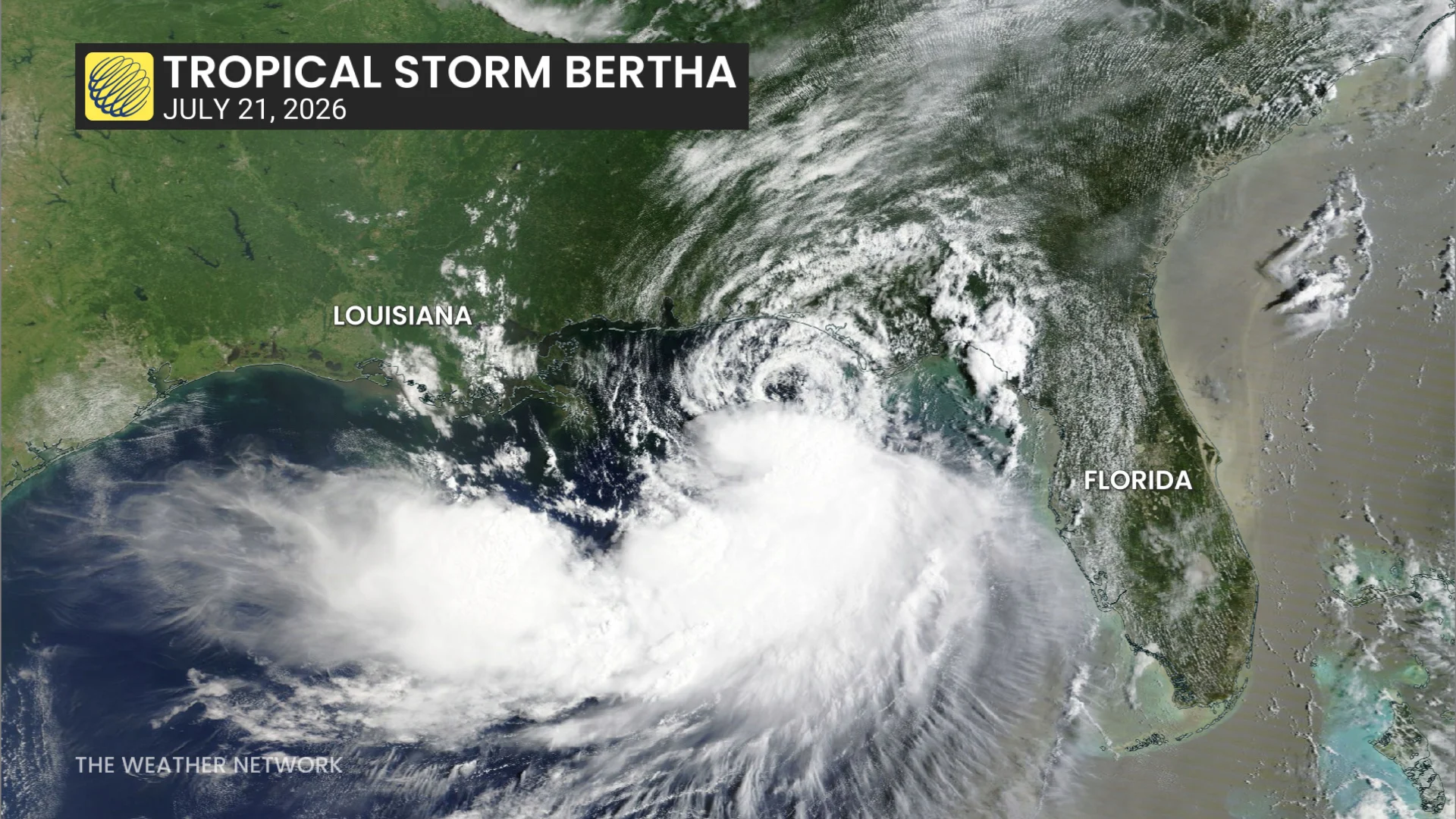
Tropical Storm Arthur formed in the Gulf of Mexico in the middle of June. Despite its weak winds and disheveled appearance, Arthur reportedly produced as much as 700+ mm of rain in parts of Louisiana.
Just over a month later, a lopsided Tropical Storm Bertha formed in the same general region and brought some wet and breezy conditions to the northern Gulf Coast.
Tropical Storm Cristobal formed from a tiny cluster of thunderstorms in a remote part of the northern Atlantic Ocean, surviving for exactly one day before dissipating.
Tropical activity running significantly behind normal
A normal Atlantic hurricane season typically produces four named storms by the middle of August. We’re not too far behind by that metric. But look under the hood and things are much different than they appear.
Forecasters use Accumulated Cyclone Energy (ACE) to gauge the intensity and longevity of each storm. A powerhouse like Hurricane Katrina earns a much higher ACE value than a 65 km/h tropical storm that only lasts 24 hours.
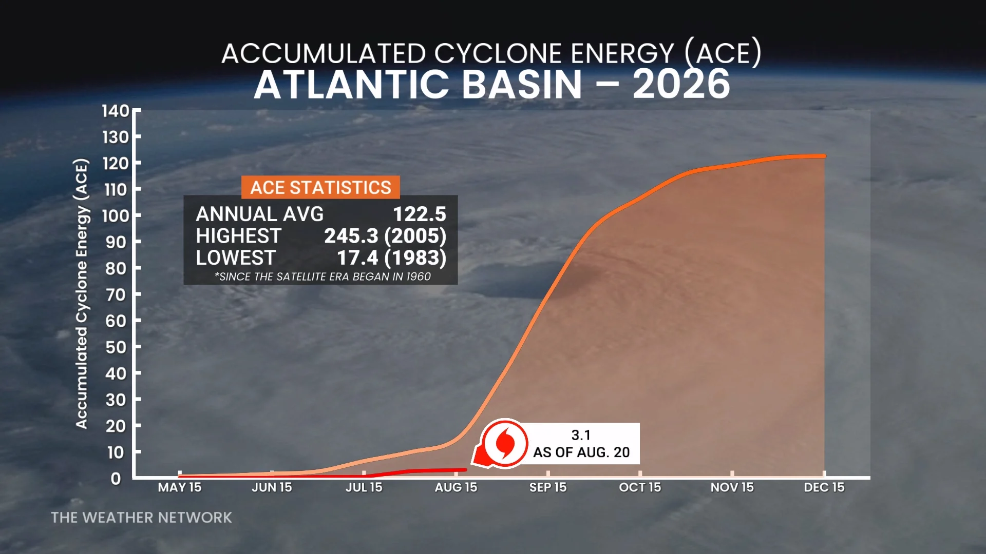
An Atlantic hurricane season as a whole typically produces an ACE value of 18.0 by Aug. 20, with that value rapidly increasing every day thereafter through the middle of September.
This season, though, our overall ACE value by Aug. 20 was 3.1, which is just 17 per cent of normal for this point in the year.
Many factors suppressing Atlantic hurricane season
Much of this year’s lack of tropical activity in the Atlantic is due to our growing El Niño in the neighbouring Pacific Ocean. This pattern leads to wind shear that disturbs and destroys budding tropical systems.
El Niño is just one piece of a larger puzzle.
RELATED: Latest El Niño forecast calls for historic heat by this autumn
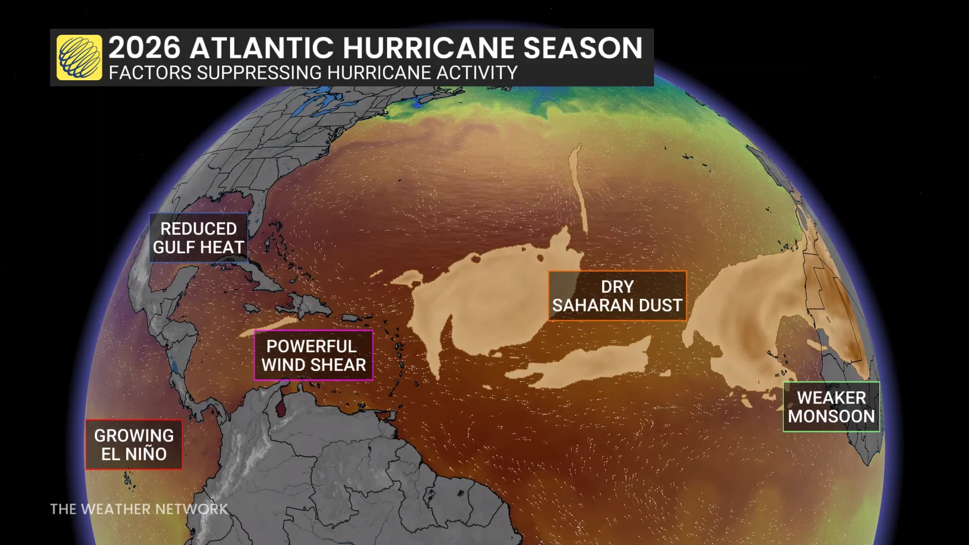
Fewer thunderstorms than normal are rolling off the African coast, which are typically the seeds from which tropical systems can develop. We’ve also seen continuous bouts of dry, dusty winds blowing off the Sahara Desert.
While sea surface temperatures are hovering near normal across most of the Atlantic Ocean, there’s a surprising lack of deep hot water across the Gulf of Mexico. Strong storms need a deep layer of warm water to sustain their intensity or else they’ll quickly churn up chilly waters and lose their strength.
What might be on the horizon?
An average Atlantic hurricane season produces 14 named storms, seven hurricanes, and three major hurricanes. Given the unfavourable conditions, forecasters entered this season calling for well below-average activity. But how quiet will it remain?
Despite the uphill battle they’ll face, we’re very likely going to see additional storms in the weeks and months ahead. Models suggest that some trouble may brew west of Africa during the final full week of August.
After all, no Atlantic hurricane season in the modern era has gone without at least one storm achieving hurricane status. And some of the slowest years have a history of producing some of the most memorable storms.
The quietest season in living memory saw just four named storms in 1983. One of those storms was Hurricane Alicia, which caused billions of dollars in damage when it slammed into Texas with 185 km/h winds.
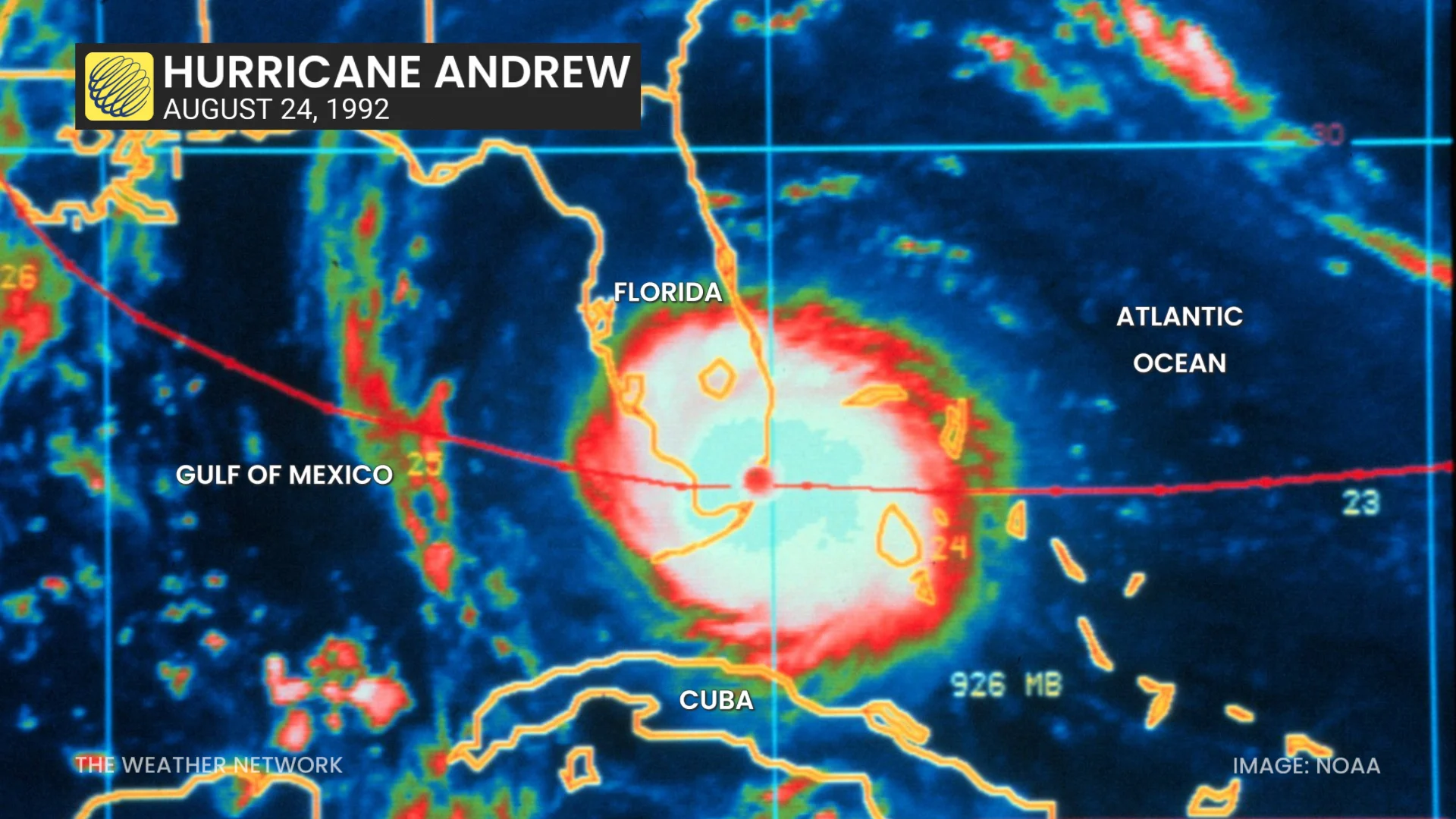
We didn’t see 1992’s first named storm until the end of August. That storm, Hurricane Andrew, remains a benchmark against which Florida residents measure all other hurricanes.
WATCH: How a hurricane can gather strength with frightening speed
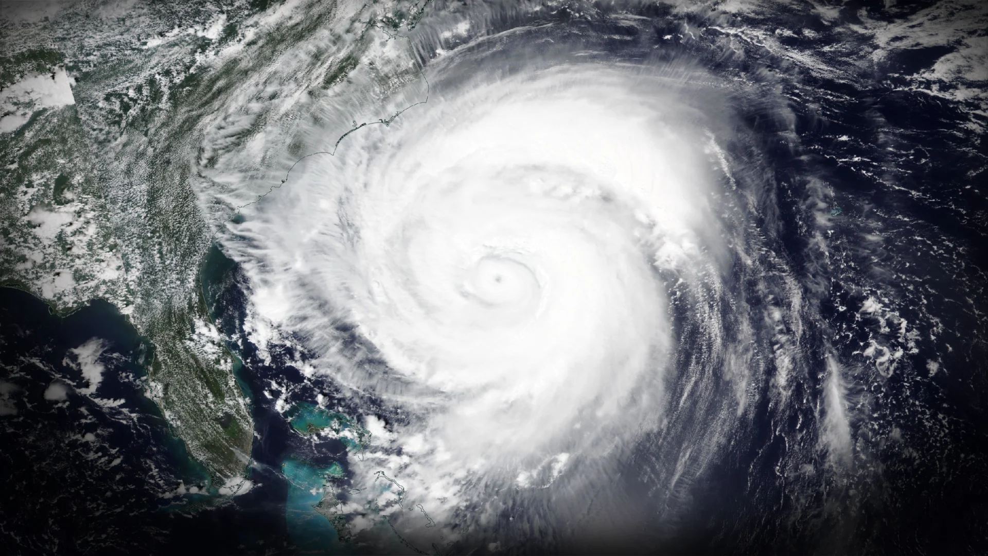
Header image of 2025's Hurricane Erin courtesy of NOAA/NASA.