Hurricane Trudy eyes Category 4 strength as Mexico braces for heavy rain

Trudy is gaining strength offshore, raising the risk of flooding and mudslides across parts of Mexico this weekend.
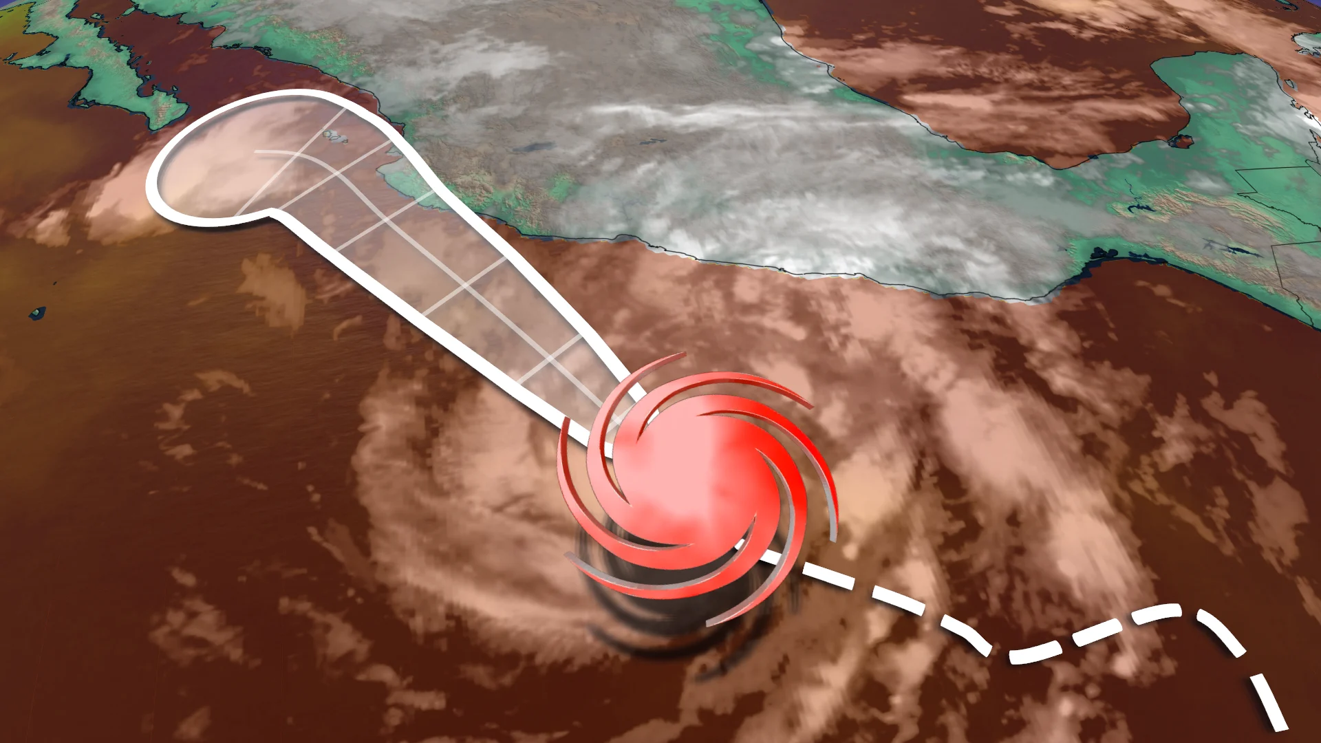
Hurricane Trudy intensified rapidly overnight, becoming a Category 3 hurricane off Mexico's Pacific coast, as the eastern Pacific hurricane season approaches a significant milestone.
Trudy is the tenth hurricane to form in the Eastern Pacific this year. It is also the first time since 2018 that the basin has seen ten major hurricanes, indicating an unusually active season.
The storm is expected to intensify further through Friday, possibly reaching Category 4 status as it churns offshore.
DON'T MISS: How the weather could be influencing your music taste
Trudy could strengthen before weakening near shore
Trudy is expected to maintain Category 4 strength through Saturday before gradually weakening as it approaches the coast. For the time being, a direct landfall is unlikely, as high pressure builds over Mexico, helping to steer the storm away from the coast.
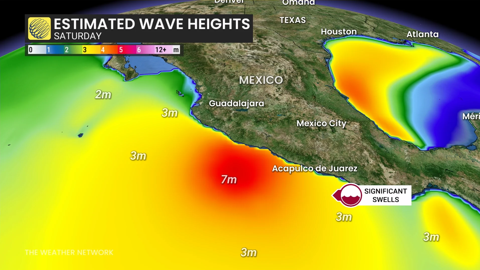
However, the forecast track may still bring severe weather to parts of southwestern and west-central Mexico. Even without a direct hit, a powerful hurricane passing close by can cause dangerous coastal conditions and torrential rains.
Trudy's longer-range movement could be similar to Hurricane Simon, which stalled offshore near the Baja California peninsula.
SEE ALSO: 5 astronomical events happening after we're gone
Flooding and mudslides possible this weekend
As Trudy moves further offshore, forecast rainfall totals have been reduced to between 100 and 150 millimeters. Despite the change, that amount of rain may still cause flooding and mudslides in vulnerable areas by the weekend.
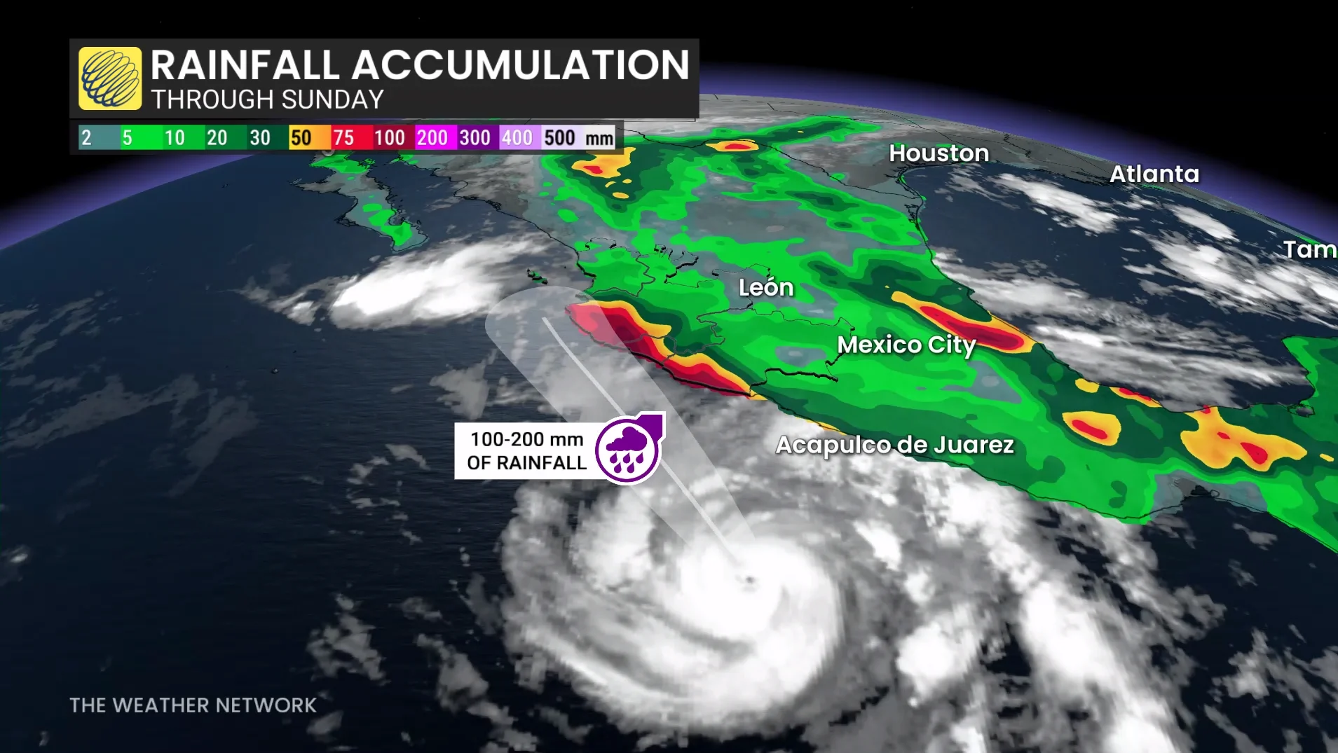
Damaging winds, storm surge, and heavy rainfall remain the most serious threats, particularly along the coast. The risk will be determined by Trudy's eventual track, intensity and proximity to land.
Hurricane and tropical storm warnings are in effect for parts of the Mexican coast and residents should monitor local forecasts and follow emergency officials' instructions.
Stay with The Weather Network for the latest updates