Ontario weekend weather: Saturday storms and a cool, fall-like Sunday

Thunderstorm potential creeps into southern Ontario for the weekend, with temperatures cooling on Sunday
Southern Ontario starts the weekend with late summer conditions, featuring mostly sunny skies and temperatures in the mid to upper 20s.
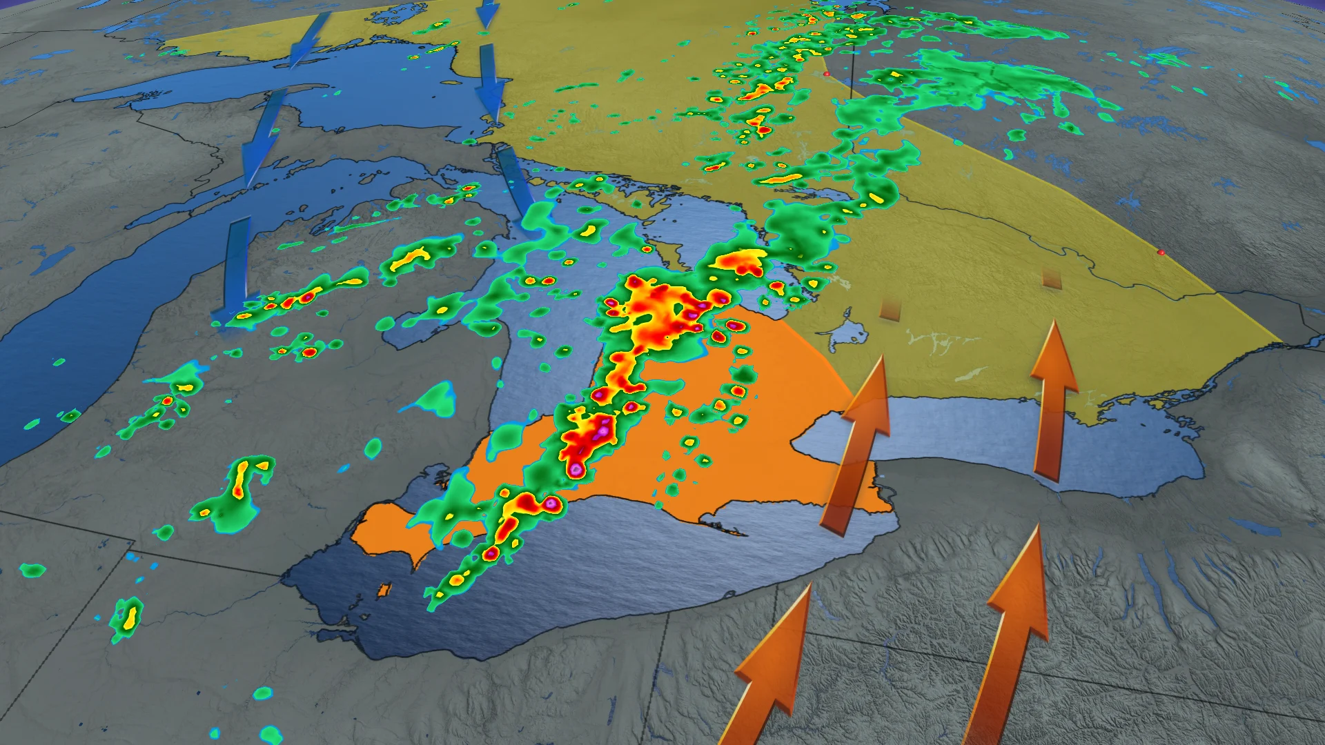
Showers and thunderstorms are expected to move west to east across the region on Saturday, however, with multiple storm lines expected to track from James Bay to Lake Erie.
DON'T MISS: How a strong El Niño could shape Ontario's fall weather
Be sure to stay alert to the changing conditions, and monitor any weather warnings or alerts in your area.
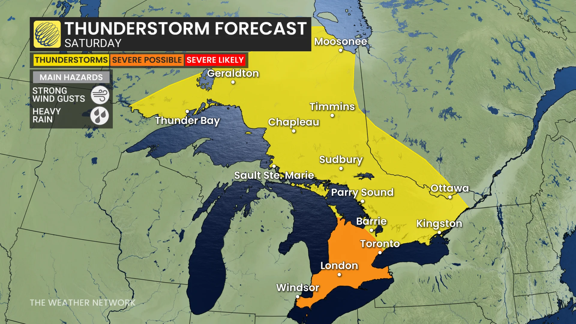
Saturday's thunderstorm risk could interrupt outdoor plans
Southwestern Ontario will be the primary focus, with rounds of thunderstorms developing from late morning into the evening on Saturday.
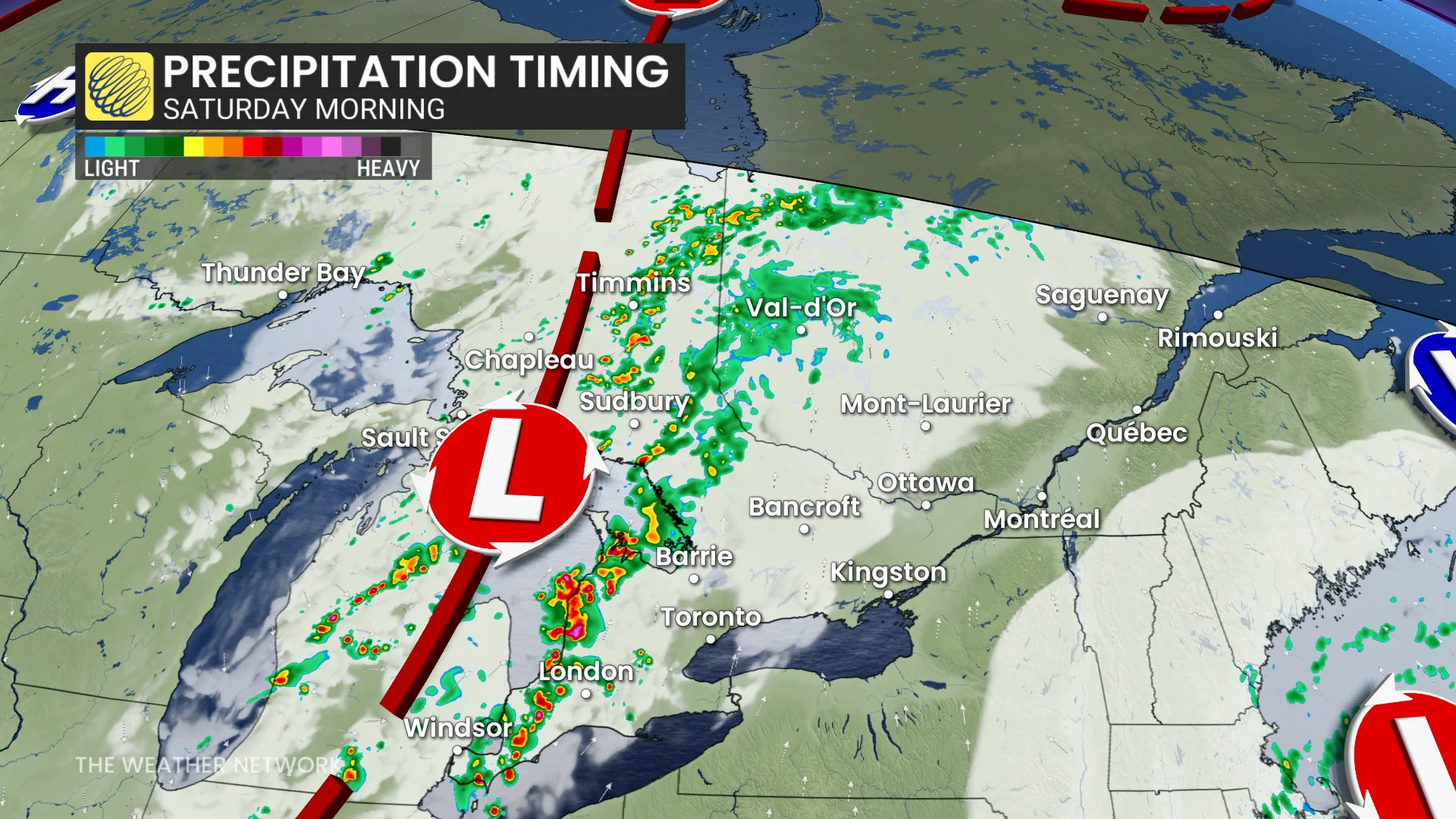
Areas east of the Greater Toronto Area (GTA) are likely to experience quieter conditions, with isolated thunderstorms more probable in the afternoon and evening.
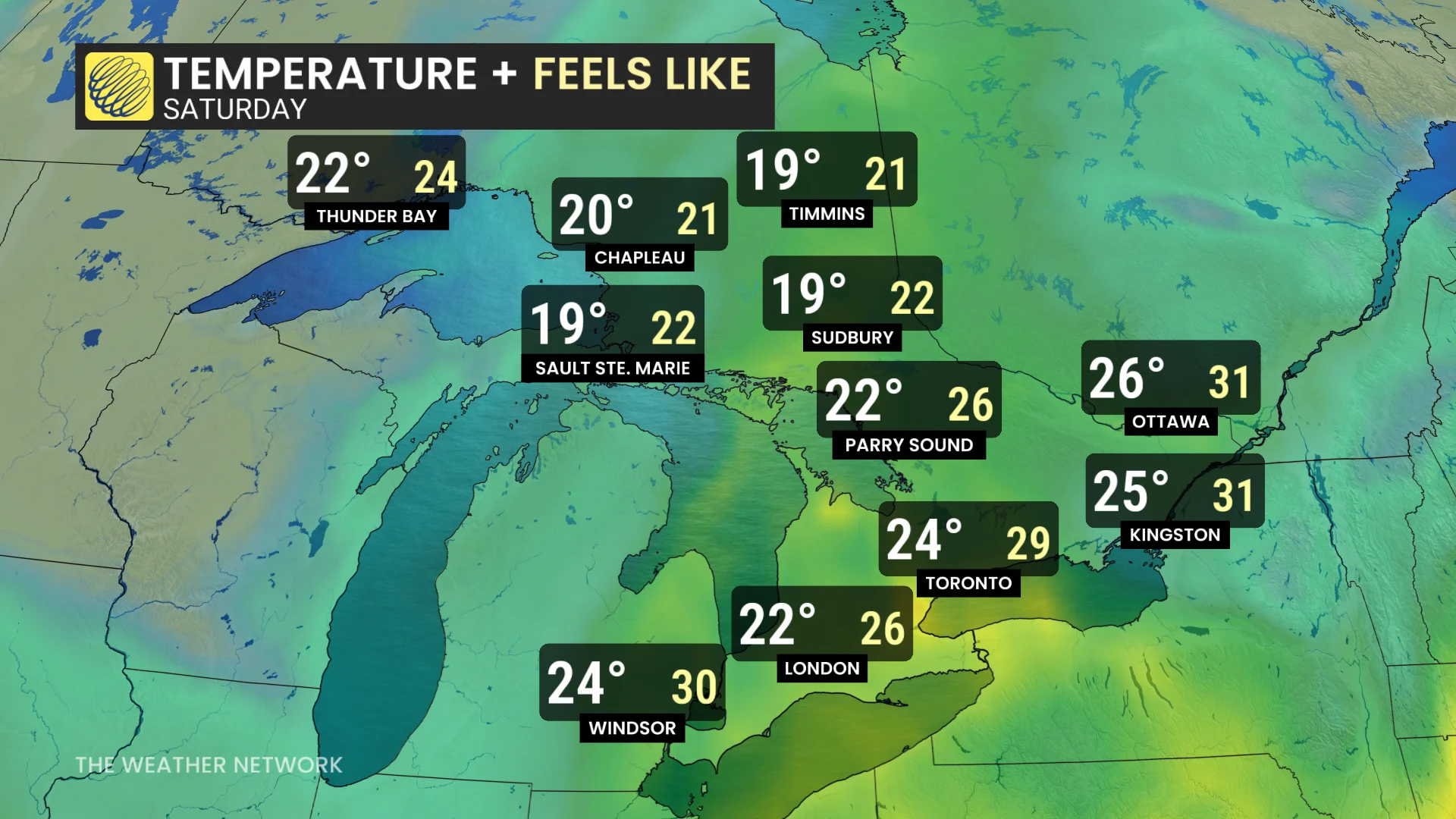
The atmosphere carries significant moisture, but with temperatures in the low to mid-20s, humidex values are not expected to be problematic.
Those outdoors should still monitor for localized severe conditions, including heavy rain and strong wind gusts.
SEE ALSO: Invasive oak wilt disease detected in southern Ontario
Fall-like feel to Sunday
Sunday will bring a sharp shift in weather as northwesterly winds move in. Temperatures will struggle to reach the 20s in the GTA, and much of the region will experience scattered afternoon showers. Expect a cooler day with a noticeably fall-like feel compared to earlier in the week.
DON'T MISS: Latest El Niño forecast calls for historic heat by this autumn
Occasional showers are expected to linger across Ontario through Monday and potentially into Tuesday morning, accompanied by brisk northwest winds. Daytime highs will range from the upper teens to lower 20s. Temperatures are forecast to return to near-seasonal values mid-week, with another chance for showers or thunderstorms late Thursday into Friday.
Temperatures trend warmer for back-to-school
As August wraps up, expect near or slightly below seasonal temperatures for the final weekend. The first week of September is projected to bring near-seasonal conditions, with warmer-than-normal temperatures likely for back-to-school week.
SEE ALSO: Canada’s August outlook holds shifting heat and wildfire concerns
Forecasters are keeping an eye on a developing tropical storm in the western Pacific, which is expected to strengthen into a major typhoon. If the typhoon tracks near Japan, it could alter the expected weather pattern, potentially delaying the warmer trend and resulting in cooler-than-normal temperatures by the end of the week.