New Brunswick's 2nd storm this week causes flooding, treacherous roads
A fast-moving system is bringing snow, ice pellets, rain or a mix of all three to all parts of New Brunswick. Snow began around midnight and had changed to rain in the south by morning.
All New Brunswick schools are closed Thursday, with some students having their third snow day this week.
Officials are warning of localized flooding and unsafe roads and asking people to avoid travel if they can.
The storm is expected to bring as much as 30 centimetres of snow in the north and 50 millimetres of rain in the south
Environment Canada says snow will change to rain over all but northwestern parts of the province by this afternoon, before tapering to scattered showers and flurries later Thursday evening.

RELATED: Dynamic winter storm to drench East Coast in wind-driven rain and snow
Felicia Murphy, spokesperson for highway operation company SNC-Lavalin, said travel is not recommended on the Trans-Canada Highway between the Quebec border and Longs Creek, west of Fredericton. She said travel is also not recommended on Route 95, from the United States border to Woodstock.
"They've deteriorated overnight," she told Information Morning Fredericton. "The roads are all snow-covered. There's icy sections throughout."
She said visibility is also poor because of drifting snow in different parts of the highway.
RCMP said driving conditions on the Trans-Canada are "extremely poor."
Travel is also not recommended on Highways 11 and 17 near Bathurst, and Highways 180 and 17 near Edmundston.
About 1,600 N.B. Power customers are without electricity.
The biggest outage is affecting about 1,300 customers on the islands of Grand Manan and White Head. The estimated restoration time is between noon and 1 p.m.

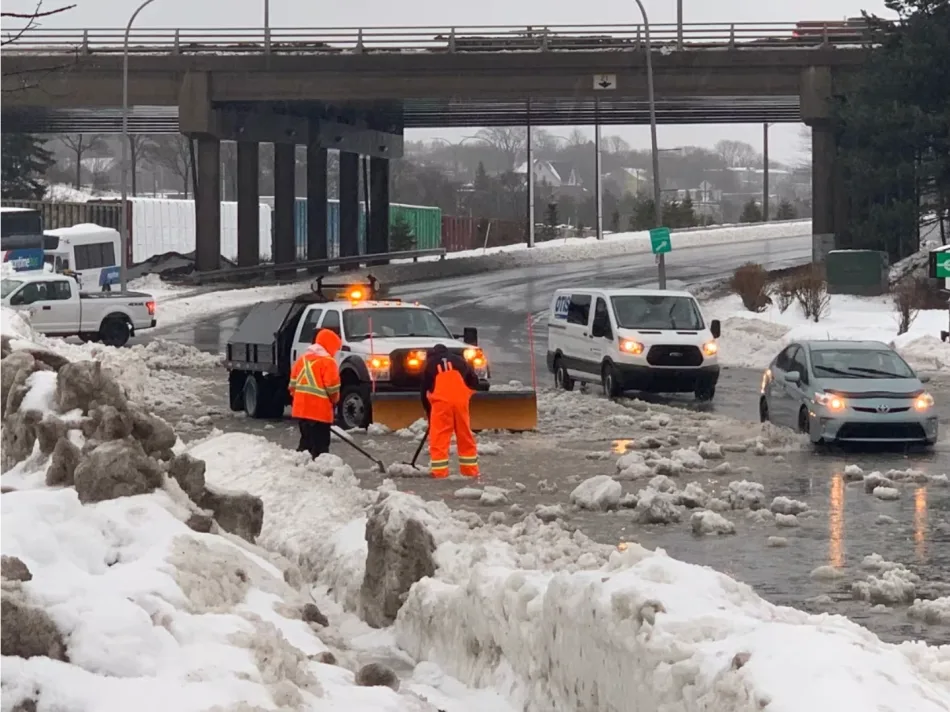
Crews work to drain a section of road near TD Station in Saint John on Thursday morning. (Roger Cosman/CBC)
Expect flooded roads
As rain falls over snow, it's expected to cause flooding and road closures. Some flooding is already happening at Fredericton intersections and at the north end of the Westmorland Street Bridge.
In Saint John, fire Chief Kevin Clifford,who is also EMO director, said the combination of rain, melting snow and the high tide at 3:20 p.m. could cause pooling in some areas.
"Be mindful about what might look like just a pool of water sometimes, in an event like today, you'll have erosion of the underground," he told Information Morning Saint John.
He said areas of concern are Drury Cove, Rothesay Road, the Glen Falls area, McAallister Drive, Rothesay Avenue and Gault Road.
Clifford said flooding will be most likely at high tide.
He recommends residents have a 72-hour emergency kit that includes water, food, a radio and flashlights.
CBC meteorologist Ryan Snodden said temperatures in the south look set to climb into the high single or low double-digits by early afternoon.
Northeastern areas will see the snow begin to mix with ice pellets and freezing rain into the afternoon and evening, he said. By evening, the rain is expected to reach Miramichi, the Acadian Peninsula and Bathurst regions.
Environment Canada is also warning of higher-than-normal water levels near the Bay of Chaleur, particularly west of Bathurst on Thursday afternoon.
This is the second major storm to roll through New Brunswick this week.
A storm on Monday brought about 30 centimetres of snow, and days of disruptions, to southern New Brunswick.
This article was originally published for CBC News. Contains files from Information Morning Fredericton and Saint John.