New Atlantic system could become the basin's first hurricane this season

After the quietest season in the Atlantic basin on record, we may now be on the forefront of finally seeing its first hurricane
While there is still some time to go before we reach the end of the Atlantic season (Nov. 30), we still are awaiting the first hurricane, an occurrence that already has set a record for the latest in the year (if it does happen).
The lack of hurricanes can at least be partly blamed on a "super" El Niño in progress. During typical El Niño years, hurricane development is usually surpressed given the amount of wind shear present in the Atlantic basin.
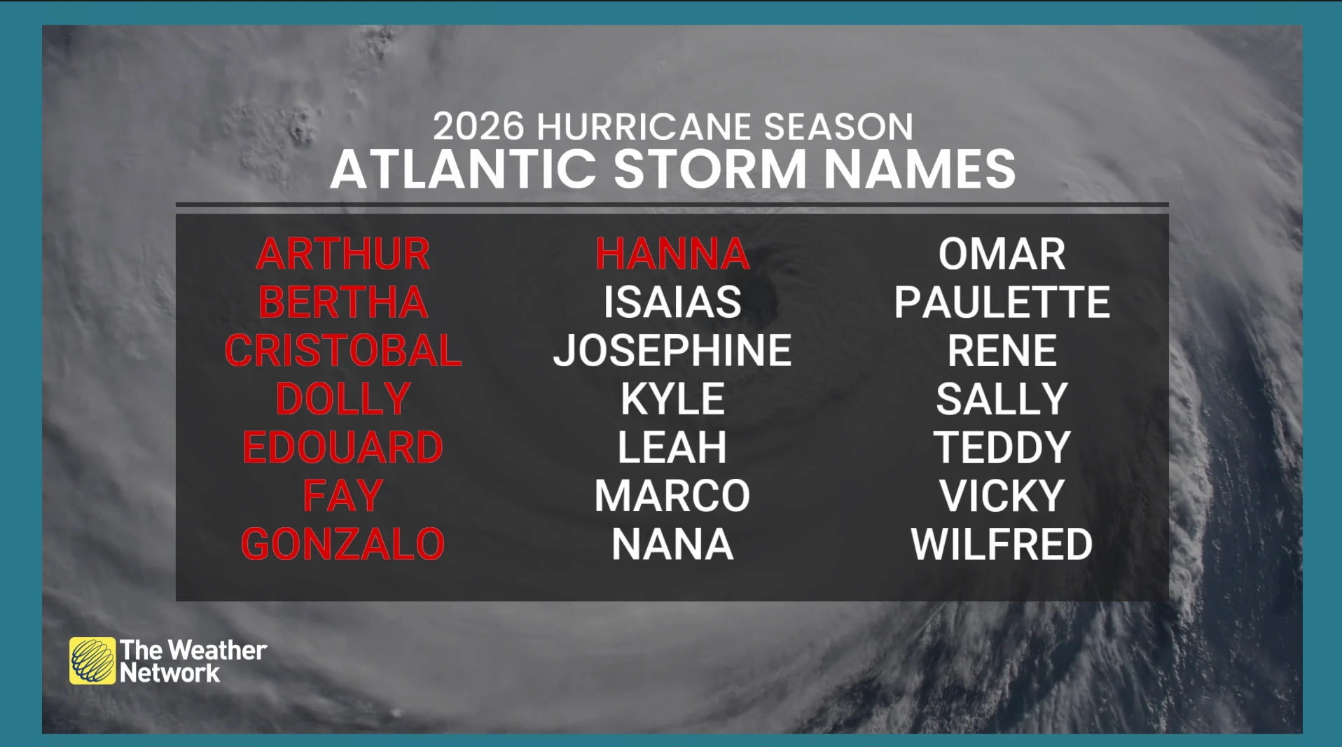
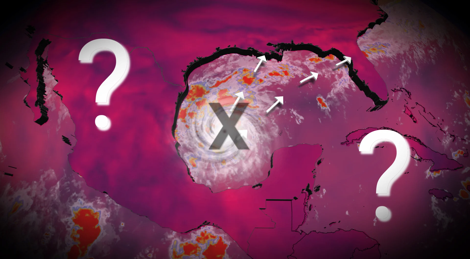
However, a new disturbance that has developed in the Gulf of Mexico is likely to become a named storm in the coming days, taking on Isaias, with some models hinting that it could reach hurricane status to become the Atlantic basin's first of the season.
Isaias is next on the 2026 Atlantic names list
As of Oct. 5, there have been eight recorded tropical storms and zero hurricanes.
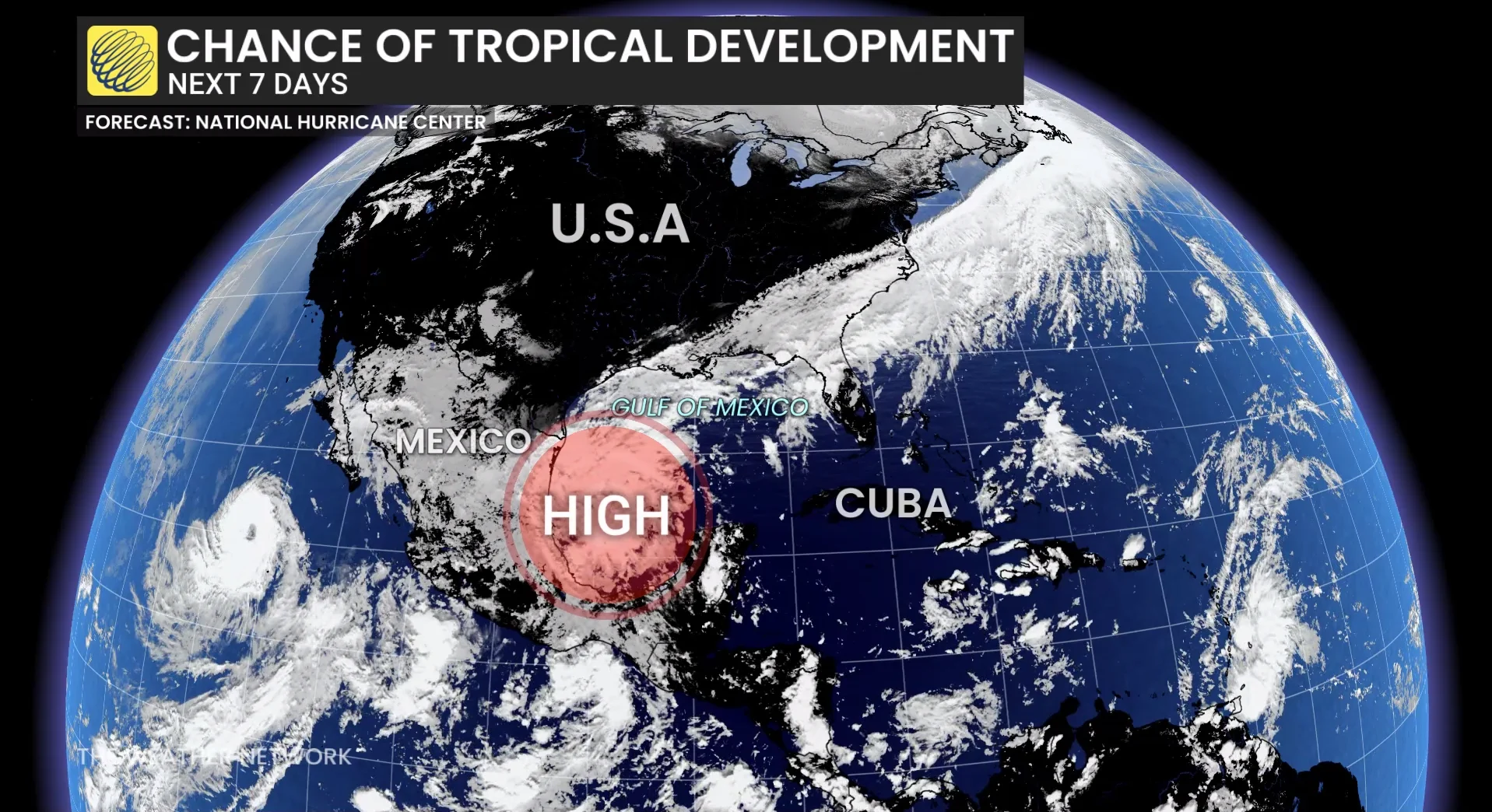
An area of low pressure is expected to form over southwestern Gulf over the next 48 hours, with the U.S. National Hurricane Center (NHC) giving it a 60 per cent chance.
The potential for a tropical depression forming in the middle of the week or onwards is up to 80 per cent.
The system is expected to drift eastwards over the next couple of days before turning northward.
If or when it becomes named, it will take on the Isaias moniker.
The Gulf of Mexico is primed for the development and strengthening of the system, so a chance to become a hurricane is not out of the question.
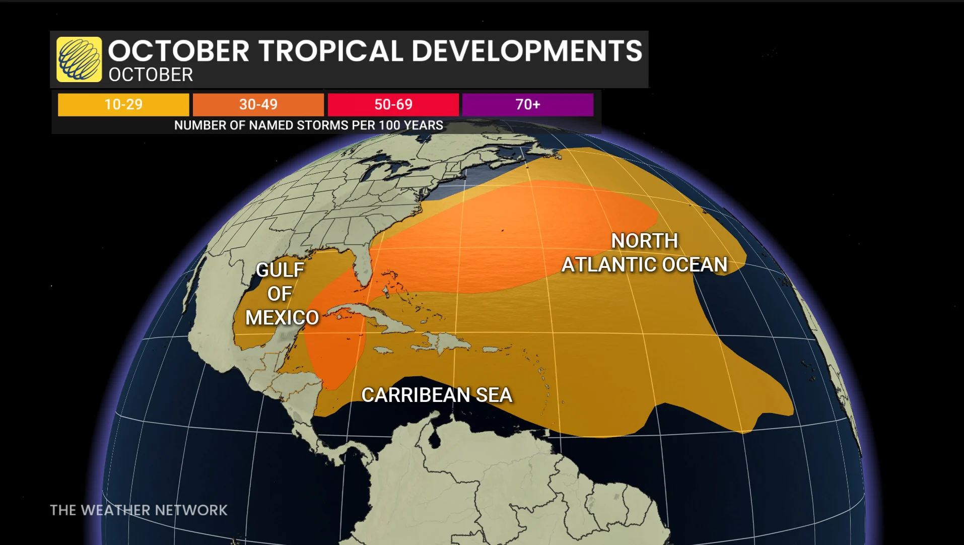
It is sitting in ocean waters that are 2°C above normal, helping to fuel the disorganized thunderstorms.
Many models are indicating the possibility of this becoming a hurricane.
However, it is too early to add the specification of the impacts.
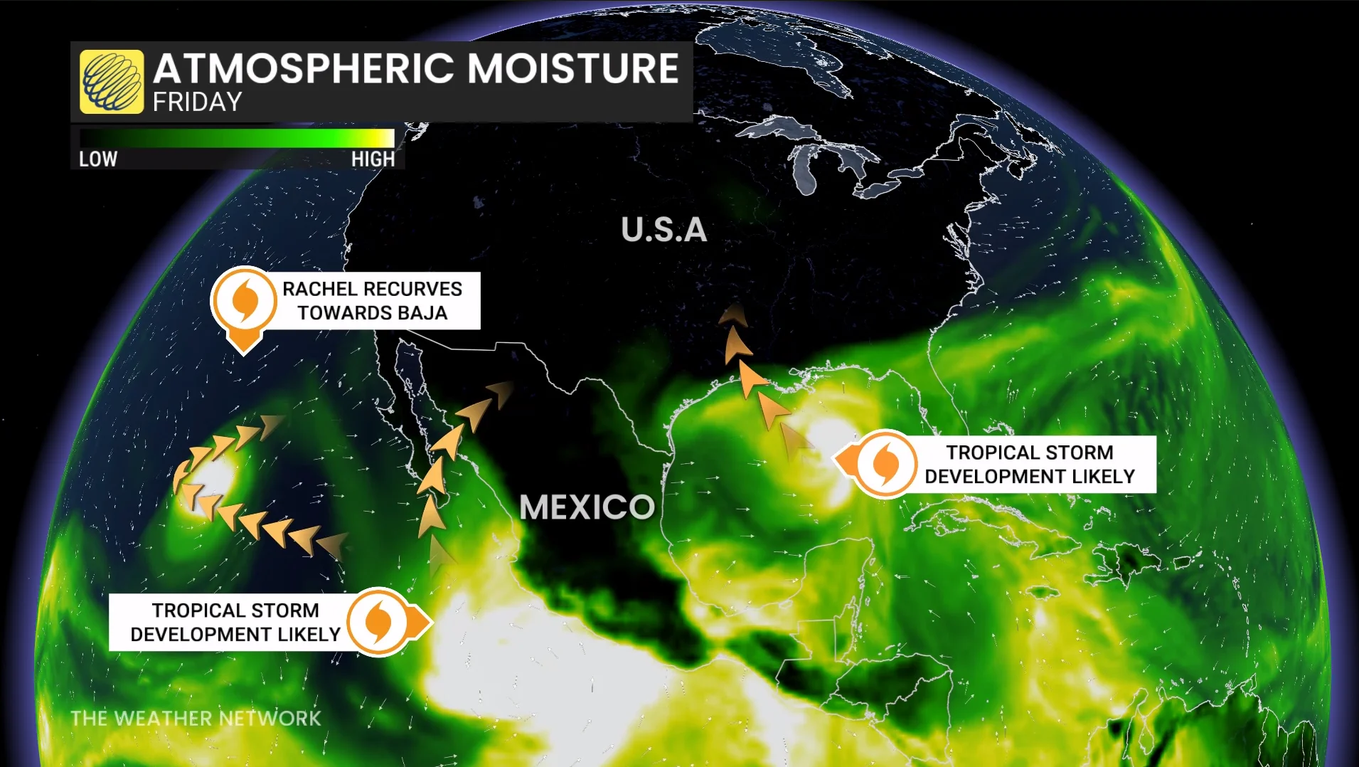
Heavy rainfall and associated flooding impactts are possible for the northern Gulf Coast, southeastern U.S. and Florida later this week and this weekend.
'Super' El Niño contributes to lack of hurricanes
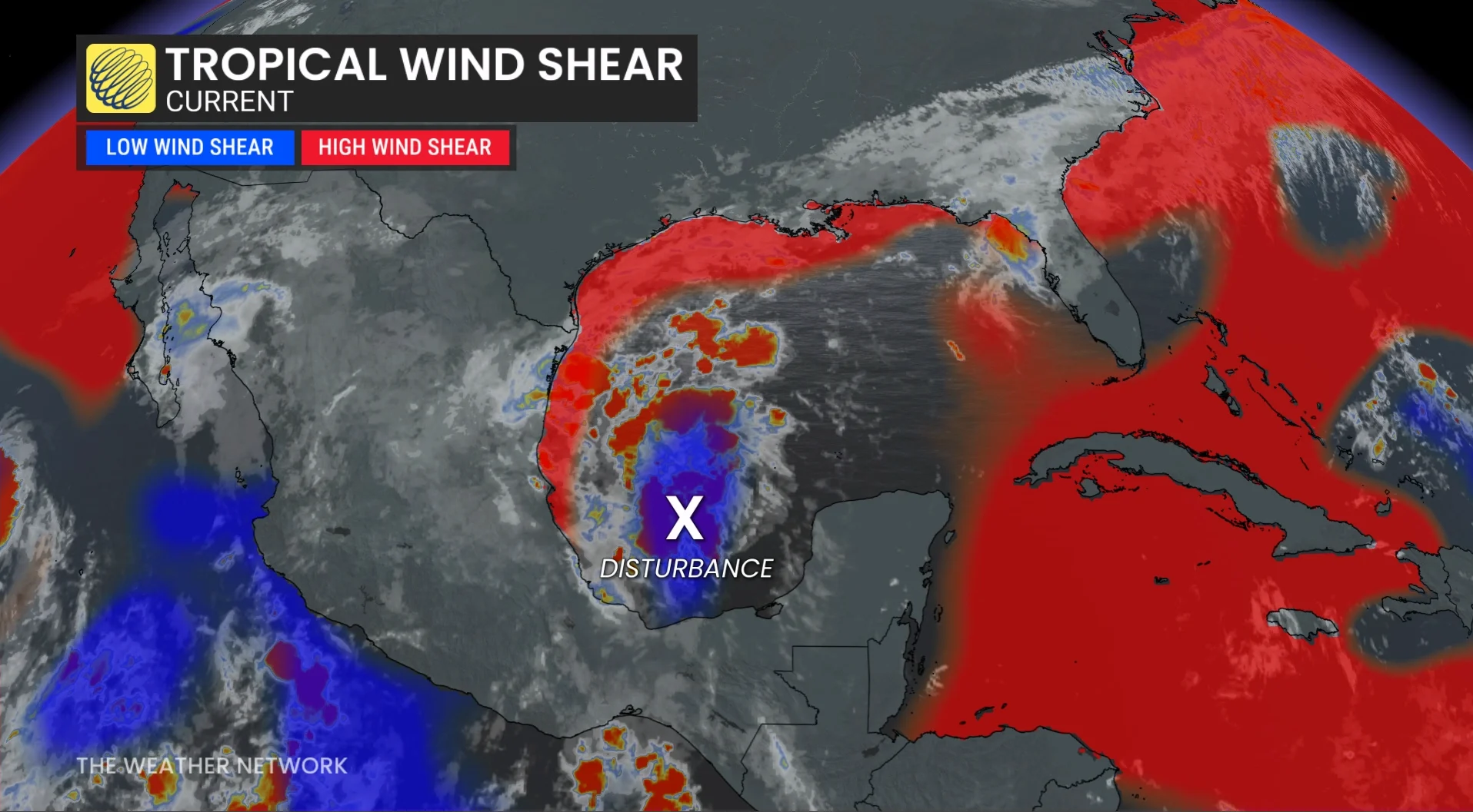
With forecasters now confirming a "super" El Niño in place, the phenomenon is driving the Pacific and Atlantic basins'respective hurricane seasons this year. These warmer-than-normal waters are having a profound effect on the atmosphere across the region.
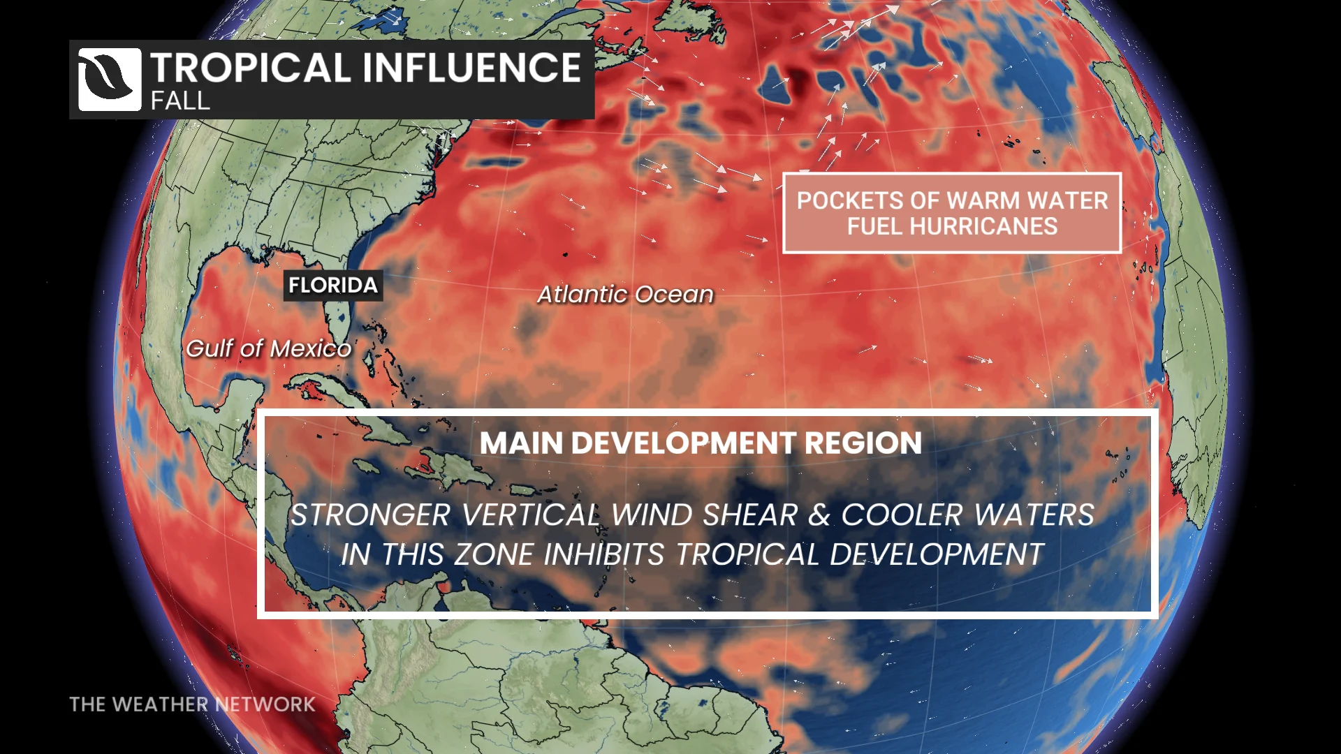
Tropical systems are thriving in the rising air and calm environmental winds throughout the northeastern Pacific. Meanwhile, this same pattern has increased the amount of disruptive wind shear blowing east over the Atlantic basin, shredding apart potential disturbances before they can develop any further.
With files Dennis Mersereau, a digital journalist and weather specialist at The Weather Network, and Nathan Howes, a digital reporter at The Weather Network.