From Hawaii to Halifax, why is this hurricane season so bizarre?

The Atlantic basin is completely quiet at the peak of hurricane season as Hawaii faces one unusual tropical threat after another
Hawaii can’t catch a break this year. Three tropical systems brought destructive winds and flooding to the Pacific islands so far this year, marking a trio of unusual swipes in a state that usually goes years without any serious threats.
Conditions placing Hawaii under constant threat this year are largely the same forces responsible for keeping the Atlantic basin historically quiet.
Forecasters expect the Atlantic to remain silent over the next week even as Hawaii faces several additional threats in the days to come.
DON'T MISS: Latest forecast calls for a historic El Niño to peak this winter
A trio of storms cause damage, major flooding
Three tropical systems have affected the Hawaiian Islands so far this season.
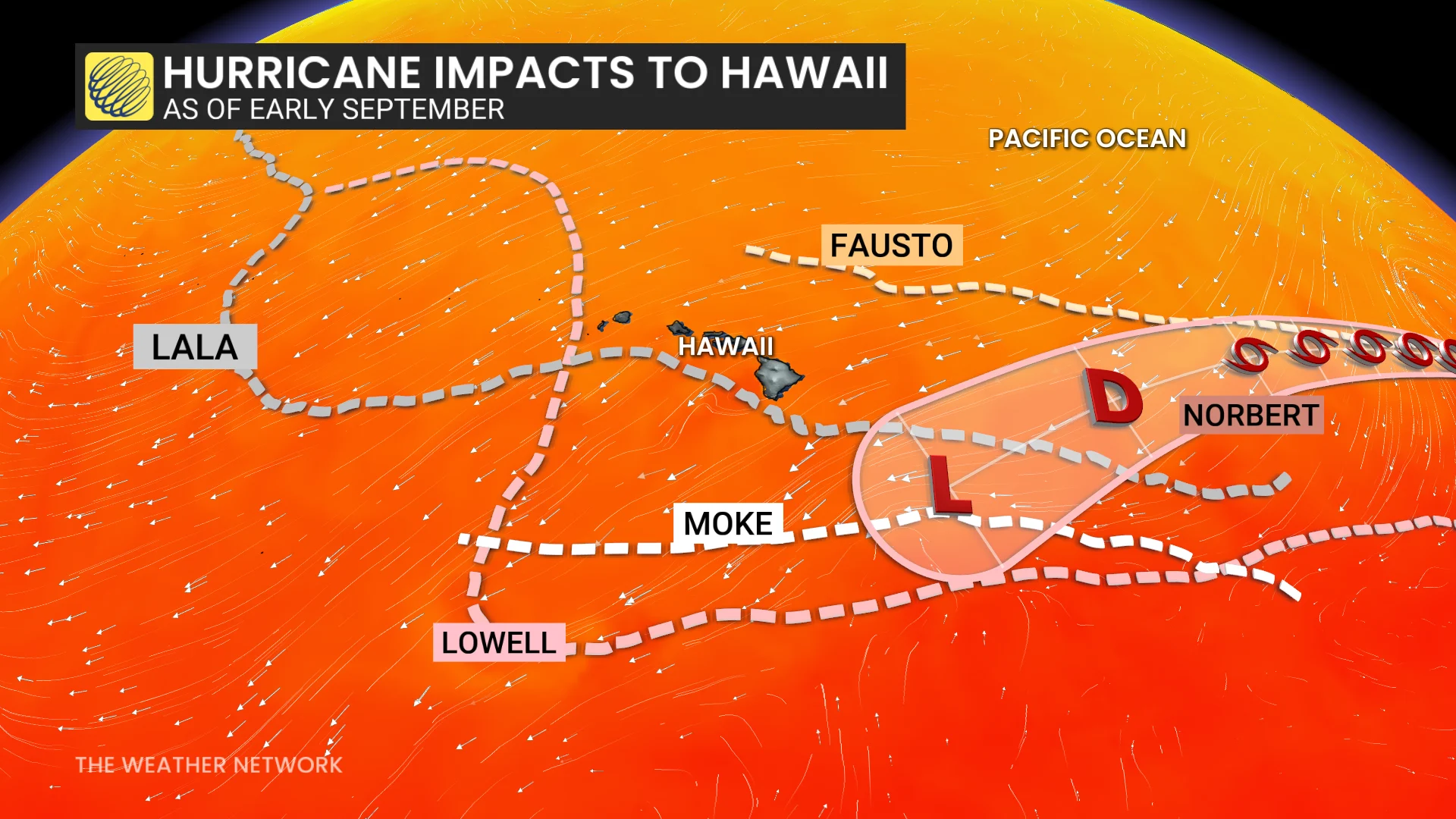
Hurricane Lala struck the Big Island on Aug. 15, with the centre of the eye missing landfall by a few dozen kilometres. High winds and torrential rains caused widespread damage across the region. Some areas received more than 900 mm of rain from the storm.
Just a week later, an additional 100 mm of rain washed over the Big Island as Tropical Storm Moke passed south of the archipelago.
Hurricane Lowell passed close to western Hawaii on Sept. 7-8, bringing damaging winds and flooding rains to the region. The storm’s outer bands prompted the first tornado watch ever issued in Hawaii.
Pacific hurricane season is bustling
Two vastly different hurricane seasons are playing out on either side of North America.
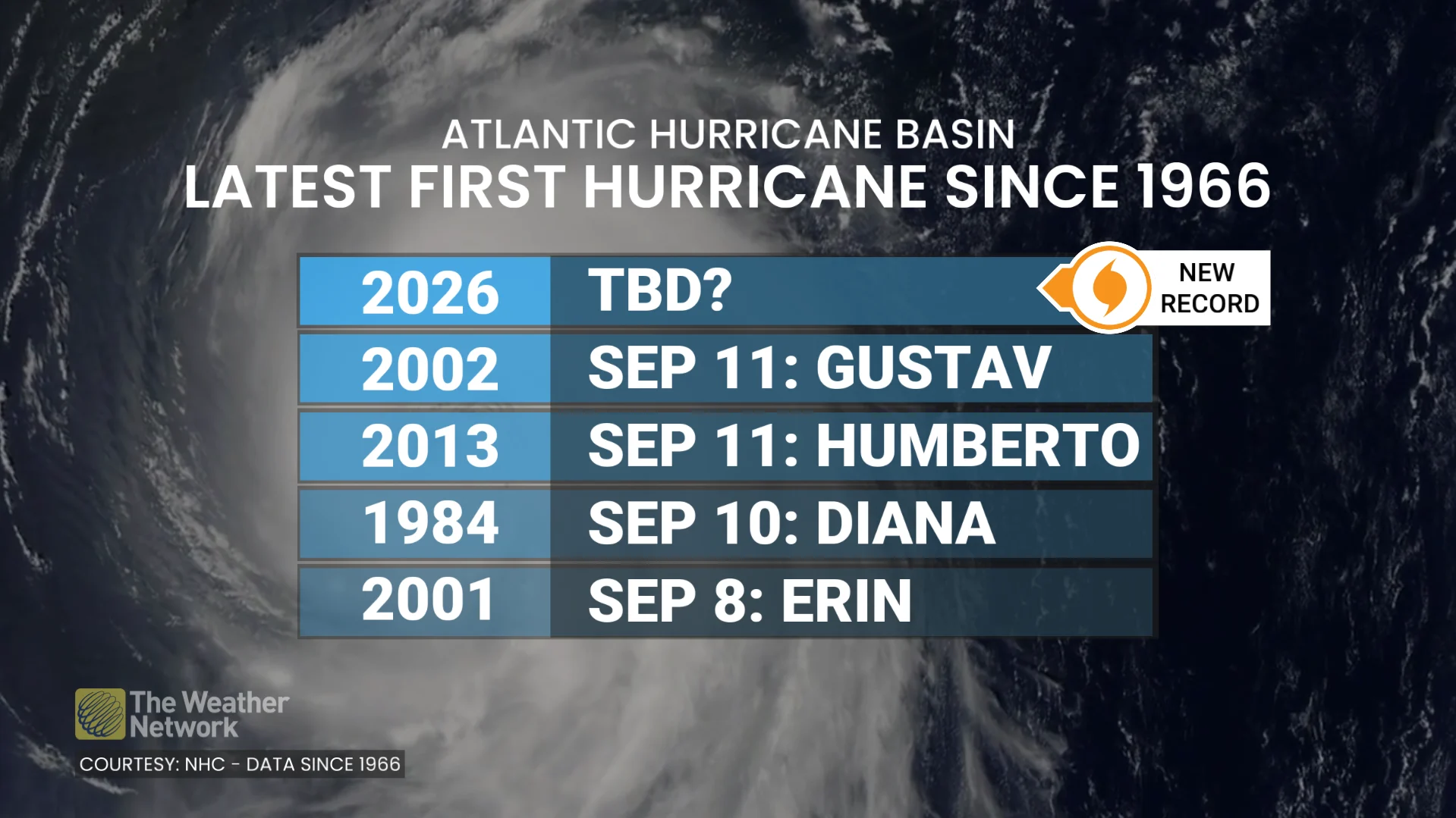
The Atlantic basin just set a record for the latest we’ve gone into the year without a hurricane since the satellite era began 60 years ago. Meanwhile, the Pacific is in the midst of one of its busiest hurricane seasons on record.
Sixteen named storms have formed across the northeastern Pacific since June. Six of those storms strengthened into hurricanes, and four of those storms achieved major hurricane status.
RELATED: ‘ACE’ is the best way to measure a hurricane season’s ferocity
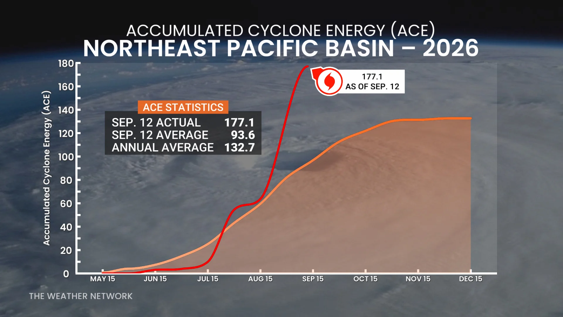
The basin’s Accumulated Cyclone Energy (ACE) reached a whopping 177.1 as of Sept. 12, which is around 30 per cent higher than the entire ACE the northeast Pacific generates during an average year (132.7).
A very high ACE is a testament to the number, intensity, and longevity of this season’s storms.
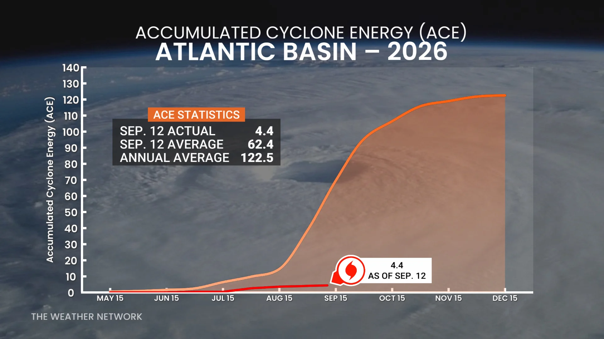
Meanwhile, the Atlantic basin has only produced five tropical storms this year for a total ACE value of just 4.4, accounting for less than 7 per cent of our typical activity by this point in the season.
El Niño is the major driver
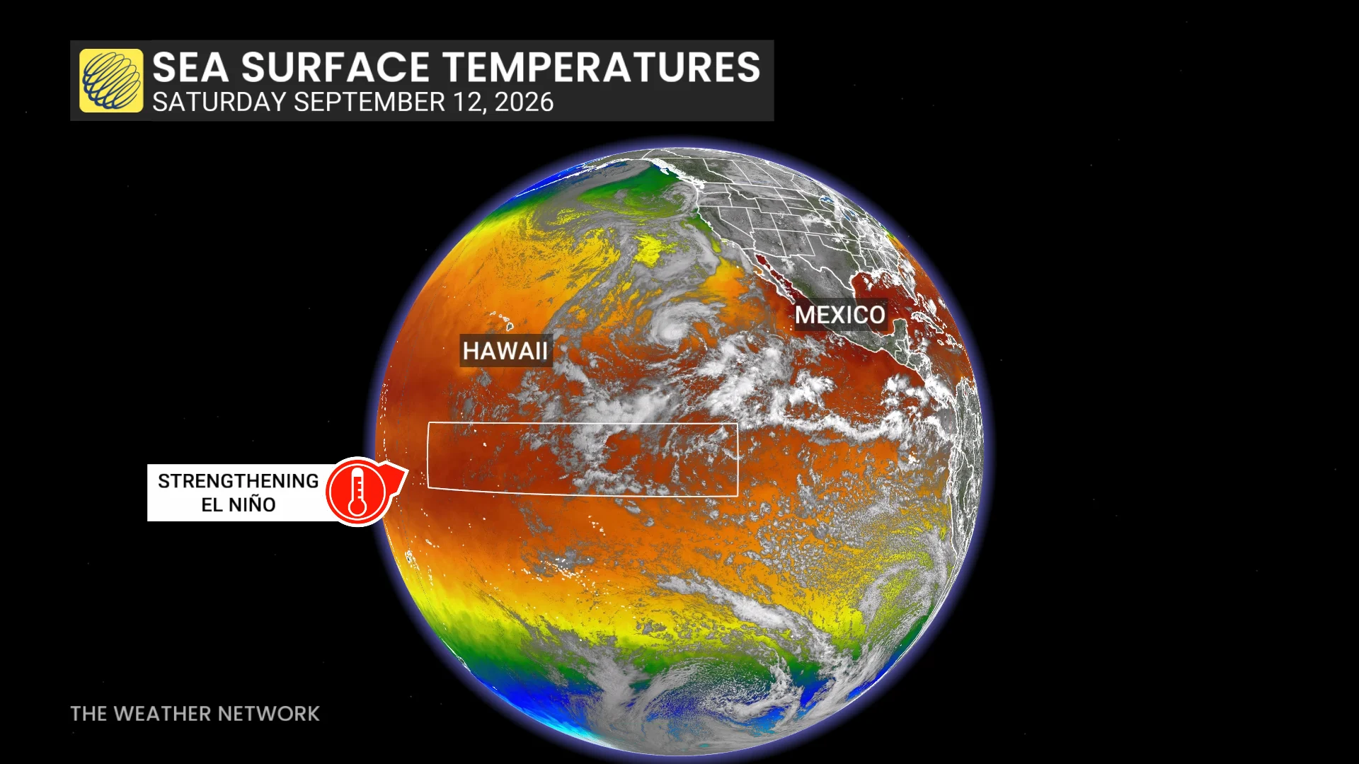
A very strong El Niño is driving both basins' respective hurricane seasons this year. These warmer-than-normal waters are having a profound effect on the atmosphere across the region.
Tropical systems are thriving in the rising air and calm environmental winds throughout the northeastern Pacific. Meanwhile, this same pattern has increased the amount of disruptive wind shear blowing east over the Atlantic basin, shredding apart potential disturbances before they can develop any further.
Hawaii only faces a tropical threat once every couple of years on average because storms usually track away from the islands, and cooler waters near the state tend to weaken any storms that do approach the archipelago.
This year, however, the sheer number of storms has broken through that general pattern. Lala, Moke, and Lowell formed and tracked far enough south that they were able to avoid hostile conditions to bring hazardous weather to the Hawaiian Islands.
Forecasters watching more Hawaiian threats
Two additional areas of development in the Pacific require extra attention in Hawaii heading into next week.
Tropical Storm Norbert will continue moving west through next week, though it’s expected to weaken well before coming close to Hawaii. Nonetheless, it may track close enough that increased moisture may bring a threat for heavy rainfall to areas that certainly don’t need it.
Another disturbance close behind Norbert may find favourable conditions for development into next week as it tracks west in Hawaii’s general direction.
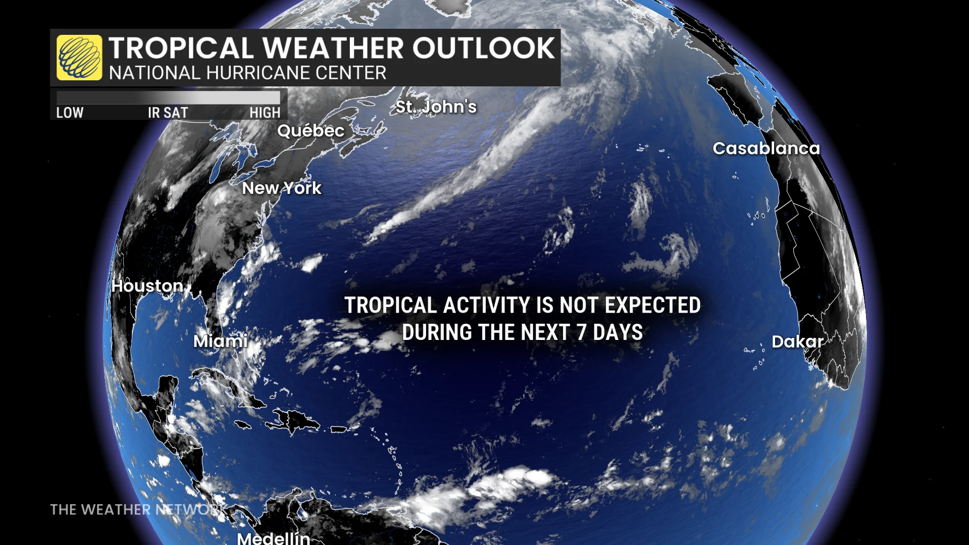
Conditions remain exceptionally and historically quiet across the Atlantic basin, where forecasters don’t expect any tropical development over at least the next seven days.
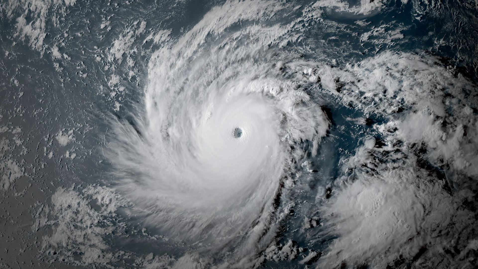
Header image of Hurricane Lowell at Cat. 5 intensity courtesy of NOAA.