Dorian heads for Atlantic Canada this weekend, some 'brutal' impact likely

Canadian Hurricane Centre warns that Dorian is expected to "severely impact" parts of the Atlantic provinces this weekend.
After a crippling impact on the Bahamas and further destruction expected along the U.S. Atlantic Coast, Hurricane Dorian is setting its sights on Canadian territory as it heads into Maritime waters this weekend.
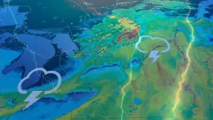
One of the most powerful Caribbean storms on record, Hurricane Dorian was at Category 5 strength when it slammed into the northern Bahamas early in the week, and at one point was all but stationary, parking itself over Grand Bahama and deluging it for most of two days. That's as its powerful winds whipped up storm surge that left huge portions of the island submerged.
Though down to Category 2 strength on Tuesday and Wednesday, the storm picked up a little more steam and is on the move again, gradually moving northeast parallel to the U.S. southeast coast and getting dangerously close to Charleston, South Carolina.
"Dorian continues to lash the coast of the Carolinas," the U.S. National Hurricane Center said early Thursday, adding that hurricane conditions are likely over parts of the area throughout the day.
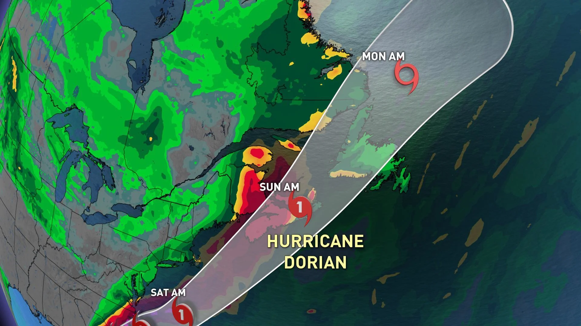
"The center should move to the southeast of extreme southeastern New England Friday night and Saturday morning, and approach Nova Scotia later on Saturday," the NHC says.
TROPICAL CYCLONE STATEMENTS ISSUED
On Wednesday, the Canadian Hurricane Centre issued the first tropical cyclone statements for Atlantic Canada with all of Nova Scotia, Prince Edward Island and parts of New Brunswick, Newfoundland and Quebec all included ahead of probable impact.

"Hurricane Dorian is expected to severely impact parts of the Atlantic provinces this weekend," the CHC warns.Hurricane Dorian is expected to move into Canadian waters early Saturday morning with the most likely track bringing the storm south of the Maritimes, pushing through eastern Nova Scotia late in the day and then over western Newfoundland by Sunday morning.
"Severe winds and rainfall will have major impacts for southeastern New Brunswick, Prince Edward Island, Nova Scotia, Western Newfoundland, and the Quebec Lower North Shore," says the CHC.
WATCH BELOW: TRACKING DORIAN'S IMPACT INTO ATLANTIC CANADA
Widespread rainfall totals of 50 to 100 mm are likely with localized amounts of 100 to 150 mm, which could produce some flash flooding, especially in areas that have recently seen similar rainfall amounts. The highest totals are expected for Nova Scotia and the Gulf of St. Lawrence region.
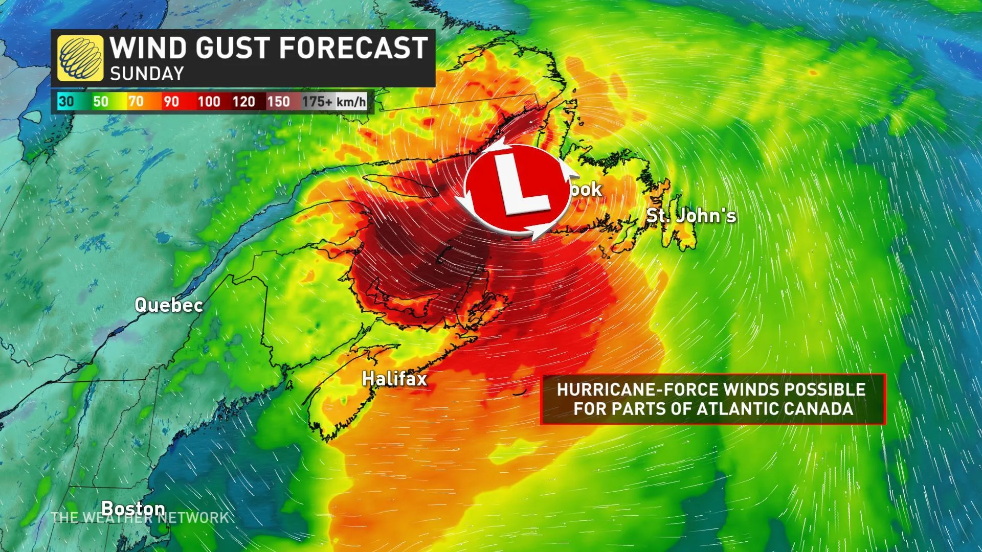
Hurricane force winds are also possible near and to the south of the storm's track with most regions experiencing at least tropical storm force gusts throughout the weekend.
"Wind impacts will likely be enhanced by foliage on the trees, potentially causing power outages," the CHC says.
WATCH BELOW: DORIAN'S WIND FIELD
SIGNIFICANT WAVE HEIGHTS
Storm surge and large waves may also impact parts of Nova Scotia and Newfoundland.
"We have high confidence for brutal surf and coastal storm erosion through Saturday afternoon and continuing into Sunday," adds Weather Network meteorologist Tyler Hamilton.
Large waves could build to near 10 metres over the eastern shore of Nova Scotia Saturday night with storm surge possible mainly for parts of Nova Scotia, Prince Edward Island, and Newfoundland.
STAY ALERT AND INFORMED
It will become easier to forecast Hurricane Dorian as it begins to accelerate and pick up its forward motion on Thursday. Stalling and slow-moving hurricanes are extremely difficult to forecast, so some of the prior difficulties with forecasting Dorian will be absent.
Water temperatures around the Maritimes are running a bit of a fever, as much as 3°C above normal. Warm sea surface temperatures not only fuel storm development, but also help it sustain its energy. We will closely monitor all of these factors as Hurricane Dorian develops over the coming days, so be sure to check back for frequent updates.
With files from meteorologist Tyler Hamilton.