
How a strong El Niño could shape Ontario's fall weather

A strong El Niño is developing, and it could bring unexpected impacts to Ontario's fall weather
A historic El Niño may be right around the corner as we get closer to fall, with signs that it’s already here in some capacity. While strong El Niño events typically result in warmer winters across Canada, their influence on fall weather is different.
The Pacific Ocean has been warming up along the equator, while the chance for the historic climate pattern to stick is building.
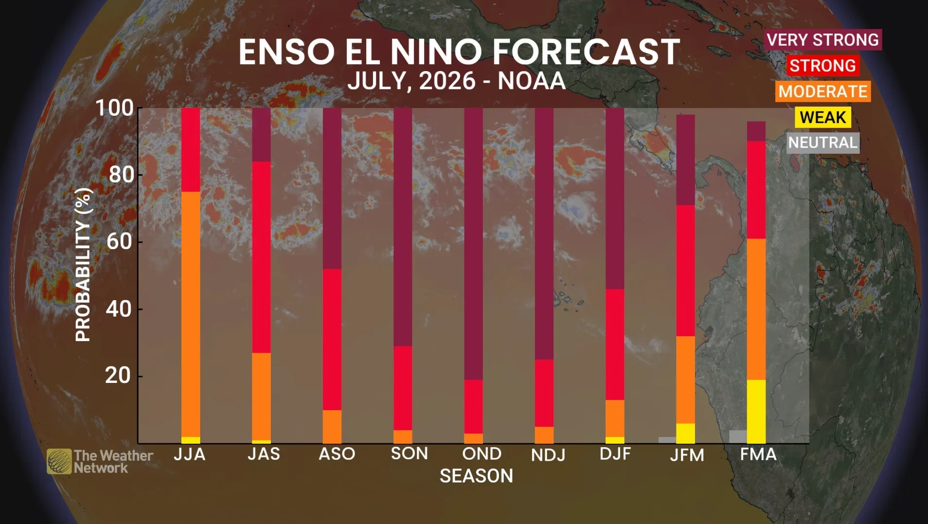
Experts believe that a very strong El Niño will be present going into the fall and winter months, estimated at a 90 per cent likelihood.
El Niño's impact on fall may be different than you expect
Since 1950, we’ve seen seven separate years with a strong El Niño during the fall, or from September to November, with the last strong pattern from 2023.
DON'T MISS: Latest El Niño forecast calls for historic heat by this autumn
Warmer winter months are associated with a strong El Niño in Canada, but the effect is different in the fall months, depending on where you are in the country.
A pronounced trough normally settles over Ontario, while a more dominant ridge covers the upper West Coast during these autumn months. That means cooler weather mostly in the East and warmer weather in the West, with the most extreme cold and warmth staying in the northern parts of Canada.
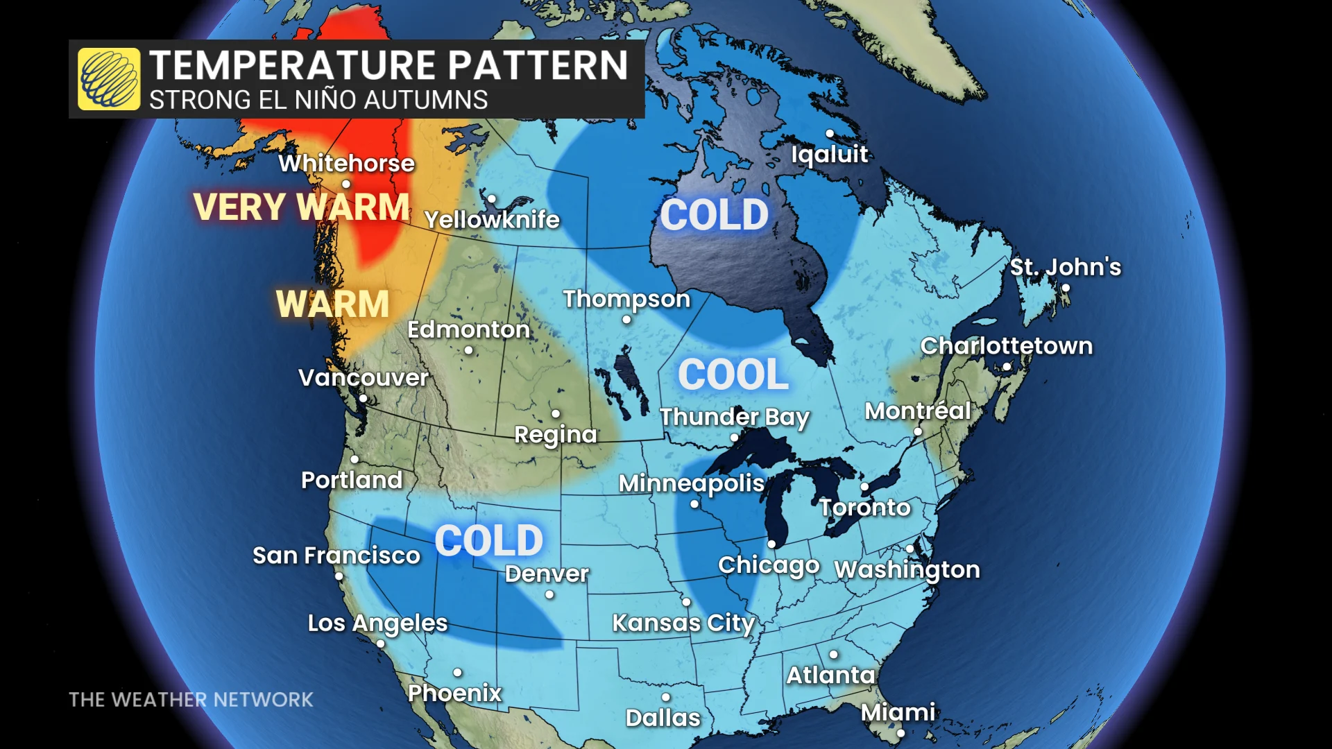
October exemplifies this, as the month tends to have the most standout patterns of the season. We tend to see the first snow for Ontario and Quebec way earlier than usual.
El Niño's effect on the GTA
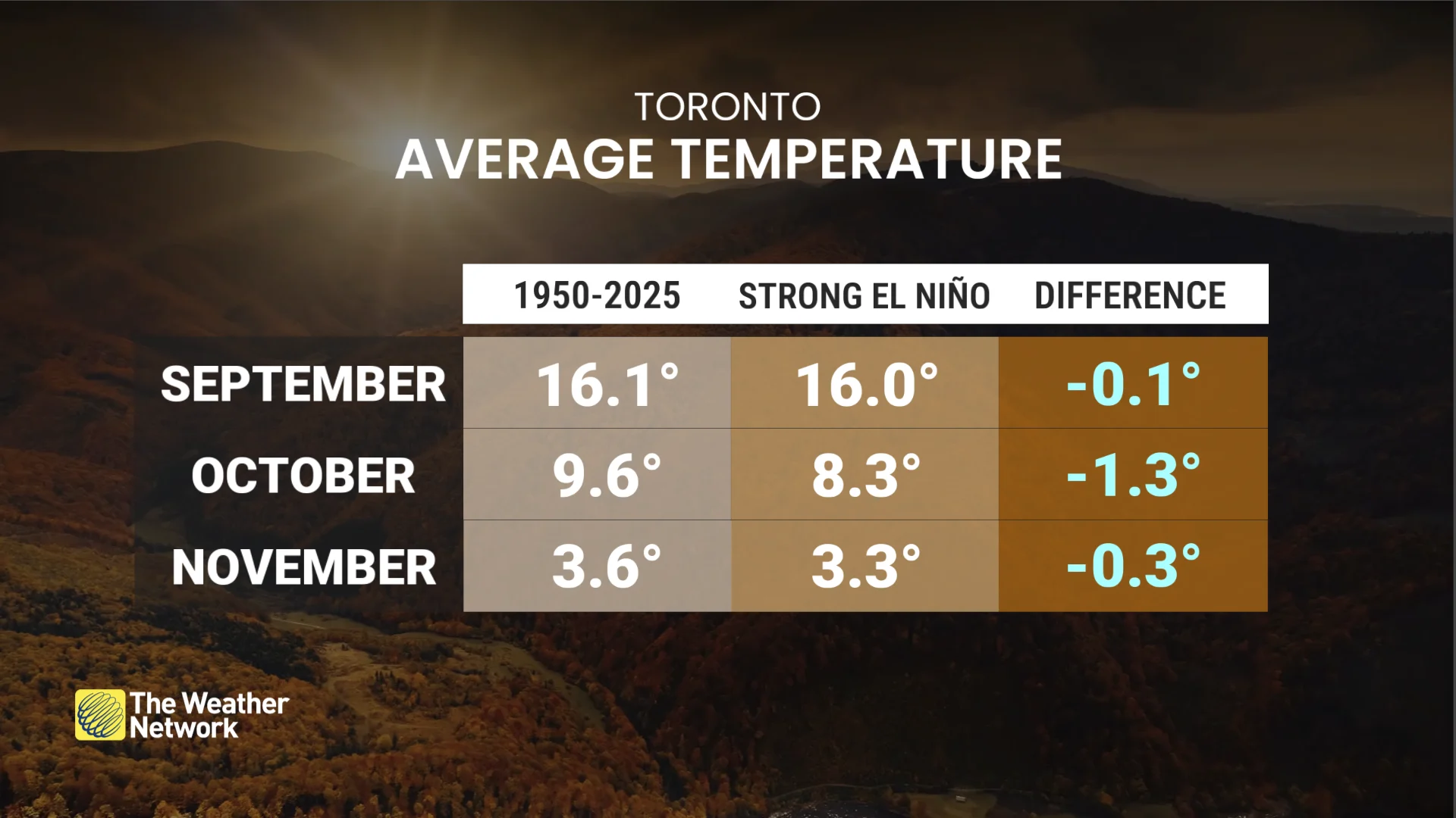
For the Greater Toronto Area (GTA), mean temperature data collected during strong El Niño falls were below the 1950-2025 average for the season as a whole, but October demonstrated the largest gap, with a difference of 1.3°C.
Snowfall also occurs a little early; the average date to first see 0.2+ cm is normally November 11. But under a strong climate, that moves to November 3, eight days earlier.
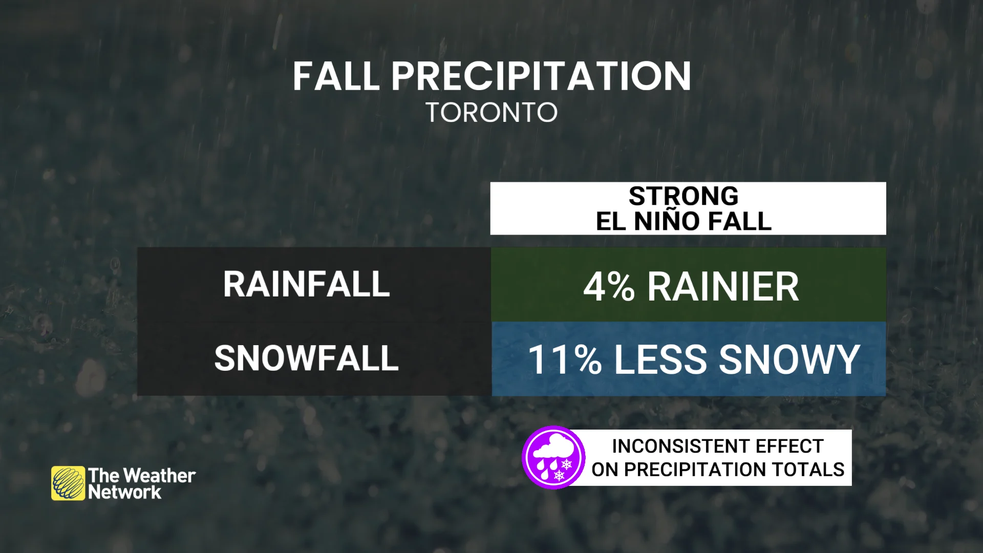
Precipitation patterns during strong El Niño falls show mixed signals for both rainfall and snowfall. Historical records indicate an almost equal number of cases with amounts above and below seasonal averages. On average, rainfall tends to be slightly higher, while snowfall is slightly lower, but no strong or consistent trend has been established.
Cold trends generally break by December and quiet sharply too, bringing a late onset to winter, translating to warmer winter starts. These warm winters arrive for most of the country, including Ontario.
During strong El Niño years, December in Toronto averages 2.6°C warmer than normal.