How a powerful El Niño will affect people around the world

Significant global impacts will stretch far beyond hurricane season
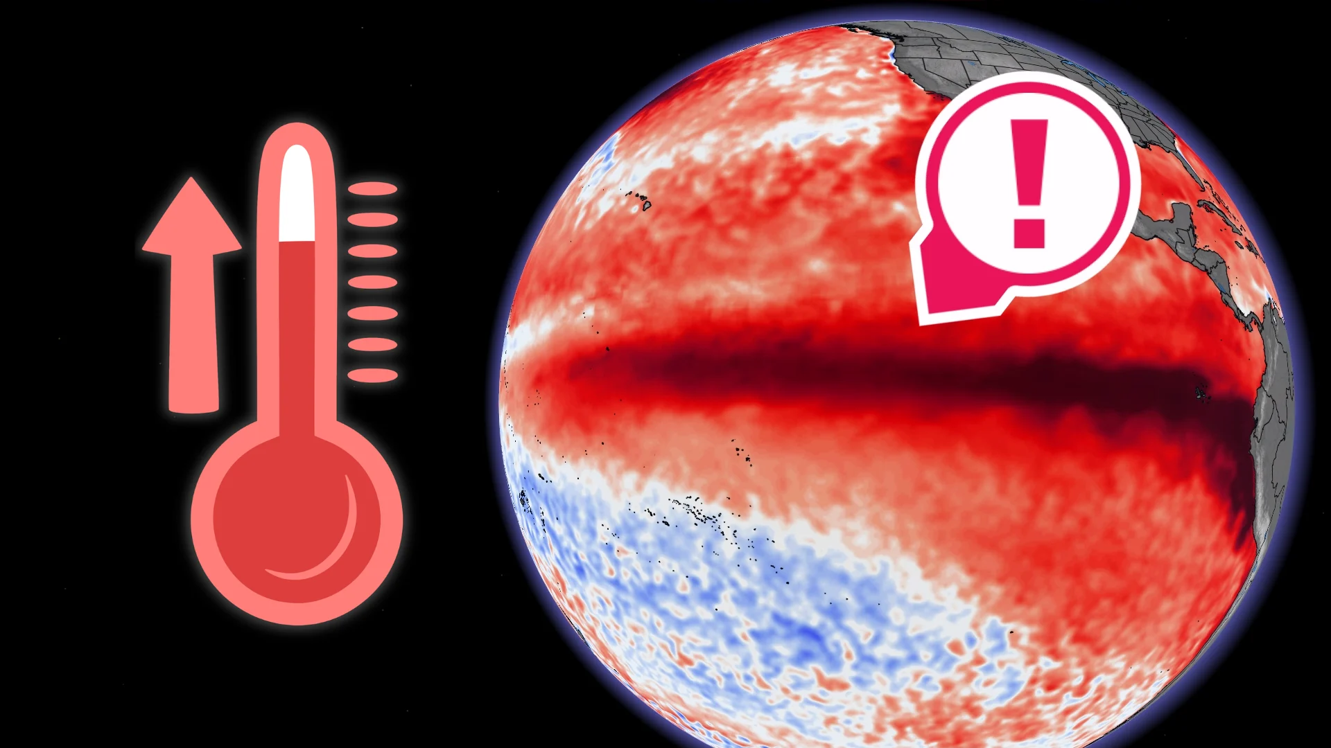
A strengthening El Niño in the Pacific Ocean will have global ramifications beyond a sleepy hurricane season in the neighbouring Atlantic.
These warmer-than-normal sea surface temperatures have a far-reaching influence that can touch every aspect of life around the world, ranging from a single person fishing for food to the most complex international trade.
"We are already seeing disruption and devastation from droughts and floods and extreme weather," the World Meteorological Organization (WMO) said in a press release on Thursday.
The agency added: "We expect these impacts to multiply - and cascade - as El Niño intensifies."
DON'T MISS: The Super El Niño that contributed to tens of millions of deaths
Water temperatures around the equatorial Pacific Ocean are a significant driver of weather patterns around the world.
Here in North America, the warmer waters of an El Niño event influence the orientation and strength of the jet stream, dictating the broad strokes of our patterns during the cooler months.
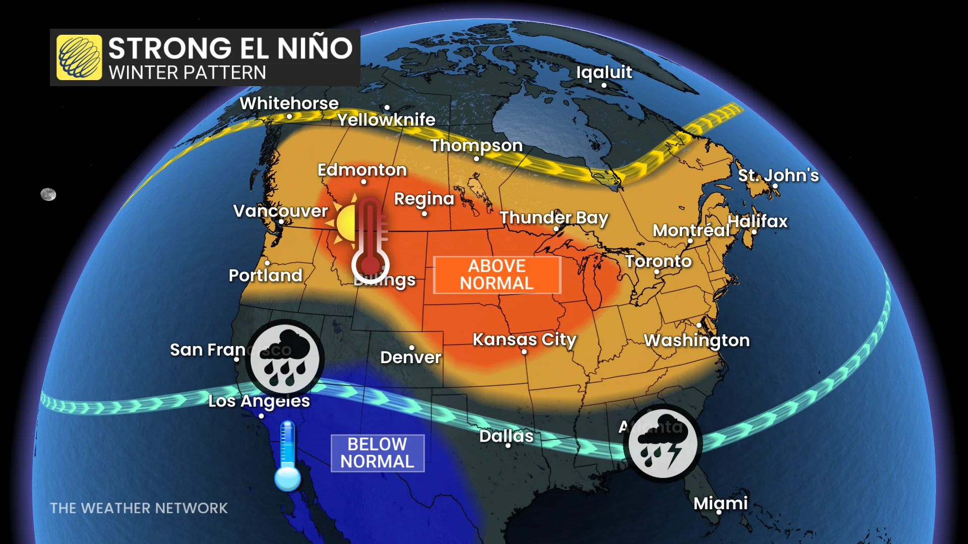
Wintertime temperatures during a strong El Niño tend to run above seasonal across a vast swath of Canada as the jet stream arches northward.
Meanwhile, a more robust subtropical jet stream keeps the southern United States cooler and wetter than normal, potentially putting a damper on excursions by vacationers and snowbirds alike.
The migration of warmer waters across the Pacific also causes significant changes in the eastern hemisphere.
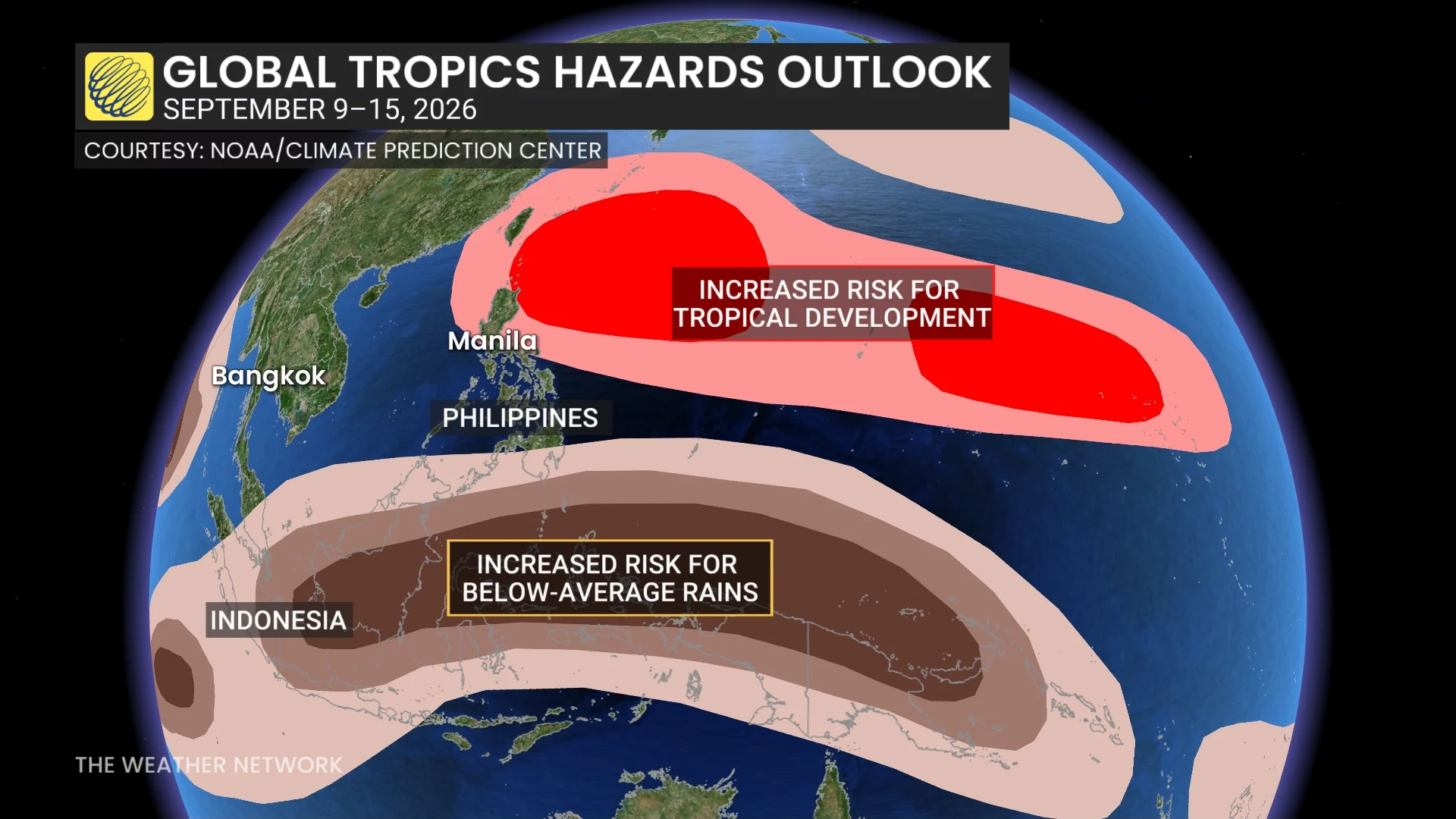
South Asia can experience a subdued monsoon during a strong El Niño. Places like Indonesia and Australia also often see well below-average precipitation, very similar to the pattern that forecasters are predicting into the middle of this September.
Above-seasonal temperatures are also common in Japan and the Korean Peninsula, as well as in southeastern Australia around Sydney and Canberra.
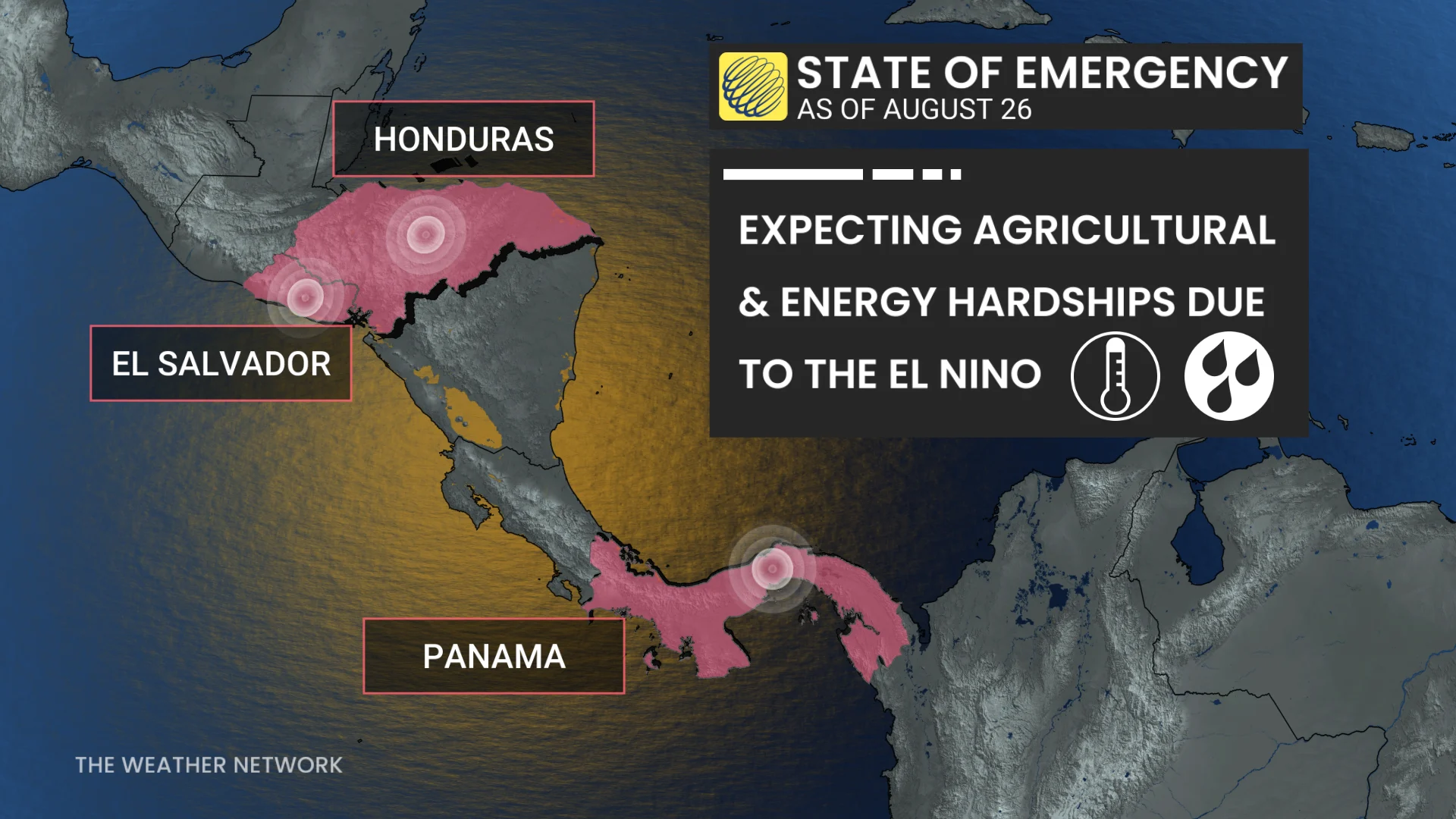
What do all of these changes mean in practical terms? Take the Panama Canal, for instance.
RELATED: Straits are geographic gateways that keep the economy moving
Authorities have capped the number of ships that can transit the Canal on a daily basis as a result of reduced water levels due to higher temperatures and below-average rainfall over Central America.
Fisheries and tourism rank among the top economic drivers for many communities throughout the Pacific basin. Significant water temperature anomalies disrupt marine habitats, which severely hampers fishing in key locations.
Extreme weather, both through droughts and excessive rainfall, can both suppress tourism and threaten the health and safety of those who live in the affected regions.