Atlantic's hurricane-free streak in jeopardy. Could Fay be the first?

The 2026 Atlantic hurricane season is running on fumes, but Tropical Storm Fay has the potential to become the first this year. If it fails to reach hurricane status, could we go a full season without one?
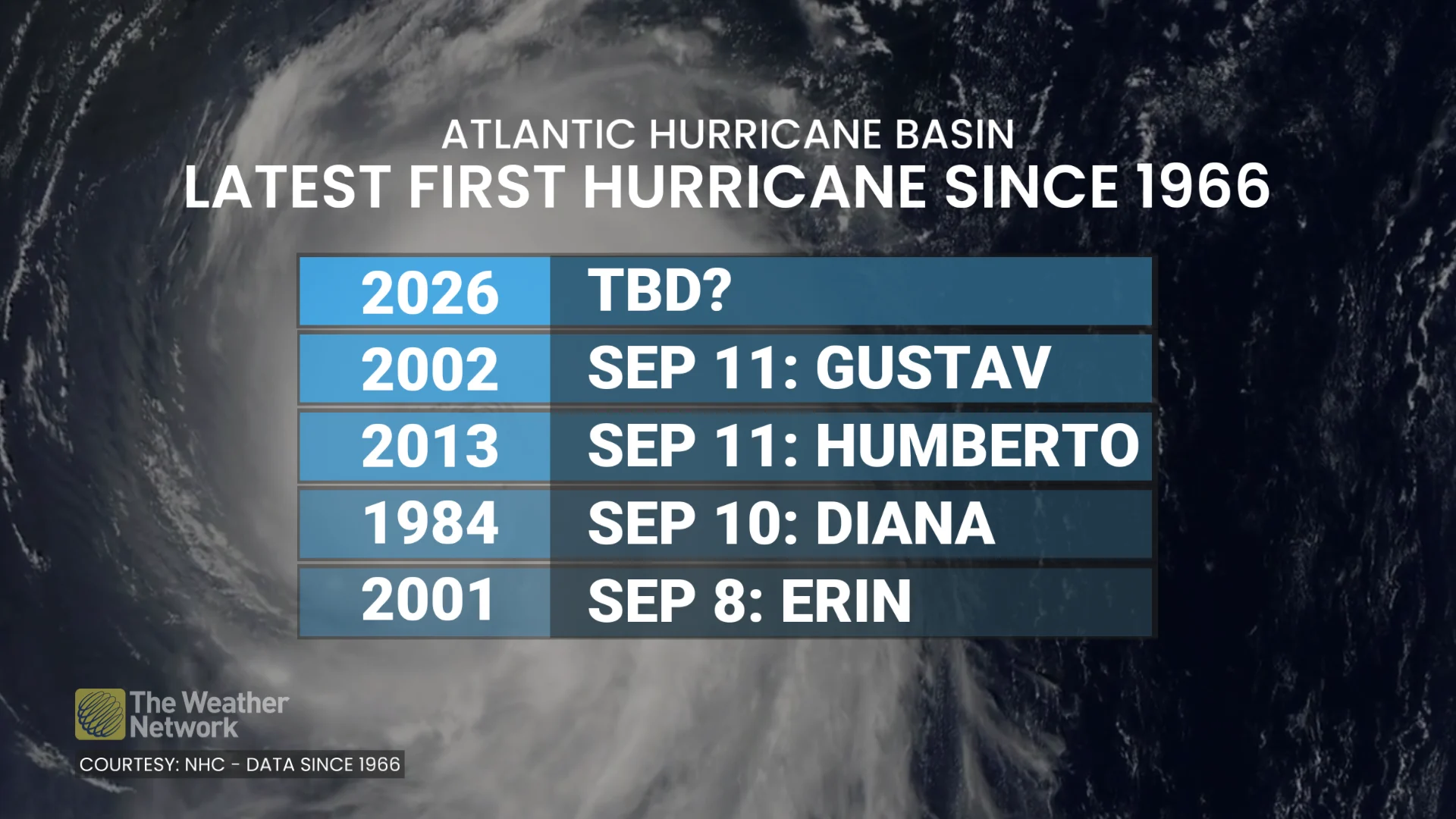
With a little more than two months still to go in the Atlantic season (Nov. 30), we still are awaiting the first hurricane, an occurrence that already has set a record for the latest in the year (if it does happen).
There are multiple factors in why there has been no hurricane, yet, but can at least be partly blamed on a "super" El Niño in progress. During typical El Niño years, hurricane development is usually surpressed given the amount of wind shear present in the Atlantic basin.
Still, though, it is odd that we haven't seen a single hurricane at this point in the season.
There is still plenty of time left in the 2026 season, but with the climatological peak in the rearview mirror (Sept. 10), is it possible we could see a hurricane-less Atlantic this year?
Well...
Fay forms with an outside chance of reaching hurricane status
As of Sept. 20, there have been six recorded tropical storms and zero hurricanes.
We do have a new tropical storm in the Atlantic basin, with forecasters now eyeing a chance it could approach or reach hurricane status.
(NOAA/NASA)
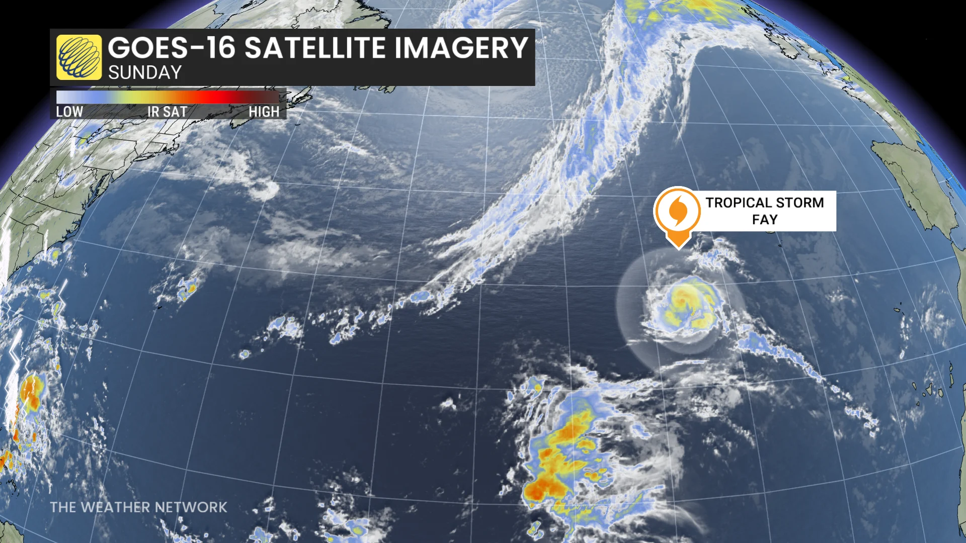
Fay came to fruition in the Atlantic basin early Sunday, but the storm poses no threat to land. The storm is currently 690 kilometres southwest of the Azores.
As of Sunday afternoon, its maximum, sustained winds have increased to near 95 km/h with higher gusts. With additional strengthening forecast, Fay could approach hurricane intensity tonight.
However, a gradual weakening trend is expected to begin on Monday as the environment becomes more hostile toward development. So, there is a short window for a potential hurricane upgrade.
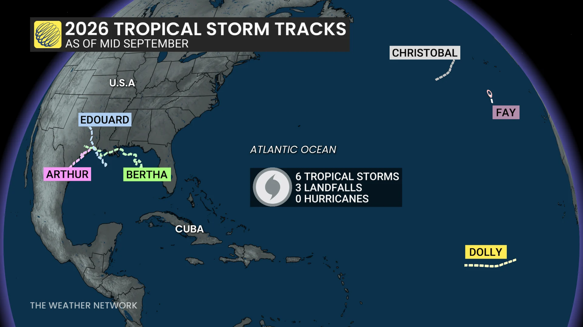
Going forward, Fay is expected to remain over open waters as a "fish storm."
'Super' El Niño contributes to lack of hurricanes
With forecasters now confirming a "super" El Niño in place, the phenomenon is driving the Pacific and Atlantic basins'respective hurricane seasons this year. These warmer-than-normal waters are having a profound effect on the atmosphere across the region.
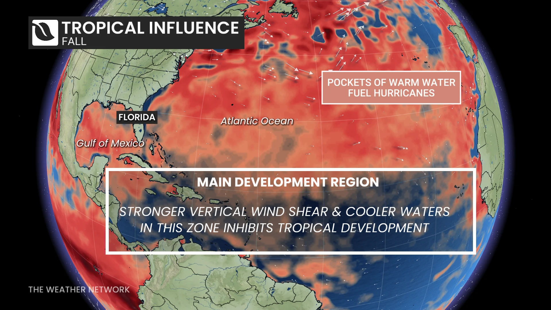
Tropical systems are thriving in the rising air and calm environmental winds throughout the northeastern Pacific. Meanwhile, this same pattern has increased the amount of disruptive wind shear blowing east over the Atlantic basin, shredding apart potential disturbances before they can develop any further.
What the data says about the season. Could we go without seeing a hurricane?
Tropical activity statistics are running well below normal in the Atlantic basin this year.
The data shows that the accumulated cyclone energy (ACE) is less than five per cent of the seasonal norm for the Atlantic.
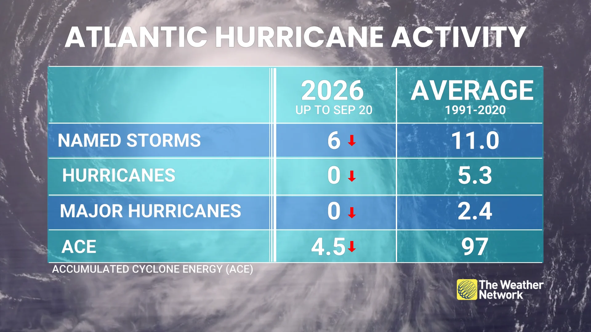
Why is that notable? ACE is a good representation of tropical activity because it factors in storm duration and strength.
In the satellite era, from 1966 and onward, it has never taken this long for a hurricane to develop.
If a hurricane does develops, it will be the latest occurrence of the basin's first on record in the satellite era.
Prior to the satellite era, there is a decent chance that some storms went unnoticed, a reason why the data is less valuable to forecasters prior to 1966.
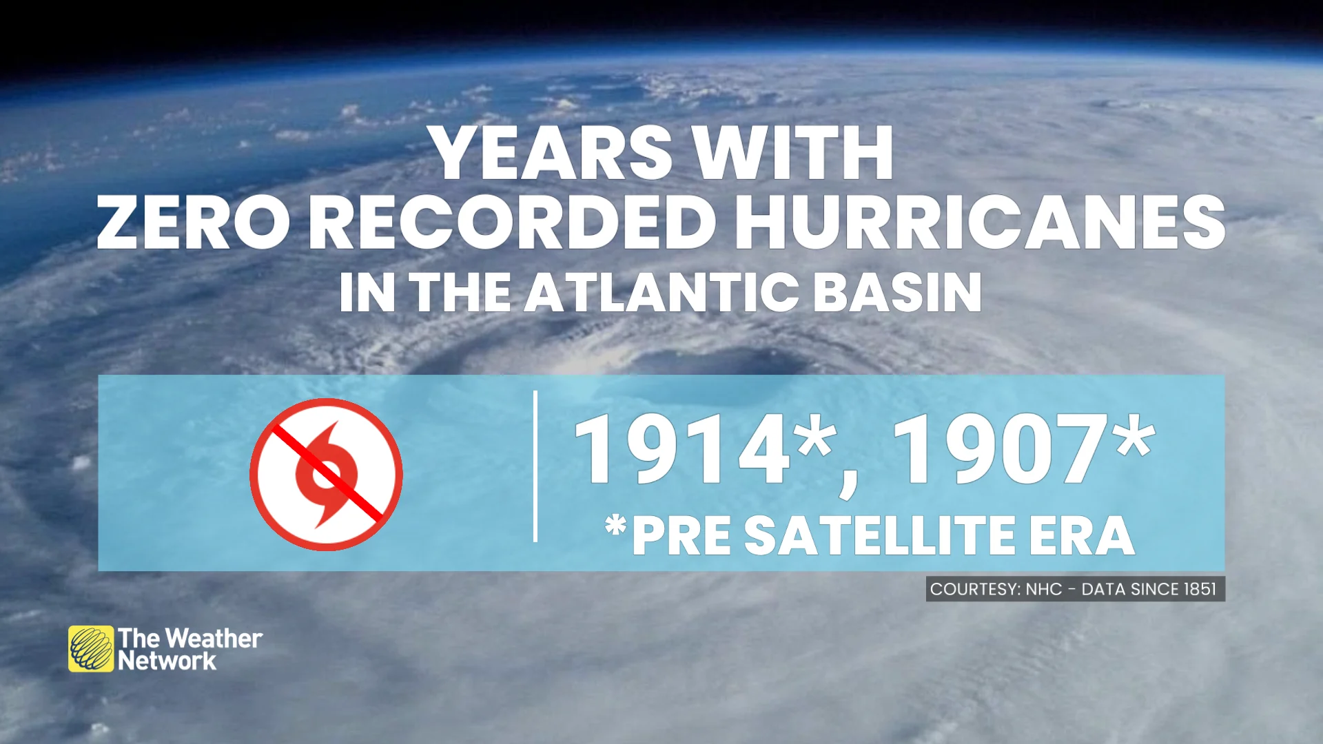
In recorded history, since 1851, there have been two years with no hurricanes in the Atlantic basin. Both 1907 and 1914 saw no recorded hurricanes in the region.
We are now beyond the climatological peak of hurrican season, and if it continues to remain slow, this could be the first satellite-era season with no recorded hurricanes in the Atlantic basin.
With files from Dylan Kikuta, a meteorologist at The Weather Network, and Dennis Mersereau, a digital journalist and weather specialist at The Weather Network.