Winter can wait: Exceptional El Niño favours an extended fall


Here's what the next few months have in store, Canada!
Fall is Canada’s ultimate transition season, but an exceptional El Niño will slow that transition considerably.
Autumn begins with echoes of summer and ends on winter’s doorstep. The question is how quickly we move through the season ahead.
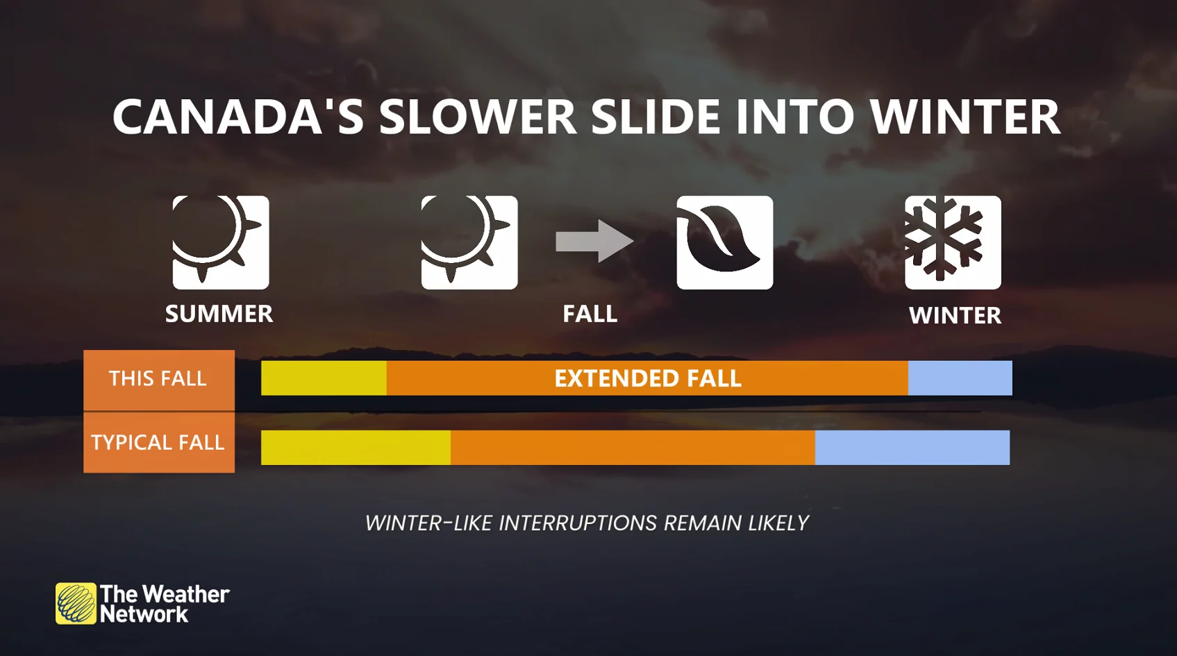
We’re favouring more mild spells than cold snaps, fewer classic fall storms, and a delayed arrival of persistent winter conditions. But be warned, the door remains open to a couple of significant pattern changes.
Fall 2026: The long road to winter
One of the strongest El Niño events ever observed is intensifying in the tropical Pacific, setting the stage for a more gradual transition through fall across Canada.
But not even the strongest El Niño can stop Canada’s inevitable temperature slide through fall. Cooler temperatures eventually win. Sorry, summer lovers, but this year, El Niño will put up a formidable fight.
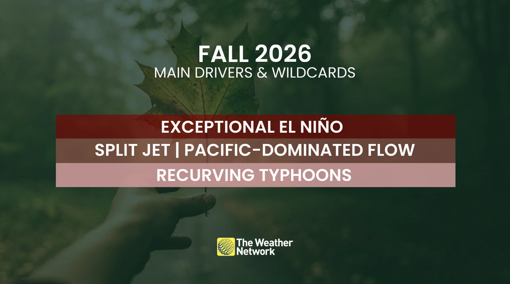
Meet the drivers & factors:
Exceptional El Niño: tilts the pattern milder
Split jet stream/Pacific-dominated flow: favours more Pacific air across Canada, making persistent Arctic intrusions less likely
Recurving typhoons: major wildcards capable of sudden pattern changes, temporarily nudging fall out of default mode
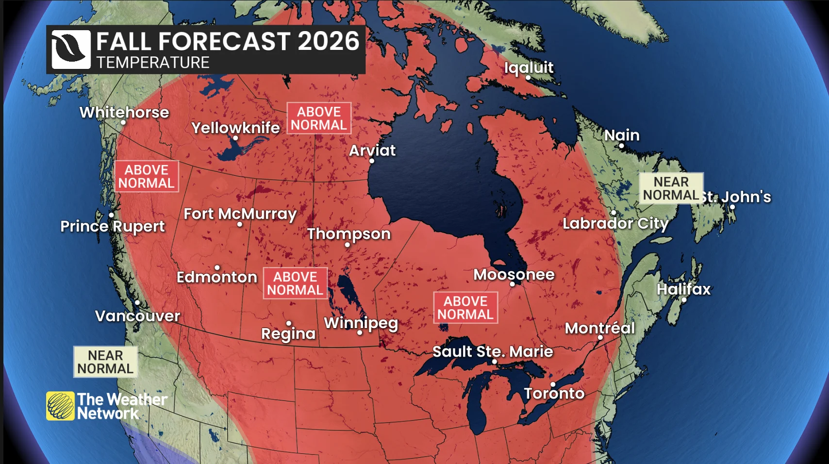
Below is a more detailed look at what we can expect across the country heading into the autumn months, including other factors in addition to El Niño. An FAQ section follows that may answer some of your questions about the autumn season ahead.
British Columbia
Fall personality: Defiant
Summer-like weather isn’t giving up without a fight
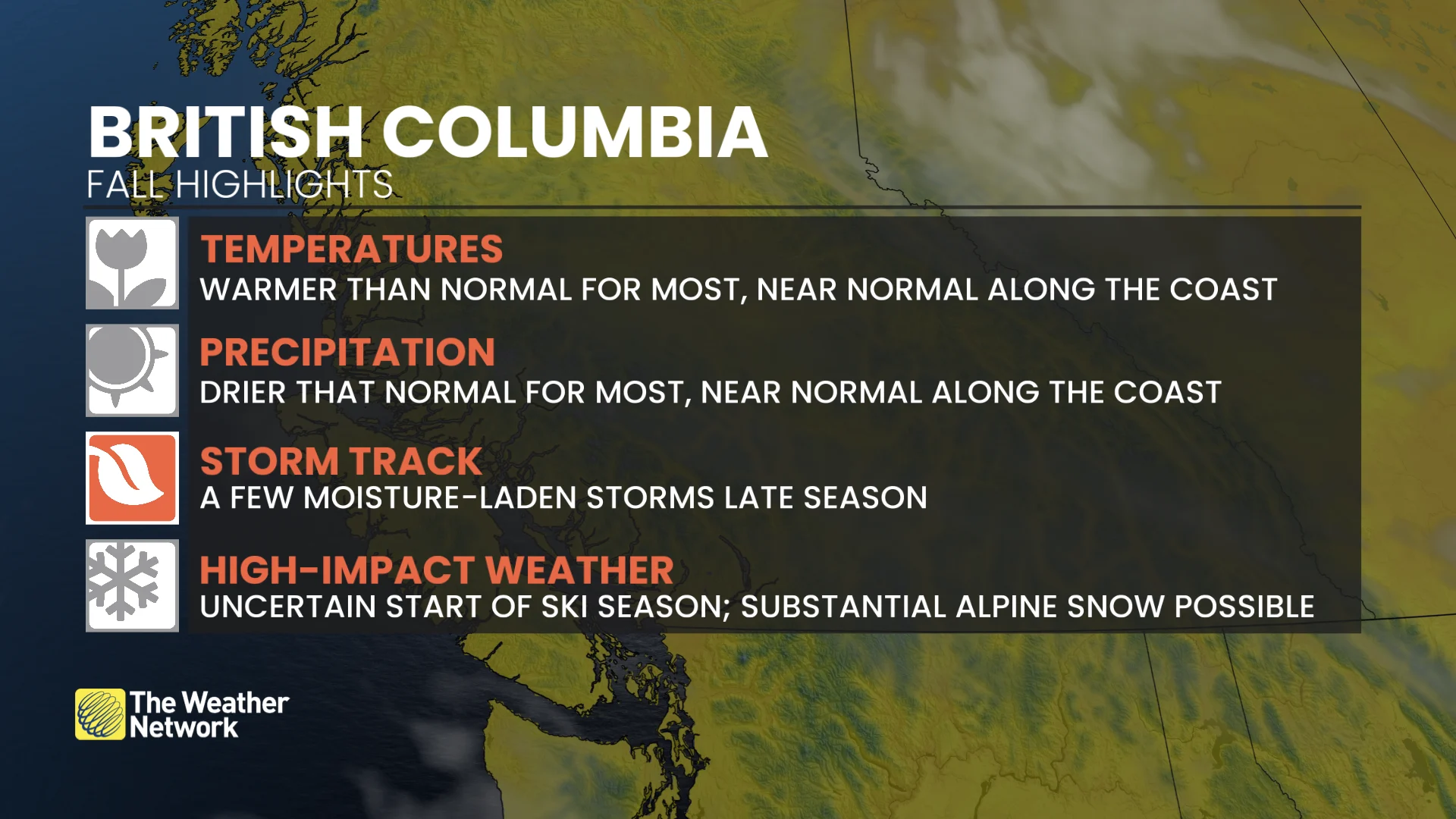
Early September’s cooler turn doesn’t necessarily mark the end of warmth.
The B.C. Interior should return to a milder and drier pattern through a big chunk of fall
Coastal B.C. is anticipated to be closer to seasonal temperatures
A more active Pacific storm pattern is expected later in fall
Alpine areas may become just cold enough for substantial early-season snow, giving us reason for cautious optimism heading into ski season
Alberta
Fall personality: Patient
Fall buys some breathing room
A warmer and drier fall should provide a longer runway for delayed harvest operations after a stormy summer left operations running behind
Winter weather is unlikely to lock in early
Mild weather should repeatedly return after chilly interruptions bring early winter-like weather.
Early snow and hard freezes are still possible (this is Alberta, after all)
Overall precipitation tips below normal
Saskatchewan & Manitoba
Fall personality: Resilient
Cold shots come, but mild weather pushes back
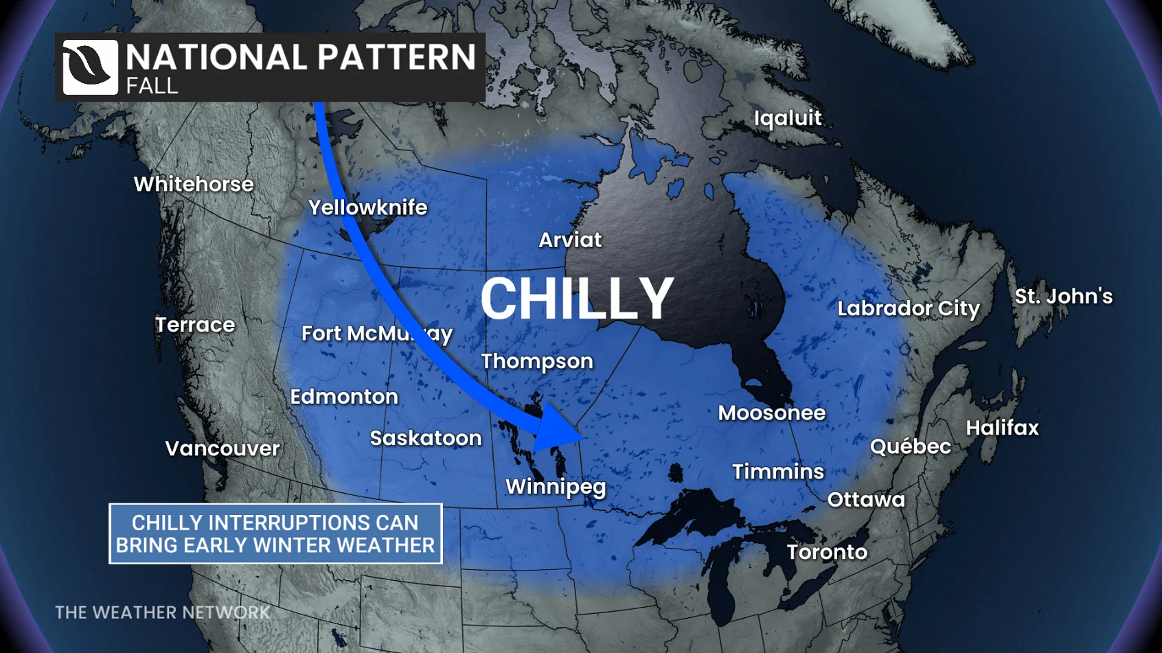
Warmer-than-normal conditions dominate the season ahead
Early wintry episodes still remain likely
Drier conditions are favoured away from southern portions of the region, where precipitation may finish closer to normal.
Ontario
Fall personality: Unhurried
Congratulations, you’ve unlocked the extended version of fall
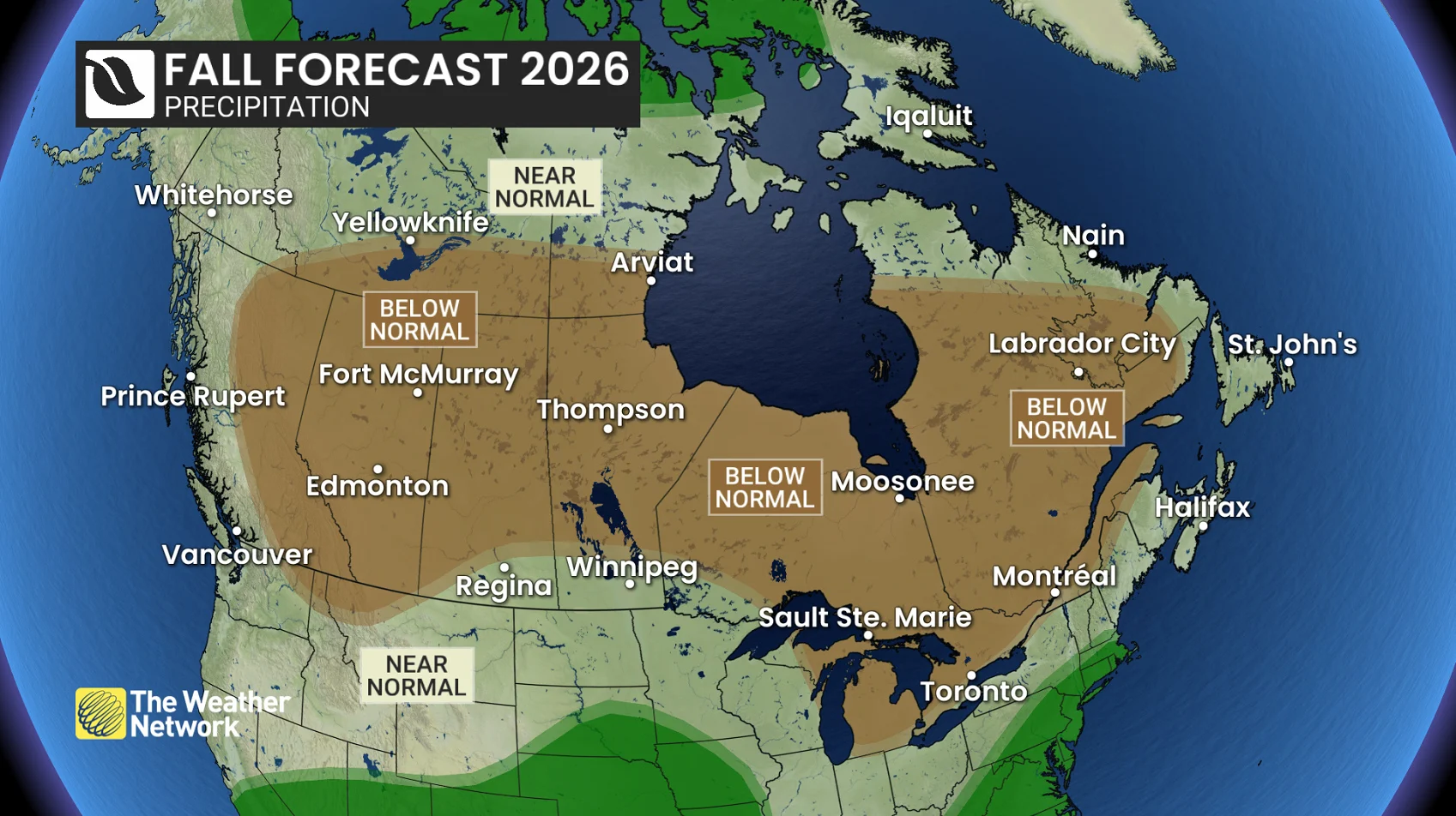
Fewer classic fall storms are expected overall
A large chunk of mid-September through mid-October may actually run surprisingly close to seasonal
One major storm can still define a season
A delayed arrival of sustained cold creates concern for early ski-area snowmaking
A larger warmth signal emerges by late fall
Watch for a fall fake-out; an early season chill doesn’t spell the beginning of winter
Quebec
Fall personality: Reluctant
Summer left early, but winter is in no hurry
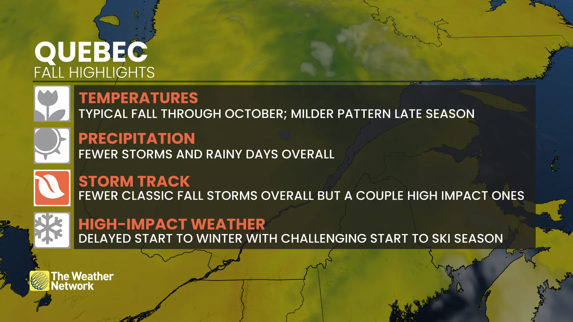
The peak of summer heat faded early
That does not imply a free-fall through fall
September and October remain typically changeable with up-and-down temperature swings
November carries a stronger, milder signal
Overall precipitation is expected to be below normal across much of Quebec
The delayed arrival of sustained cold could make for a challenging start to the ski season.
Atlantic Canada
Fall personality: Watchful
The tropics are quiet, but the door remains open to trouble
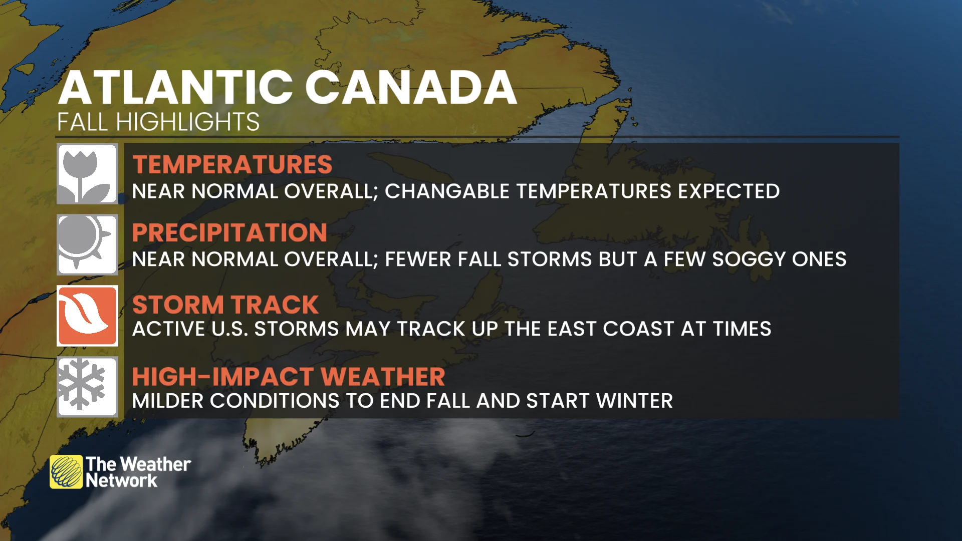
Overall, temperatures should finish close to seasonal
Atlantic hurricane activity has been well below normal through early September
Exceptionally warm waters nearby mean late-season systems still pose a risk
Home-grown systems closer to North America remain an important late-season wildcard
Cooler interruptions may be more noticeable through early fall
The southern U.S. storm track may occasionally feed moisture across the area
Northern Canada
Fall personality: Disrupted
A mild fall is relative this far north
Most of northern Canada will be tilted warmer than normal
This is deceptive, and seasonal temperatures drop by close to 1°C every couple of days through the heart of fall
Hudson Bay freeze-up is likely to be delayed, extending the wait for polar bears to return to the sea ice like last season
Arctic sea ice is expected to remain well below normal this fall, with long-term climate warming the primary driver and the exceptional El Niño adding additional warmth
The El Niño paradox
The unprecedented El Niño driving the pattern doesn’t guarantee an unprecedented fall in Canada.
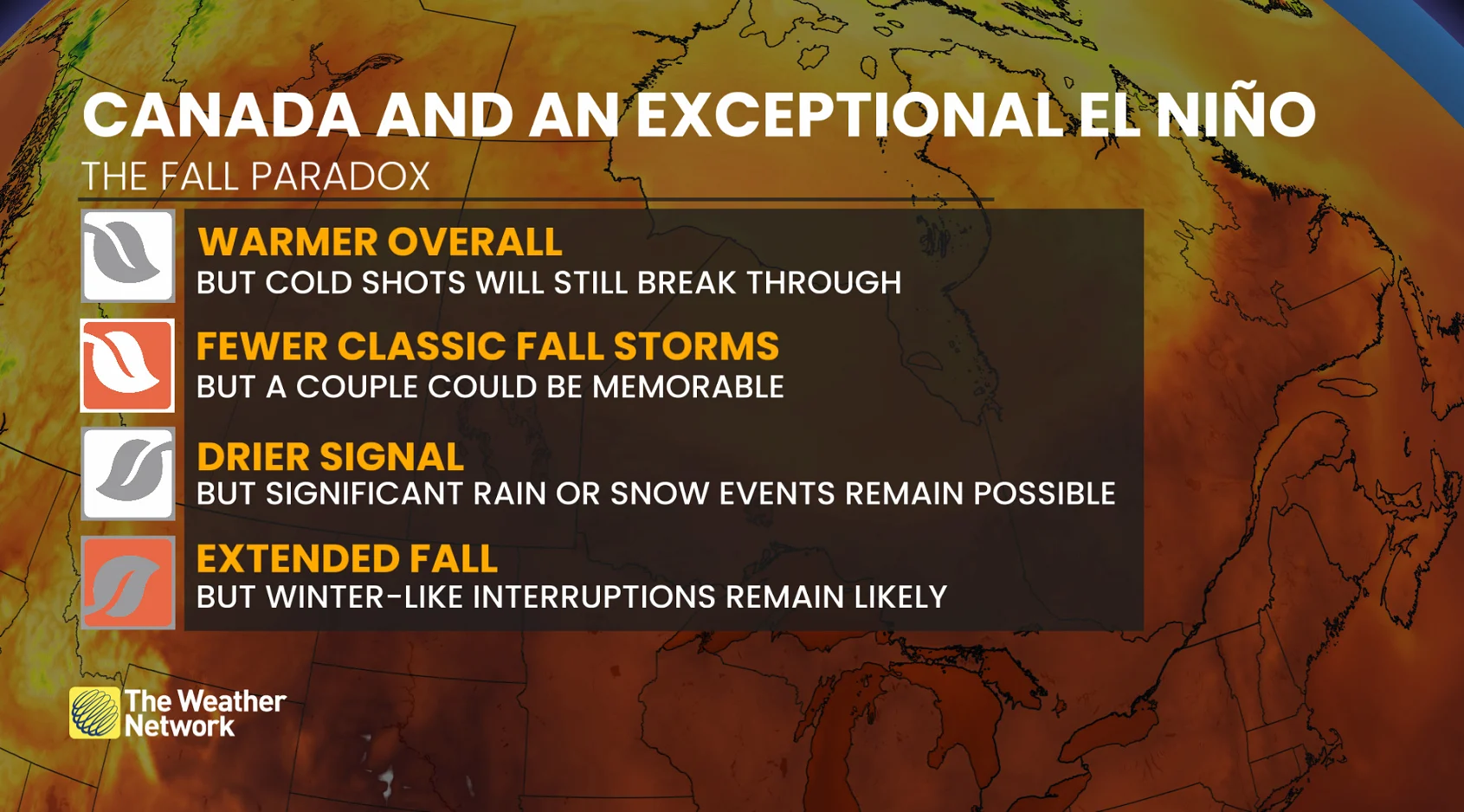
An El Niño this anomalous adds uncertainty. Its downstream effects may not fit neatly into previous years.
This leaves room for surprises. Seasonal forecasts sketch out the dominant pattern, but unexpected impacts, including significant weather events, are still possible.
What does this mean for winter?
Every single fall forecast gets the same question, so you’re probably wondering it yourself.
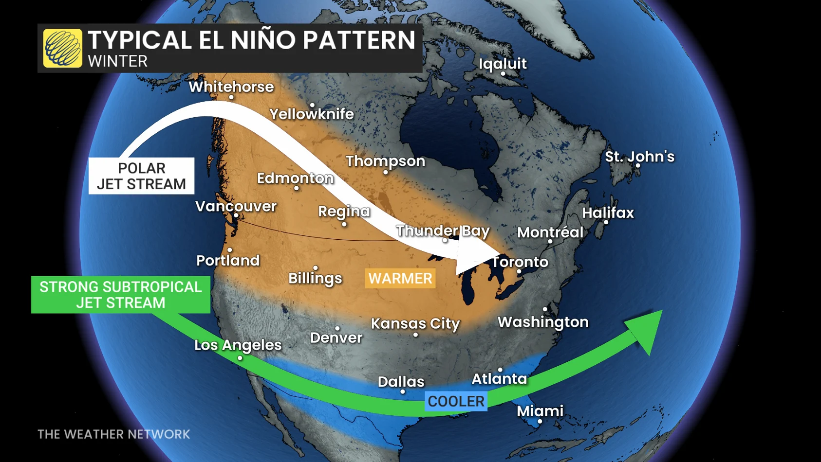
We’ll have more to say down the road, but El Niño will likely delay the onset of persistent winter conditions. This El Niño developed unusually early, raising an important question for winter: does it peak before the season gets underway, or maintain its exceptional strength into the heart of winter?
Frequently asked questions
Q: Does a warmer fall mean we’ll coast through and winter weather won’t arrive until December?
A: Hard no. Snow, hard freezes, and Arctic air are normal parts of the transition through fall. Our forecast is made to identify the dominant pattern, and cold spells are more likely to be interrupted by mild weather rather than becoming the permanent pattern.
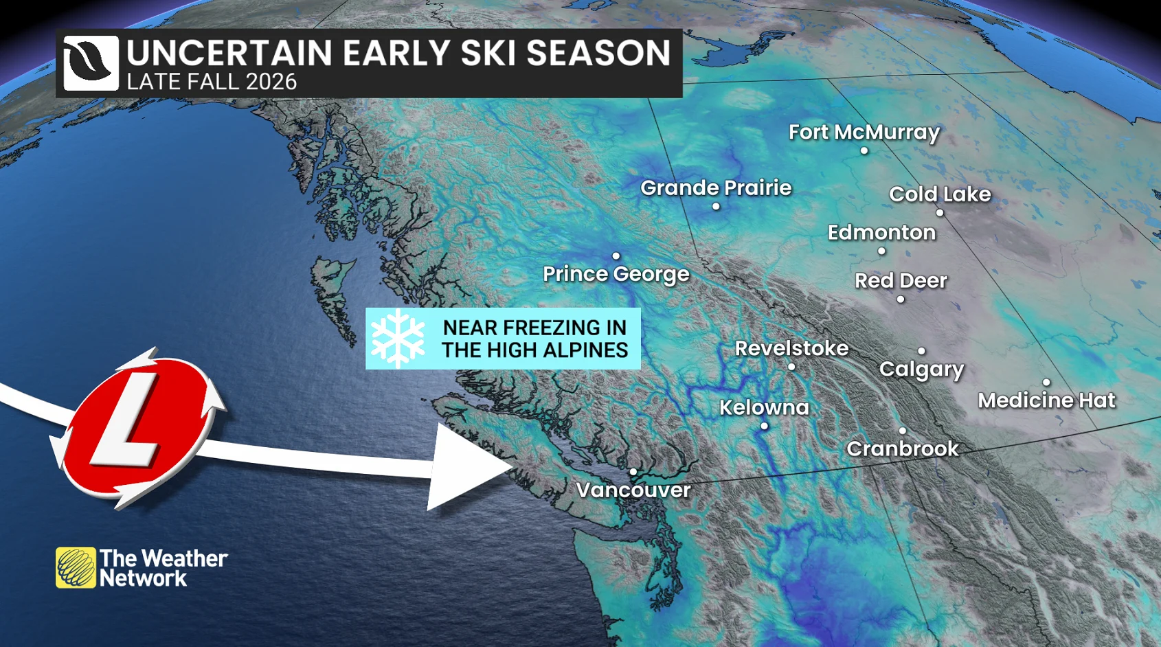
Q: Will ski season be delayed?
A: We’re carefully watching central and eastern Canada, where there’s a real risk of delays, while western Canada looks more nuanced and will be elevation-dependent. Previous strong El Niños have even delivered above-average snowfall amounts to B.C.’s mountains.
Q: The fall forecast sounds kind of boring. Are we destined for a storm-free season?
A: No. Even if precipitation finishes below normal, the season can still produce a handful of memorable, major storms.
Q: Could Canada face a historic fall storm?
A: Yes. Fewer storms doesn’t mean weaker storms, and one major event can define how an entire season is remembered.
Q: Does El Niño mean a mild winter?
A: Keep an eye out for our Winter Sneak Peek release in the coming weeks. The winter forecast will depend on how El Niño evolves and several other atmospheric factors.
Q: Will we get an early snowstorm?
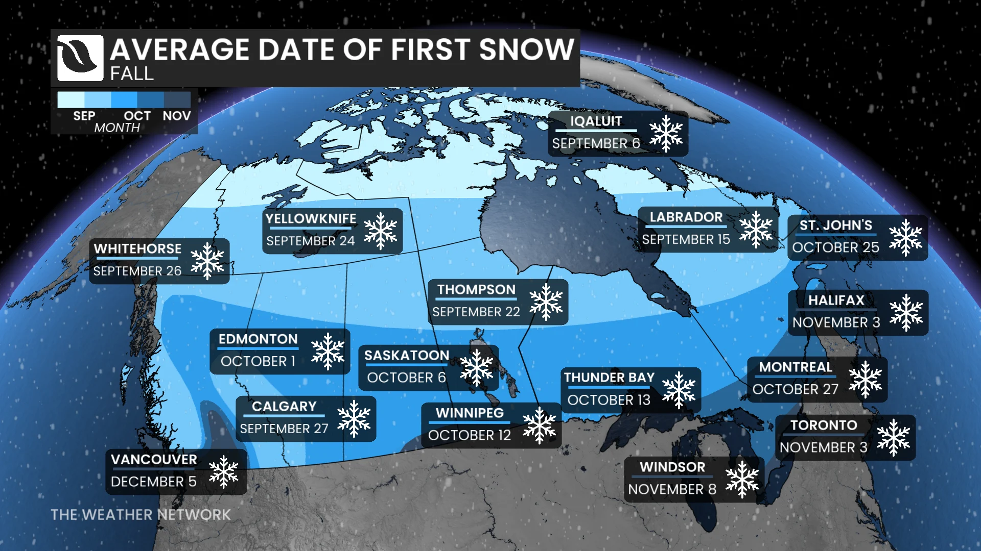
A: It depends where you reside. Victoria, B.C.: highly unlikely. Churchill, MB: count on it. All it takes is a sharp pattern disruption that would temporarily overwhelm the dominant pattern.
The most important question isn’t whether winter weather appears, but whether it sticks around.
Winter weather will knock at times. This year, don’t expect it to move in right away.
This article was written with the guidance and expert forecasting of Dr. Doug Gillham, a senior meteorologist specializing in long-range forecasting at The Weather Network.