Winter weather knocking on southern Ontario doorsteps with first snow

A perfect pattern is setting up to bring cold air and snow to southern Ontario by the end of the week. See which areas will be most affected by lake-effect snow and the season's coldest temperatures.
While other provinces have had a snowy taste of the winter to come, temperatures in Ontario have stayed well above seasonal thanks to a block of high pressure off the United States' East Coast.
But that is about to change. A deep, upper-level trough is forecast to dig across much of Eastern Canada and the U.S. by the end of the week, dragging cold, northern air southward.
SEE ALSO: What this record-breaking jet stream may mean for Canada's winter
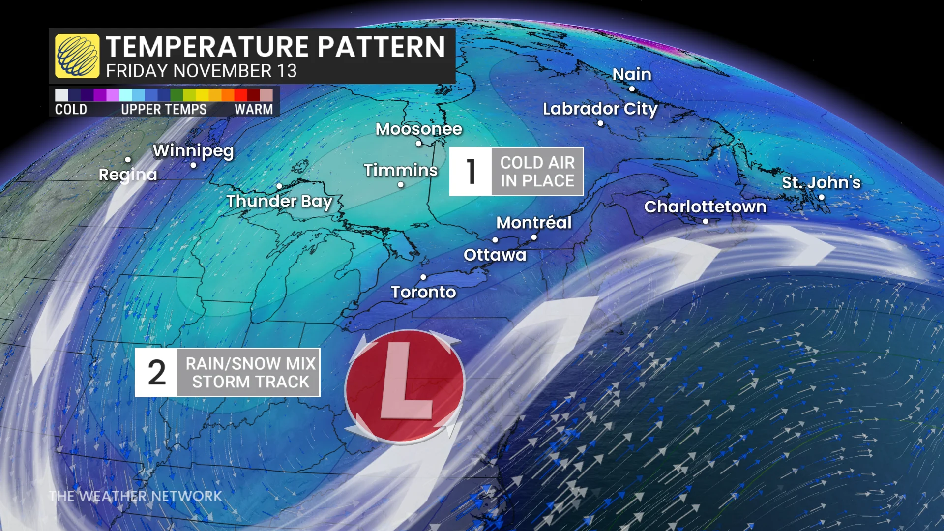
That means some areas are in like to see some of their snowfall of the season. While accumulations may not be high, the first snowfall can catch many drivers off guard, especially for those who haven't put their winter tires on.
Potential for first flakes by Friday
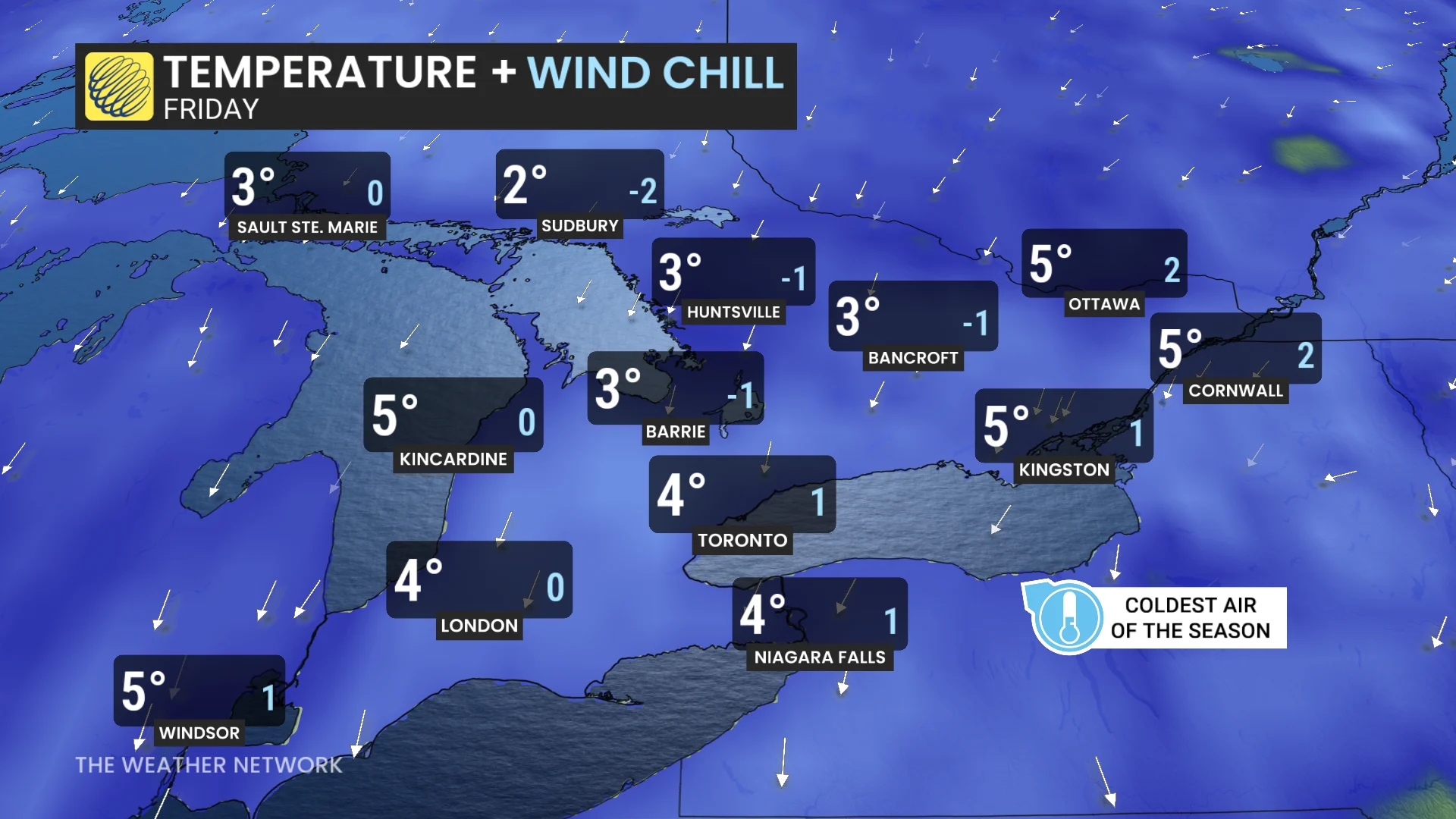
This is expected to be the coldest burst of air of the season so far for southern Ontario, with temperatures forecast to fall Thursday into Friday.
Daytime highs across the region on Friday are forecast to stay in the single digits, and wind chills should make it feel even colder.
Toronto's best chance to see the thermometer dip to freezing could be Thursday or Friday night.
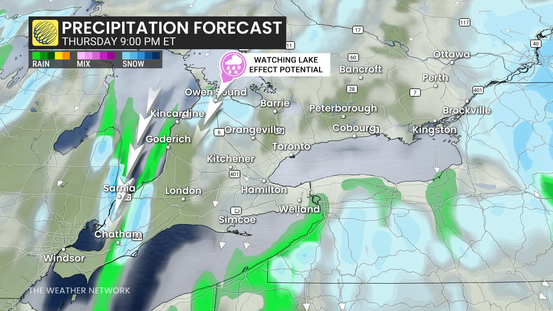
Forecasters are also closely watching for a low-pressure system to form over Illinois by the midweek, most likely staying south of the border as it tracks over Lake Erie. But, its close pass may trigger showers across southern and eastern Ontario Thursday into Friday.
DON'T MISS: El Niño, climate change made October the world’s warmest on record
Cold air being pulled behind the developing low could help to develop flurries just south of the Great Lakes.
Areas to watch will be Sarnia and the snowbelt communities for the first accumulation of the season.
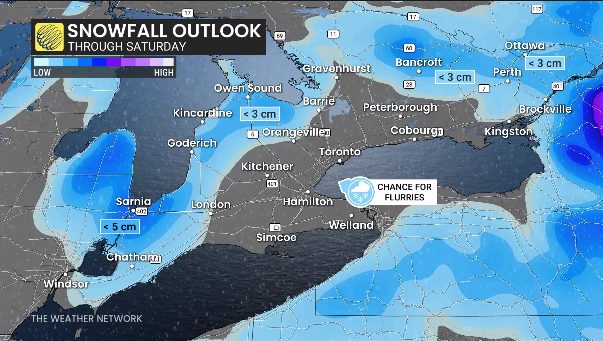
However, Sarnia and surrounding cities should see less than 5 cm. But, some models are indicating the totals exceeding 5 cm. There is still uncertainty in the exact totals, however.
Stay with The Weather Network for more information and updates on your forecast across Ontario.