What this record-breaking jet stream may mean for Canada’s winter

El Niño’s fingerprints are already showing up on the season ahead
A potentially historic jet stream is shaping up in the months ahead as El Niño exerts its influence over global weather patterns.
Models indicate a growing potential for a record-breaking subtropical jet stream. If this pattern comes to pass, it could have a significant effect on winter weather for parts of Canada.
DON’T MISS: El Niño, climate change made October the world’s warmest on record
Powerful El Niño influences the jet stream
Jet streams drive the bulk of our active weather during the cold months. These bands of strong winds swirling through the upper atmosphere push and pull on air near the ground, creating centres of high pressure and low pressure.
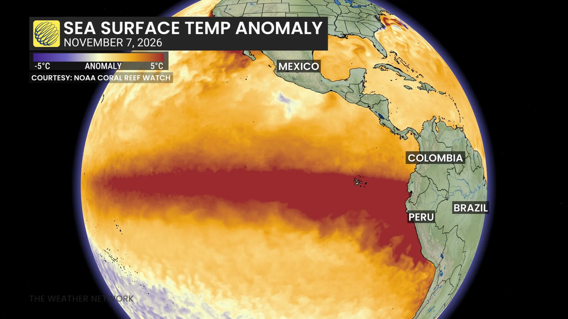
The extreme water temperature anomalies of our ongoing strong El Niño increases heating throughout the region, which can in turn influence the strength and placement of upper-level winds.
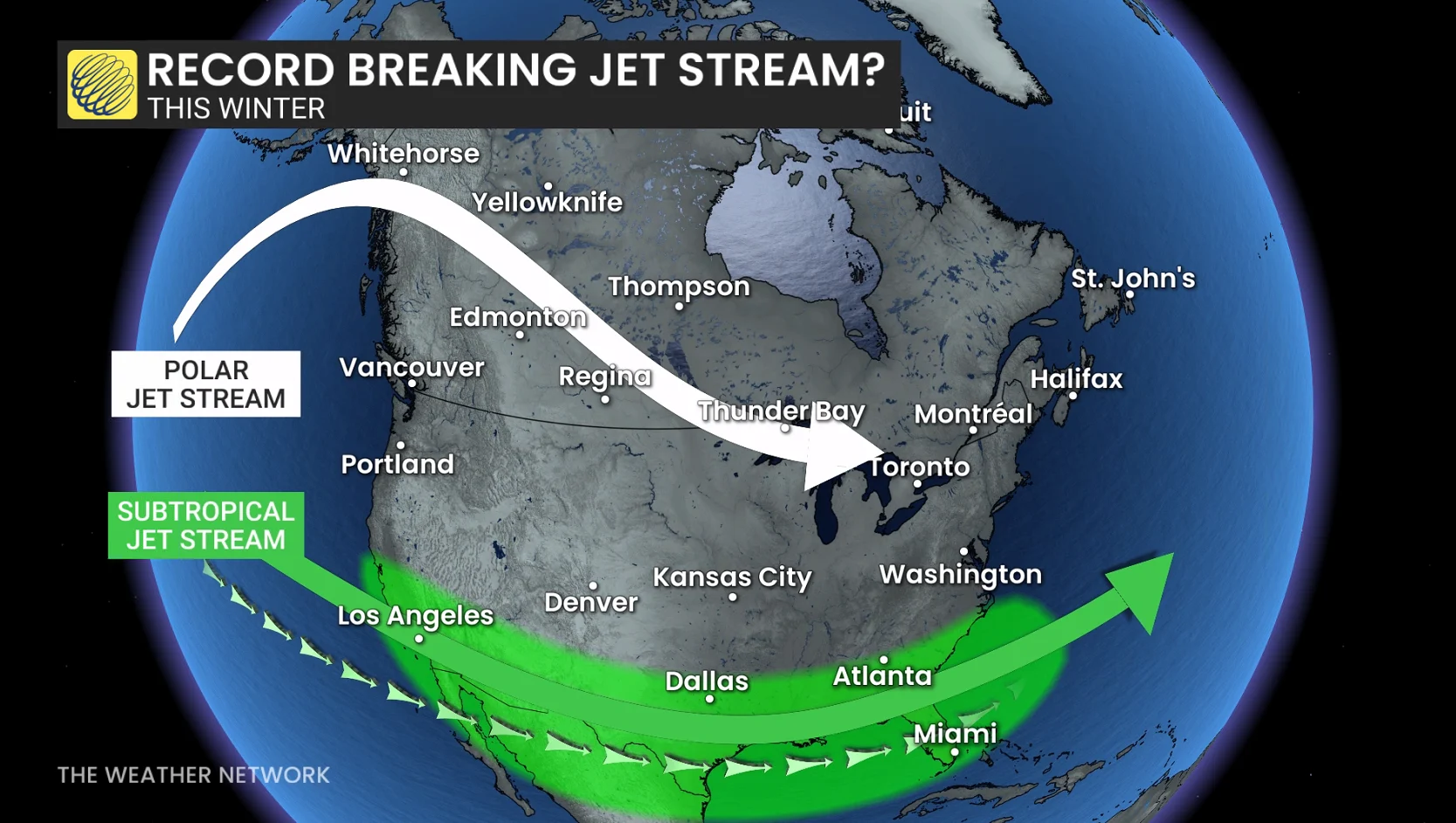
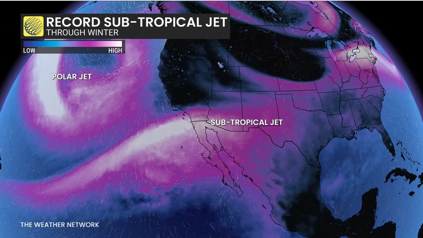
A strong El Niño tends to increase the strength of the subtropical jet stream and drag its location farther south. The latest long-range computer guidance from the European (ECMWF) model highlights that this subtropical jet stream may grow into the strongest on record this winter.
One caveat, of course, is that this is just a forecast. Lots of factors influence the jet stream, and it wouldn’t remain at peak intensity for the entire season. But the European model’s guidance is largely in line with NOAA’s latest El Niño update released in October.
What it could mean for Canada
A stronger, more southerly subtropical jet stream would lead to an active storm track across the southern United States. This kind of pattern would likely see waves of moisture push into California, with repeated spells of unsettled conditions progressing toward the East Coast.
The active storm track south of the border will remain key for the eastern half of Canada.
Even in an overall mild pattern, a storm track south of the Great Lakes can still bring significant winter weather. Storms that affect the southeastern U.S. could sweep north and affect the Atlantic provinces.
It’s the polar jet stream that will remain important for British Columbia’s storm track, as well as any Arctic outbreaks that dive southward across the country. The polar jet stream provides enhanced energy for the Canadian storm track, and it can even interact with the subtropical jet stream at times.
Stay tuned for more in The Weather Network’s winter forecast on Wednesday, Nov. 25.