A blast of wintry air will continue to fuel snow squalls in Ontario Wednesday
More snow is on the way for southern Ontario on Wednesday, a not-so pleasant way to welcome spring into the region for its first full day.
Spring officially arrived late Tuesday night, but the first full day of the season will not be what Ontarians expect.
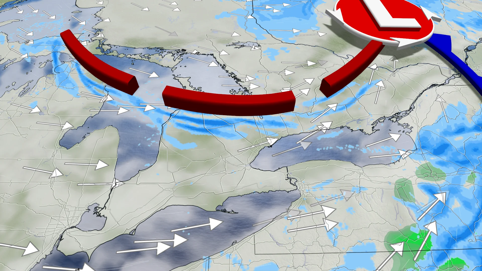
With cool temperatures, a lingering system and the expected starting of the lake-effect machine, another shot of snow is expected for southern Ontario to usher in spring.
DON'T MISS: Canada's spring gets sidelined as winter fights back for start of the season
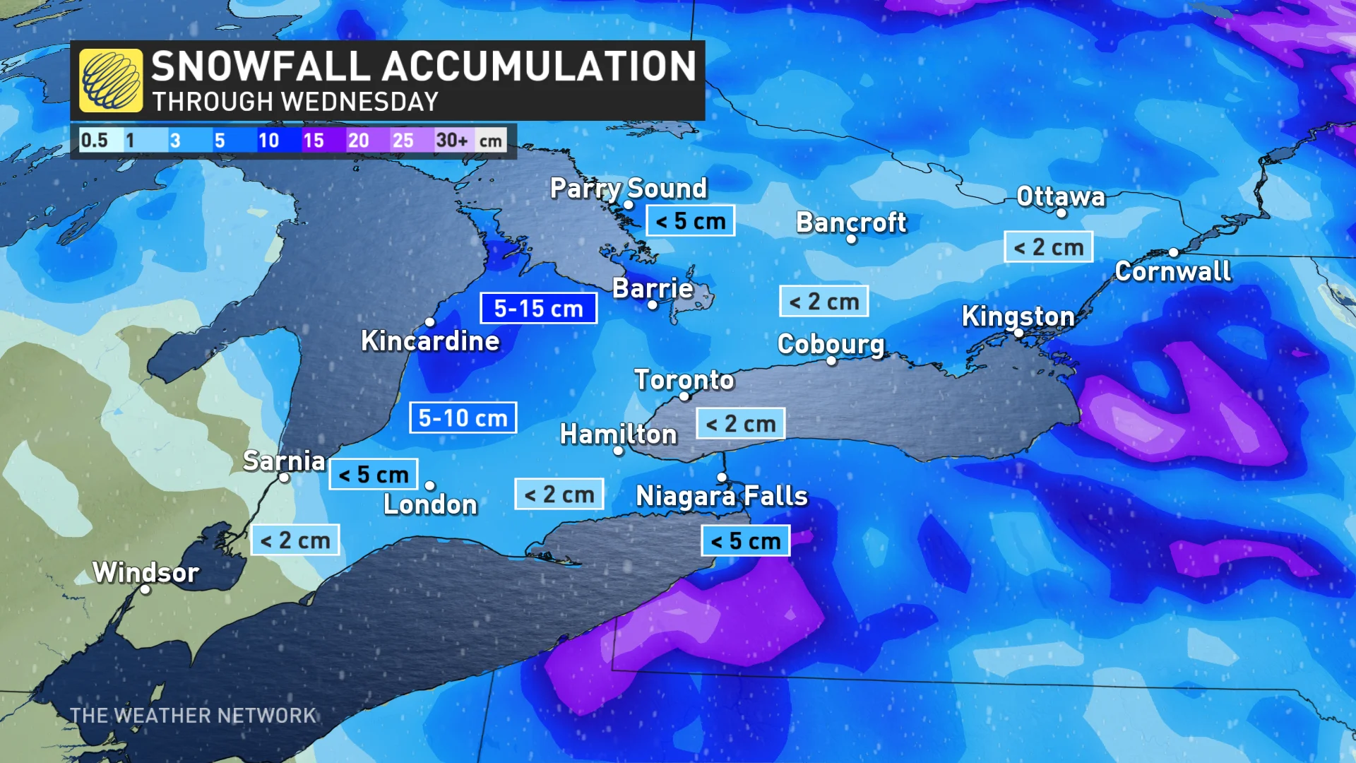
The heaviest amounts will be near Lake Huron and Georgian Bay, so expect difficulty travelling in those regions on Wednesday.
If you're hoping for a quick return to last week's warmth, don't hold your breath. Thursday and Friday will be the coldest days of the week, as much of the region remains below freezing.
Wednesday: More bursts of snow, and lake-effect squalls develop
The lingering system continues to bring snowfall chances on Wednesday afternoon across southern Ontario and the Greater Toronto Area (GTA).
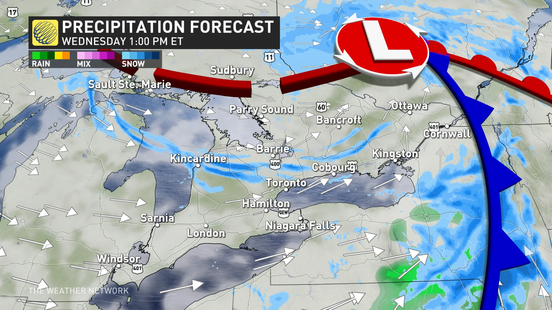
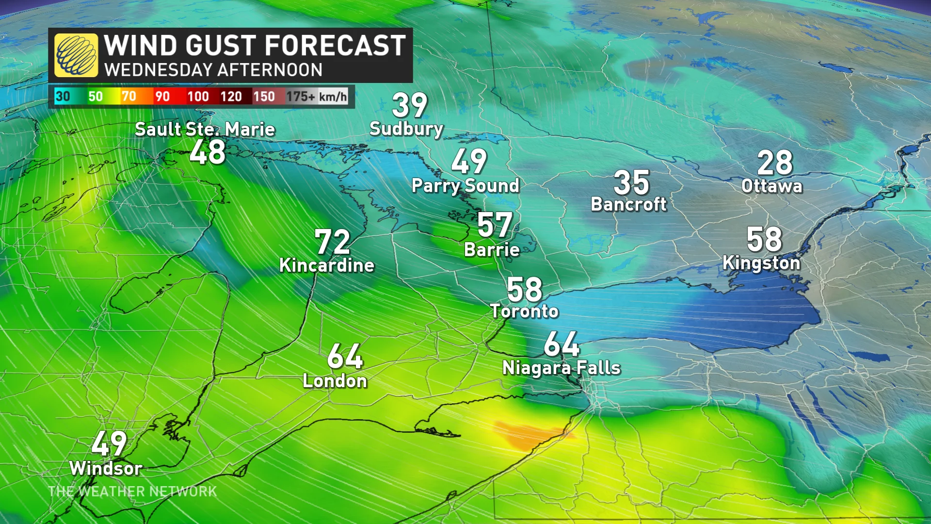
The GTA could see flurries off and on throughout the morning, with a chance for heavier snowfall to develop across Hamilton and Niagara during the afternoon. That line of snow will be short-lived but will reduce visibility quite quickly. Winds will be strong, with gusts of 40-70+ km/h becoming widespread by the afternoon.
As the winds pick up, lake-effect snow squalls will develop Wednesday evening across the snowbelts, possibly impacting northern parts of the GTA, as well.
Environment and Climate Change Canada has issued widespread snow squall warnings along the Lake Huron shore and inland, extending to the GTA, where the warnings transition into special weather statements.
"Consider postponing non-essential travel until conditions improve," the agency advises.
Be aware of rapidly changing road conditions and adjust your driving speed and following distance accordingly.
WATCH: Will your garden survive the cold and snow in Ontario
MUST SEE: Is hacking the atmosphere a 'cool' idea to offset global warming?
The snowbelts could see accumulations of 5-15 cm, but expect fluctuating totals locally.
Final accumulations will depend on a number of factors including system snow, lake enhancement, terrain and fluctuating temperatures.
Looking ahead, colder-than-seasonal temperatures remain through the weekend, then becoming milder for a couple days early next week with rain developing, and a thunderstorms risk, late Tuesday and/or Wednesday from the Colorado low tracking west and north of the region.
An active pattern with changeable temperature is expected through the end of March and into early April.
Stay with The Weather Network for the latest on your forecast across Ontario.