Will summer fade into the second half of August? Not so fast

School is just around the corner, but it may not be time to pack away the swimsuits and prepare for the cold just yet
Summer’s end is near. School is right around the corner, pumpkin spice is about to debut, and the calendar is inching ever closer to the start of September.
But summer’s end doesn’t necessarily mean the end to summer-like weather. Are we going to dive straight into fall with the close of August? Not so fast. Warm temperatures will stand firm even as a shakeup lingers on the horizon.
DON’T MISS: Latest El Niño forecast calls for historic heat by this autumn
It’s been a summer of severe storms, heat, and smoke across much of Canada.
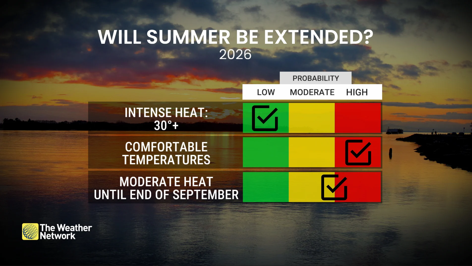
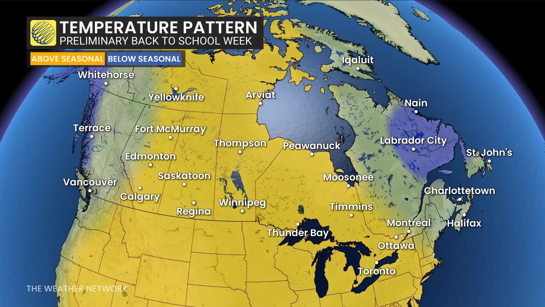
We’ll see the heat remain firmly anchored across the West between now and early September, with above-seasonal temperatures expected from British Columbia to Manitoba.
While many communities may still experience the odd 30-degree reading, the stretches of multi-day extreme heat might be behind us for the season.
Folks in Ontario and Quebec, on the other hand, are locked into a slightly cooler pattern where temperatures will hover near or slightly below seasonal.
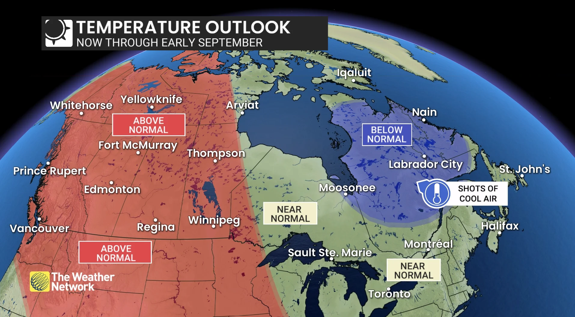
A shakeup may arrive once we roll into the month of September. The beginning of climatological autumn is always a transition month, with temperatures generally cooling off from their summertime heights.
The first week of the month looks to feature near-normal temperatures in the East, with the occasional dose of cooler air pushing into the Atlantic provinces. Heat should continue to hold on for folks in the West.
By the second week of September, however, we may see the heat shift farther east. Above-seasonal temperatures will remain present on the Prairies, with a steady spell of warmer-than-normal temperatures inching into Ontario and southern Quebec.
One wildcard worth monitoring this time of year is the potential for recurving typhoons in the western Pacific Ocean. Tropical activity is hopping in the Pacific basin thanks to an intensifying El Niño.
A typhoon recurving toward the north can inject into the jet stream, potentially influencing upper-level weather patterns downwind over North America. This atmospheric disruption can lead to steep, hot ridges for Western Canada while spells of cooler air can swoop south into the East.