Hazardous air quality continues in B.C. as thick smoke hangs tough

Thick low-level smoke will keep air quality levels firmly in dangerous territory for parts of B.C. heading into the second half of the weekend
Visit The Weather Network's wildfire hub to keep up with the latest on the unprecedented wildfire season across Canada.
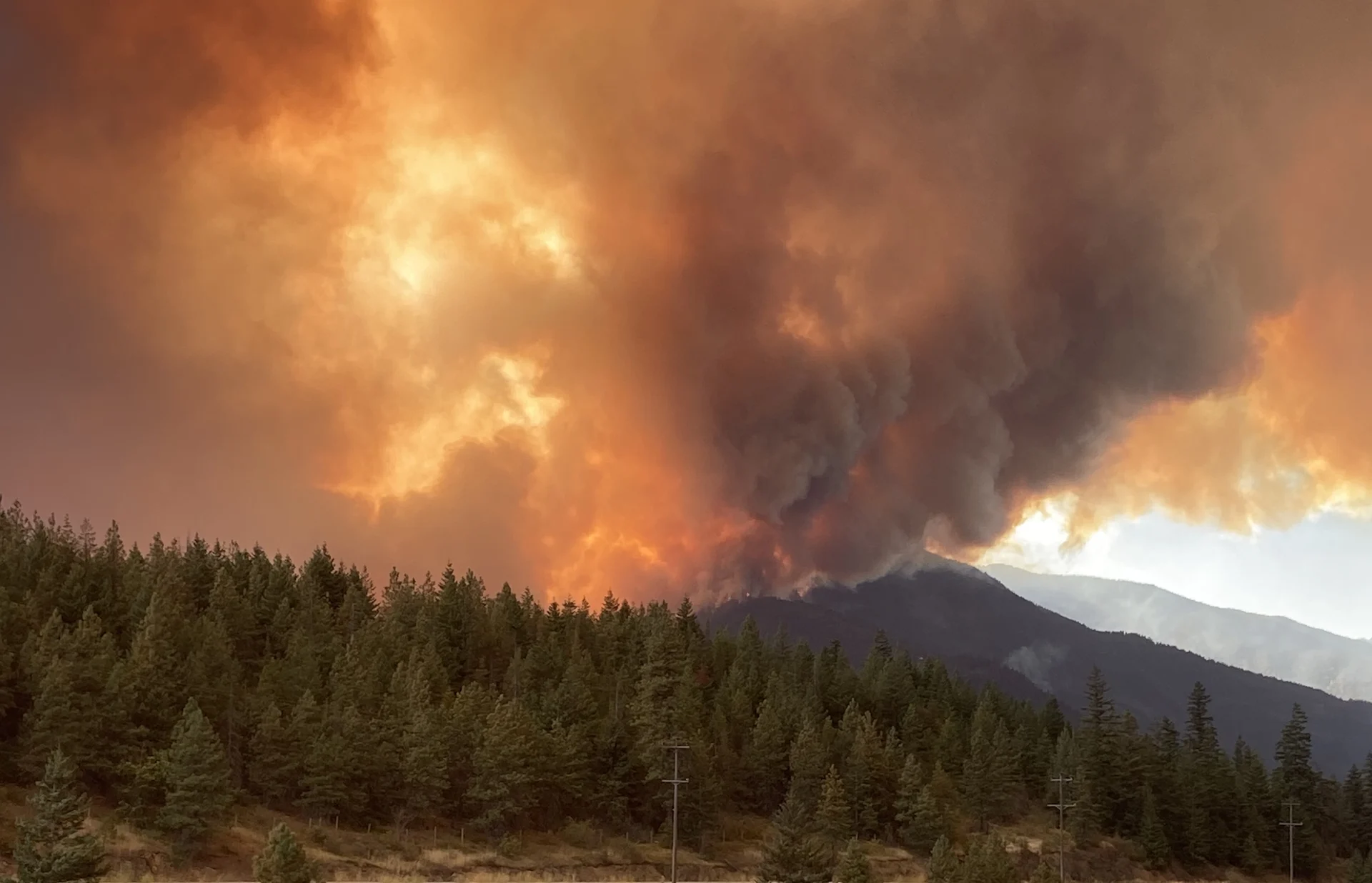
Many folks across British Columbia are dealing with dangerous to downright hazardous air quality as unfavourable winds blow low-level wildfire smoke into populated areas.
The smoke comes as a historic wildfire season shows no signs of slowing across the province. Raging fires throughout the Interior have forced thousands from their homes as crews rushed to battle the spreading flames. Officials have declared a provincewide state of emergency in response to the blazes.

SEE ALSO: B.C. under state of emergency as wildfire destroys homes near West Kelowna
Smoky conditions won’t improve much on Sunday, but a small bit of relief may be on the way this week in part due—of all things—to the hurricane hitting the American Southwest on Sunday.
Sunday
Areas: South Coast and Interior
Timing: Through Sunday
Air Quality: Air quality suffered greatly throughout southern B.C. on Saturday as the wildfire situation worsened across the province. Low-level smoke sent air quality readings soaring toward the top of the scale, with hazardous air quality expected in Kamloops and the Okanagan at least through Sunday night.

DON'T MISS: Best practices to keep yourself safe from wildfire smoke
A centre of high pressure sitting over the province will keep skies clear, robbing any short-term potential for beneficial rains across areas that need it the most.
Temperatures: The only bright spot amid the grim conditions across B.C. is that temperatures have fallen to reasonable levels this weekend, a relief from the record heat we saw just a few days ago.

Temperatures will remain seasonal across southern B.C. on Sunday, with daytime highs in the mid-20s to lower 30s throughout the region.
Long-range: We’re looking south of the border for a minor opportunity for relief as a result of Hurricane Hilary’s remnants moving toward Western Canada.

A significant heat dome parked over the central United States will guide Hilary’s remnant moisture north of the border, bringing an opportunity for clouds and scattered showers toward the middle of the week.
Unfortunately, this won’t bring the widespread heavy rain needed to improve the drought situation. Even so, any moisture is helpful in the battle against ongoing fires and the spark of additional blazes.
WATCH: Calmer winds help Kelowna firefighters Saturday, dry weather lingers
Thumbnail courtesy of the B.C Wildfire Service via Twitter.
Stay tuned to The Weather Network for the latest forecast updates for B.C.