Widespread wet snow to blanket Atlantic Canada into Tuesday
Plan ahead for slow going on the roads Monday and Tuesday as a blanket of snow falls across much of Atlantic Canada
A slug of wintry weather is on the way for much of the Maritimes as a moisture-laden storm dumping heavy snow on Ottawa and Montreal sides east to start the week.
Snow that began pushing into the Maritimes through the second half of Sunday will fill in across the region as we head into Monday. This will be a decent, shovellable snow for parts of the region, with a sharp cutoff in totals near Halifax as milder temperatures push in.
We’ll see the system move toward Newfoundland late Monday into Tuesday, with a modest coat of snow expected on the Burin and Avalon Peninsulas.
WINTER 2024: El Niño will play a critical role in the weeks ahead
It’s a classic early-winter setup for the region. A system sliding across New England is pulling in plenty of Gulf moisture from the south, which is running against cold air locked at the surface across the eastern half of Canada.

A shield of snow built in as that moisture spilled north of the border, laying down a healthy blanket of snow from Ontario’s cottage country that’ll eventually track east into the Maritimes.
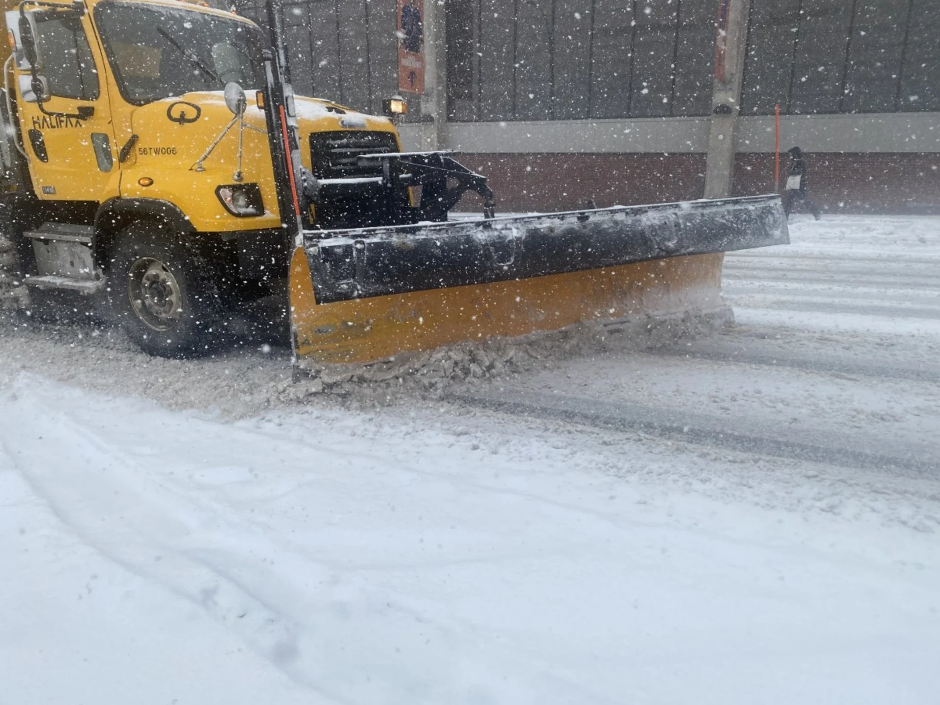
Moderate to locally heavy snow will be in full swing across much of the Maritimes to begin the Monday morning commute. The most formidable snows will fall along the Bay of Fundy shores into central Nova Scotia.

Areas that manage to stay all-snow for this event stand to see the greatest accumulations by the time the storm pulls away from the region late Monday afternoon into the evening. We could see 10-15+ cm of snow around Saint John and the Halifax Regional Municipality (HRM).
WATCH: Major snowfall heading to Halifax with some convenient timing
However, milder air just offshore will start to push into Nova Scotia during the day Monday. This potential for mixing will lead to a sharp snowfall gradient between coastal and inland sections of the HRM.
A minor dusting at the coast will grow to 5-10 cm in downtown Halifax, rising to around 15 cm expected out near Upper Sackville.
Wind's won’t pose much of an issue, but with 40-60 km/h gusts, that could make for blowing snow and poor visibility on the roads.

Snow eases Monday afternoon across the Halifax region and most of the Maritimes, while the snow begins its push across the Avalon Peninsula, where up to 10 cm of snowfall is possible. This is slightly lower than previous forecasts as the storm’s predicted track shifted farther south.
Northerly flow will build in behind this system as it departs, which could lead to the development of scattered sea-effect snow showers.
This will be a sticky, wet snow that clings to trees and power lines, leading to a slight potential for power outages in areas that see the greatest accumulations. It’ll also make it difficult to shovel, so keep your cardio health and muscles in mind before heading out to clear off sidewalks and driveways.
The wet snow could also lead to airport delays and possible cancellations as crews will have to work to clear the sticky snow off aircraft for a safe departure.
Plan ahead for potential travel issues on the road through Monday and Tuesday, and stay up-to-date with the potential for delays and cancellations throughout the region.
Stay with The Weather Network for the latest on this wintry forecast across Atlantic Canada.