Snow makes a reappearance in southern Ontario after a short break
Plan ahead now, southern Ontario. Thursday will see the return of accumulating snow, which will threaten to disrupt afternoon and evening commutes. Most areas will see 5-15 cm, but some locales could see up to 20 cm
While it appeared winter was on a hiatus in southern Ontario recently, people will quickly discover it still has plenty of life left in it.
RELATED: Record warmth melts Great Lakes ice to historic February lows
Compared to the East Coast storm, amounts will be relatively mild, though. A range of 5-15 cm of snowfall is expected for much of southern Ontario through Thursday, with upwards of 20 cm possible for areas near Lake Huron and Georgian Bay.
It will likely have a significant impact on the afternoon and evening commute times, with moderate snowfall rates expected for a few hours. Drivers are urged to plan ahead.
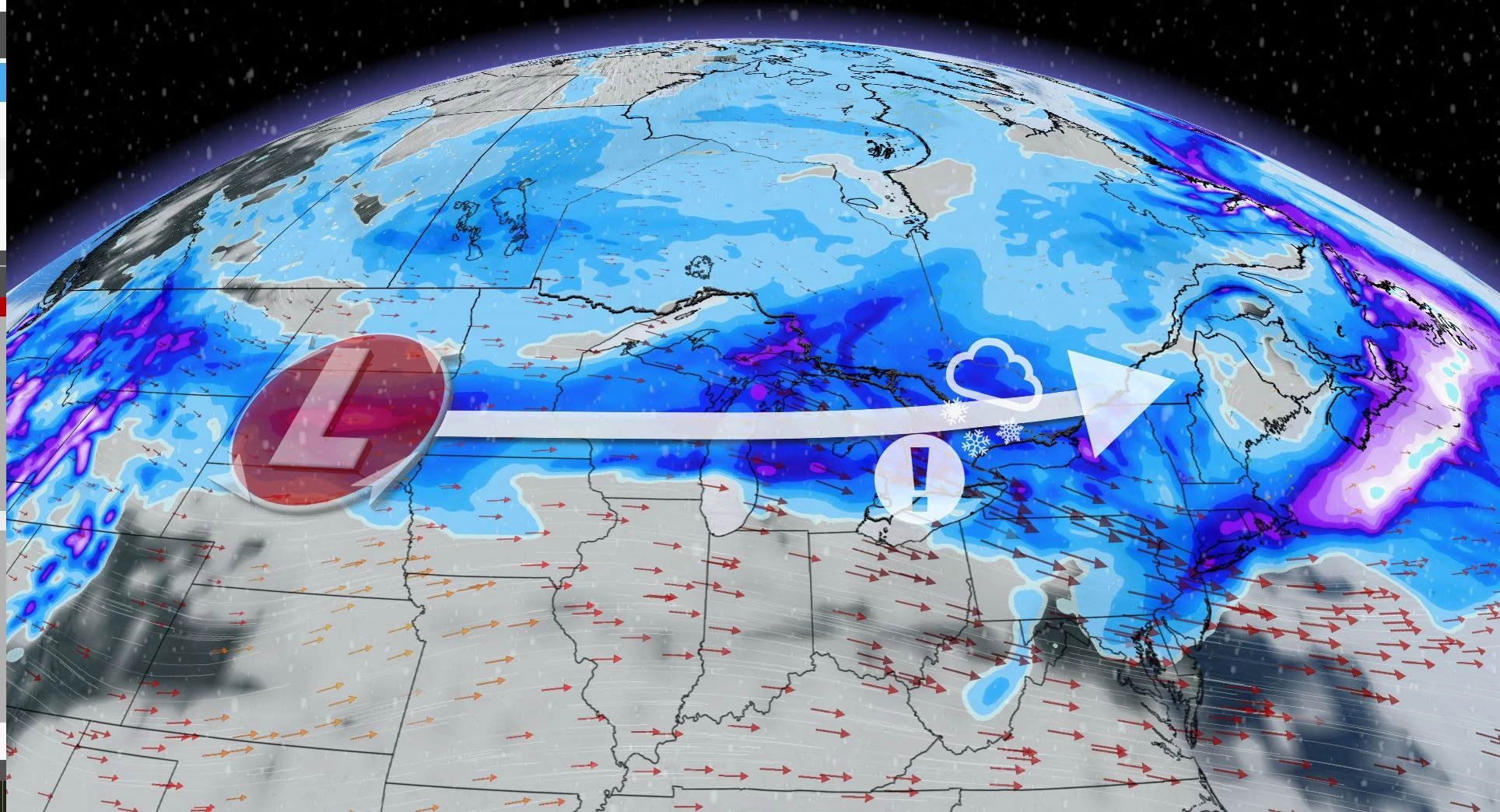
Winter resurfaces with accumulating snow on Thursday
A low will track into Ontario Thursday with snow starting along the lakes Huron and Superior shorelines Thursday morning.

Snow will track east through the day with snowfall rates picking up for the afternoon and evening, reaching the Greater Toronto Area (GTA) late afternoon and the Ottawa region after the evening commute.
Southern Ontario can expect a tricky Thursday evening commute. Moderate snowfall paired with 50-70+ km/h winds will reduce visibilities along major highways. Localized power outages may also occur where the strongest gusts occur.

Snowfall amounts will be highest around and near Lake Huron and Georgian Bay –– with a potential for up to 20 cm –– and lowest in extreme southwestern Ontario as some mixing could occur, thereby reducing accumulating snow.
Accumulations of 5-15 cm are expected for most areas, with 5-10 cm expected in the GTA. If the forecast trends on the high end, it will be quite a season slip for the city. The last time Toronto recorded near 10 cm of snowfall was nearly a year ago in March 2023.

It’s a rather quick system, however, so snowfall will end for the GTA Thursday overnight and by Friday morning for Ottawa, leaving a fresh blanket of snow.
Lake-effect snow threat kicks off the long weekend
Behind the system, colder temperatures will move in, setting up some lake-effect bands off of Lake Huron and Georgian Bay for Friday.
A multi-day, lake-effect snow event is expected. Snow squalls are likely southeast of Lake Huron and Georgian Bay, starting Thursday night and continuing through the weekend. Strong, northwesterly winds gusting to 50-70+ km/h will cause extensive blowing and drifting snow, with whiteouts for the traditional snowbelt regions Thursday night and into Friday.

The wind will diminish Friday afternoon and evening, but breezy conditions will return at times again during the weekend.
Temperatures next week will be within a few degrees of seasonal. No major storms are expected through the middle of next week.
Keep checking back to The Weather Network for more forecast information and updates on your weather across Ontario.


