Major storm could bring 50+ cm of snow to parts of Atlantic Canada
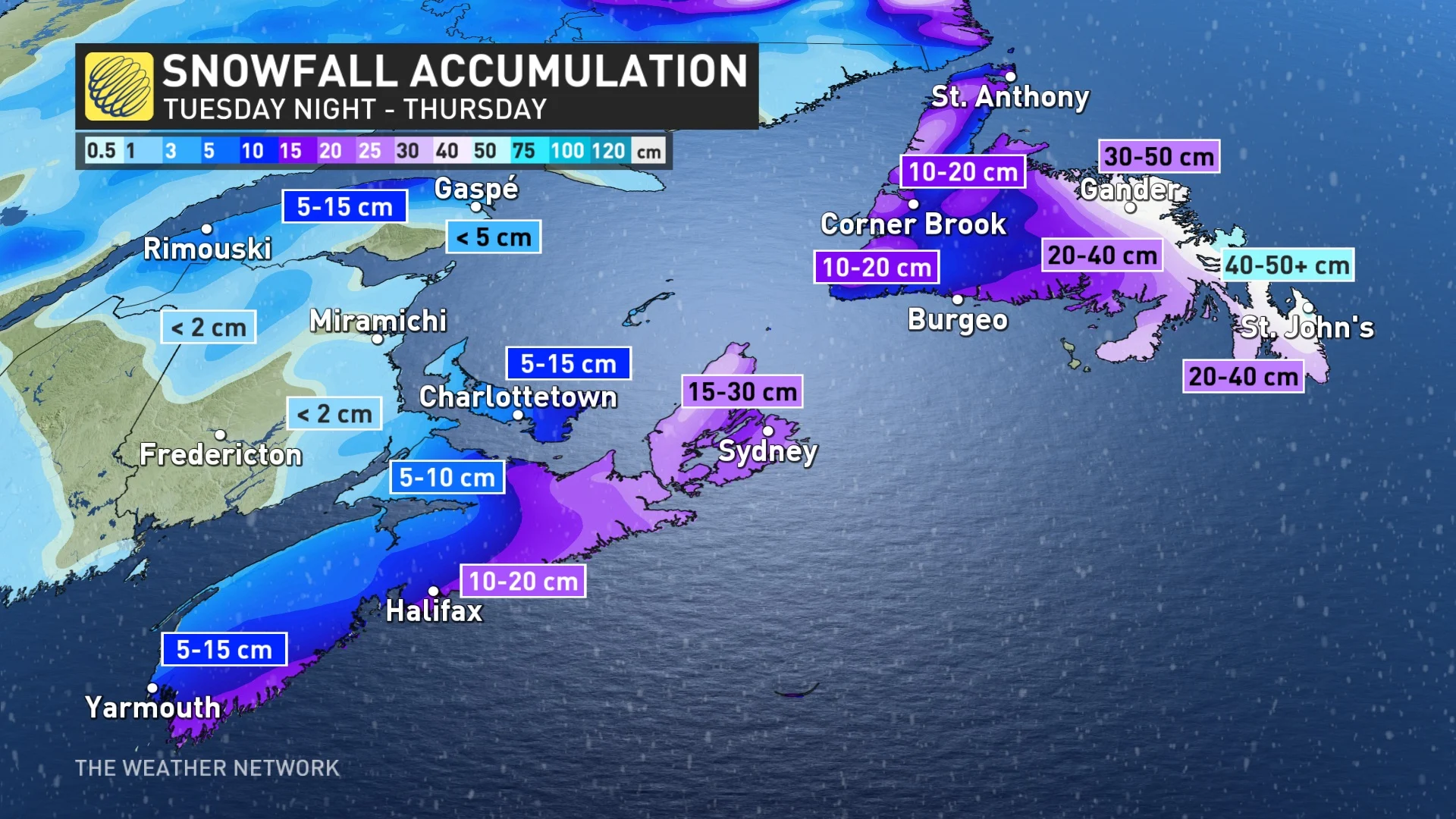
As much as 50+ cm of snow is forecast for parts of Newfoundland as a nor'easter brings heavy snow and blizzard conditions to Atlantic Canada through Valentine's Day
A classic nor’easter, which is named for the powerful, northeasterly winds that hammer coastal communities, has arrived in Atlantic Canada after plowing through the U.S. Northeast with significant snowfall Tuesday.
A wide range of totals are expected for the East Coast, too, which could see anywhere from 10-50+ cm of snow, depending on the exact location, by the time all is said and done.
EXPLAINER: What is a nor'easter, exactly?
Winter storm watches and warnings are in place. Heavy snowfall, blowing snow, and reduced visibility are all hazards with the nor’easter.
It is worth noting that similar storms in the past have caused hazardous driving conditions, school closures and cancellations of scheduled activities, and disruptions to public services.
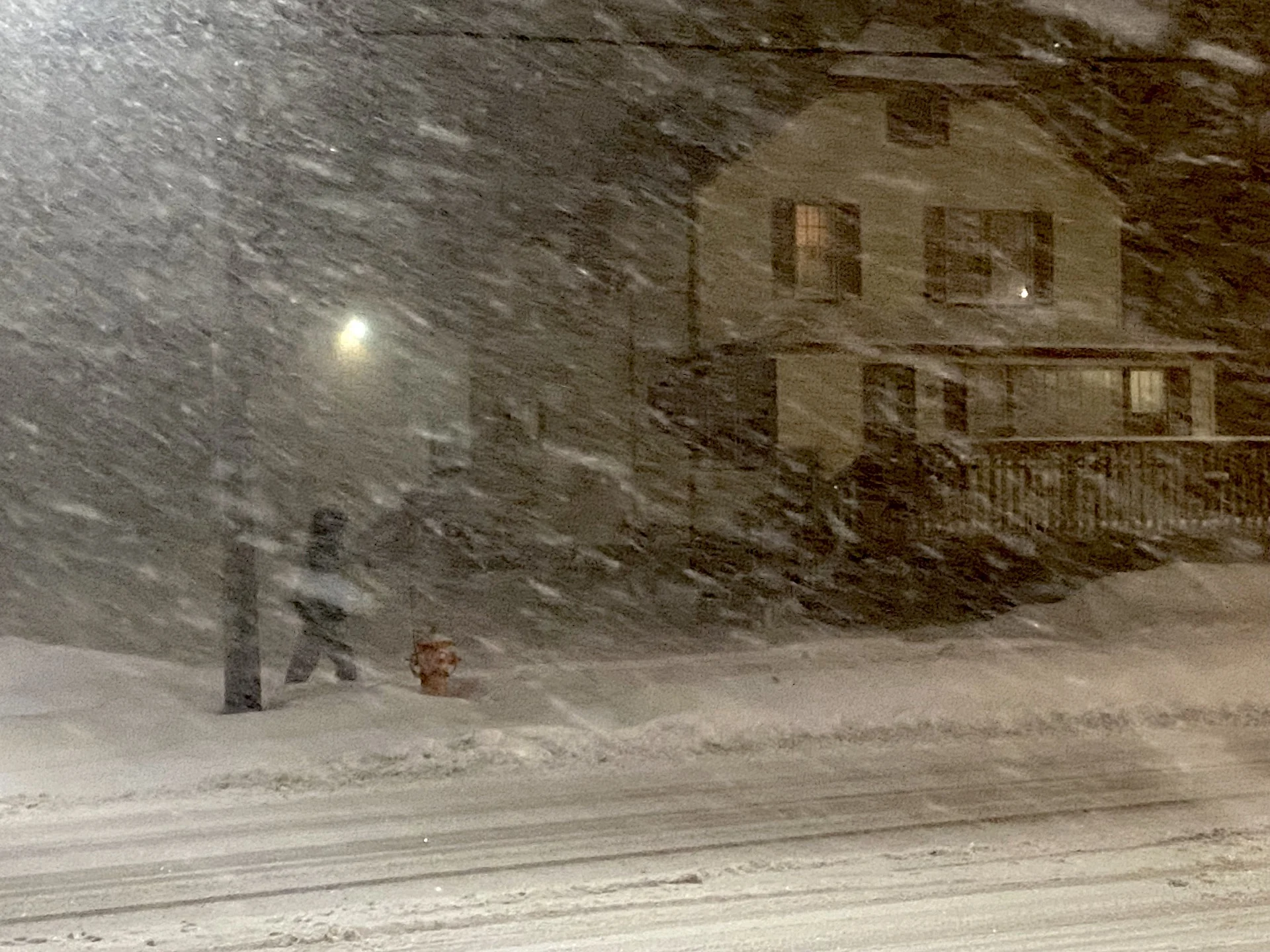
There will be considerable travel interruptions as rapidly accumulating snow will make commuting difficult over many locations. Visibility will be suddenly reduced to near zero at times in heavy snow and blowing snow.
Storm picks up steam Tuesday night
A swath of significant snow associated with the nor'easter is pushing across the U.S. Northeast from northern Pennsylvania, east through Massachusetts, including the Boston metro area. Numerous travel delays and cancellations have been reported in multiple states.
RELATED: Heading south? Nor'easter to blanket New York, Boston in snow

Conditions deteriorate Tuesday night across Nova Scotia, as the low tracks closer to Sable Island.
Peak snowfall rates are expected Tuesday overnight, with the heaviest expected to be finished by Wednesday morning. Wind gusts will be a concern for coastal Nova Scotia when the highest snowfall rates occur, drastically reducing visibility. Gusts of 50-70 km/h are expected through Wednesday morning.

The heaviest snow in the Maritimes will fall in southern Nova Scotia, Cape Breton, and eastern P.E.I. Totals of 15-30 cm of snow are expected for Cape Breton, while 10-20 cm is forecast for Halifax, Yarmouth, and New Glasgow.
Snowfall amounts have slightly been reduced for the Maritimes from the prior forecast as the low is forecast to track just a bit farther south than thought earlier.
BEWARE: Towering snow piles could lead to very expensive problems you didn't see coming
Valentine's Day blizzard possible for Newfoundland
Blizzard conditions and nearly half a metre of snow is forecast Wednesday to Thursday in Newfoundland. Travel is not recommended. We anticipate school and business closures in regions southeast of Gander, including New-Wes-Valley, Clarenville, Bonavista, and the Burin and Avalon peninsulas.

Snowfall and gusty winds begin Wednesday morning, intensifying into the afternoon. At this time, snowfall rates will top 3-5 centimetres an hour.
Paired with wind gusts 50-70 km/h, it will create very dangerous conditions. Near-zero visibility and blizzard conditions are expected southeast of Gander, including in St. John’s.

The nor’easter is forecast to reach the deepest low pressure late Wednesday-Thursday morning, hitting ~950 hPA as the centre of the low passes by the Avalon. That will fuel the very strong winds and blizzard conditions.
Snowfall will continue Thursday, but primarily for the northern coast, adding more snow to the heavy accumulations from Wednesday.
As the low tracks close to the Avalon, some warmer air can move onto the Avalon, bringing the threat of a brief wintry mix. It will slightly limit, albeit still high, snowfall totals here. 30-50+ cm is possible for much of the eastern half of Newfoundland and along the Trans-Canada Highway.
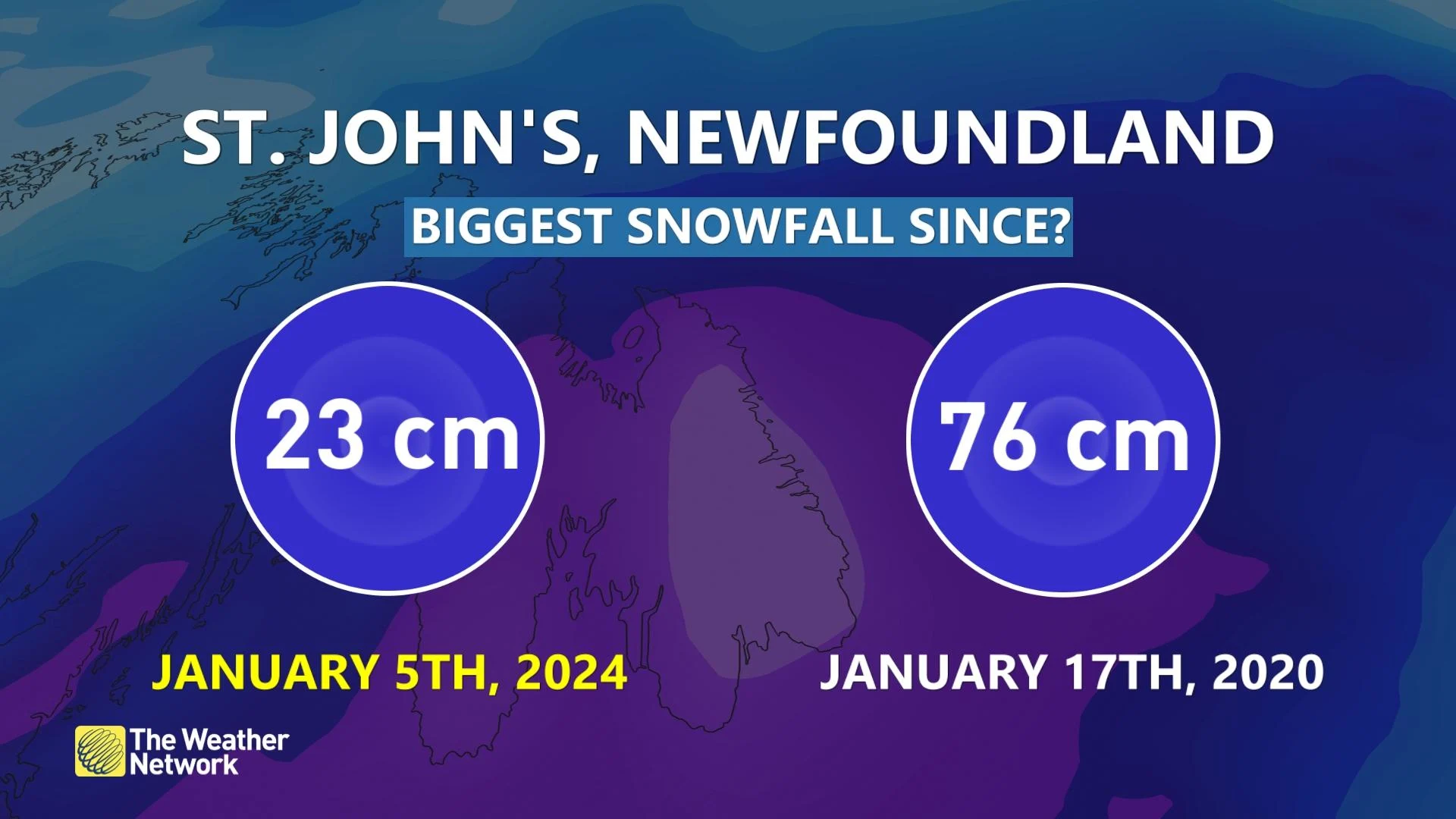
It’s likely the biggest snowfall of the entire season for St. John’s, with the previous high occurring on Jan. 5, 2024 with 23 cm of daily snowfall.
2024 will continue St. John’s three-year Valentine's Day snowstorm streak, with this event possibly cracking into the top two or three as 35-40+cm is forecast.

Make sure to keep checking back to The Weather Network for forecast updates and impact information across the Atlantic provinces.