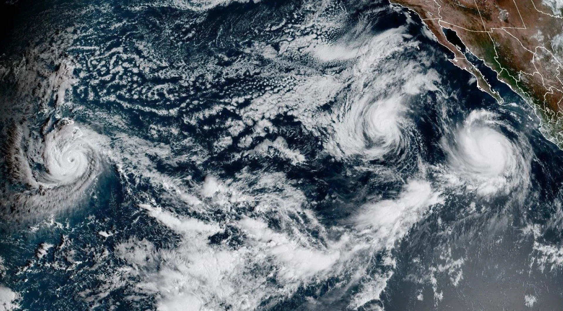
Mexico, Hawaii face major impacts from pair of menacing Pacific hurricanes

Hurricanes Polo and Nolo are powerful storms that are expected to bring significant impacts to Mexico and Hawaii, respectively, over the next few days
The Pacific remains firmly under the influence of El Niño this week as a few hurricanes move through the region.
Hurricane Polo has lost some strength and is now at Category 4 strength as of Saturday, as it churns off Mexico’s west coast. The system threatens an impactful landfall on Monday.
Hurricane Nolo is gathering strength as it inches toward Hawaii over the next few days, but will remain well south. It is expected to become a major hurricane by Saturday night or early Sunday morning. The storm will threaten major flooding across areas already hard-hit by storms this year.
DON'T MISS: From Hawaii to Halifax, why is this hurricane season so bizarre?
Hurricane Polo's remnants could reach Canada next week
The fact that we have two concurrent storms named “Polo” and “Nolo” is a coincidence of how storms are named both in the eastern and central Pacific basins.
Polo is the history-making hurricane lurking off the western shores of Mexico. The system reached the scale-topping Category 5 intensity several times week.
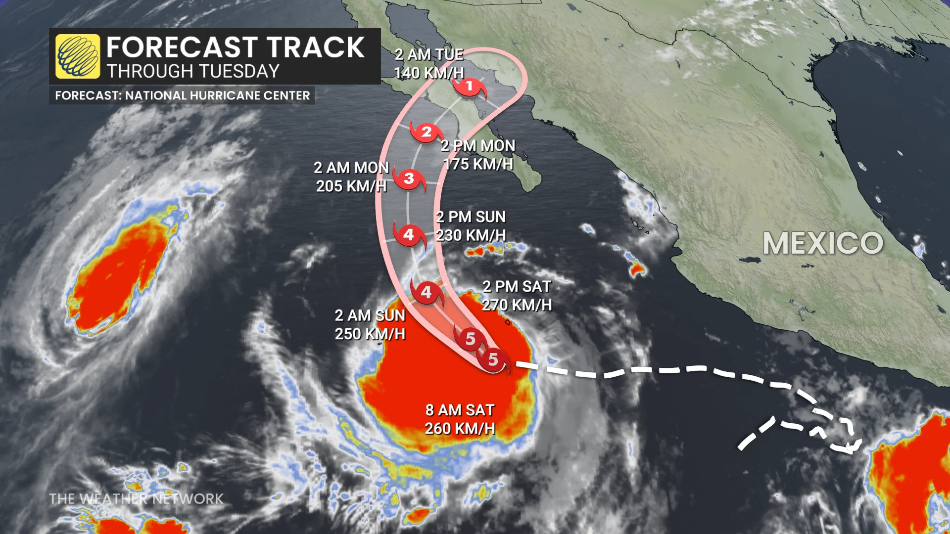
The intense hurricane is currently moving west away from land. Polo has started to weaken and more is forecast during the next couple of days. However, as it gradually hooks back toward the northeast, it will likely remain a strong hurricane as it makes landfall on Mexico’s Baja Peninsula during the day Monday.
A deep reserve of tropical moisture will follow the storm inland through next week. Flooding rains are possible throughout portions of the U.S. Southwest and southern Plains. Some of Polo’s remnant moisture may reach Canada by this time next week.
Regarding the track of the remnants of Hurricane Polo, there are a wide range of scenarios, ranging from staying out to sea to tracking across Mexico and into New Mexico and west Texas, and continuing into the central U.S.
Major flood threat builds in Hawaii with Nolo
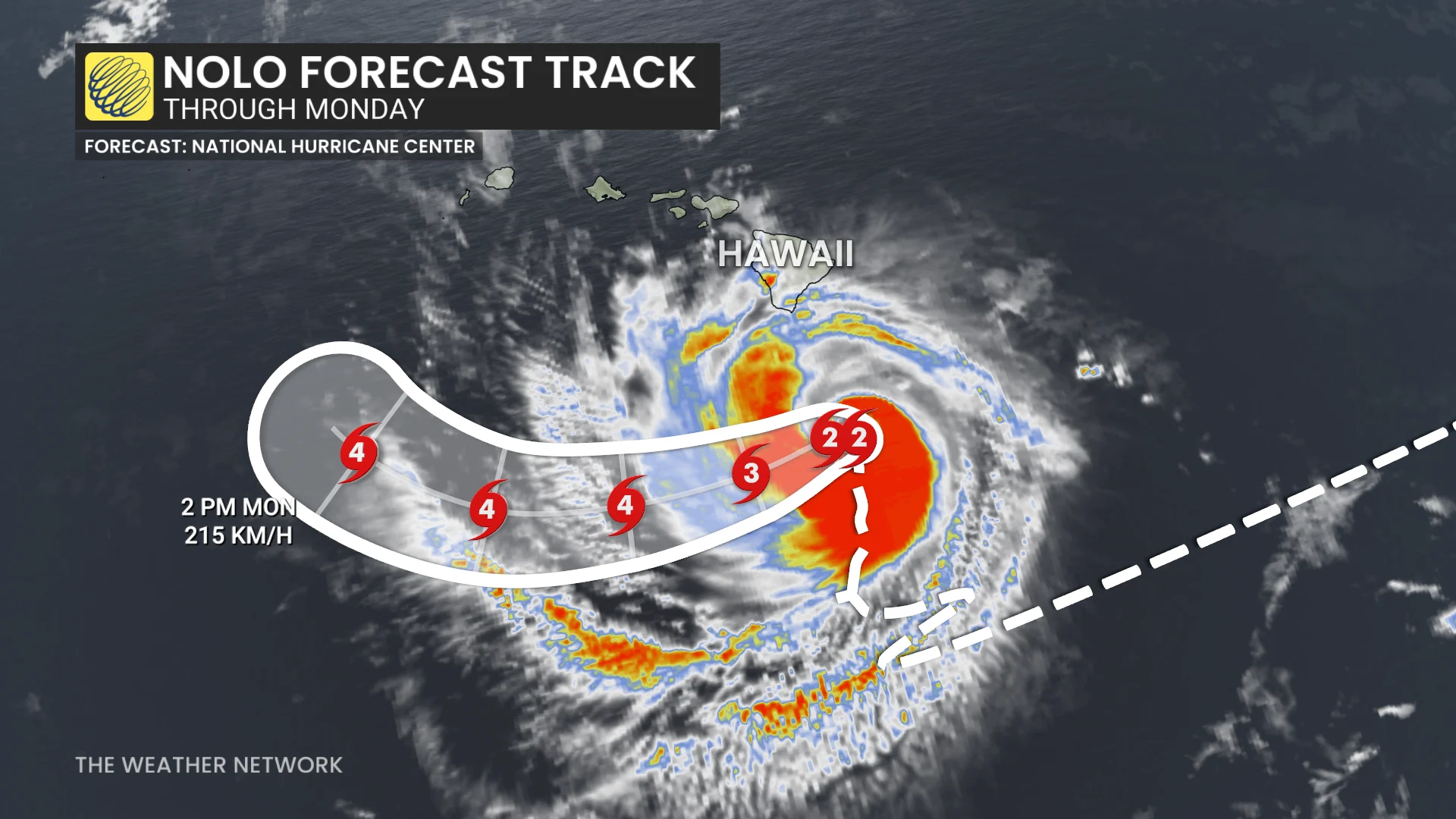
Hurricane Nolo, centred around 235 kilometres south of Hawaii's Big Island, is nearly stationary as of Saturday morning, but it will make a turn toward the northwest and north-northwest on Monday.
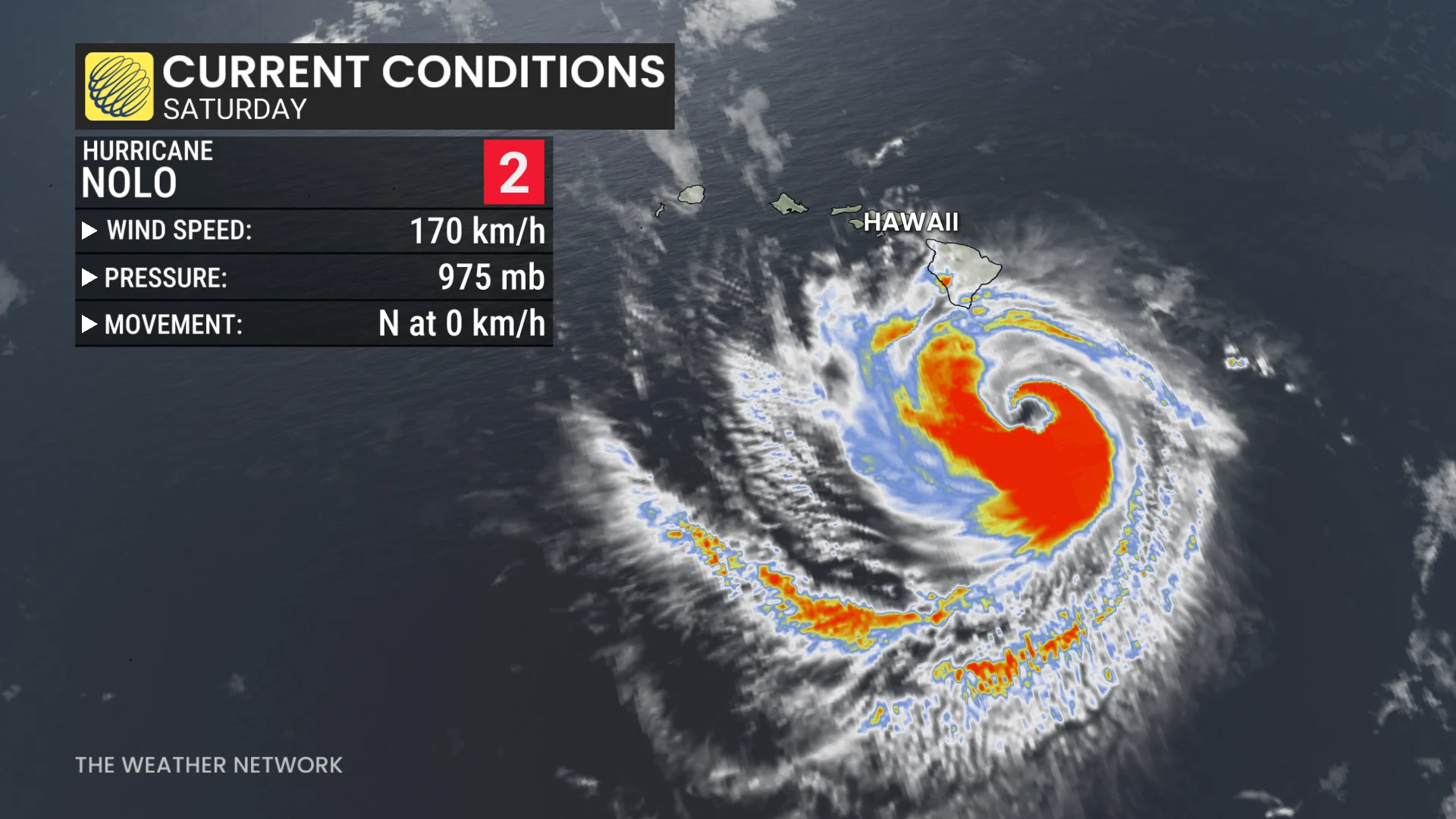
The system is in a favourable environment to intensify into a major hurricane by Saturday night as it tracks perilously close to the Big Island, where a tropical storm warning and hurricane watch are in effect.
A persistent stream of intense tropical moisture streaming into the islands’ rugged terrain will unleash flooding rains through the weekend.
Rainfall totals of 400-600+ mm are expected on for parts of the Big Island, with 100-250+ mm in the forecast for Maui. Oahu, home to Honolulu, may see 25-50 mm of rain from this system.
Nolo’s arrival is terrible news for an island chain that’s already been hit hard by damaging winds and flooding rains by three other storms this season, including Hurricane Lala, Tropical Storm Moke, and Hurricane Lowell.
Odalys also in the mix
A third hurricane, named Odalys, almost located halfway between Nolo and Polo. The system is a formidable hurricane in its own right, but it’s expected to remain safely out to sea where it will weaken over the next five days.
It's currently a Category 3 hurricane, with winds near 185 km/h, but weakening will continue through early next week.
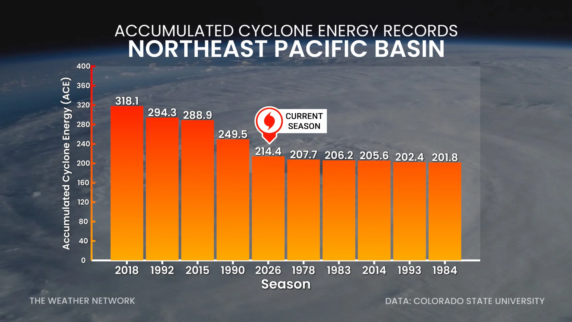
Based on Accumulated Cyclone Energy (ACE), this will soon be the fifth-most active northeast Pacific hurricane season since records began in 1949. Meanwhile, the Atlantic basin has seen less than 10 per cent of its normal activity so far this year.
Thumbnail courtesy of NOAA.