We regret to inform you, Ontario, but more snow is on the way
We apologize in advance, Ontario, as more wintry weather is expected to reappear Thursday––and likely again later this month––as the cold and snow aren't ready to depart southern Ontario for good.
Winter will keep its grip on the Great Lakes for the foreseeable future, at least, testing the patience of Ontarians wanting to move on from the cold and snow.
The next chance for wet snow will be on Thursday, so travellers should be cautious when out on the roads. While significant accumulations aren't expected, roads could be slippery enough to make for slower-than-usual commutes.
RELATED: PHOTOS: Surprise! 'Sprinter' shows up in parts of Canada this week
Those hoping Thursday's taste will be the final dance with winter shouldn't hold their breath just yet. There is plenty of uncertainty at this time, but we may not be done with winter weather as we head into next week.
Be sure to monitor local weather alerts and check highway conditions before heading out to start the week.
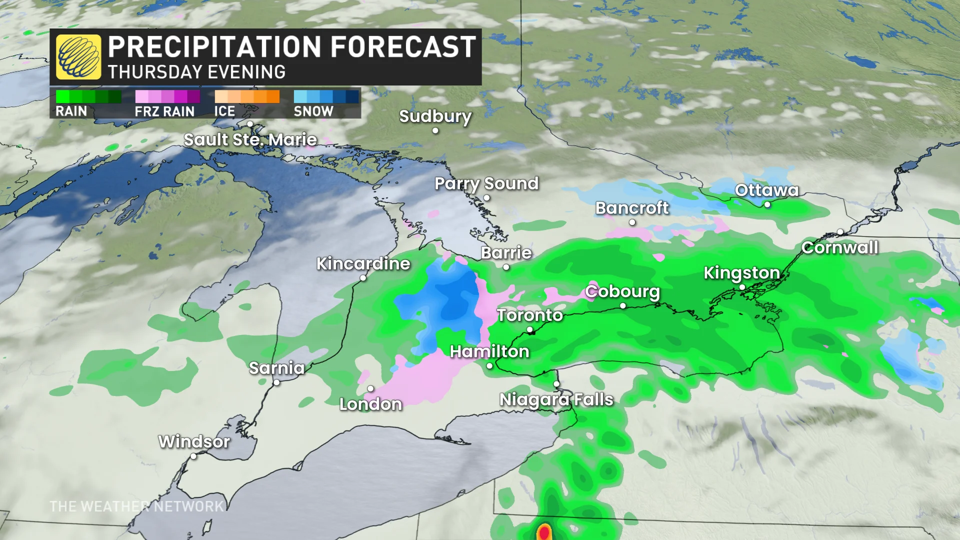
Thursday to Friday: Wet snow arrives to make for slick travel
The next chance of wintry weather will arrive on Thursday, with wet snow and rain for parts of the region. Ontario will be stuck with below-seasonal temperatures for most of this week, as well.
DON’T MISS: Canada's capital plummets to a new (chilly) low
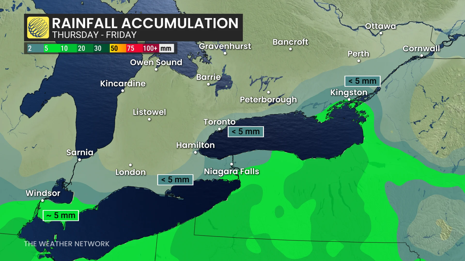
A weak system will track south of the Great Lakes, allowing for brief wet snow changing to rain, moving into southwestern Ontario first on Thursday morning. Expect a rain-snow mix in Windsor, then trekking east along the Lake Erie shores.
Not a lot is expected to accumulate, if any, with less than 3 cm of wet snow possible––perhaps not quite enough to slick up roadways as it melts on contact in most places.
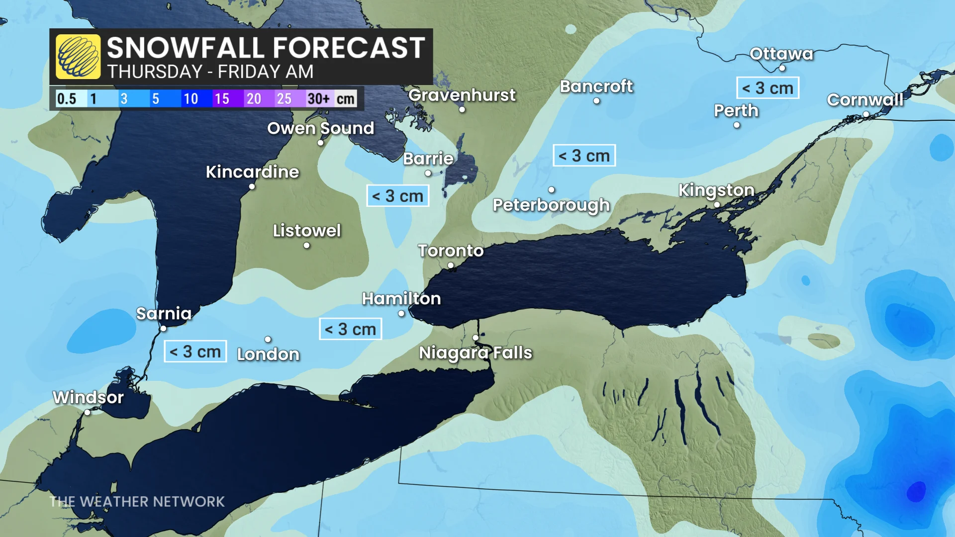
Rain will then spread east into the Niagara region by the afternoon. For the Greater Toronto Area (GTA), there will be a chance for an initial shot of wet snow, with less than 3 cm for the region. The precipitation will change to rain as the system moves east.
RELATED: Multiple collisions in Toronto Tuesday amid black ice, slippery road conditions
As the energy fizzles out, on-and-off showers are expected in the GTA on Friday.
There is uncertainty in snow totals due to the weak, changeable nature of the system, but travel will be impacted somewhat as a result of the slippery roads.

More wintry weather expected in April, potentially for Easter weekend
Those looking for a warm-up will get a reprieve from the cold and snow Sunday and Monday, with daytime highs rising up to the teens.
But there will be more. Thursday's wet snow chance won't be the last of the wintry weather, either. There are some hints of a colder pattern with the risk of snow as we get closer to Easter weekend.
However, there is considerable uncertainty with the setup at this time, but we may not be done with winter weather as people prepare to remove their snow tires.
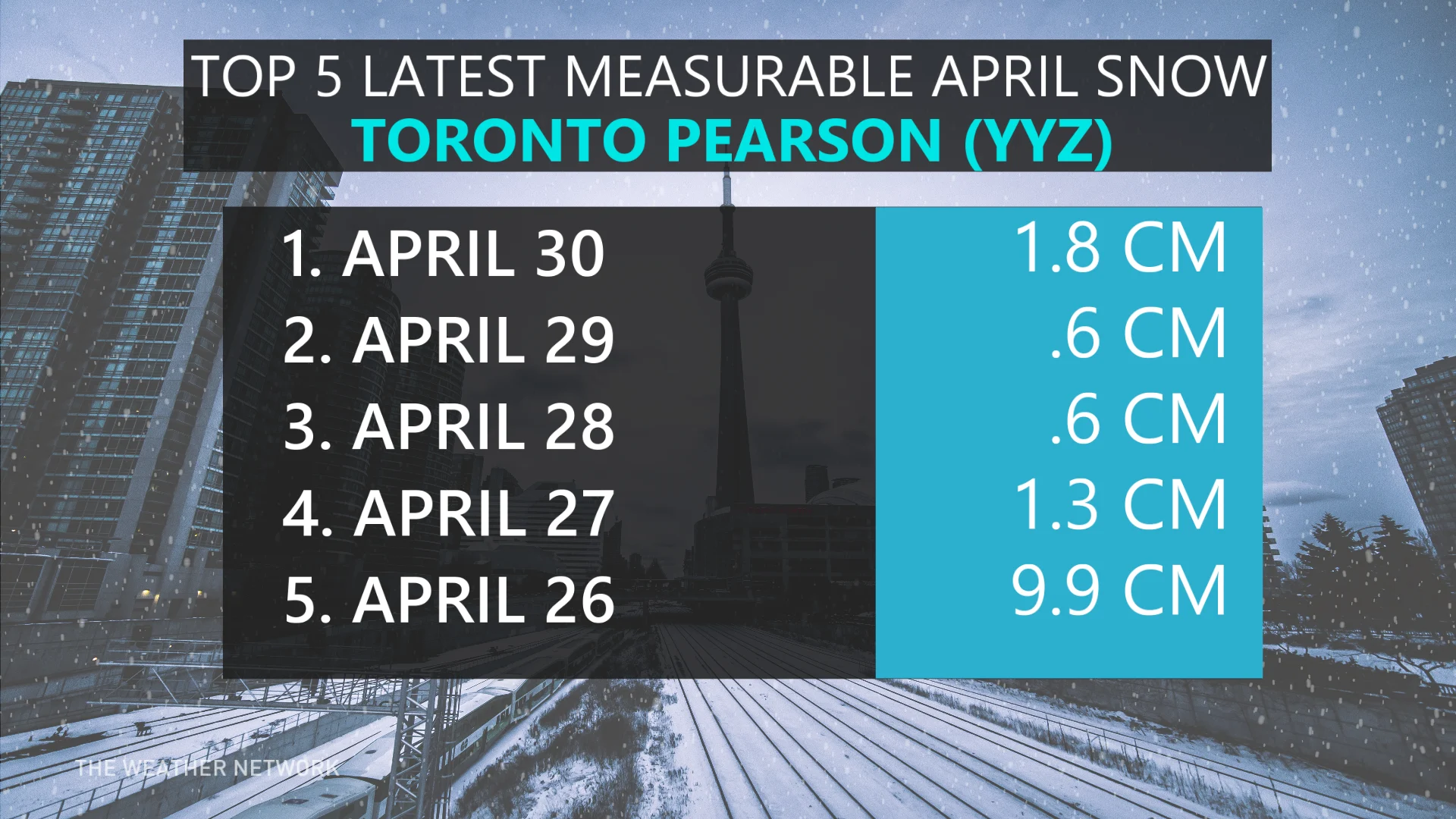
It is not uncommon to get snow in southern Ontario in April, especially in the traditional snowbelts regions, as lake-effect snow can continue this time of year. Even Toronto has recorded many snow days in April, and even two days in May.
Stay with The Weather Network for all the latest on conditions across Ontario.