Warnings span East Coast for heavy rain, ice and snow, major impacts into Friday
Travel, business and power impacts likely into Friday, as a powerful late winter storm hits Atlantic Canada with heavy rain, hours of ice and 15-60 cm of snowfall
A messy and potent late winter system will pick up through Atlantic Canada Thursday, with changing precipitation types expected, and some very heavy storm totals into Friday. That's as the cold and warm air battle along a band of heavy moisture streaming into the region. For some areas, this could mean hours of freezing rain and icy impacts, while others could be looking at over 50 cm of snow, and blizzard-like conditions.
Impacts are likely across the Maritimes Thursday, with conditions rapidly deteriorating in Newfoundland for Friday.
SPRING 2024: Get an in-depth look at the Spring Forecast, tips to plan for it, and much more!
Residents can expect hazardous driving conditions, traffic delays and possible road closures. Scattered power outages aren't out of the question, either. Plan ahead if you're doing any travelling and ensure electronic devices are charged.

Thursday afternoon: Rain intensifies before transitioning to freezing rain or snow
With milder temperatures in place, precipitation started as rain across much of the Maritimes early Thursday prompting widespread warnings with the threat of localized flooding.
As the day progresses, precipitation rates will intensify, with rain getting heavier at times in southern Nova Scotia, especially. Between 30-60 mm of rain is forecast in the hardest hit areas through Friday.

The milder air and rain will eventually be overtaken by colder air and snow for much of New Brunswick and P.E.I., with the threat for some mixed precipitation and prolonged freezing rain, spilling into Cape Breton, N.S., as well.
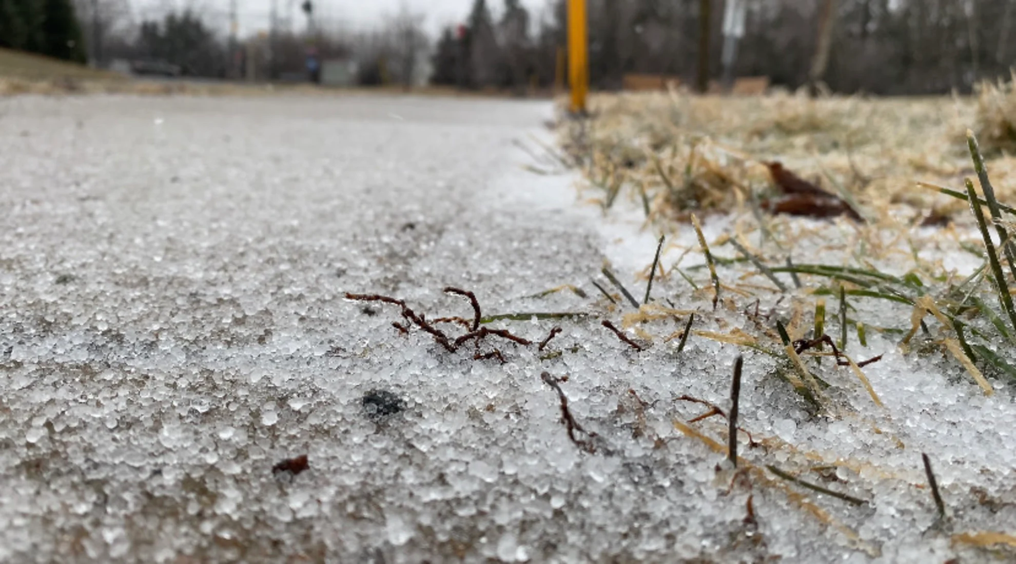
"Surfaces, such as roads, streets, sidewalks and parking lots, may become icy and slippery. Use caution when walking or driving in affected areas," says Environment and Climate Change Canada (ECCC) in the freezing rain warning posted early Thursday morning.
In areas where ice accumulation is significant, there could be the risk of broken tree branches and localized power outages.

Across the Gulf, snow begins along the southern coastlines of Newfoundland, building across the island and into St. John’s in the late afternoon and evening hours on Thursday.
Thursday overnight: Colder air moves in, snow picks up in Newfoundland with blizzard-like conditions possible
Precipitation rates will ease in the Maritimes through the overnight hours Thursday, though not completely ending at this time. As colder air moves further south, there will be a slight risk of snow and mixed precipitation across Nova Scotia.
Newfoundland will also see precipitation rates strengthen during this time, with blizzard-like conditions expected for coastal areas. Strong, sustained winds for Newfoundland, including much of the Avalon, in the overnight period.
A warm front noses into the southern Avalon and Burin peninsulas in the evening, providing an ice pellet environment that continues through the overnight.

Friday: Precipitation ends in the Maritimes, but will persist in Newfoundland
By Friday morning, the Maritimes will see precipitation come to an end. Snowfall totals of 20-40 cm are possible for areas of east central New Brunswick and P.E.I.

In Newfoundland, ice pellets and snowfall accumulations will persist through the day Friday. Blustery wind gusts of 60-80+ km/h will linger Friday evening in the Avalon and Burin, possibly increasing power outages amid blowing snow.
MUST SEE: Staying safe during a power outage: Infographic
In terms of snowfall, how far north the ice pellets go could dictate the amount of snow for St. John’s. A slight shift may mean significantly less snow, but as of now, 40-60 cm of snowfall is expected.

Another system is expected to track into Maine on Sunday and bring unsettled weather to the region starting in the overnight period, then continuing through early next week.
The exact storm track and local impacts are still highly uncertain, but this system could deliver significant winter weather to parts of the region.
WATCH: Freezing rain is the WORST type of precipitation, don't underestimate it
Be sure to check back for the latest weather updates across Atlantic Canada.