Warnings issued as multiple tropical systems strengthen

The peak of Atlantic hurricane season is just days away
A tropical storm warning is in effect for coastal sections of Texas and Louisiana as a budding storm develops in the northern Gulf of Mexico.
Farther west, two storms in the Pacific are taking advantage of favourable conditions to rapidly intensify as they traverse the open waters. Hawaii may have to watch the progress of one of those storms.
We’re just several days away from the climatological peak of the Atlantic hurricane season.
DON’T MISS: Staying safe from flash floods, a serious and deadly hazard
Warnings issued along the Gulf Coast
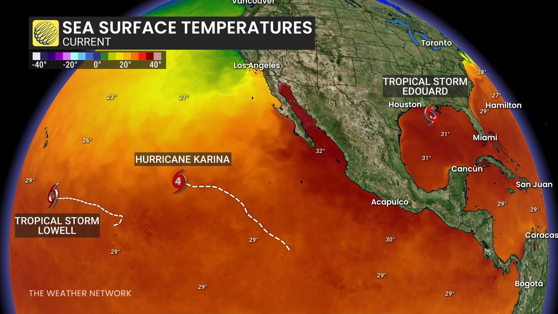
Tropical Storm Edouard formed in the northern Gulf of Mexico on Monday as a disturbance grew organized over the region’s warm waters.
The U.S. National Hurricane Center (NHC) issued a tropical storm warning for portions of eastern Texas and southwestern Louisiana ahead of the system’s anticipated arrival on Tuesday. A storm surge watch is also in effect for the potential for a surge up to 1.2 metres above ground level in spots.
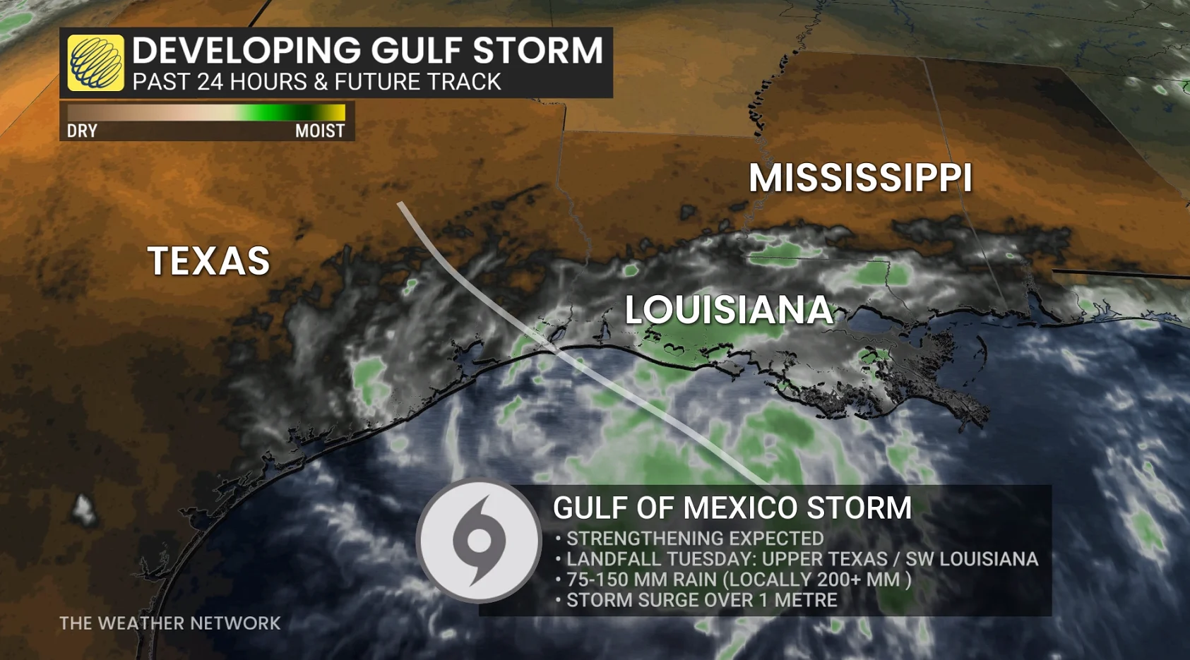
Forecasters expect the system to quickly intensify before reaching land, with winds possibly as high as 100 km/h by the time the centre comes ashore on Tuesday. Regardless of high winds, flooding rains will pose the main hazard to communities in the region.
Widespread rainfall totals of 25-75 mm are expected through mid-week, including across the Houston/Galveston area. Some areas may see more than 100 mm of rain, which may lead to localized flooding.
Tropical development isn’t expected anywhere else in the Atlantic basin to kick off the month of September. The second week of the month is the climatological peak of the season. We’ve seen just about 10 per cent of our typical Accumulated Cyclone Energy (ACE) through the end of August.
Pacific basin is hopping to kick off September
A raging El Niño in the Pacific Ocean has kept the basin bustling with tropical activity so far this summer.
Hurricane Karina reached Category 4 status on Monday with maximum sustained winds of 220 km/h as it churned through the open waters of the eastern Pacific. The NHC expects this system to slowly weaken this week as it remains out to sea.
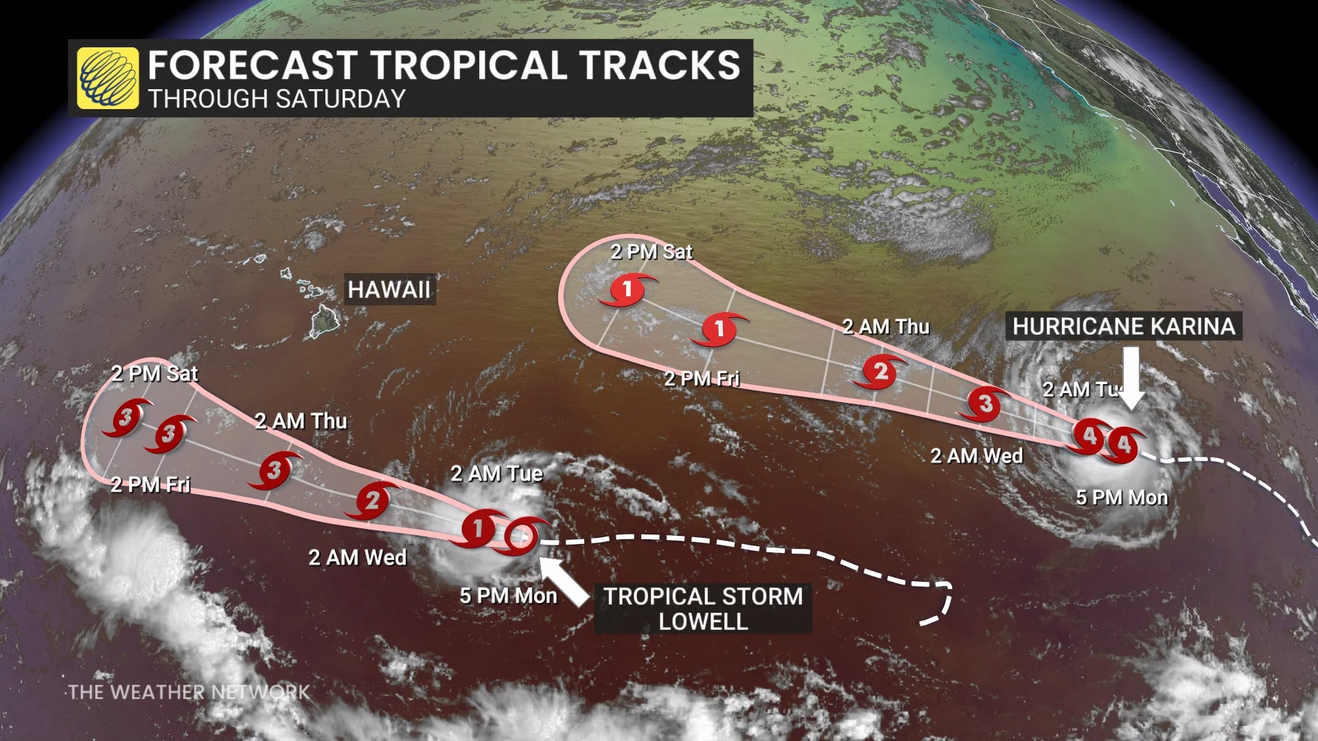
Tropical Storm Lowell is on the cusp of rapidly intensifying into a major Category 3 storm as it passes far south of Hawaii this week. Despite its southerly track, interests in hard-hit Hawaii are encouraged to keep a close eye on this storm as it moves through the region.
Another region not far behind Karina has a very high chance of developing into the Pacific’s next named storm over the next couple of days. The system will encounter favourable conditions to intensify into a powerful hurricane later this week, and its eventual track will have to be closely monitored.