Warmer weather brings risk of freezing rain to southern Ontario
Temperatures continue to climb across southern Ontario, with freezing rain more and more likely
Soak in the sunshine while you can on Wednesday, southern Ontario. As temperatures get warmer and we move away from the snowy winter weather, we'll see a threat of freezing rain across the region on Thursday, as well as incoming rain late Friday and into Saturday.
Luckily, folks will get a taste of the season ahead over the weekend as temperatures continue to climb into the teens on Saturday. Parts of the province could even see the thermometer reach the 20-degree mark by the end of the weekend!
SEE ALSO: Alberta considers scrapping time change, but not Ontario
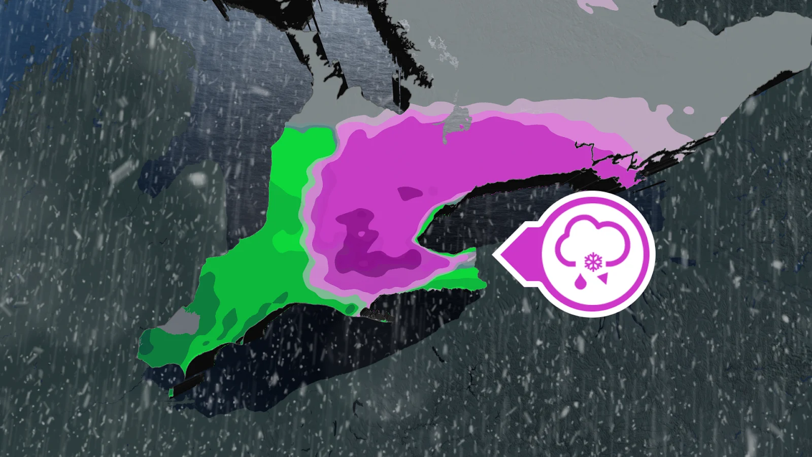
Freezing rain certain, just not how much
Cloudy skies and rain showers will begin to spread across southern Ontario early Thursday, between Windsor and Hamilton. Showers will then spread across the southwest and toward the Greater Toronto Area (GTA) through the afternoon and evening hours.
Some thunderstorms may be embedded in the showers as they move across southern Ontario, but it isn’t guaranteed.

Around the afternoon, the surface temperature will begin to cool, causing the downfall to change from showers into freezing rain. The most likely areas to be hit include Hamilton and the surrounding regions, including the 401 and the GTA.
Some other areas that may be hit hard include Waterford, Woodstock and Waterloo, with a high amount of potential freezing rain possible between the three.

There remains a high amount of uncertainty for how far north the freezing rain will move, with a high pressure system from northern Ontario limiting the warm air. This will create a boundary for the freezing rain, cutting off its northward expansion.
Marginal temperatures will also mark the actual impact of the freezing rain and the amount that will be seen. The location and amount of freezing rain could be decided by half a degree. The small temperature difference will drastically change what the expected impacts will be, so it's difficult to give a certain forecast of how much impact the rain will have at this time.
The showers and freezing rain will continue into the overnight, but improve by Friday morning, making for slippery commutes and delays as folks head into work.
Colorado low approaches Friday
A Colorado low is forecast to make its way toward the province from the southwest on Friday, pushing in another round of mild air as well as more widespread rain.
The rain will extend north of the GTA on Friday, skirting the Lake Ontario's north shore. The heaviest rain, however, is expected to be along Lake Erie's shores, with up to 30 mm possible.

Parts of southwestern Ontario, including Windsor, could even hear a few rumbles of thunder!
DON'T MISS: Two oceans fuel Ontario's thaw, and there's 200 mm of water locked in snow
Temperatures will climb throughout the day and continue into Saturday, along with lingering showers. We could even see temperatures reach 20 degrees in Windsor!

We'll see the mild and pleasant weather stick around on Sunday and into Tuesday across central and southern Ontario, but we could see some messy weather move back in for the mid- to late week.
Stay with The Weather Network for more information and updates on your weather across Ontario.