Warm winds blowing over Alberta to offer a brief reprieve from winter
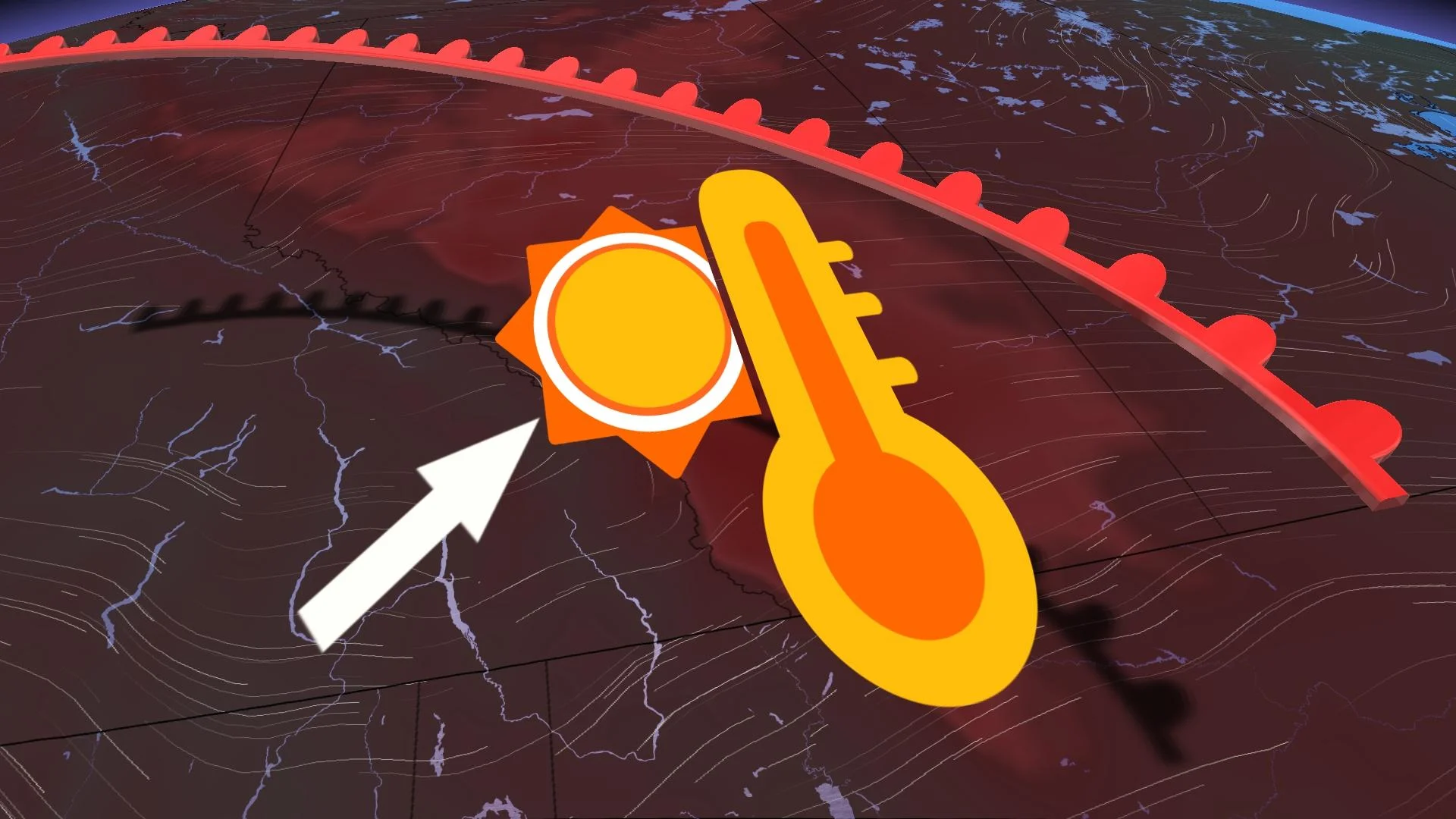
Temperatures will soar double-digits above seasonal for parts of Alberta next week as chinook winds take hold
A pattern of mild temperatures and dry conditions that steered November across Alberta looks to stay the course into December.
We’re going to stay relatively dry across the province even as several moisture-laden systems move into British Columbia over the next five days.
An active jet stream blowing over the western half of the country will bring a significant but brief warm-up heading into the next work week. Temperatures will register more than 10 degrees above seasonal for many areas, with daytime readings more common of October than December.
MUST SEE: Canada's Winter Forecast: El Niño a critical factor for the season ahead
Seasonal temperatures in Calgary, Lethbridge, and Medicine Hat should hover around or just below the zero-degree mark by the beginning of December.
However, the ridge building over the western Prairies—combined with winds flowing up and over the Rockies—will combine to bring a spell of above-seasonal temperatures to the region.
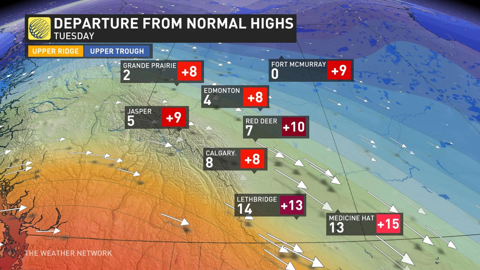
Tuesday looks to bring the warmest conditions to southern Alberta, with above-seasonal temperatures lingering into Wednesday.
Daytime high temperatures on Tuesday will range from 0°C in Fort McMurray to an eyebrow-raising 14°C down in Lethbridge, with highs across the province coming in 8 to as much as 15 degrees above seasonal for this time of year.
RELATED: Active weekend ahead as a strong, straight jet stream aims for Canada
But will these highs break records? Surprisingly, the answer looks to be "no." As warm as these early December temperatures will rise, they won’t match the 19.4°C witnessed in Calgary on Dec. 5, 1939, nor will it match the 16.1°C measured there more recently on Dec. 3, 2020.
Like all nice weather in early winter, this warmup will come at a cost.
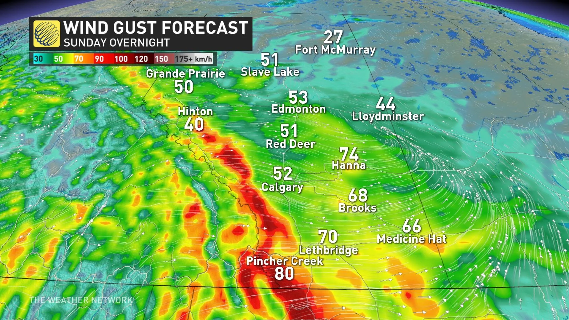
Wind gusts of 80+ km/h are likely on both Sunday night and Tuesday night as air soars over the Rockies and accelerates down the leeward side of the mountains. Locals are all-too-familiar with this setup, known as a Chinook wind.
Chinook events have historically grown so strong that they can tip over trucks on local highways, so use extra caution if travelling in the southern foothills on Sunday night and again on Tuesday night.
This pattern will remain locked over the region until the latter half of the week, when we’ll see the return of daytime highs closer to seasonal.
Stay with The Weather Network for the latest on conditions across Alberta.