
Ontario: Lingering snow Monday will be followed by another burst on Tuesday

The wraparound snow that greeted Ontario residents Monday morning will persist during the day for central and eastern portions but is expected to end in the evening hours. Wind gusts will remain strong and could reach 60-70 km/h along Lake Huron and Georgian Bay -- areas that could see up to 15+ cm of snow. Another system moves in Tuesday, bringing more light snow in the afternoon. We have more details on Monday's and Tuesday's snowfall, as well as a look at the warmth returning and a potential messy system on the weekend, below.
Visit our Complete Guide to Winter 2019/2020 for an in-depth look at the Winter Forecast, tips to plan for it and a sneak peek at the spring season next year
WEATHER HIGHLIGHTS:
Lake-effect snow continues Monday along Lake Huron and Georgian Bay, along with strong, westerly winds
More snow and rain later in the week, as well as milder temperatures
Possible messy weekend system
Stay up-to-date on the ALERTS in your area
THROUGH EARLY TUESDAY: LAKE-EFFECT SNOW CONTINUES THROUGH THE EVENING HOURS
Light snow will persist for central and eastern Ontario through Monday evening.
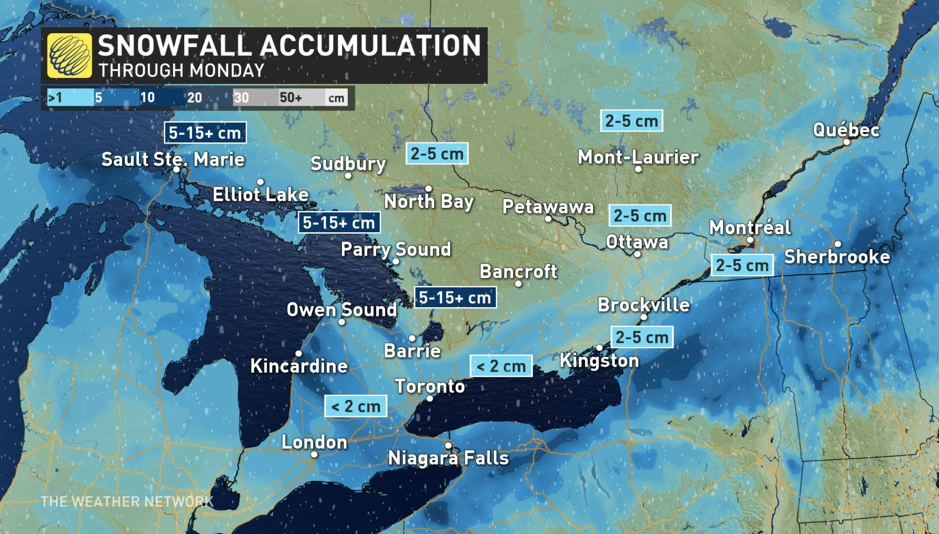
As the winds shift behind the clipper, lake-effect bands off of Lake Huron and Georgian Bay are expected to add a last shot of snow to areas along southeastern Lake Superior, Muskoka and parts of the Kawarthas. Some of these areas can expect snowfall totals approaching or exceeding 15 cm by the time it tapers off late Monday night.
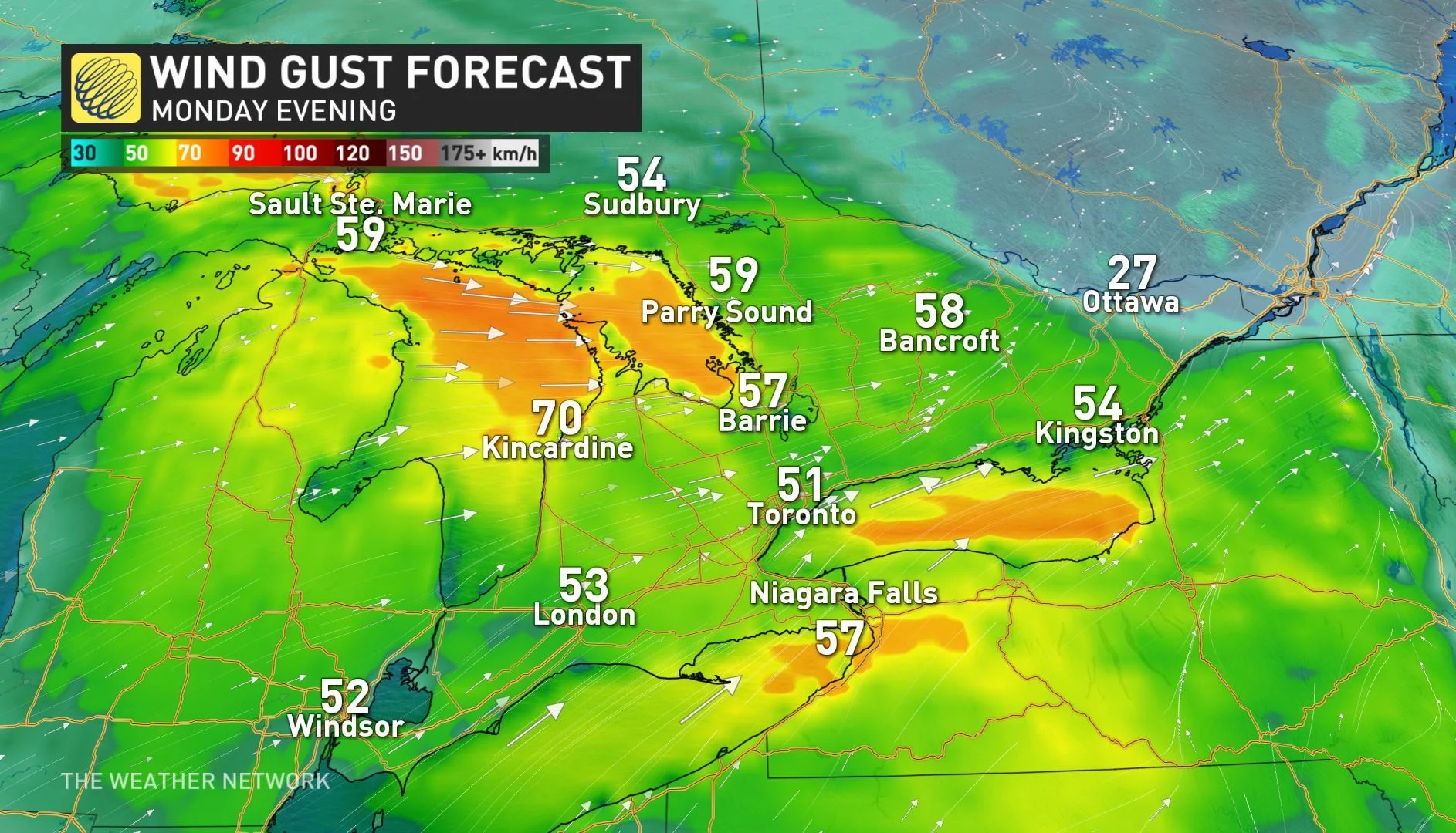
The strong, westerly winds that are driving the lake-effect snow bands will continue through Monday evening, with some gusts reaching 50-70 km/h for much of the south, before winding down in the overnight hours.
The snow will dissipate Monday night, but the break in snow will be brief. Another system moves into the province Tuesday afternoon, bringing another round of light snow. As the system departs Wednesday morning, there will be some lake-effect flurries continuing during the day.
A surge of southern air late week will gives temperatures a big boost -- at least, by January standards.
WATCH BELOW: MORE LIGHT SNOW FOR TUESDAY
LOOK AHEAD: MILDER DAYS, POTENTIAL MESSY SYSTEM FOR WEEKEND
The active storm track continues over southern Ontario for much of the week ahead. While no significant systems are on imminent, several quick shots of snow and, later, rain, in the forecast as weak systems drift by.
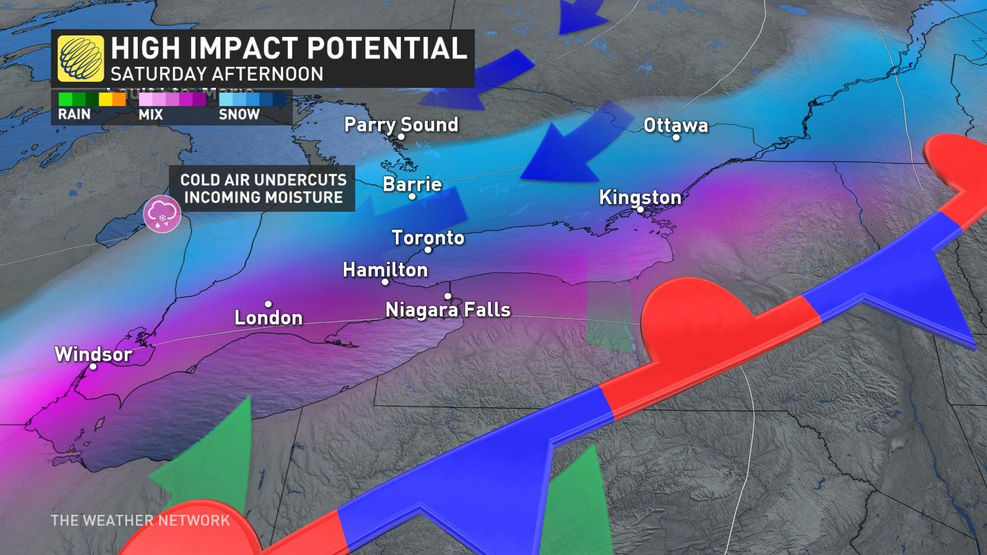
Following Friday's rain, a moisture-laden system is expected to track south of the region on the weekend. Because of its close proximity, there is the potential for some messy weather Saturday and possibly Sunday. But, six days out, there is still a lot of uncertainty in the details and possible impacts
"It is possible that the system will completely miss us to the south. However, the pattern and several models show a risk for a messy mix, including a threat for significant freezing rain, ice pellets and snow across our region," Weather Network meteorologist Dr. Doug Gillham says.
Looking ahead even further, Gillham doesn't expect we'll see consistent cold weather in our region at least through until mid-January. "A very a mild pattern will return to the eastern U.S., and that mild weather will also surge back into southern Ontario and southern Quebec," he added.


