Two oceans fuel Ontario thaw, and there's 200 mm of water locked in snow

There's nearly 200 mm of water locked in snow up in cottage country, so any warm-up needs to be tracked carefully.
By now, you’ve likely heard about the warm-up headed for Ontario, but what’s coming together to produce such a sharp surge in temperatures?
Not one, but two oceans and competing air masses are aligning to deliver a substantial warm-up across the region. And, while the milder air may feel welcome, it comes with clear challenges.
DON'T MISS: Canada to feel magnified March madness in the month ahead
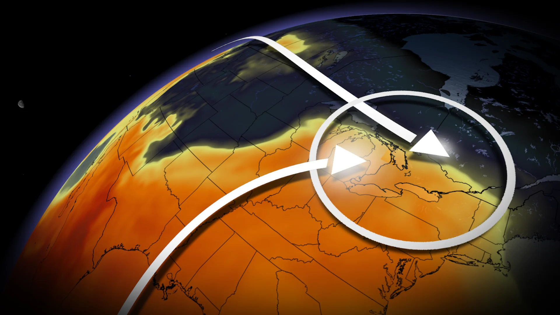
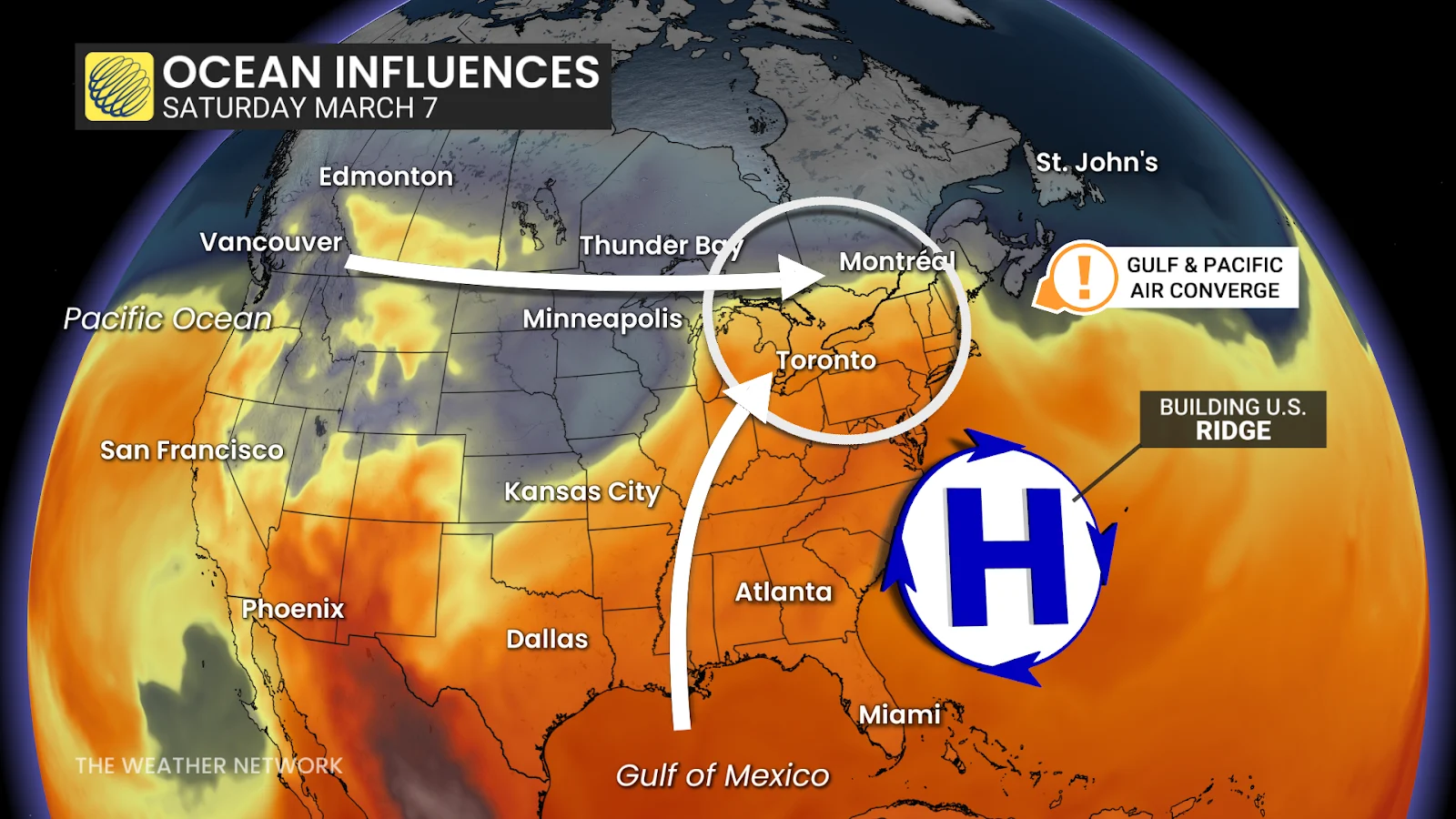
Air from the Gulf of Mexico will surge northward, aided by a strengthening upper-level ridge across the southeastern United States. That ridge will act like a conveyor belt, funnelling warmth and moisture deep into southern Ontario.

Earlier this week, the air you’ll eventually breathe over Ontario was thousands of kilometres to the southwest over the Atlantic. Over the coming days, it will sweep around the high-pressure system, drawing up additional warmth and tropical moisture from the Gulf.
Q: Is this early for the first 20°C potential reading in Ontario? A: Absolutely. If, on the slim chance, Toronto, London, or Hamilton reach 20°C this weekend, it would tie or surpass the earliest such reading on record. (Sorry, Windsor: your earliest 20°C already happened on Feb. 26, 2000, when the temperature reached 20.4°C.)
Q: Will this rival March’s all-time heat records? A: No. Not even close. Think back to March 2012. Between March 19 and 22, all-time March records were obliterated across much of Ontario (and North America). Some locations soared nearly 28°C above normal, temperatures more typical of late June or July.
March 2012: the sizzling March heat event
That extraordinary event was driven by a highly amplified jet stream pattern, featuring a dominant eastern ridge and an intense low-level southerly jet that transported Gulf warmth deep into Canada. The snowpack that winter was well below average, which allowed the ground to heat more efficiently and amplified daytime warmth.

Here’s how extreme those March 2012 highs were:
Windsor: 28.4°C
Timmins: 27.9°C
London: 27.5°C
Ottawa: 27.4°C
Hamilton: 26.8°C
Sault Ste. Marie: 26.7°C
Toronto: 26.0°C
North Bay: 25.2°C
Kenora: 23.8°C
The forecast warmth is impressive, but it’s not in that league.
The flood threat: heavy rain risk
Q: Is there a threat of heavy rain and localized flooding? A: Yes. Warmer air can hold more moisture, and this pattern will tap into the Gulf of Mexico.
By Saturday, precipitable water values could approach 30 mm over southern Ontario, a highly anomalous amount for early March.
SEE ALSO: 466 cm: Canada's winter saw extreme snows and bitter cold
It may not sound extreme, but for this time of year, that is a significant moisture load. If that moisture converts efficiently into rainfall, localized rainfall totals could climb quickly!

The wildcard: Snow and ice
Q: Will the bulk of southern Ontario’s snow melt over the next 7-10 days? A: It depends on where you live.
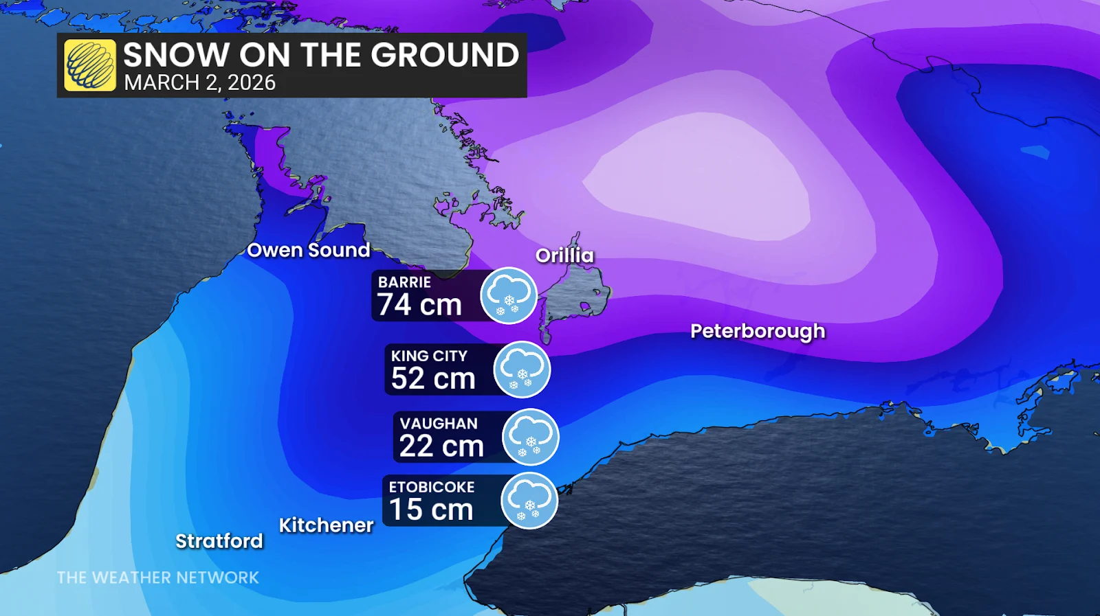
Snowpack varies widely as of March 2:
Northwest of Barrie: 74 cm
King City: 52 cm
Vaughan: 22 cm
Etobicoke: 15 cm
The flood risk from snowmelt increases the farther north you go.
The Greater Toronto Area is likely to lose most, if not all, of its snow cover over the next week. But Cottage Country still has substantial snow depth, with some areas exceeding 70 cm.
What’s particularly concerning is the water locked inside that snowpack. Snow water equivalent northwest of Barrie measures roughly 198.6 mm; that’s nearly 200 mm of water waiting to be released. That’s a red flag for flood risk.
A deep snowpack increases runoff, compounding rainfall totals. It also blocks storm drains and clogs drainage systems, heightening the risk of low-lying flooding.
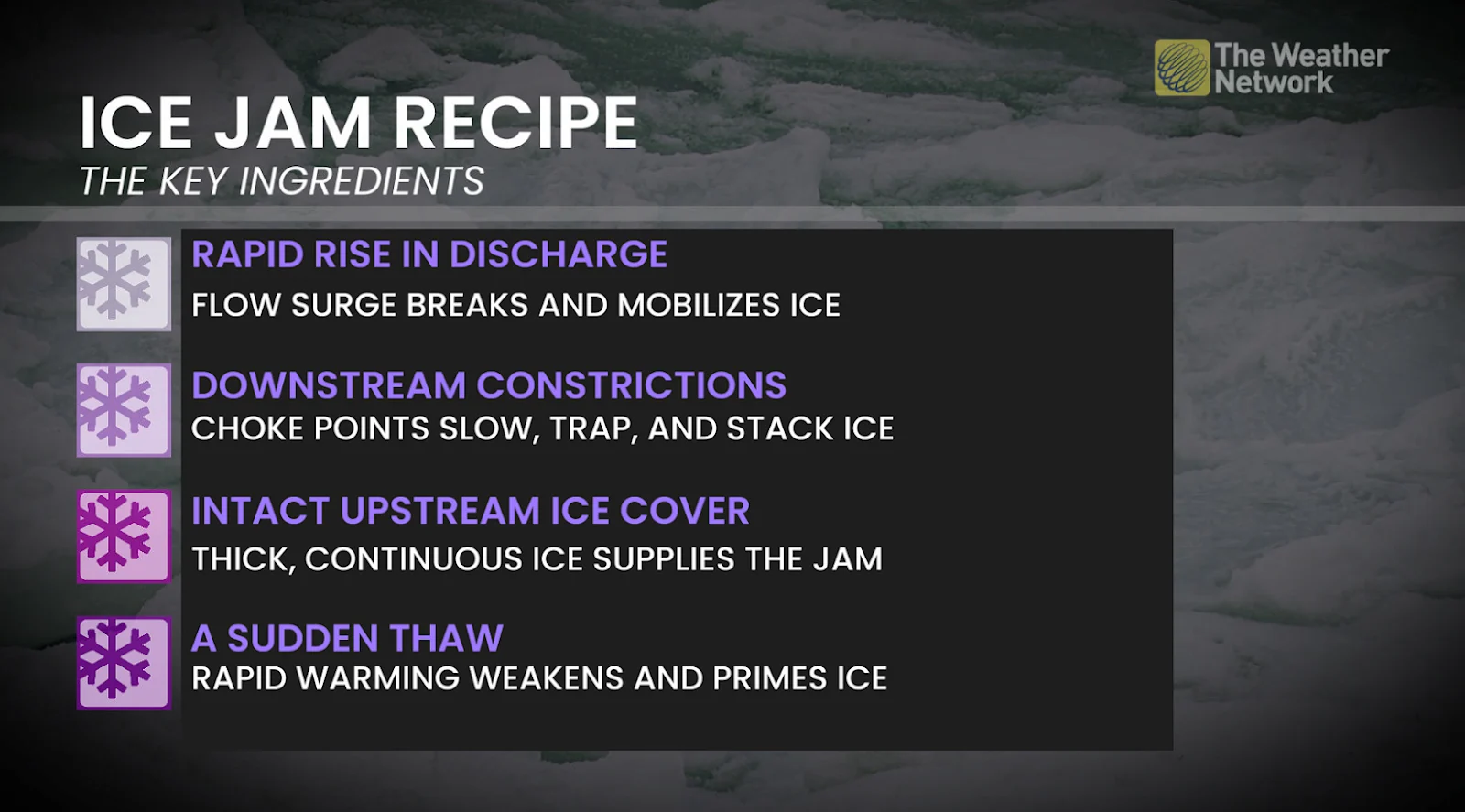
Ice jams are another concern. A sudden thaw following a prolonged freeze can dislodge river ice, causing downstream blockages. When combined with increased runoff from both snowmelt and rainfall, water levels can rise quickly and, frankly, unpredictably.
Exact rainfall totals and temperature extremes remain difficult to pin down with precision this far out. Small shifts in storm track or wind direction could make a big difference.
Stay tuned and check the forecast regularly over the next week for the most up-to-date details.