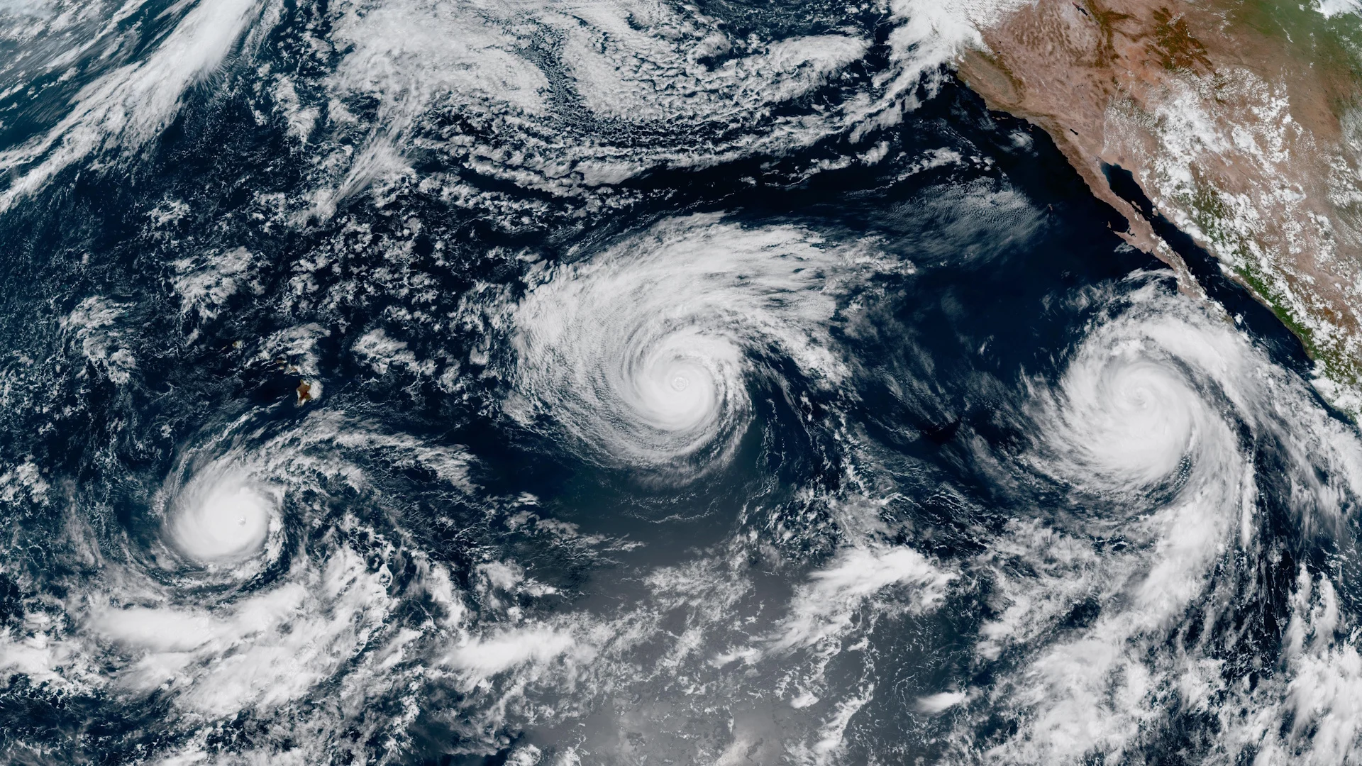
Trio of hurricanes threaten Pacific tropical troubles

Hawaii has to watch for yet another tropical threat this weekend as Hurricane Lowell lurks south of the islands
The eastern Pacific Ocean is bustling with activity to begin September as a powerful El Niño continues to influence the region’s weather patterns.
Hurricane Lowell became this year’s sixth storm to achieve Category 5 intensity on Wednesday. Another hurricane may send tropical moisture surging northward into next week.
DON’T MISS: Destructive Atlantic hurricanes can still happen during El Niño
Hawaii on alert for possible impacts from Lowell
All eyes are on Hurricane Lowell heading into this weekend as the powerful storm churns about 1,000 km south of the Hawaiian Islands.
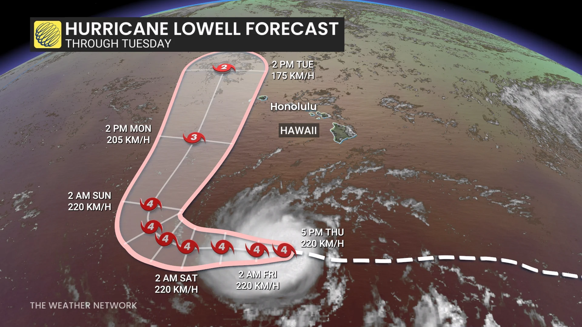
Lowell briefly achieved Category 5 intensity on Wednesday afternoon, becoming the world’s sixth storm to hit scale-topping strength so far this year. The system remained a Category 4 hurricane on Thursday with maximum winds of 220 km/h.
Forecasters with the U.S. National Hurricane Center (NHC) expect Lowell to sustain major hurricane intensity in the coming days as it traverses warm waters and a favourable atmospheric setup.
A trough digging over the northern Pacific will create a weakness in the setup to allow Lowell to make a sharp northward turn this weekend, eventually pulling the storm dangerously close to the Hawaiian Islands.
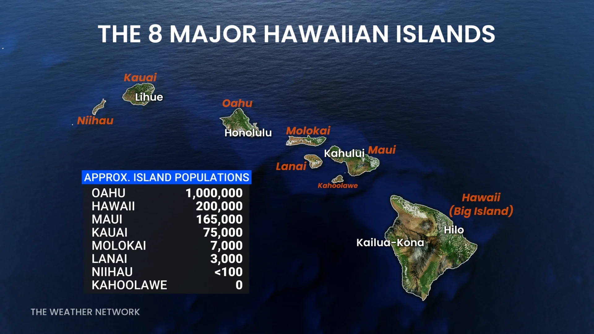
The islands of Niihau and Kauai, collectively home to about 75,000 people, are within the NHC forecast’s cone of uncertainty. Some uncertainty remains in the track forecast, though, and an earlier northward turn may bring it closer to more populous islands.
Hawaii’s two most populous islands, where most visitors go, are Oahu and the Big Island, the latter of which saw major damage from Hurricane Lala last month. The last hurricane to make a direct landfall in Hawaii occurred when Iniki struck Kauai in September 1992.
Hurricane Marie strengthening off Mexico’s west coast
Farther east, we’re also monitoring the progress of Hurricane Karina and Hurricane Marie.
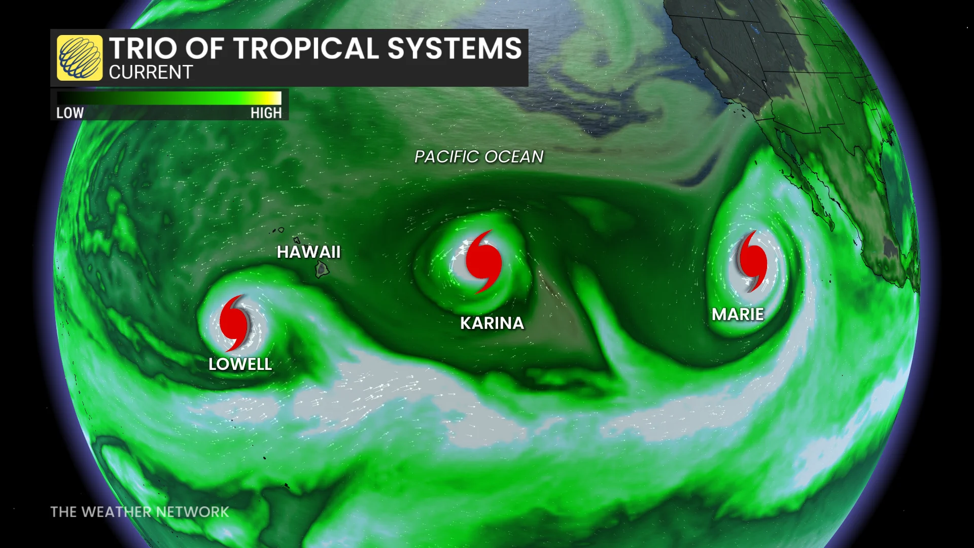
Karina remains a major hurricane as it tracks over open waters far away from land. The NHC expects Marie to strengthen a little further as it gradually moves away from Mexico’s western shores.
Moisture from Hurricane Marie will likely move north through this weekend, potentially affecting weather in Canada looking ahead to early next week. Stay tuned for more on that potential over the next few days.
Atlantic falls quiet after Edouard’s heavy rains
While the eastern Pacific basin overachieves in the tropics department, there’s nothing of interest to watch in the Atlantic Ocean over the next five to seven days.
Tropical Storm Edouard made landfall on the northern Gulf Coast earlier this week, bringing as much as 625 mm of flooding rains to portions of eastern Texas.
RELATED: The best way to prepare for a hurricane is well ahead of a potential disaster
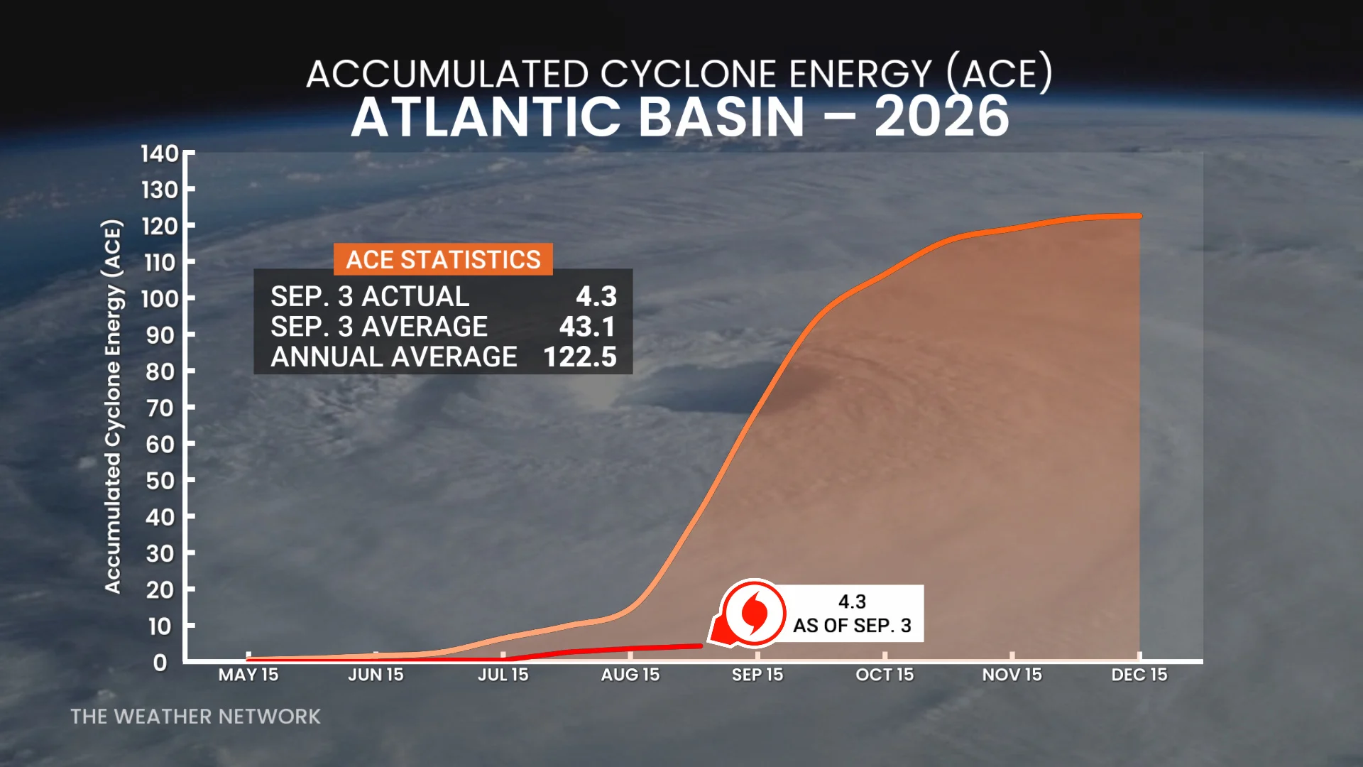
The climatological peak of the Atlantic hurricane season arrives during the second week of September. This season has produced less than 10 per cent of its average Accumulated Cyclone Energy through Sept. 3, which is a remarkable testament to the weak and quiet nature of the basin so far this year.
Quiet doesn’t mean over, though. Coastal residents are advised to remain prepared through the end of hurricane season on Nov. 30. The peak of the season continues through much of September, and strong storms often form during October and sometimes even in November.