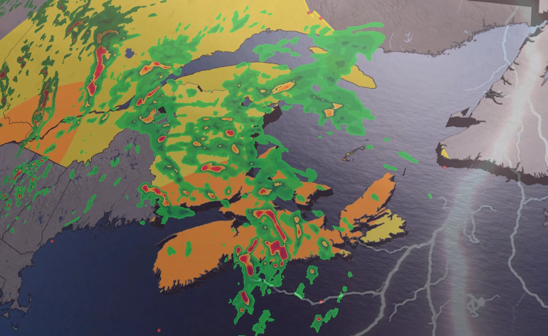
Torrential downpours expected in the Maritimes on Sunday

A front lifting through the region will set the stage for bursts of heavy rainfall throughout the Maritimes to end the weekend
Grab your umbrella if you’ve got plans in the Maritimes on Sunday.
Strong to severe thunderstorms may produce torrential downpours throughout the region during the day. Beware the threat for localized flooding beneath the heaviest storms.
DON’T MISS: Trouble may lurk beyond hurricane season’s very quiet start
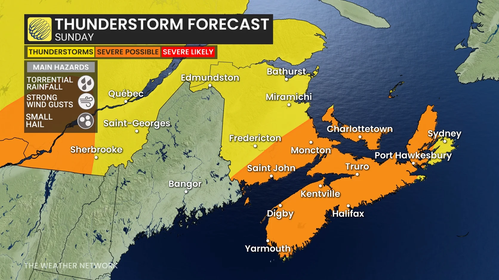
A warm front lifting across the Maritimes will drag a rich reserve of atmospheric moisture over the region. Showers and thunderstorms will tap into this ample moisture to produce very heavy rainfall throughout the region.
We’ll see patches of heavy rainfall begin to sweep across southern Nova Scotia, New Brunswick, and eventually Prince Edward Island on Saturday night.
Localized totals of 30-50 mm of rainfall are possible with this first round of heavy showers through the pre-dawn hours on Sunday.
RELATED: Tips to stay safe during a flash flood as peak season draws near
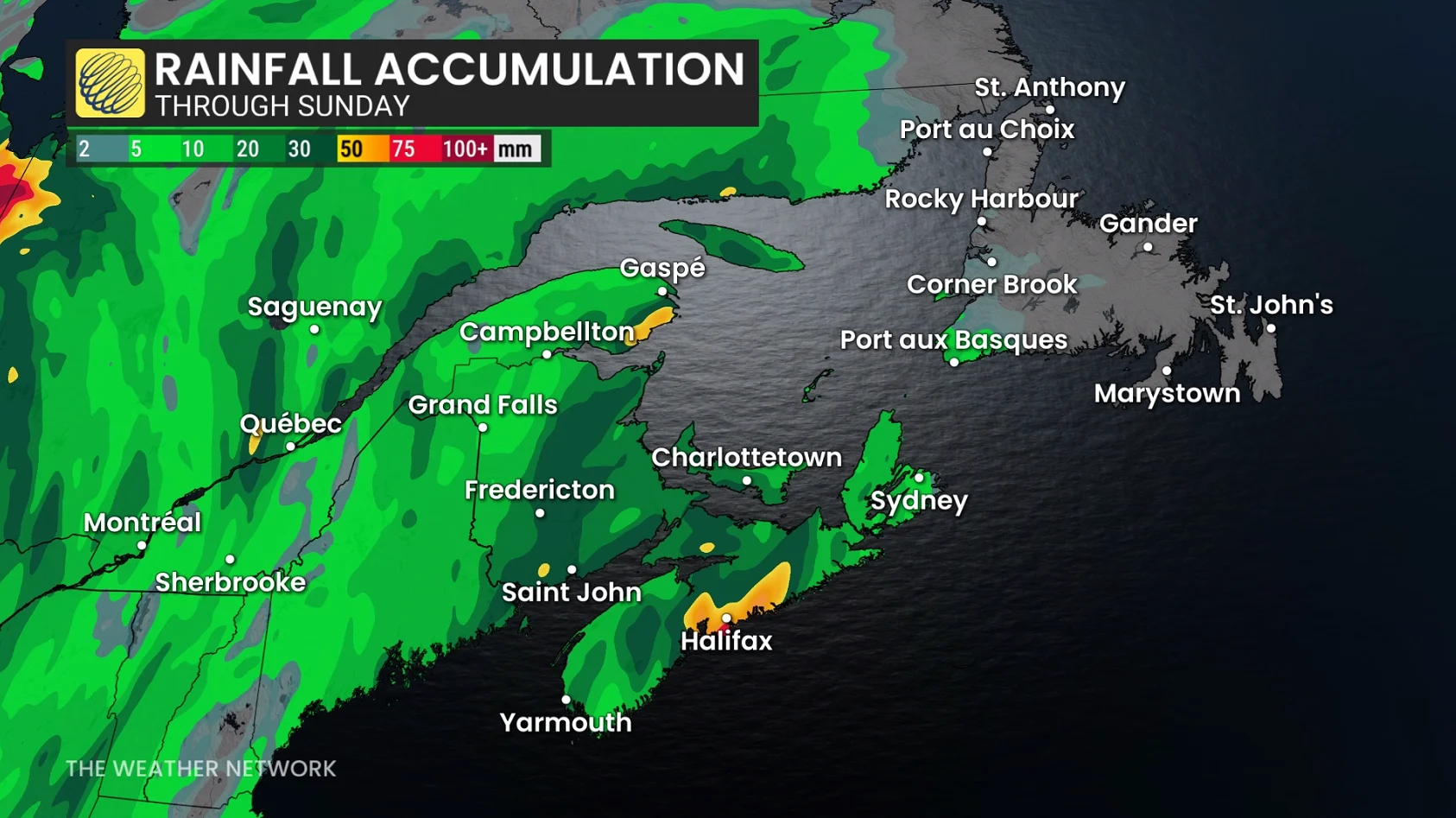
Downpours and thunderstorms will continue throughout Nova Scotia much of Sunday morning, padding the totals of any precipitation that fell the night before.
Several rounds of torrential rains are forecast to sweep north across the Maritimes through Sunday before easing into Sunday night.
Localized rainfall amounts in the 75-100 mm range are possible through Monday morning in some communities across Nova Scotia. General totals of 30-50 mm are possible in both southern New Brunswick and P.E.I.
This much rain in such a short period of time may lead to localized flooding in vulnerable areas. Remember, never try to drive across a flooded roadway. It’s impossible to tell how deep the water is until it’s too late, and it takes surprisingly little water to lift a car off the road.