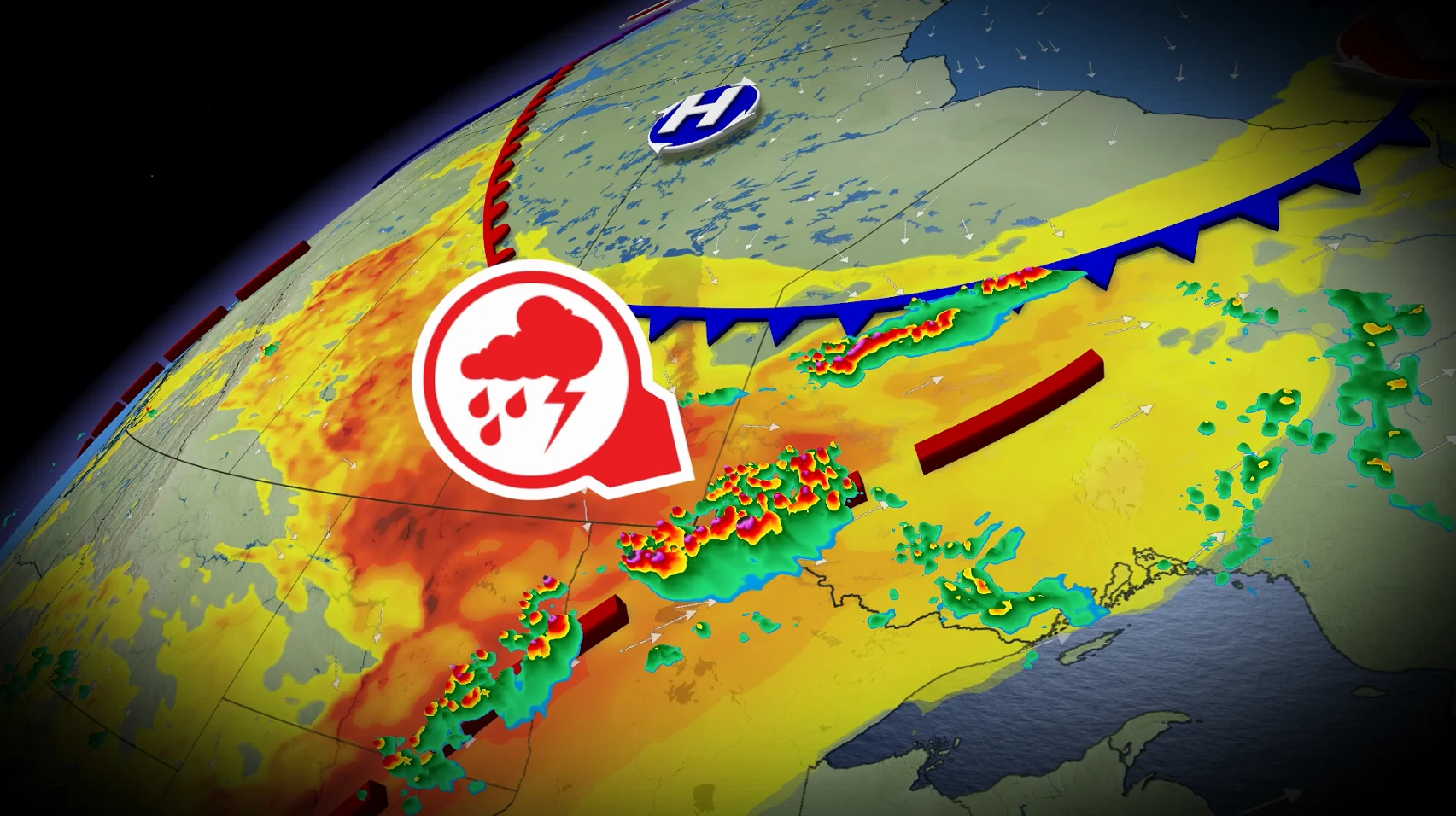
Tornado, hail threats continue overnight in Manitoba, northwest Ontario

Damaging winds, large hail and isolated tornadoes threaten parts of Manitoba and northwestern Ontario Friday
Severe thunderstorms will continue into Friday night across southern Manitoba and northwestern Ontario. A tornado watch remains in effect for much of the area.
A tornado watch means that conditions are favourable for the development of tornadoes. A watch may be upgraded to a warning if meteorologists detect a thunderstorm capable of producing a tornado, or if a tornado is spotted on the ground.
Large hail, damaging winds, and heavy rainfall are also significant threats in any severe thunderstorms that form across the region.
Please keep up with the latest watches and warnings in your area. Take immediate action if a tornado warning is issued for your location.
The original article with the full forecast for the region continues below.
On Friday, a dynamic weather system is predicted to cause severe thunderstorms across southern Manitoba and northwestern Ontario, with some communities at risk of tornadoes by late afternoon and evening.
The biggest concern extends from eastern Manitoba to northwestern Ontario, where a powerful mix of heat, humidity and an oncoming cold front will create the conditions for dangerous storms.
Some severe thunderstorm warnings were issued across Manitoba Friday morning, with storm strength expected to grow throughout the day.
DON'T MISS: How the weather could be influencing your music taste
Damaging winds, large hail and tornadoes possible
As instability increases throughout the afternoon, thunderstorms are predicted to form a line as the front moves east, allowing dangerous weather to strike a larger area rather than being isolated.
The heaviest storms could generate wind gusts of up to 100 km/h, as well as torrential rain and huge hail.
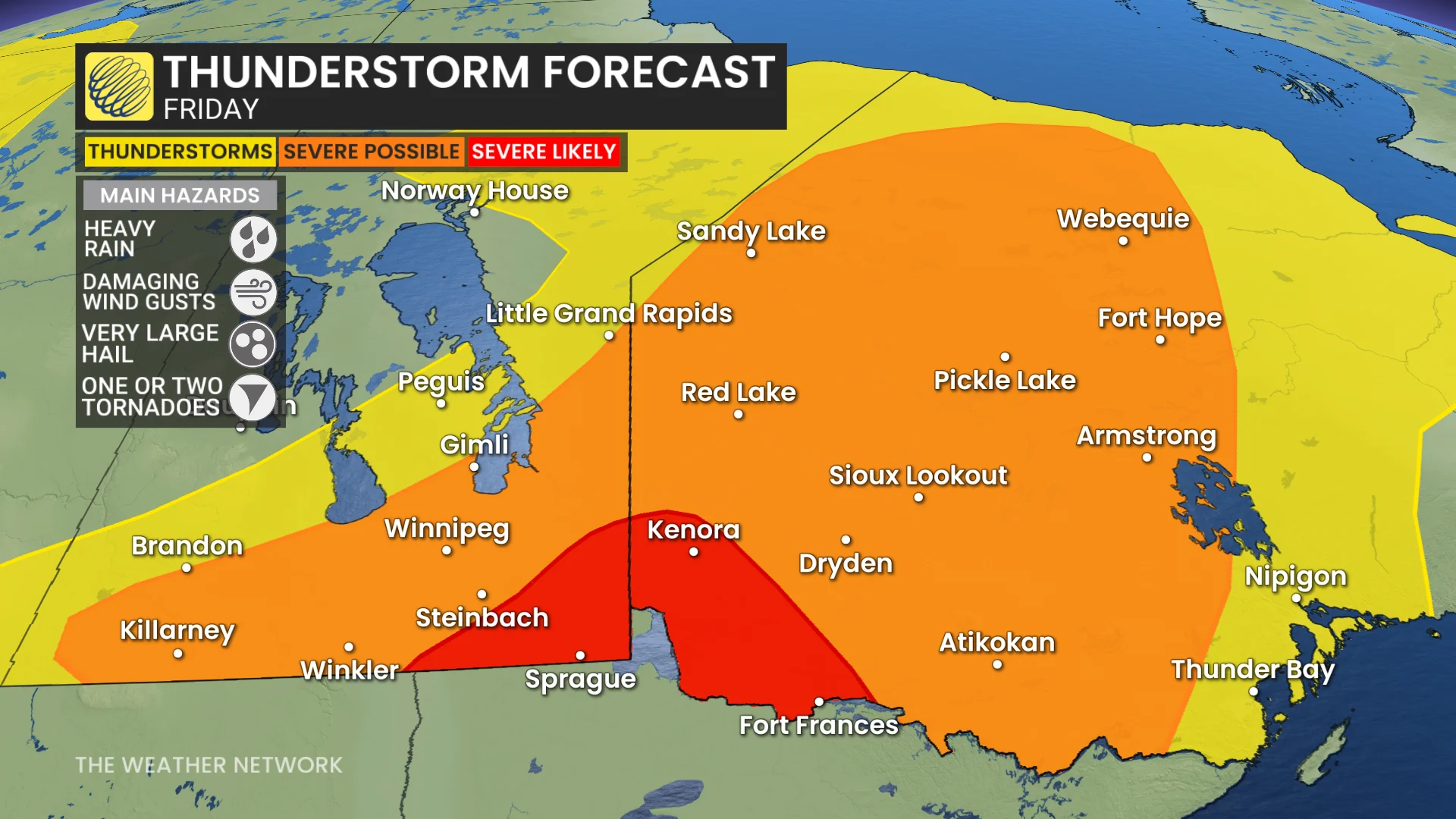
The highest tornado risk will be east of Winnipeg, around Kenora, Dryden, Atikokan and Armstrong, where higher wind shear may support rotating thunderstorms capable of producing isolated tornadoes. Hail larger than golf balls is also achievable in the most powerful cells.
As the storm system moves north, areas as far north as Peawanuck may continue to see heavy rain, strong winds and hail.
CHECK OUT: First transmissible cancer found in freshwater fish in Canada-U.S. lake
Storms bring wildfire concerns before offering relief
The approaching system paints a mixed picture for areas affected by current wildfires.
Strong, gusty winds ahead of the storms could ignite current fires, while dry lightning might start new ones before widespread rain arrives. However, as the storms pass, substantial rain should help to reduce the risk of fire in some areas.
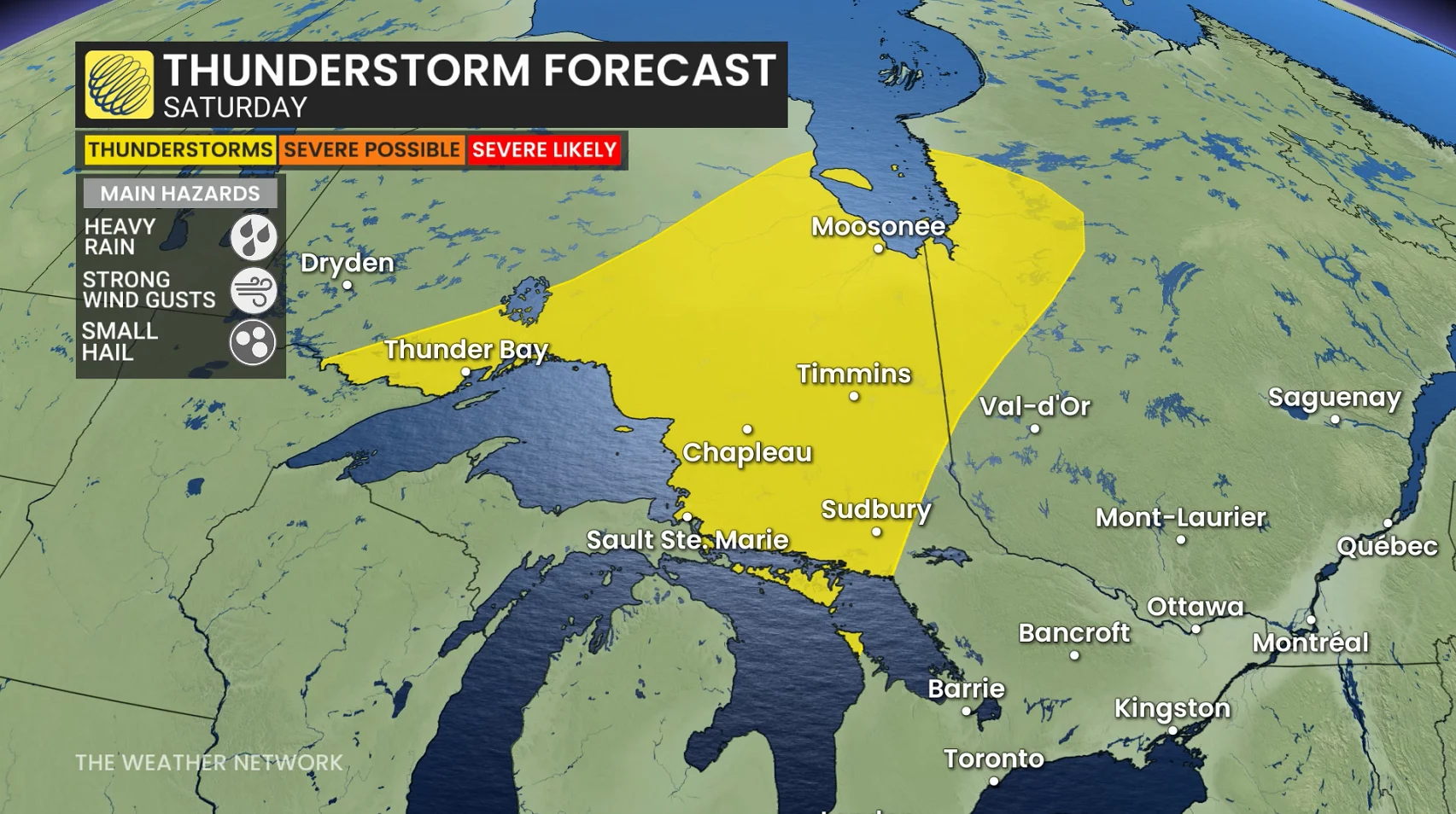
The severe weather threat will reduce significantly on Saturday when the front moves into northeastern Ontario. While sporadic showers and non-severe thunderstorms are still possible from the Lake Superior shoreline and Georgian Bay north to James Bay, atmospheric conditions will no longer be conducive to widespread severe storms.
Stay with The Weather Network for the lates across Manitoba and Ontario