Thunderstorm threat builds for Ontario’s long holiday weekend
Stay close to safe shelter if you have outdoor plans across Ontario over the next couple of days
Keep an eye to the skies across Ontario this long holiday weekend as rising heat and humidity will accompany a risk for thunderstorms throughout the region.
Your forecast doesn’t hold a complete washout by any means. But each day through early next week will hold the potential for rain and thunderstorms from northeastern Ontario to the southwestern corner of the province.
Stay close to safe shelter if you have outdoor plans this weekend. If you can hear thunder, you’re close enough to get struck by lightning.
DON'T MISS: Latest forecast warns a very strong El Niño could emerge soon
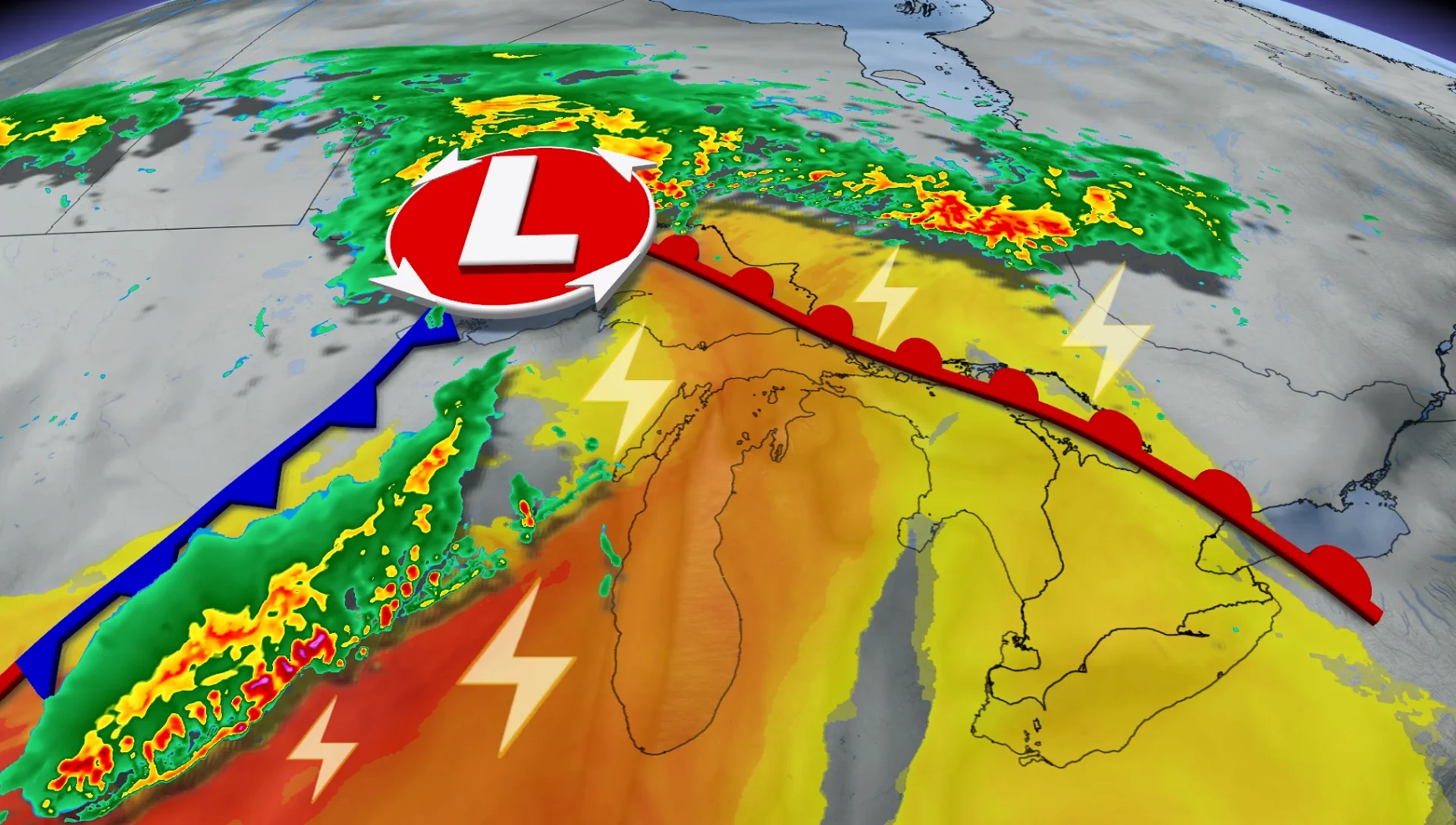
Rising instability pushes into Ontario to start the long weekend
Saturday will see warm temperatures surge into northeastern Ontario just as a cold front arrives in the region, providing the instability and trigger needed for thunderstorms to develop around communities including Timmins and Sudbury.

The main hazard with storms in northeastern Ontario will include strong wind gusts and large hail. A potential for rotating storms exists across this region, as well.
We’ll also see the potential for a few embedded thunderstorms to push into southern Ontario during the first half of the day as some moisture and residual pre-dawn storm activity from Michigan slips through.
Approaching low kicks off multiple rounds of storm chances
Most of the province will be rain- and storm-free on Sunday. But forecasters will watch a low-pressure system track across the border toward northwestern Ontario late in the day.
We’ll see the threat for evening or overnight rain and thunderstorms for communities along the border between Ontario and Minnesota.

A slight chance for an isolated thunderstorm could build into extreme southwestern Ontario during the evening hours on Sunday.
High moisture from the Gulf of Mexico, along with southerly winds, will push temperatures into the upper 20s across most of southern Ontario to begin the new week. Some areas could crack the 30-degree mark.

As a result, Monday will see the thunderstorm risk become a bit more widespread for northeastern and central Ontario, as well as portions of southern Ontario.
Tuesday’s storm chances bubble across central and southern Ontario as the Colorado low’s cold front slices into widespread heat and humidity parked over the region.
Thunderstorm safety is vital on a holiday weekend
A warm holiday weekend guarantees that plenty of folks will spend time outdoors in the days ahead, making thunderstorm safety paramount.
Lightning can strike dozens of kilometres away from the heart of a storm. If you’re close enough to hear thunder, you’re close enough to get struck by lightning. If someone nearby is struck by lightning, don’t wait to render aid! It’s a myth that it’s dangerous to touch a lightning strike victim.
Severe weather can strike suddenly. Flying debris and falling trees are a significant hazard during a storm’s sudden high winds. Large hail is dangerous to anyone caught outdoors.
Make sure you have a way to receive severe weather warnings the moment they’re issued.