Dreaded Pineapple Express set to obliterate the snowpack in parts of B.C.

A Pineapple Express set to bring extreme rainfall and soaring freezing levels to B.C. next week will likely obliterate the snowpack, and increase the flood and landslide threats
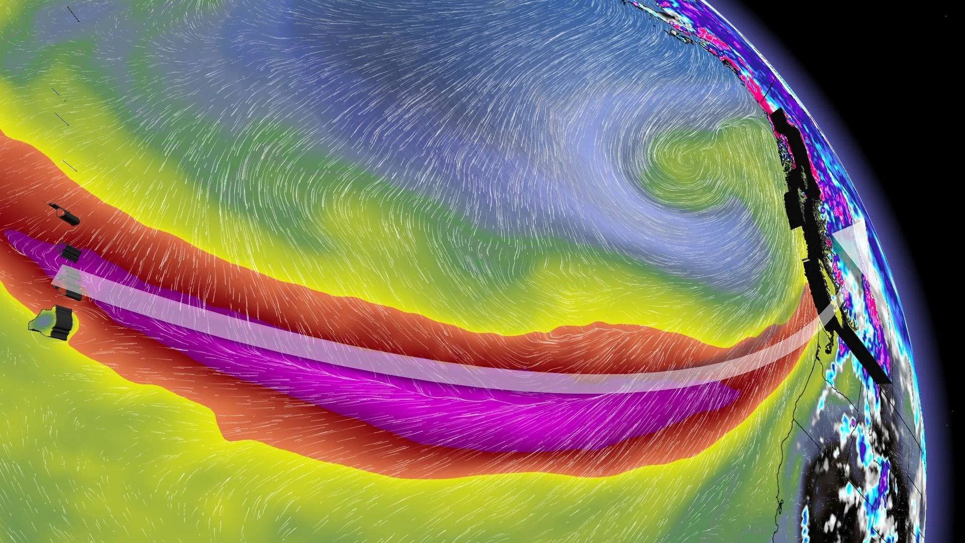
A painful reality in an El Niño winter is the looming threat of multiple atmospheric rivers building up in the tropical Pacific to form what's known as a 'Pineapple Express'.
In early December, B.C. found itself in a pattern that brought nearly 150 mm of rain to western Vancouver Island from moisture that stemmed from Hawaii. It brought 50 mm of rainfall to Vancouver International Airport (YVR), the wettest day since November 2021.
This pattern to finish January will be longer-lasting and warmer, inflicting more damage to the modest snowpack.

RELATED: What is a 'pineapple express'?
January 2010 proxy: The Winter Games fiasco
Remember the 2010 Winter Games' snow struggles? That stemmed from nearly two weeks of temperatures fluctuating between 10-14°C with more than 100 mm of rainfall across the lowest elevations during a moderate El Niño.
We're not hosting the Winter Games this year, but skiers would like some good news.
It's not a warm pattern that will linger much into February. Signs are for temperatures to return to seasonal as we push into February. High-elevation snow will return, and the ski hills will stage a comeback.
DON'T MISS: A 10,000-km-long, super-straight jet stream poses issues for Canada
Flood threat
No, we won't record the 120 mm of rainfall over 72 hours at YVR like the destructive atmospheric river of 2021, as this atmospheric river will likely be farther north, aimed towards Howe Sound and Central Vancouver Island. There will be an increased landslide risk along the Sunshine Coast, Sea-to-Sky corridor and a sizable portion of Vancouver Island.

It will come in two main atmospheric rivers. Although Friday night and Saturday will feature a relatively moist frontal system, the first Pineapple Express arrives by Sunday afternoon and evening.
During the day on Monday, the atmosphere will stall across Vancouver Island before weakening and moving southeast.
Total rainfall amounts will easily exceed 200 mm for western Vancouver Island (and be locally more than 400 mm in remote regions). Much less amounts are forecast for east Vancouver Island and Greater Victoria, with an uptick across the Lower Mainland and Sunshine Coast.

A secondary atmospheric river could follow by next Tuesday, bringing additional heavy rainfall and stressing the swollen waterways.
Soaring freezing levels and a dwindling snowpack
A rule of thumb is as follows: Temperatures of 6-8°C at sea level are a dream to skiers with general alpine snow below 1200 metres. 8-10°C proceed with caution, and mixing is possible. 10-12°C is a writeoff.
We may reach the mid-teens next week across the Lower Mainland. Here are the forecast freezing levels for Vancouver Island in the next seven days.

Regrettably, some ski resorts will have to shut down temporarily as the temperatures are unseasonably warm and unsustainable for skiing.
The snowpack data as of Jan. 10 highlighted a big chunk of the province at 30-50 per cent of normal.
Silver lining: Reservoir top-up
Although there are moderate drought conditions across Vancouver Island and the Lower Mainland, this volume of rainfall will continue to lower drought indices while providing necessary top-ups to the local reservoirs to prepare for summer.

But in this case, it's looking like that delicate balance between beneficial rains and harmful amounts of rain will be tested.