Ontario's 'extraordinary' stretch of warm weather links to a super typhoon
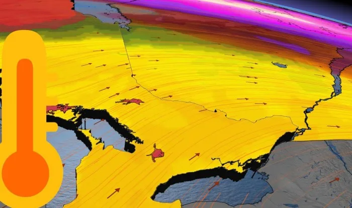
Ontario's 'extraordinary' stretch of warm weather started Wednesday, and the longevity of this November warmth links to a super typhoon.
Super Typhoon Goni quickly climbed the ranks for 2020, not only for strengthening to the most powerful storm on Earth last week, but for also becoming the strongest storm of the entire year so far.
The storm underwent rapid intensification during the week, with an astounding peak wind gust of 380 km/h reported. Goni made landfall in the Philippines as a full-fledged and devastating Category 5 storm near Baras on the island of Catanduanes early Sunday.

GONI HELPS TO REINFORCE THE LONGEVITY OF WARMTH IN ONTARIO
Goni has since weakened, but its track is critical to the type of impact it has on the jet stream pattern. It could also help to explain the extended stretch of well above seasonal conditions coming to parts of Ontario.
"Super Typhoon Goni is not expected to have a major impact on weather patterns across North America as the storm stays too far south to interact with the polar jet stream," says Weather Network meteorologist Dr. Doug Gillham. "However, this track will actually help to reinforce the warm pattern over the eastern U.S. and adjacent parts of Canada."
Recurving typhoons can amplify the jet stream and cause it to plunge south, but with the typhoons that stay in the tropics, similar to Goni, that can help to strengthen the subtropical weather patterns.

The westerly track of Goni reinforces a pattern that further strengthens the Bermuda high over the southeastern U.S. While it's a weaker connection than what is typically seen with recurving typhoons, it is still a contributor to the overall long range pattern.
"So in our case, that will help to reinforce and amplify the warmth in Ontario, and also hold off the cold," Gillham adds. "We can't credit Goni for the warmer weather we will see on Wednesday and Thursday (that would've happened regardless), but it is part of the explanation for why we have a shot at 20°C early next week."
EXTENDED STRETCH OF SPECTACULAR FALL WEATHER STARTED WEDNESDAY
After a chilly start to the week that saw bitter wind chills and some of the first flakes of the season fly, the temperature climb began Wednesday, and is set to last well into the weekend and early next week.
These temperatures will be more typical of early October, and even late September for some, with daytime highs soaring into the mid to upper teens for the next seven days.
Though it's already been said once or twice before, some areas have a shot at reaching 20°C one, or even two more times, this year.
"As a meteorologist, never try to predict the last 20°C day of the year. You will lose," said Weather Network meteorologist Tyler Hamilton in the November outlook that emphasizes the noticeable pattern reversal this month. "Toronto Pearson hit 22°C on October 10, and we probably said 'it’ll be the last 20°C day of the year.'"
NO CONSISTENT COLD IN SIGHT
It doesn't just stop there either. Along with the exceptionally warm temperatures, will be an abundance of sunshine, likely helping to defy the November reputation of being an overall gloomy month.
Temperatures are expected to remain on the mild side of seasonal through the end of next week, with no extended periods of cold weather in sight and above seasonal temperatures dominating through mid November.
"This delay in the arrival of the consistent cold weather will make for quite a contrast to the past two Novembers we've had," says Gillham.
Be sure to check back for the lastest weather updates in your area.


