November begins with noticeable pattern reversal across Canada
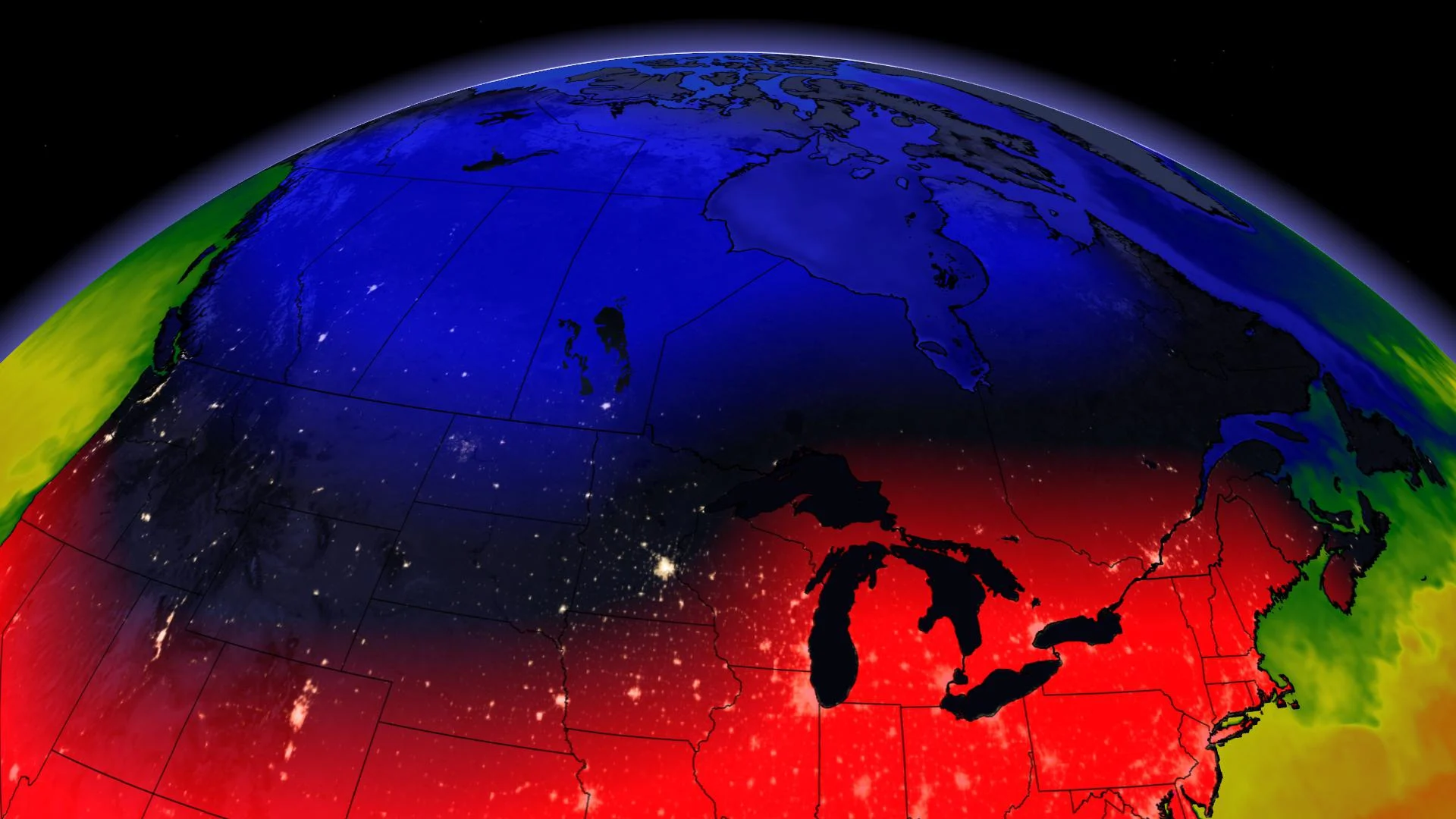
The evenings are getting darker sooner and the temperatures are becoming colder, which has many wondering what the weather during November will be like across Canada. Fall is a highly changeable season and unsurprisingly, a substantial pattern reversal is underway.
The December-like temperatures across Ontario, Quebec, and Atlantic Canada will gradually ease. We'll welcome some pleasant early-October weather across the Prairies, which will eventually reach Ontario and Quebec by mid to late-week.

TIPPING TO THE WARM SIDE OF NOVEMBER
Which provinces have the best shot of tipping to the warm side for November? That goes to southern Ontario and extreme southern Quebec.
Compared to recent Novembers, this should be a walk in the park for many. Do you remember the Remembrance Day snowstorm of 2019, Ontario?
That noteworthy storm ended up being the largest snowfall of the 2019-2020 winter season for many southern Ontario residents, as it dumped more than 15 cm across parts of the region.

Of course, when compared to October, this early November warmth is a welcome reprieve across western Canada, but we can guarantee that it won’t last.
COLD ANOMALY PARKS OVER THE WEST
A formidable cold anomaly, albeit slightly less extreme than the October chill, is poised to park over western Canada for an extended period this month. It'll be quite cold at times, but the polar vortex is expected to shift to the other side of the globe as the month progresses, so the chilliest of air is likely off the table, for now. At times, there will be significant snow for the Prairies, but that's not unusual for the month of November.
There will also be a period of drier weather along the B.C. coast as outflow conditions set up. With a ridge anchored offshore, a northwest storm track may very well prevail, lowering freezing levels.
THE LAST 20°C TEMPERATURE OF THE YEAR STILL TO COME?
A word to the wise. As a meteorologist, never try to predict the last 20°C day of the year. You will lose. Toronto Pearson hit 22°C on October 10, and we probably said "it’ll be the last 20°C day of the year."
Then October 23 happened, where the mercury pushed to nearly 25°C. We’ll soon see what tricks November has in store, but it looks like parts of southern Ontario could approach and even reach 20°C one or two more times.

ANOTHER PIECE OF THE PUZZLE: THE OCEAN
This year, we're working with a different sea surface configuration. An anomalous blob of warm sea surface temperatures still can dictate the weather patterns of the Pacific Northwest, and La Niña continues to intensify as we push towards winter. Super Typhoon Goni, is not expected to have a major impact on weather patterns across North America as the storm stays too far south to interact with the polar jet stream. However, this track will actually help to reinforce the warm pattern over the eastern U.S. and adjacent parts of Canada.

For the month of November as a whole, we expect most of Canada will end up within a couple of degrees of normal. This is in contrast to October which featured temperatures nearly 5°C below normal across pockets of the Prairies.
We'll keep an eye out for a potential shift to a more wintry pattern in eastern Canada towards the end of November, but that pattern change could hold off until December. This year has been anything but predictable, and the weather is no exception.


