Stunning, but strange cloud phenomenon captured by satellite

On May 8, satellites captured a cluster of swirling formations off the coast of Mexico -- known as Von Karman clouds.
A mysterious phenomenon that was seen spiralling off the coast of Mexico earlier this month may have had you scratching your head as to what it is.
The May 8 imagery captured by satellites is a unique, but peculiar occurrence known as Von Karman clouds -- named after Theodore von Kármán, a Hungarian-American physicist and one of the first scientists to describe the sight, according to the National Oceanic and Atmospheric Administration (NOAA).
So, how do these strange clouds form?
SEE ALSO: Scary cloud seen in Canada's skies not as rare as you think
Michael Carter, a meteorologist at The Weather Network, refers to the Von Karman vortex shedding -- a process that happens when the flow in a stable layer in the atmosphere gets blocked by an obstacle.

The May 8 imagery captured off the Mexico coast by satellites is a unique, but peculiar occurrence known as Von Karman clouds. (NOAA)
"Like a rock in a stream, the flow splits around the disruption, usually a mountain or island, and the split flow takes on some spin, leading to swirls. It happens a lot off the West Coast because the water is cold, so you get that stable layer in the atmosphere," says Carter.
With respect to the most recent satellite image, the blocking feature was Guadalupe Island. Winds from the west trekked eastward across the island, forcing air and clouds to go around it. The combination of the two ended up spinning, resulting in the remarkable display of the swirls.
What also makes the phenomenon special is the fact that a Von Karman vortex can't just happen anywhere, and is mostly found in regions encountering trade winds.
According to NOAA, the trade winds are normally found between about 30 degrees north and 30 degrees south of the equator. However, the phenomenon doesn't always have to develop in close proximity to the equator.

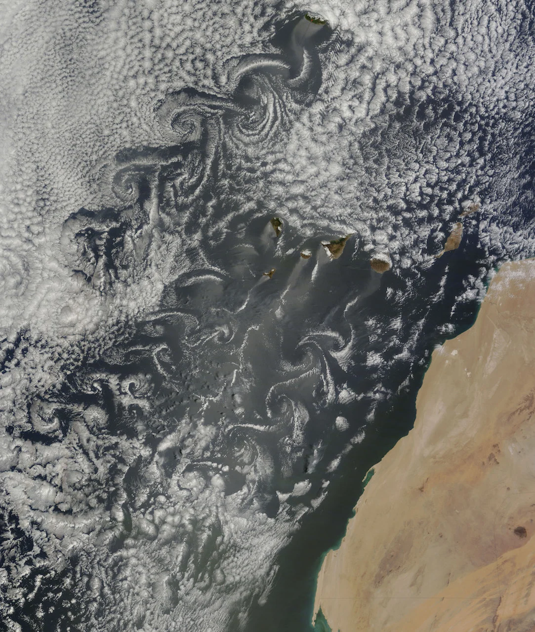
A satellite image taken on May 20, 2015, displays another example of Von Karman vortices around the Canary Islands. (NASA)
Satellite sensors have picked up Von Karman vortices in other parts of the globe before, including near the coast of Chile, in the Greenland Sea, in the Arctic, and even adjacent to a tropical storm, according to NASA.
"As long as you can satisfy the requirements to produce Von Karman vortices, which include something like an island that 'sticks up' into the air flow, a favourable wind speed, and cloud cover that can help mark or visualize the wind footprint, they can occur elsewhere on the globe," said AccuWeather lead international forecaster Jason Nicholls, in a story the weather agency recently published.
Thumbnail courtesy of NASA.