Interruptions in power and travel possible with intense B.C. wind gusts
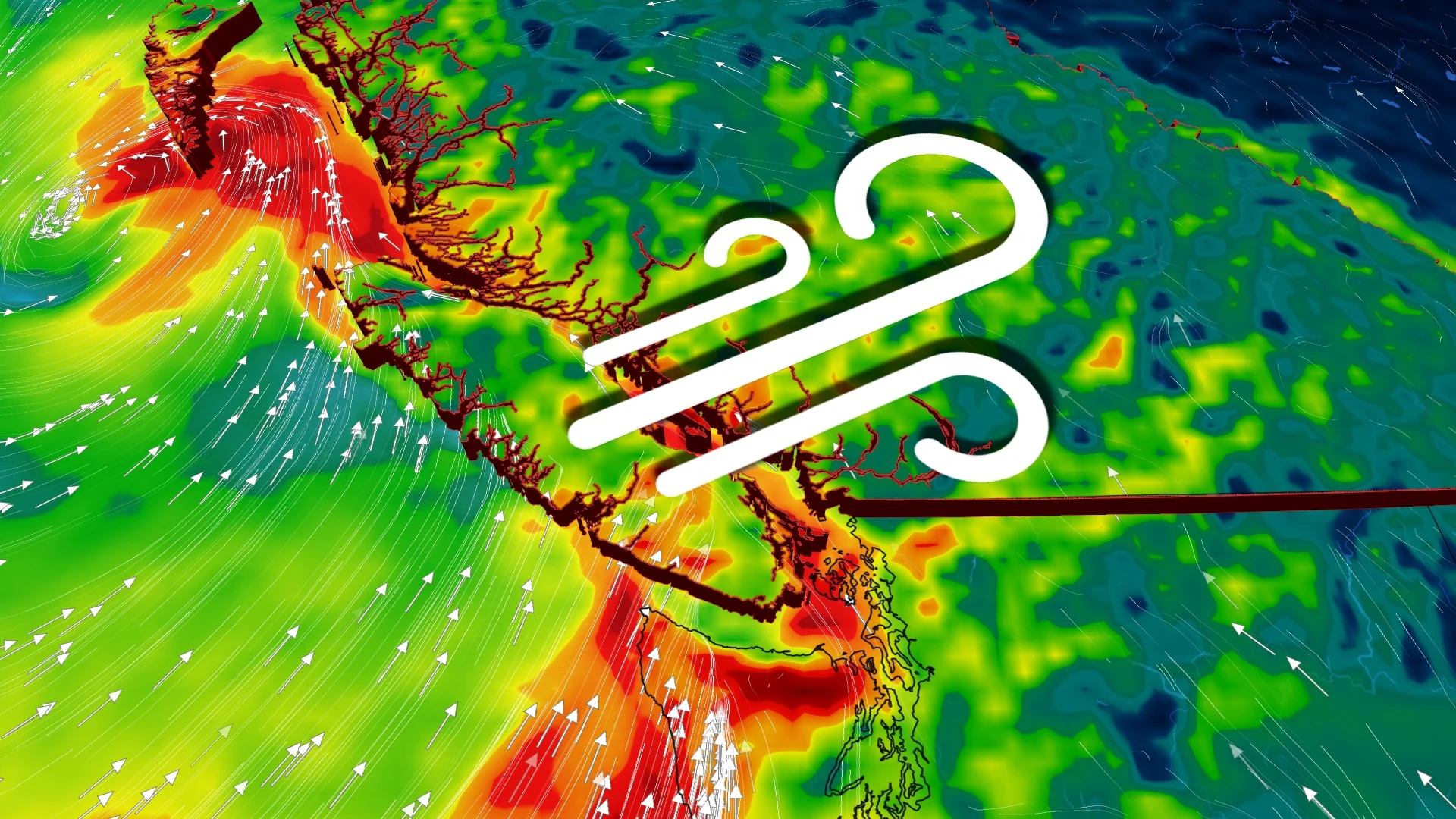
A powerful low is crossing B.C. with intense wind gusts into Tuesday morning. Additional impacts to power and travel are likely.
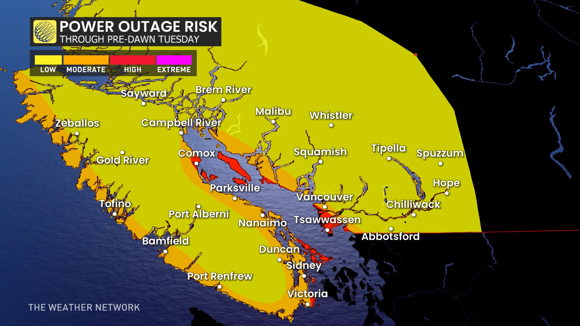
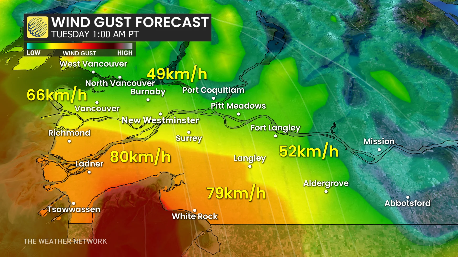
Power outages and travel impacts are likely along the B.C. coast into Tuesday as a potent system continues to make its presence felt.
A rapidly developing low-pressure system trekked west of Tofino on Monday night, setting off blustery wind gusts and large waves as it moved through. The breezy conditions will continue into Tuesday morning, so many people may wake up to power outages. As well, motorists can anticipate further travel disruptions.
DON’T MISS: La Niña’s last hurrah? Pattern could disappear by this spring
The winds aren't the only issues with this storm. With temperatures warming up, freezing levels rise, and alpine rain is forecast many times this week, as well. As a result, there is a continued risk for avalanches this week as the mountain snowpack destabilizes.
Into Tuesday morning: Wind threat with possible travel and power issues
The strongest winds are forecast for Greater Victoria and exposed, coastal sections of Vancouver Island. But potent gusts across southern sections of the Lower Mainland are possible Monday night.
Gusts may exceed 90 km/h for coastal sections of Greater Victoria and the southern Gulf Islands (Saturna, Pender, Mayne). Peak wind timing: 10 p.m. Monday to 4 a.m. Tuesday.
Gusts may surpass 70 km/h for Tsawwassen, Boundary Bay, Delta, and White Rock. Peak wind timing: 12 a.m. to 6 a.m. Tuesday.
Travel interruptions are possible, including ferry disruptions, through early Tuesday. Ensure your devices are charged as power outages are possible.
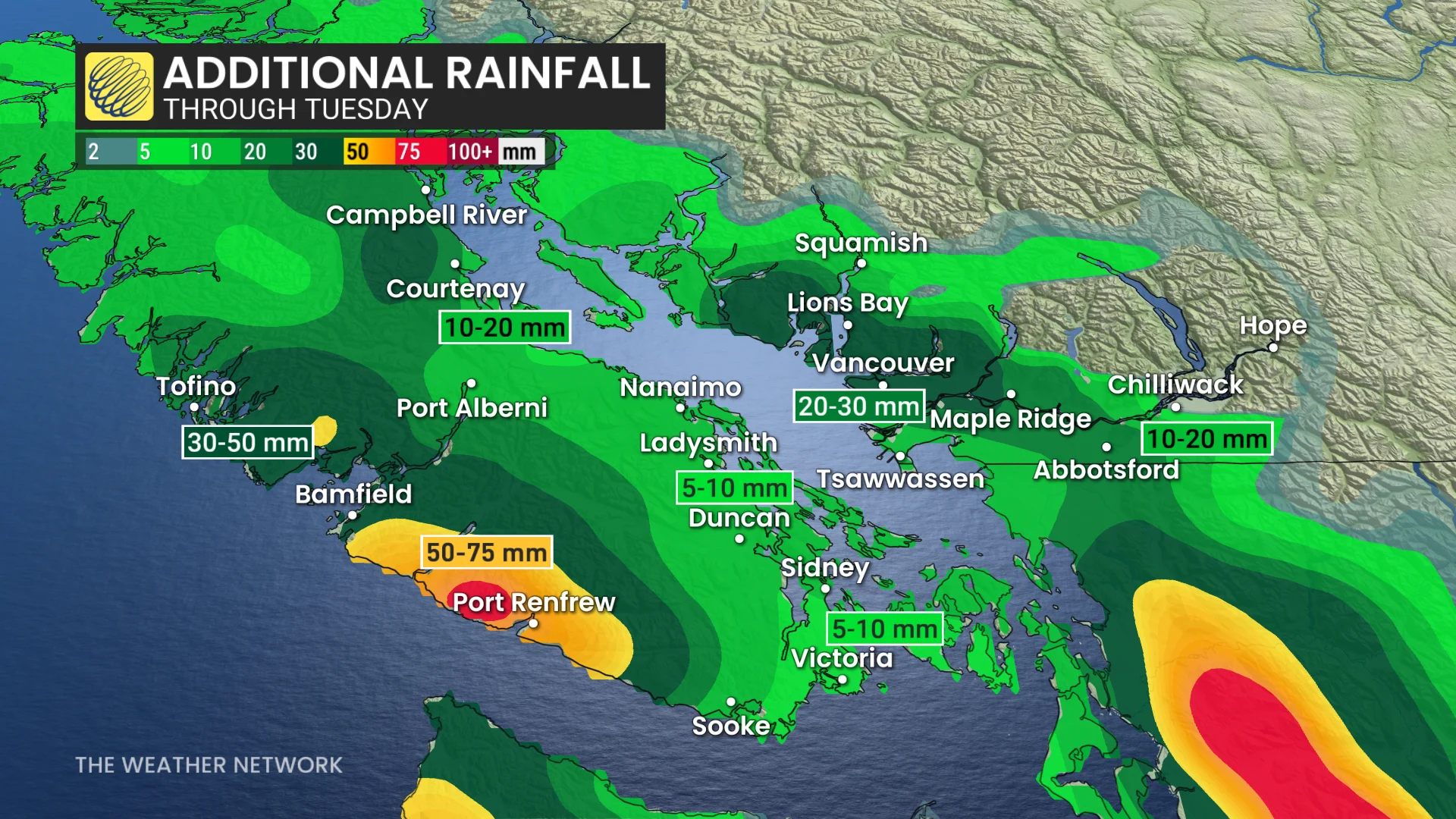
The gusty winds winds will be accompanied by heavy rain at times, as well.
Between 30-50+ mm is forecast across west Vancouver Island, with 20-30+ mm likely for north Vancouver.
Avalanche danger remains high this week
As temperatures warm, freezing levels rise. Alpine rain is forecast many times this week, as well.
All of that combined will increase the risk for avalanches as the mountain snowpack destabilizes.

"The parade of storms has woken up a nasty persistent slab and more snow is coming," said Avalanche Canada in a renewed warning. "The consequences of triggering an avalanche could be much higher than surface instabilities suggest."
According to Avalanche Canada, a high danger rating means that conditions are very dangerous, and travel in avalanche terrain is not recommended.
Another period of drier-than-normal weather, with mild temperatures, is expected to return by mid-week, and will continue through early March. However, an unsettled pattern should return before we get too deep into March.
Science behind: Could your voice trigger an avalanche?
Stay with The Weather Network for all the latest updates on conditions across B.C.