Wildfire smoke blankets Ontario, widespread risk of severe storms

Wildfire smoke has made for some hazy skies in southern Ontario, prompting special air quality statements that will continue Tuesday, along with the continued risk for severe storms as a cold front sweeps through.
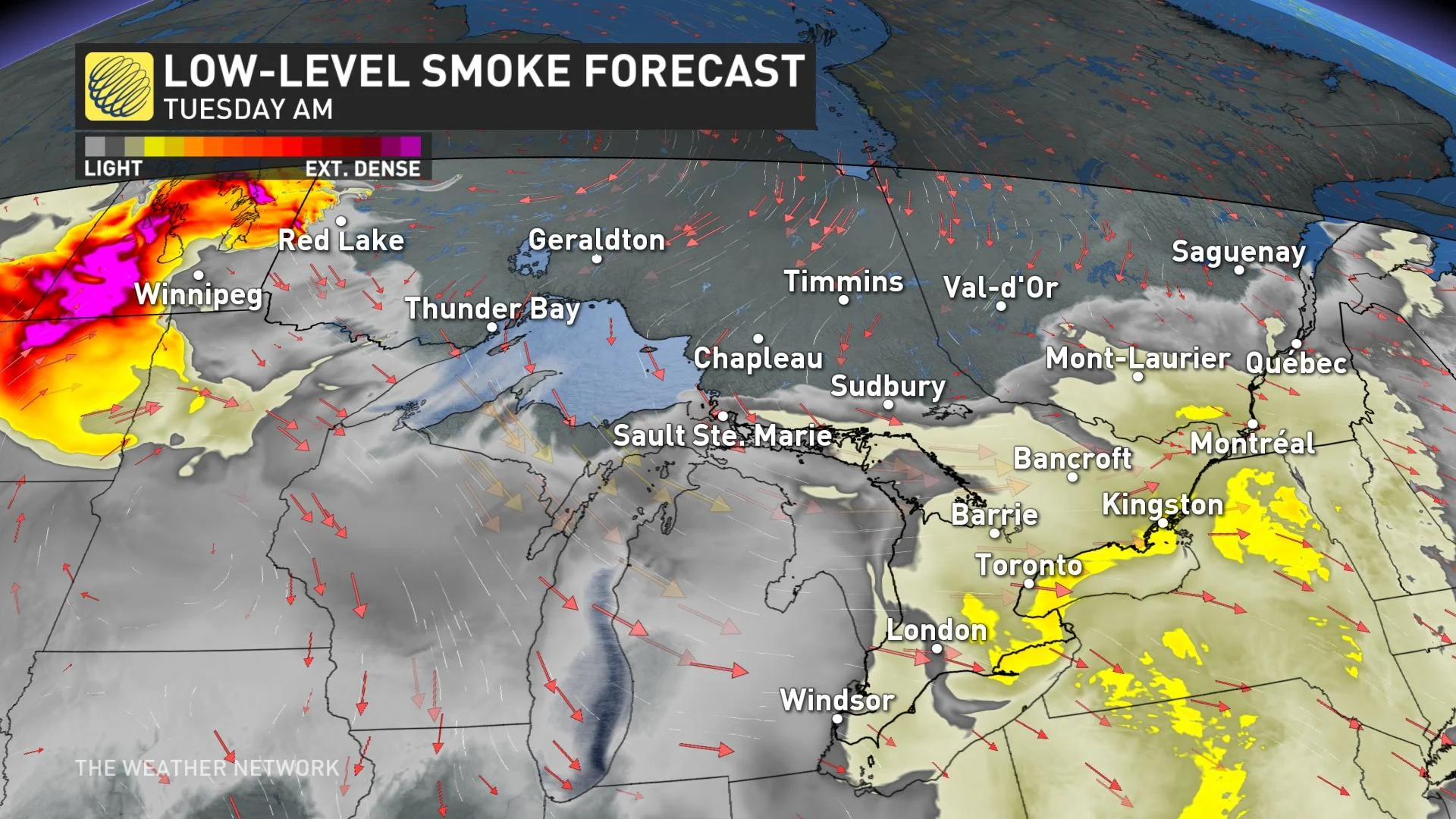
The wildfire smoke from northwestern Ontario has reached the south, creating a smoky, hazy blanket in the skies. Because of the health risks from the associated air pollution, special air quality statements are in place in northern and southern Ontario. Conditions won't improve in the south until Tuesday evening, once the cold front passes through. But the front could also trigger severe thunderstorms along it as it sweeps southward through the afternoon and evening. Temperatures in the upper 20s and low 30s will hang on for one more day, as will the humidex values into the mid-30s. Wednesday will see a noticeable drop in temperatures as cooler air moves in. More on the storm timing and wildfire smoke impacts, below.
TUESDAY: COLD FRONT BRINGS WIDESPREAD SEVERE STORM RISK, SMOKE REDUCES AIR QUALITY
Smoke from the active forest fires in northwestern Ontario has moved into southern Ontario. Elevated particulate matter levels and hazy conditions have been experienced throughout the region. Reduced visibilities and deteriorating air quality are possible if the smoke descends to ground level.
RELATED: One firefighter dies as more than 100 wildfires burn across northwestern Ontario
Special air quality statements are in effect across northern and southern Ontario.
"If you or those in your care are exposed to wildfire smoke, consider taking extra precautions to reduce your exposure. Wildfire smoke is a constantly-changing mixture of particles and gases which includes many chemicals that can be harmful to your health," warns Environment Canada in the statement.
Conditions are expected to improve in northern Ontario by Tuesday morning, as a cold front sweeps through and winds become more northeasterly, but will linger in the south until the system passes through the region.
MUST SEE: Smoky skies span the country with nearly 800 active wildfires burning
Meanwhile, a more widespread threat for thunderstorms will continue on Tuesday as the cold front from the north marches southward. Strong to severe storms are possible across much of southern, eastern and central Ontario, extending into southern Quebec and New Brunswick, with localized torrential rain being a main risk. Potent storms may also produce strong wind gusts and large hail.
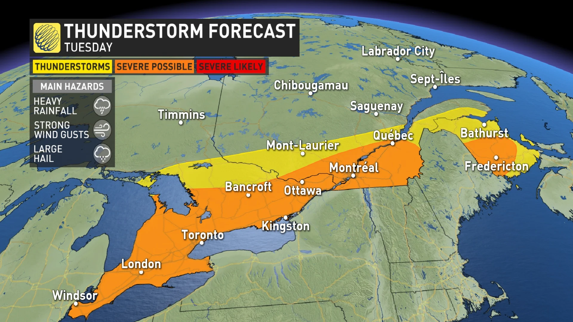
The front will trek south into Georgian Bay region by early afternoon, with storms likely to fire off, reaching the GTA by mid-afternoon. Another area to watch for severe storms will be in the late afternoon and evening across the Lake Huron shores, impacting areas from Windsor to London.
The third area of potential thunderstorm development will be centred in southeastern Ontario, where they could fire up in the evening and overnight period.
Daytime highs will still remain in the upper 20s and low 30s, with humidex values reaching the mid-30s Tuesday. Once the front passes, there will be a noticeable cooldown for Wednesday, though still a tad humid, but nowhere near as muggy as it has been in recent days.
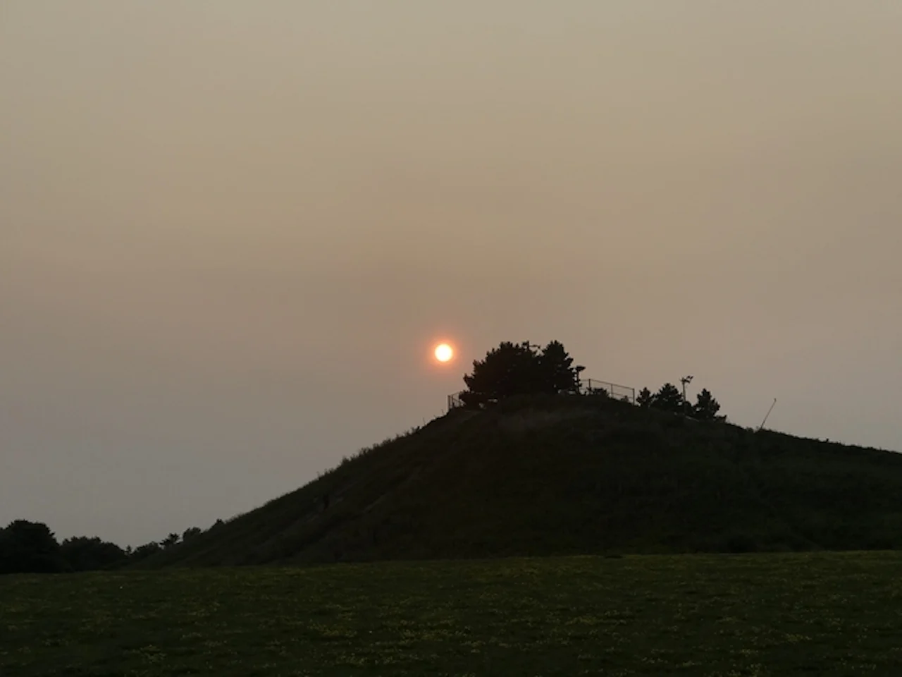
HAZY, SMOKY SKIES ARE SCREENING OUT THE SUN IN COTTAGE COUNTRY
LOOK AHEAD: COOLDOWN MID-WEEK, NO SUSTAINED HEAT IN SIGHT
Mostly sunny for southern Ontario on Wednesday after the passage of the cold front. Temperatures will also cool down, with just a dash of humidity left into late week. Temperatures will be a few degrees cooler than seasonal.
Threat for showers and thunderstorms in southern Ontario Thursday night. Fair weather will return Friday and Saturday, but forecasters are watching the potential for a system to bring widespread showers Saturday night into early Sunday for southern Ontario, and on Sunday for eastern Ontario.
Fair weather with near or slightly above seasonal temperatures is expected for a few days early next week, but there will be no extended stretches of hot weather in sight through early August.
Thumbnail courtesy of Armish, taken in Brampton, Ont.
Stay with The Weather Network for the latest on the storm threat across southern Ontario.


