Flood risk accompanies spring's arrival for these provinces

Spring has arrived and so have warmer temperatures. Snow is beginning to melt, rivers are starting to rush and the threat for flooding is here in Canada.
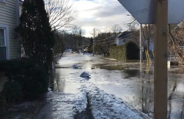
Residents across southern Ontario have already been dealing with early season flooding along the Humber River through the Caledon area after snowmelt, ice jams and rain caused rivers to burst their banks last Friday. Some 200 residents were forced to evacuate temporarily, but drier and cooler weather conditions have since allowed floodwaters to recede and evacuees are now home.
While the area will be monitored for more flooding through the season, below is a look at what other parts of the country are also at risk for spring flooding.
MANITOBA FLOOD FORECAST
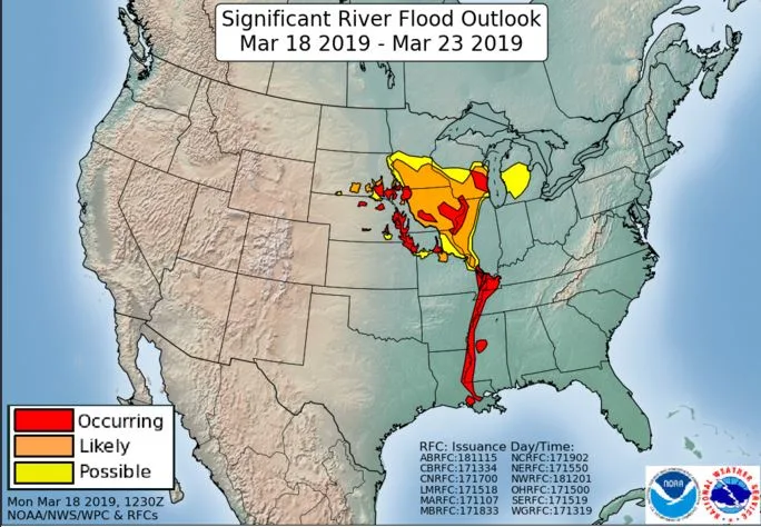
According to the Manitoba Flood Outlook issued on March 18, heavy snows have fallen in the northern United States and across the Red River Valley -- which means the focus at this time is on the Red River and its tributaries, as this is where substantial flooding is forecast to occur.
Flood water levels will depend on the rate of snow melt, snow and rain accumulation over the coming weeks, however, with favourable weather (mostly dry weather and a gradual thaw), the flood forecast at this stage indicates the Red would rise to 2011 flood levels, the outlook adds. With unfavourable weather conditions (higher temperatures leading to rapid snowmelt and excessive rainfall), water levels will be higher than 2009 levels by almost one foot at Emerson and by 1.5 feet at Ste. Agathe and reach 22 feet at James Avenue in the City of Winnipeg.
Officials add that the Assiniboine River system is expected to see limited flooding this spring.
WHAT WE'RE WATCHING ALONG THE RED RIVER
While the heavy snowfall during the month of February puts the Red River at risk of major flooding this spring, the bigger problem could be what's yet to come from our friends south of the border. That's because the Red River flows south to north.
In the U.S., major to historic river flooding is expected to continue across parts of the Missouri and Mississippi River Basins due to rapid snow melt the past week. Flood warnings and advisories have been in effect through last weekend and this past week across parts of the northern plains. In its second spring flood outlook of 2019, the U.S. National Weather Service upgraded the risk of significant flooding along the North Dakota and Minnesota portions of the Red River basin from low to substantial, with the possibility of record flooding.
Should significant overland flooding occur, local roads may have to close, including Highway 75 - a vital link between Winnipeg and the American border.
HOW AND WHY THIS OCCURS THIS TIME OF YEAR
Several factors determine if an area is vulnerable to flooding, including:
• how much water flow the local system of waterways can handle, • the shape of the local terrain, since that will determine where all the water in the system comes from • the type of soil that is most common, since the soil acts to slow the progress of water as it moves from where it fell to where it enters the system of waterways, and • how much water actually enters the system at any one time.
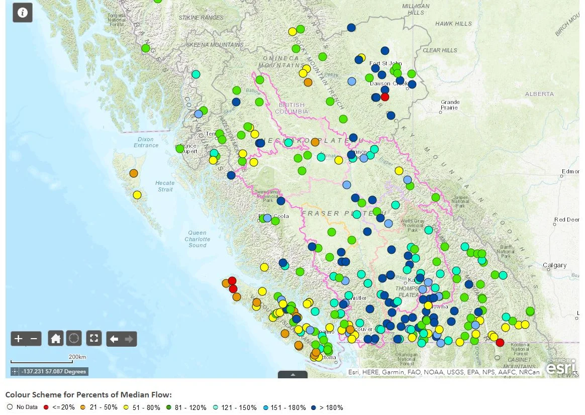
The first thing to look at when considering the potential for spring flooding is the amount of water that is flowing through rivers and waterways, even before the seasonal thaw begins. If they are already running high then an area could be in for trouble. This map indicates the streamflow (the amount of water moving through rivers and streams) and there are signs that this is already above the average before the bulk of our spring melt.
B.C. WILL NEED TO BE MONITORED
Very warm temperatures, courtesy of a ridge of high pressure are expected to continue this week will make for dangerous travel conditions throughout B.C. with the avalanche risk at high levels.
The snowpack is deep and and while flooding will be a big concern moving ahead this year, snowpack is considerably less than last season where we saw major spring flooding across southern B.C. --including Grand Forks.
Typically, El Niño is linked to warmer winters across British Columbia, with a trend towards lower than normal snowpack. El Niño didn't behave accordingly this winter season, and in a lot of mountainous regions, received near normal snowpack. Warmer temperatures were present throughout the province in December and January. However, a strong arctic airmass significantly influenced British Columbia in February and March bringing more snow to the alpine regions.
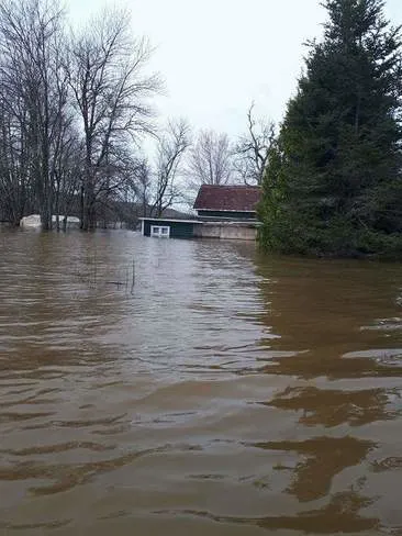
Flooding near the St.John river last season in New Brunswick
NEW BRUNSWICK HAS A LOT OF SNOW TO MELT
With heavy snow throughout the 2018-2019 winter season it will be important for New Brunswick to have a gradual melt in order to avoid flooding. While the long range forecast does not suggest a sudden strong warm signal, there is still a lot of snow to melt from the season. It would be ideal if the temperatures could gradually warm up closer to the end of March and into April in order to not experience major river flooding. Too quick of a melt and the rivers get overwhelmed. Too slow of a melt means the snowpack is still formidable once the warm air arrives in ernest.
ICE MOVEMENT ALONG RIVERS POSSIBLE IN COMING DAYS
The New Brunswick Emergency Measures Organization advises residents to be vigilant along waterways in the coming weeks, as the forecast is calling for up to 30 mm of rain in the province’s extreme south and up to 15 mm in the central and northern regions, with temperatures between 5 C and 9 C today and Saturday.
"People living or working in areas prone to localized flooding are reminded to be aware and take the proper precautions to safeguard their homes and possessions, cautions the organization in a statement. "River Watch officials continue to monitor the situation closely."
With files from meteorologists Scott Sutherland and Tyler Hamilton
Sources: www.gov.mb.ca | National Wather Service | www2.gnb.ca