'High' avalanche risk for some through Friday

While this late winter warm-up has western Canadians flocking outdoors and shedding the layers, danger lies in the mountains as the above seasonal and record breaking temperatures build.
If you live in western Canada, and even as far as the Northwest Territories, you've been having a very toasty week, with temperature record after temperature record falling in the wake of unseasonal warmth flooding the region.
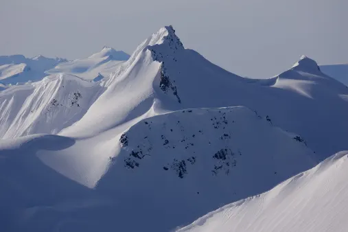
But that warmth has a potentially deadly price for the unwary: The high temperatures are combining with mountain snowpack to make for high avalanche risk. So high, in fact, that Avalanche Canada issued a special statement to the public as early as Monday.
"This is the first big warming to hit our snowpack, which is still fairly complex and winter-like," said Senior Avalanche Forecaster Grant Helgeson in the agency's statement at the time. "Any time the snowpack is hit with a big change, it tends to de-stabilize."

SEE ALSO: Vehicle caught in B.C. Interior avalanche
Helgeson says the high temperatures, coupled with lack of night-time cooling, together weaken the snowpack "on all aspects," making large avalanches more likely, and making it easier for a person to trigger one.
Avalanche Canada says the risk for many of the interior ranges will decline after Thursday, though still remaining high for the highest-elevation zones, including Banff, Yoho, Jasper and Kootenay National Parks through Friday.
WATCH BELOW: LARGE NATURAL AVALANCHE CYCLE LIKELY TRIGGERED IN ALBERTA
Officials have warned backcountry users, including those going outside of ski area boundaries, to "keep careful track of their regional avalanche forecasts at www.avalanche.ca. Avalanche Canada also urges everyone to have the essential rescue gear including a transceiver, probe and shovel.