Severe thunderstorms fire up in southern Ontario Saturday, here's what to come

Severe thunderstorms produced flash floods, power outages in parts of southern Ontario Saturday
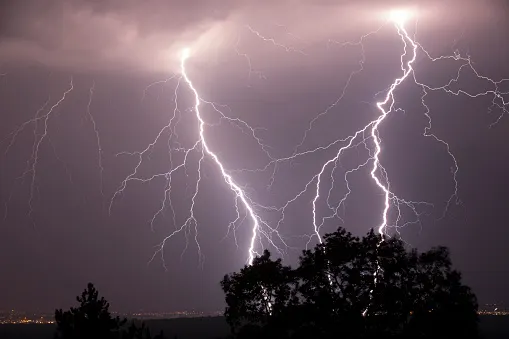
It's been a stormy Saturday afternoon already, as severe thunderstorms fired up across parts of southern Ontario and dumped up to 100 mm of rain or more in the Hamilton area before tapering off. The storm also caused power outages in Ancaster, with approximately 8,200 customers currently without power. We take a look at the timing of rain this weekend and the gorgeous weather conditions for Sunday, below.
Summer revealed! Visit our Complete Guide to Summer 2019 for an in-depth look at the Summer Forecast, tips to plan for it and much more
WEATHER HIGHLIGHTS:
Risk for thunderstorms continues through Saturday, on and around lakes Ontario and Erie
Humidity subsides somewhat into Sunday in wake of cold front
Widespread heat warnings in effect; latest watches and warnings HERE
WATCH BELOW: STORM ENERGY CLINGS TO THE LAKE SHORE
Parts of southern Ontaro already saw localized downpours Friday night ahead of a wide-ranging cold front. That same front is leaving behind enough storm energy to make for thunderstorm development throughout the day Saturday as well, though the strongest chance will be along the 401 corridor in the afternoon.
SEE ALSO: IN PHOTOS: Waterdown, Ontario hit with flash flooding
Though much of the south is still sweltering with humidity -- a major ingredient in thunderstorm risk -- most places that are likely to see storms on Saturday will be along the northern shores of Lake Erie and the Niagara Region. Isolated cells are also possible through the late afternoon, impacting parts of the GTA and the west end of Lake Ontario.
The main threats will be localized heavy downpours and strong wind gusts.

The Toronto and Region Conservation Authority (TRCA) is advising that this passing system could cause significant wave action and storm surge in Lake Ontario due to the potential for 40 mm of rain and wind gusts up to 80 km/h. All rivers and streams within the GTA should be considered hazardous due to the potential for higher flows and water levels.
WATCH BELOW: RAINFALL AMOUNTS IN THE LAST 12 HOURS
GORGEOUS SUMMER WEATHER ON SUNDAY
The upside is the cold front will usher some fresher air back into southern Ontario and will make humidity levels more palatable for at least part of the weekend, though people should prepare to endure one more day of extreme heat Saturday.
"Temperatures will remain near thirty with humidex values in the upper thirties to forty; however with the passage of a cold front this evening, cooler temperatures and lower humidity is expected for the remainder of the weekend," a heat warning from Environment Canada says.
How fast the front moves will make all the difference between a steamy or satisfying Saturday, but the early part of the day, at least, is expected to be very muggy as the front heads for the Lower Great Lakes early Saturday afternoon.

While temperatures don't drop that much by Sunday due to the building high pressure that will keep skies full of sunshine, the humidity will be cut significantly, making it feel much more pleasant across the province.

A warming trend returns for next week, but it won't mean a return to high humidity as the driver this time is high pressure from over the U.S. Southern Plains, rather than the Atlantic.
"We're looking at gorgeous summer weather for early next week with sunshine and a warming trend," says Weather Network meteorologist Dr. Doug Gillham. "Temperatures could even top 30°C during the middle of next week."