Sneaky thunderstorm risk brews for Quebec on Sunday

A setup moving through the region on Sunday bears close watching
Folks across southern Quebec should keep an eye to the skies to close out the weekend as a risk for strong to severe thunderstorms builds over the region.
The risk isn’t exceptional on paper, but the setup bears watching for its sneaky severe potential. Stay alert for rapidly changing conditions, and closely monitor potential watches and warnings in your area.
DON'T MISS: Latest El Niño forecast calls for historic heat by this autumn
An area of low pressure will push a cold front through the area from the north. At the same time, instability will build over southern Quebec by the early afternoon hours.
This setup will see a line of strong to severe thunderstorms sweep the region, including Montreal, by the late afternoon and into the early evening.
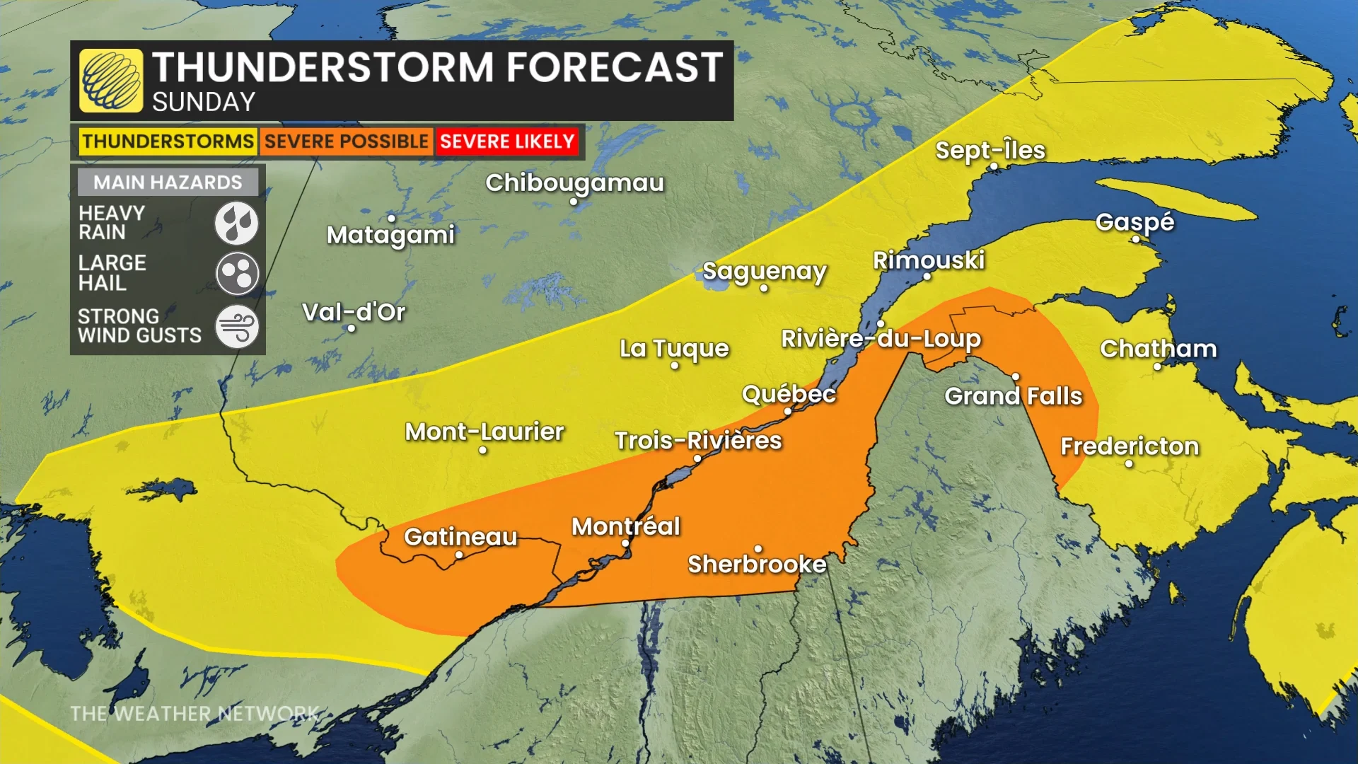
Rich moisture aloft will fuel downpours throughout the region, raising the risk for flash flooding. This potential will be higher in urban areas. We’ll also have to watch the potential for gusty winds and small hail (1-2 cm in diameter).
A low tornado risk may also develop as the cold front may serve as a focus for storms to acquire pockets of rotation.
Stay with The Weather Network for all the latest on conditions across Quebec.