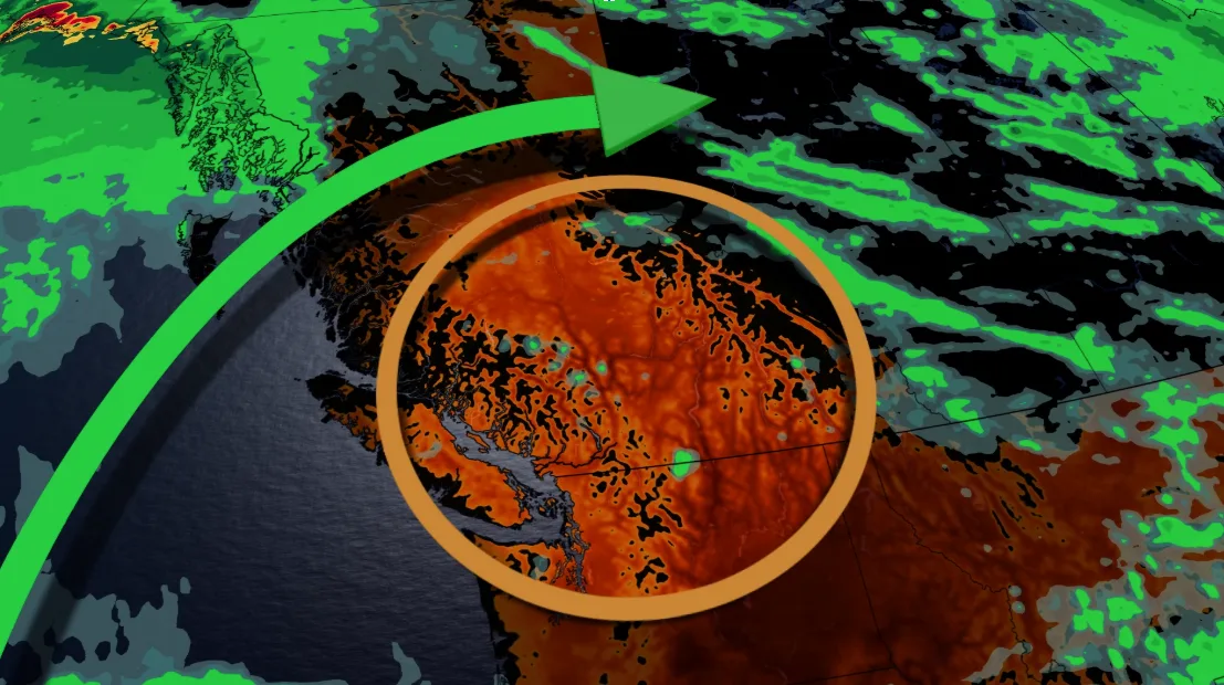
Shifting heat dome brings dry conditions and fire risks to B.C.

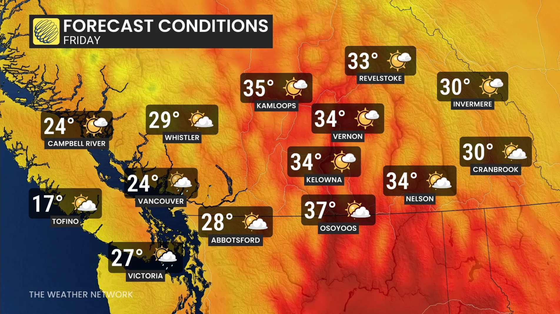
A shifting weather pattern will bring a heatwave to British Columbia this week, with interior temperatures reaching the 30s. The heat may worsen wildfire conditions and impact air quality in smoke-affected areas
A heat dome situated over the southern U.S. is shifting westward, prompting a surge in high pressure conditions across western Canada.
DON'T MISS: The Weather Network's hub for all wildfire information in Canada
This system will dominate British Columbia's weather through the week, maintaining dry, sunny conditions and a low risk of dry lightning—an important aspect amidst the province's ongoing wildfire crisis.
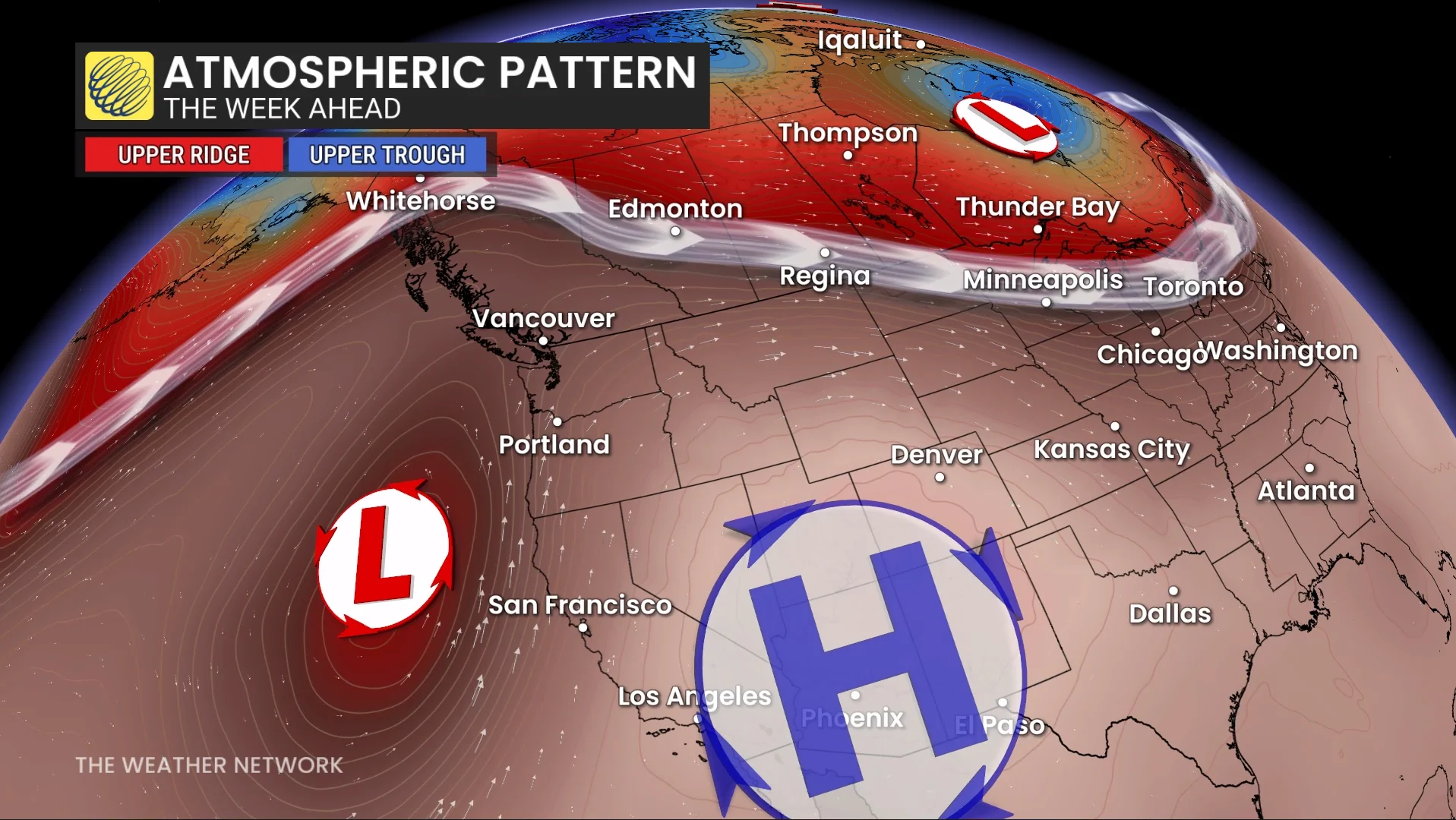
With a ridge of high pressure offshore, moist air is being directed northward, sparing B.C.'s coastline from excessive heat. Temperatures along the coastal regions will stay near seasonal norms due to the moderating effects of onshore flow.
However, interior regions and valleys are expected to see above-seasonal heat Thursday and Friday, coinciding with peak wildfire activity. These conditions could exacerbate wildfire challenges in already hard-hit areas.
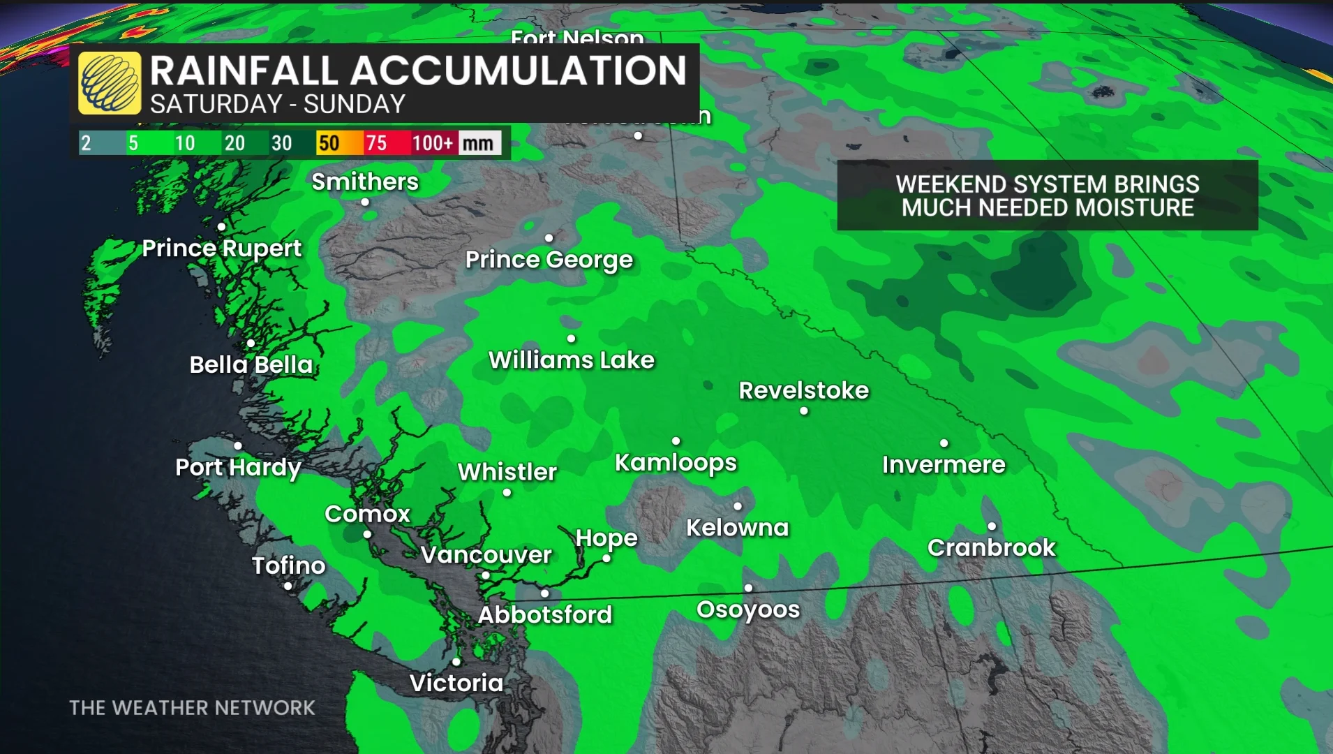
A change in weather is expected heading into the weekend, as a northern low pressure system brings cooler air, showers, and scattered thunderstorms.
While the precipitation may offer some relief to firefighters, it also carries the risk of lightning sparking new fires.
B.C. remains under a state of emergency. The Pearce Lake wildfire has burned over 159,300 hectares, part of a total 429,400 hectares scorched this season as of August 16.
Residents are advised to monitor updates and alerts.