Severe weather risk in southern Ontario, but wildfire smoke could be a factor

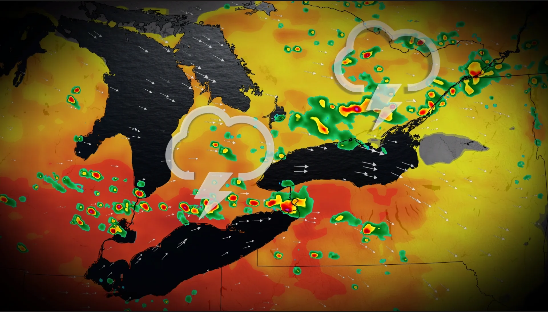
Parts of southern Ontario will see a setup for strong to severe thunderstorms on Wednesday, depending on the wildfire smoke. Threats include heavy downpours, localized flooding, large hail and strong wind gusts
A multi-day threat for thunderstorms will continue on Wednesday in southern Ontario.
The active, recent stretch of thunderstorm activity could continue on Wednesday, with a severe chance across a good swath of the lower Great Lakes region in southern Ontario. But wildfire smoke could be a factor in any storm development.
SEE ALSO: Look up! This week's Perseid meteor shower peak could be the best in years
Be sure to stay up-to-date on any changing conditions and weather alerts in your area.
Risk of severe storms on Wednesday in southern Ontario, but there's a catch
A potent setup is expected to come to fruition for southern Ontario on Wednesday.
A surface trough, combined with the lake breezes and daytime heating, will be the initial triggers of the storms.
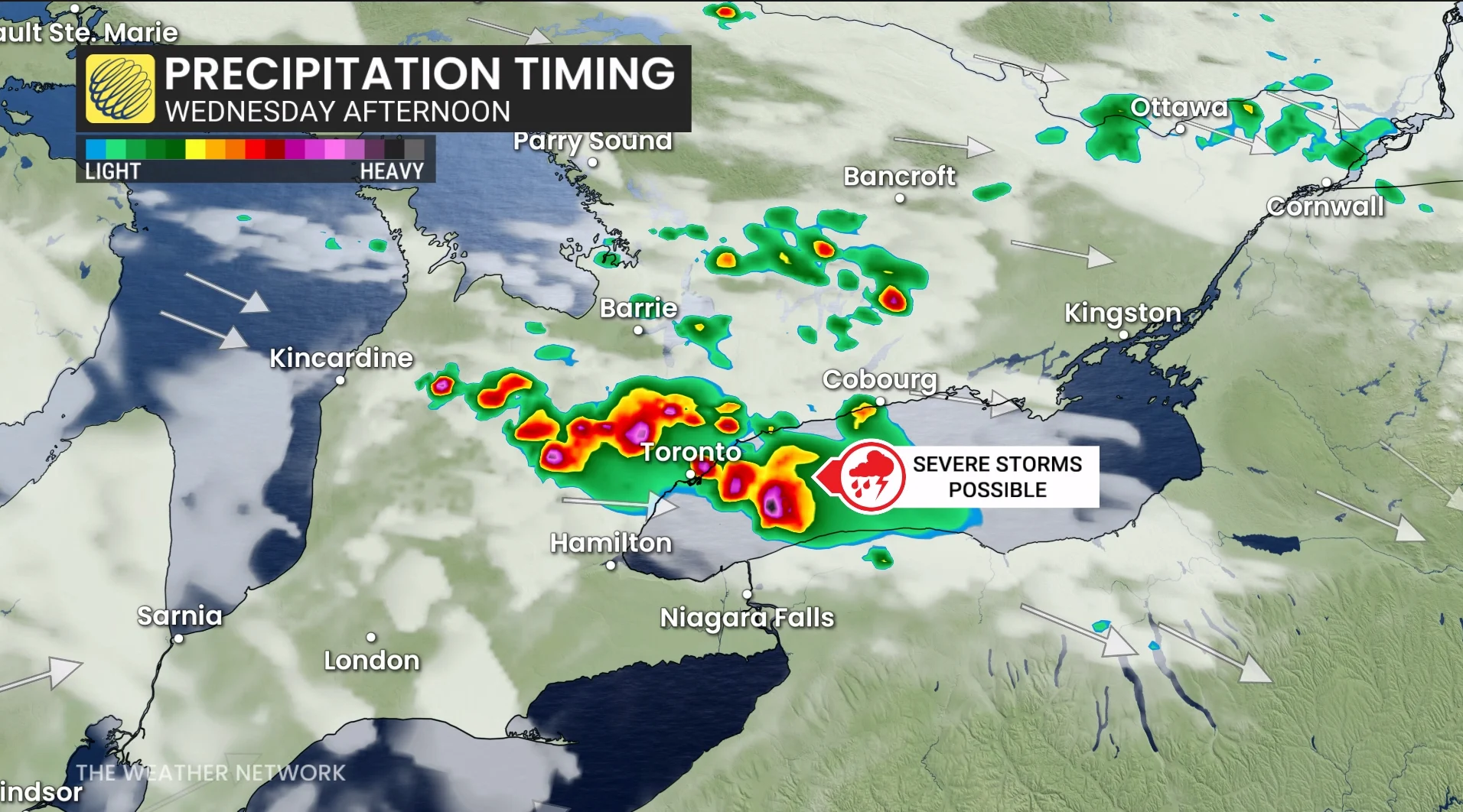
The storms will initiate along the lake breeze in the late morning, then continuing to push farther east as they track into the Greater Toronto Area (GTA).
Those particular cells will be capable of heavy downpours, localized flooding, and strong wind gusts.
The most impactful hazard will be the large hail, which could be as large as ping pong ball-sized--sufficient enough to inflict considerable damage in parts of the region.
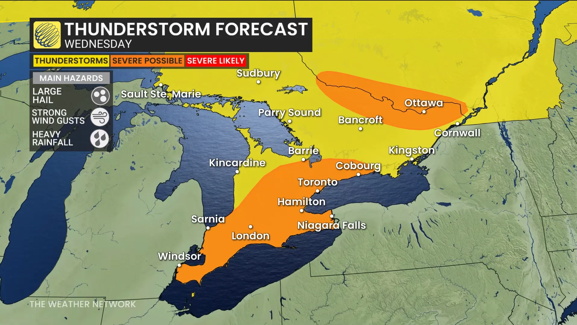
As well, rotating storms cannot be completely ruled out.
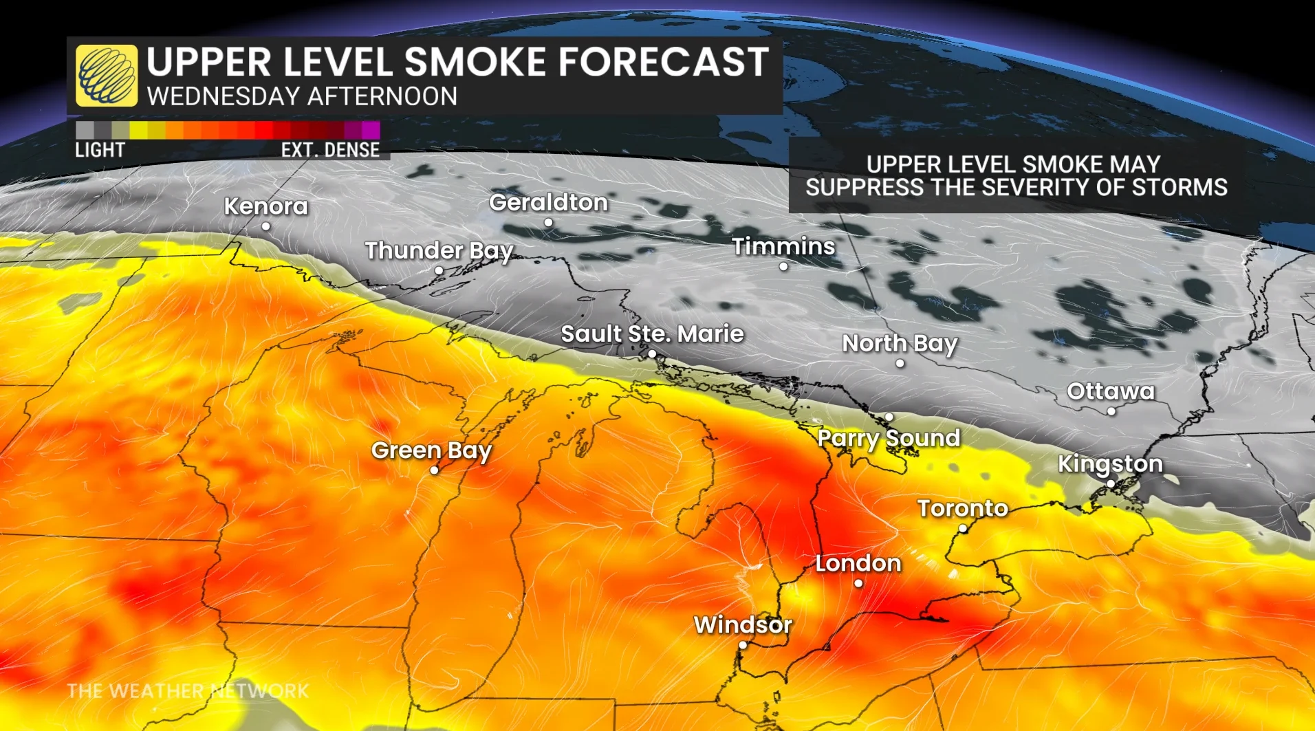
However, upper-level smoke from wildfires will further add to the uncertainty, as it could suppress thunderstorm development and severity.
The jet stream is transporting smoke directly from B.C. to Ontario.
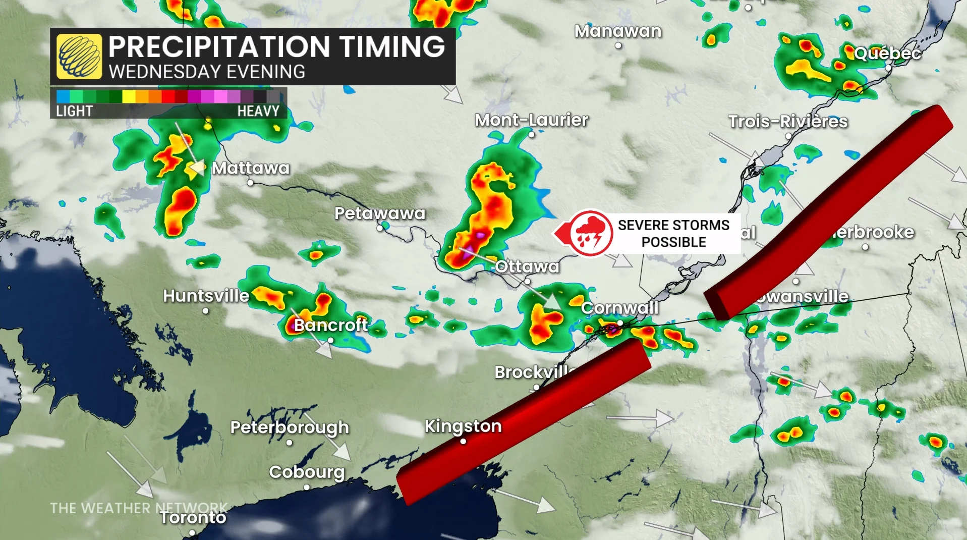
In eastern Ontario, there will be an additional risk of severe storms across the provincial border with Quebec.
These storms are expected in the early afternoon, then track along the provincial border.
With those cells, the main hazards include heavy rainfall, large hail and strong winds.
By Friday, a provincewide cooldown is expected to bring temperatures down to slightly below seasonal values.
Stay with The Weather Network for more information and updates on your forecast across Ontario.