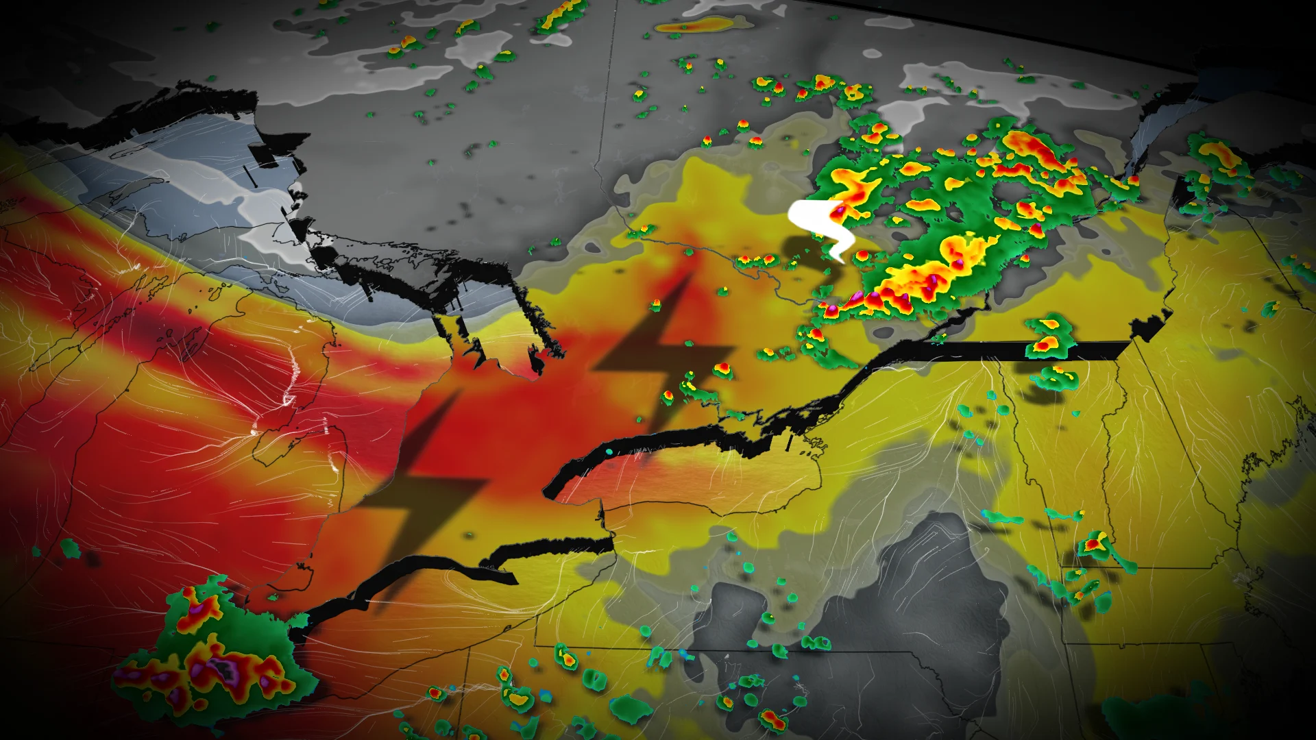
Ontario faces renewed storm risk after Saturday's tornado activity

Following this weekend's stormy conditions in southern and eastern Ontario, which included reports of at least two tornadoes, another threat is developing across much of the province for Monday
A stormy Saturday ended with at least two reports of tornadoes touching down in southern Ontario, near Woodstock and Lindsay.
As we move through Monday, forecasters are watching the risk for stormy weather to fire back up across southern and eastern regions of the province.
SEE ALSO: B.C. declares provincewide state of emergency amidst wildfires
A low pressure system moving into Ontario and southern Quebec is expected to trigger severe thunderstorms. An associated cold front will sweep across southern Ontario, sparking isolated storms ahead of it.
Rain and thunderstorms will not impact all areas, with higher chances focused on extreme southwestern Ontario, areas north and east of the Greater Toronto Area (GTA), and deep eastern Ontario.
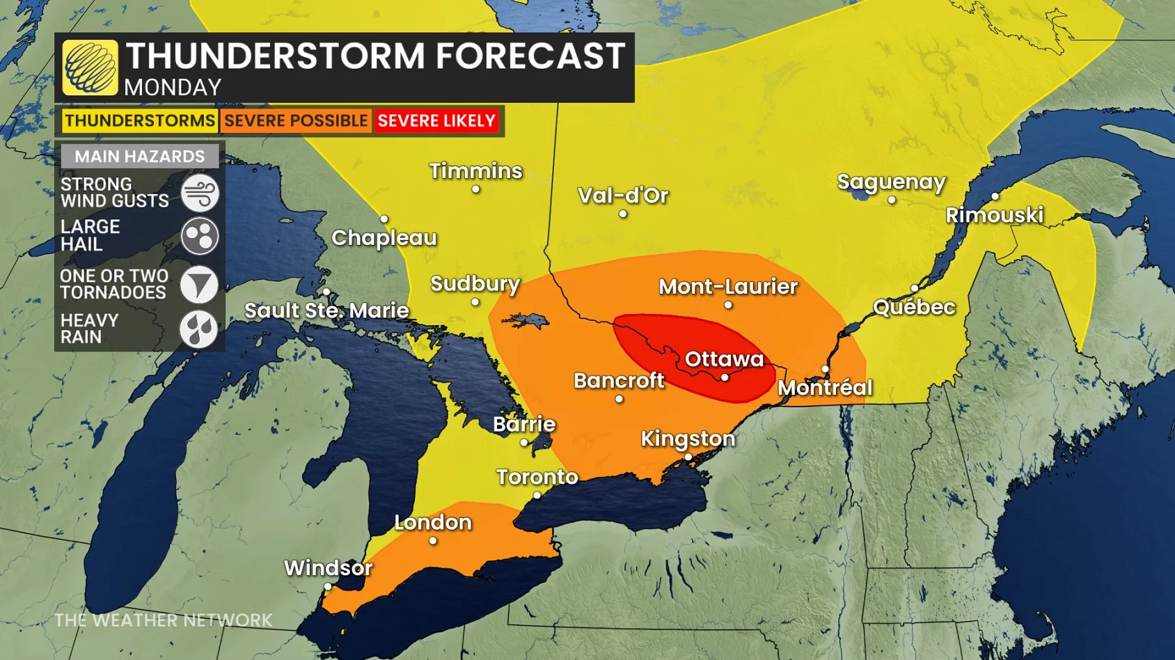
Some showers and storms could align with the morning and evening commutes, so be sure to keep an eye on the latest forecast updates, warnings, and radar.
Severe storm risk spreads across southern and eastern Ontario Monday
The storm risk across the GTA will be highest from late Monday afternoon into the evening.
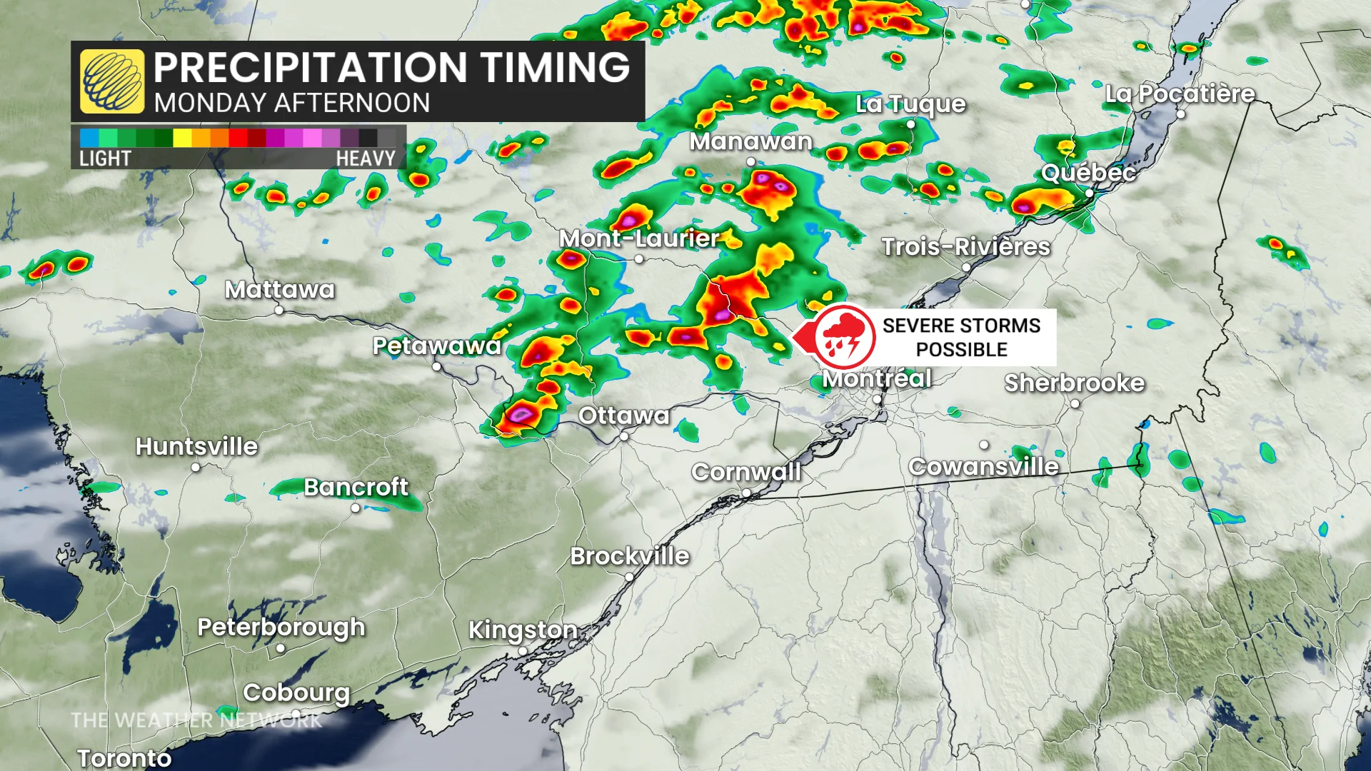
More organized storm activity is possible along a lake-breeze boundary stretching from Lake Simcoe to Pickering and Oshawa. These storms could reach severe levels, with the potential for large hail and strong wind gusts.
DON'T MISS: New TikTok trend comes with increased cancer risk, dermatologists warn
Thunderstorms are expected to develop off Lake Huron through the early evening hours. While computer models suggest the most severe storms are likely to remain south of the border, there remains a marginal risk for locally severe storms in the area. Residents should be prepared for the possibility of isolated strong winds and heavy downpours.
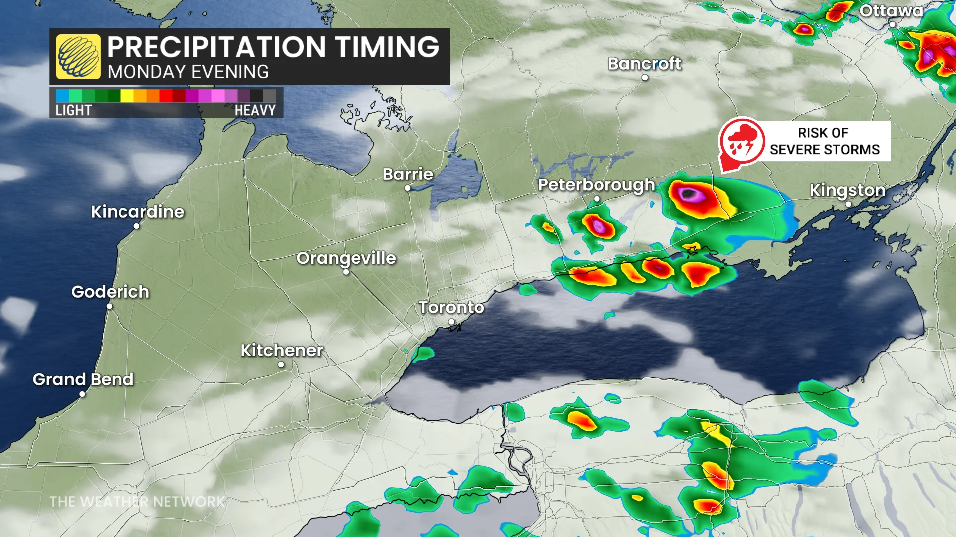
Threat for rotating storms in eastern Ontario
Meanwhile, in eastern Ontario, thunderstorms are expected to develop early to mid-afternoon, with more organized activity persisting near the Ontario-Quebec border into early Monday evening.
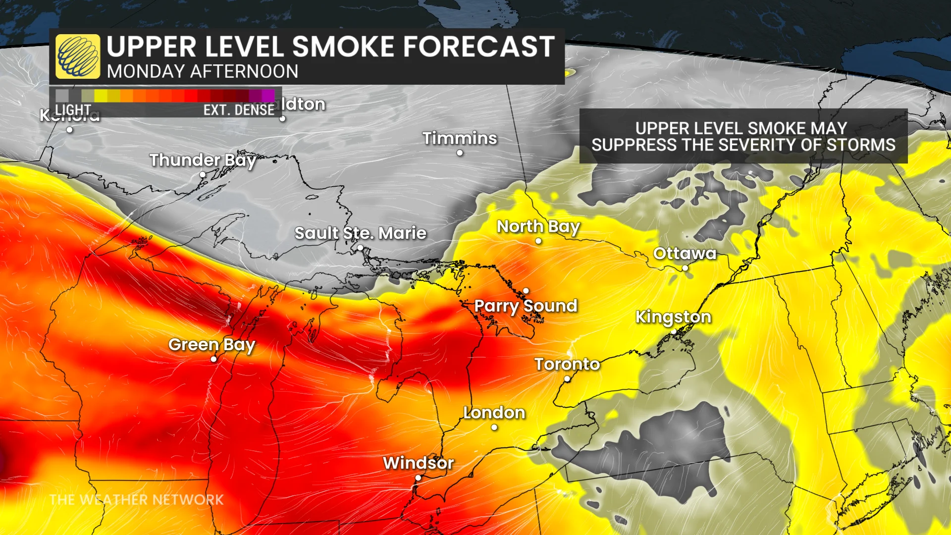
These storms carry an elevated risk of producing strong winds and hail, with some hailstones potentially reaching the size of ping-pong balls. While rotating storms are also possible along the provincial border, the presence of smoke may help reduce this risk.
Long range outlook for this week
Looking at the rest of the week ahead, Tuesday is forecast to stay fairly quiet before another storm risk begins to build on Wednesday across southwestern Ontario.
Temperatures will also begin to dip toward more seasonal levels, and we may finally see a break in the humidity.
Some folks across southern Ontario may also find it a bit hazy outside during the week, thanks to wildfire smoke. Luckily, the bulk of the smoke is forecast to stay aloft in the atmosphere, which means the air quality at the surface level shouldn't be too degraded.
Stay with The Weather Network for the latest updates on your weather across Ontario.