Severe storms possible Saturday as instability builds over B.C.

A pattern change will trigger a risk for widespread thunderstorms across British Columbia to kick off the weekend
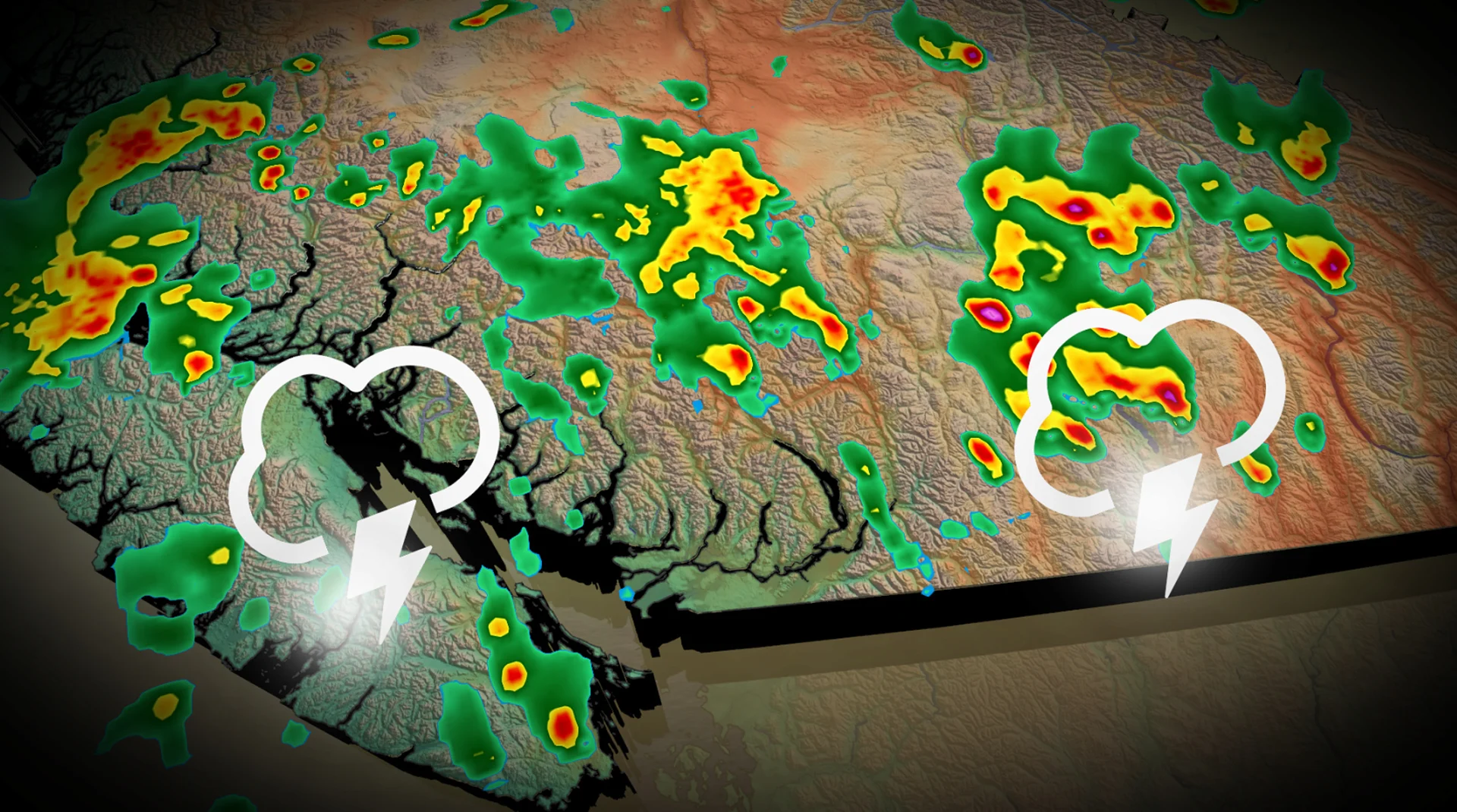
Prepare for an active Saturday across much of southern British Columbia as a pattern change brings the region a chance for widespread thunderstorms.
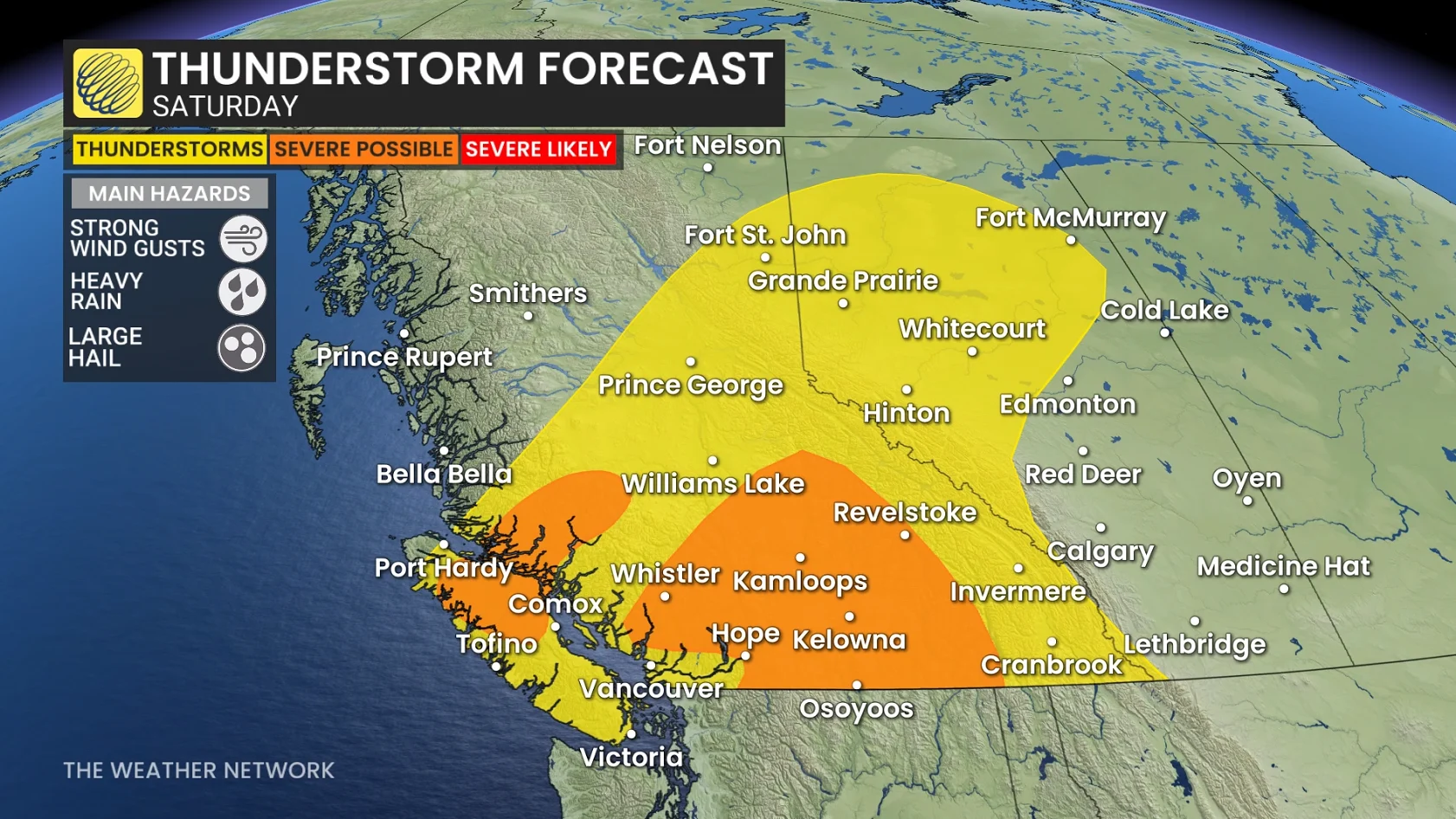
Some of the thunderstorms could turn severe with a risk for strong winds and large hail. Saturday’s potential may be the first rain we’ve seen all August for many communities in the area.
DON’T MISS: Latest El Niño forecast calls for historic heat by this autumn
Saturday severe storm potential in British Columbia
The ridge responsible for the recent heat will shift to the Prairies this weekend, taking the bulk of the elevated temperatures with it. We’ll see conditions cool off by more than 10 degrees from Friday to Saturday, with a 5-7 degree drop for the Lower Mainland.
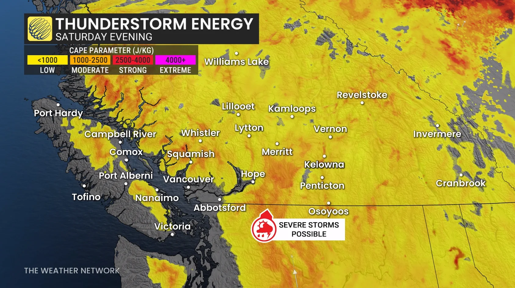
Rising instability will follow a low-pressure system expected to form along the coast and track northward over B.C. We’ll see pockets of downpours and thunderstorms as this system swings through the region.
Most guidance highlights the risk for thunderstorms through the day on Saturday across much of the South Coast, including Vancouver Island and the Sea to Sky Corridor.
SEE ALSO: Two rare tornadoes struck New York City on Thursday
We’ll see the thunderstorm risk peak later in the evening across the southern Interior, where strong winds and large hail will pose the main hazards.
The upcoming storms won’t produce blockbuster rainfall totals by any means, with 5-10 mm expected for many areas. Amounts will be highly variable beneath storms in the Interior.
Saturday’s rain will be the first precipitation we’ve seen all August for many communities.
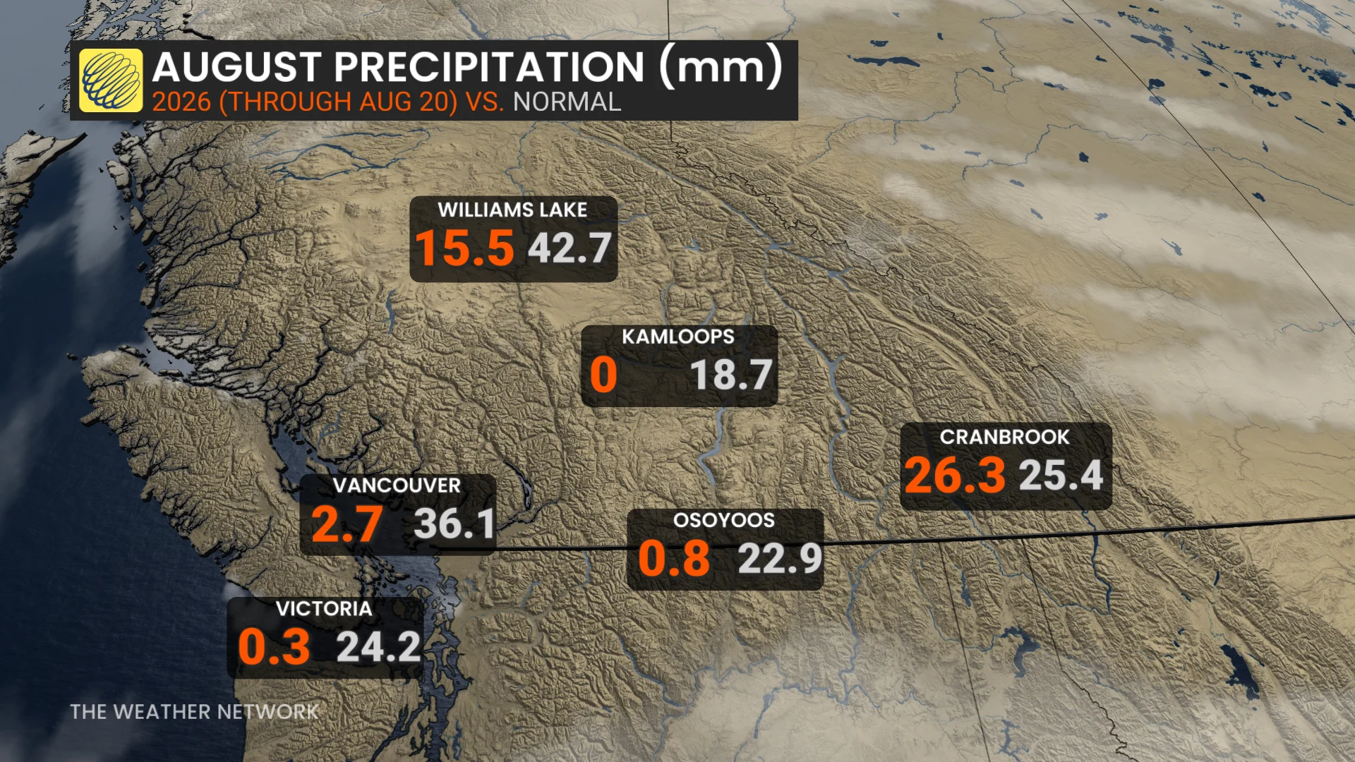
Vancouver International Airport has observed just 55 mm of rain so far this summer, making it the eighth driest meteorological summer on record. Victoria has only picked up 0.3 mm of rain since the beginning of August. Kamloops hasn’t seen measurable rainfall since July 2.