Severe storms and isolated tornado risk for parts of Ontario, Quebec

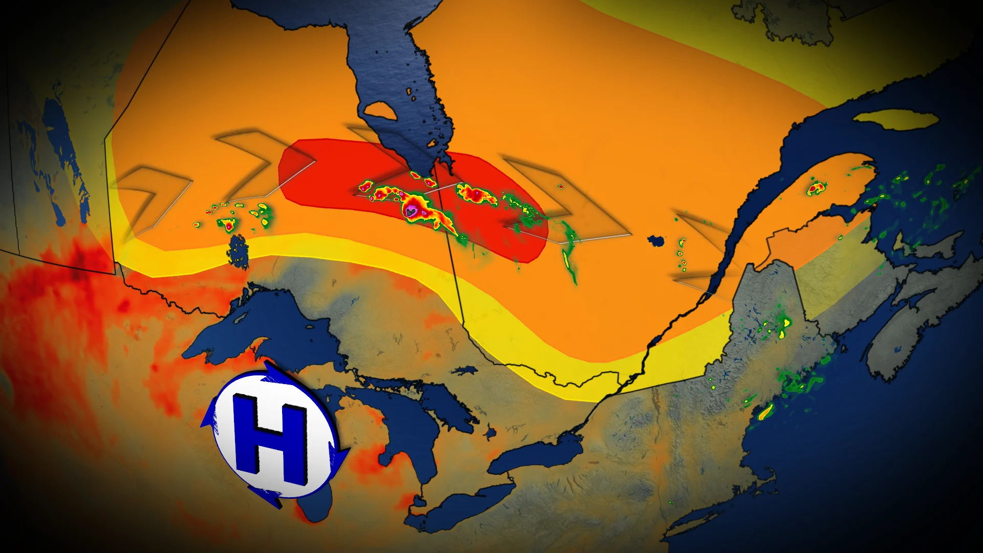
A multi-day severe weather event is unfolding across Ontario and Quebec. A heat dome to the south is driving a "ring of fire" pattern, increasing the risk of torrential rain, damaging winds, large hail, and the potential for tornadoes in affected regions
A persistent heat dome affecting Ontario is causing temperatures to soar into the 30s, with humidex values reaching the 40s across northern regions on Monday and Tuesday. This extreme heat is worsening fire weather conditions in northwestern Ontario, where wildfires continue to burn.
Severe thunderstorms, fuelled by this heat dome’s outer edge—a phenomenon often referred to as the "ring of fire"—are set to develop Monday through Tuesday.
DON'T MISS: How a U.S. heat dome could bring severe summer storms to Canada
Residents across both Ontario and Quebec should monitor alerts, and be prepared for potential severe weather impacts including damaging winds, torrential downpours, and an isolated tornado.
Monday: Ring of fire thunderstorms threaten damaging winds and an isolated tornado
Central Quebec faces the risk for multiple waves of severe storms continuing through Tuesday. The first wave stems from lingering overnight convection, expected to move into the St. Lawrence region late Monday morning into the early afternoon. These storms could bring significant rainfall and strong winds as they remain elevated.
Scattered thunderstorms may also develop near Ottawa and areas north of Saguenay on Monday afternoon.
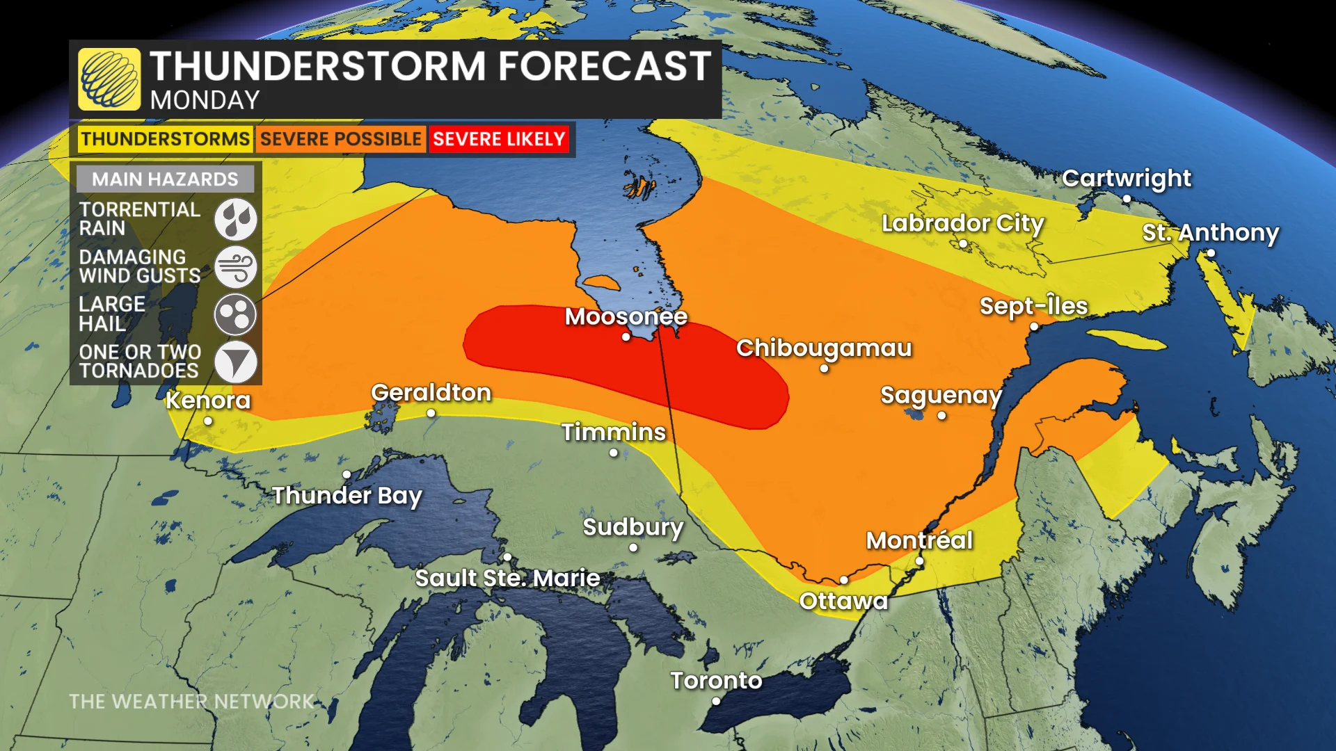
Later in the day, northwestern and northern Ontario, particularly near Moosonee and surrounding areas, could see new severe storm activity by late afternoon and evening.
These storms present the risk of damaging wind gusts, torrential rainfall, and the potential for an isolated tornado.
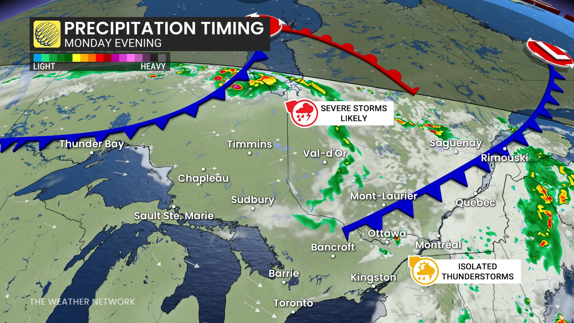
Severe weather is expected to persist as these storms track into central Quebec overnight Monday, with impacts likely extending well past sunset.
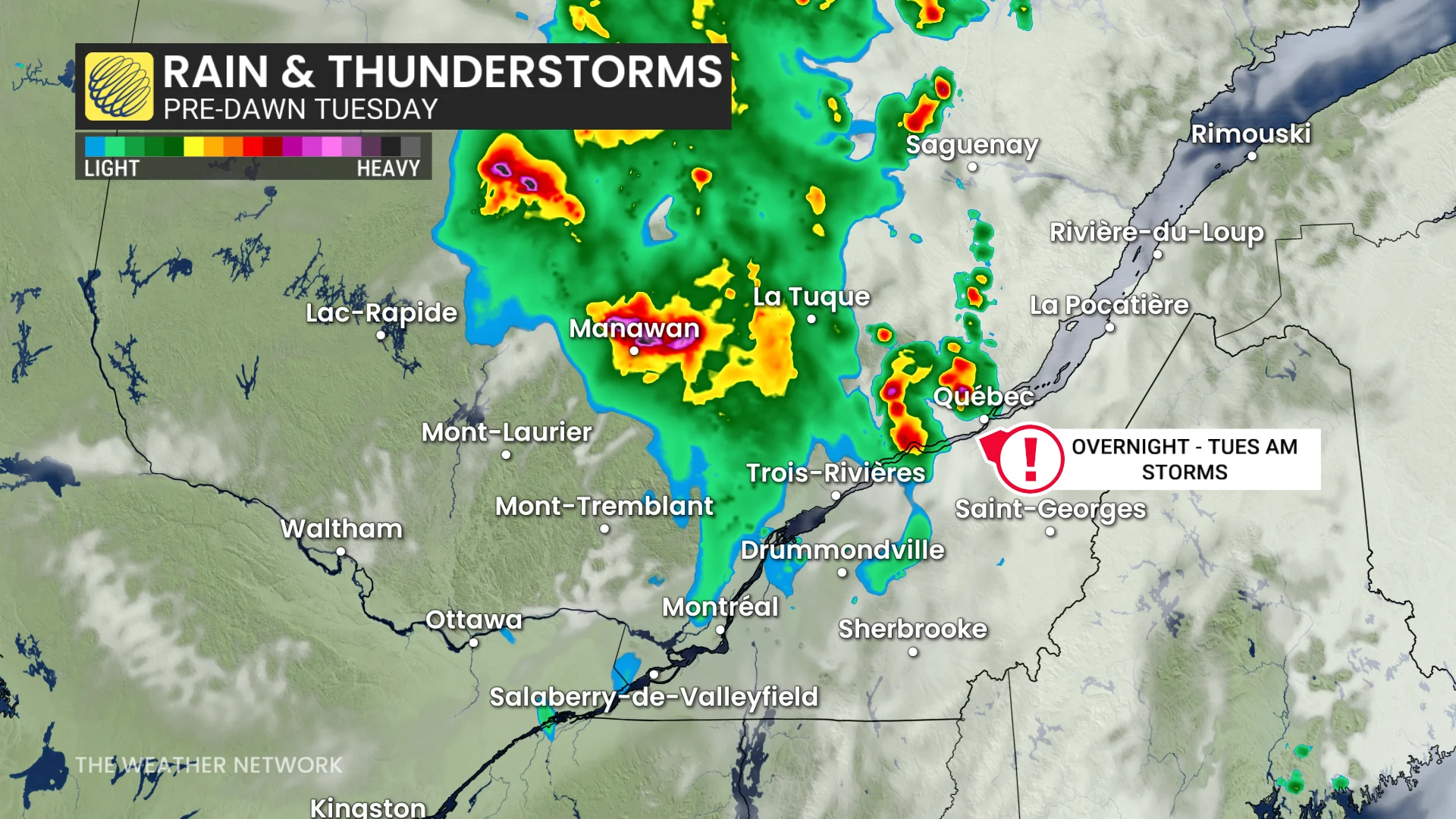
By Tuesday morning, the St. Lawrence corridor—including areas from La Tuque to Quebec City and Trois-Rivières—could face storm activity. However, some uncertainty remains around the exact storm pathway.
Tuesday: Severe thunderstorm risk for eastern Ontario, St. Lawrence, and southern Quebec
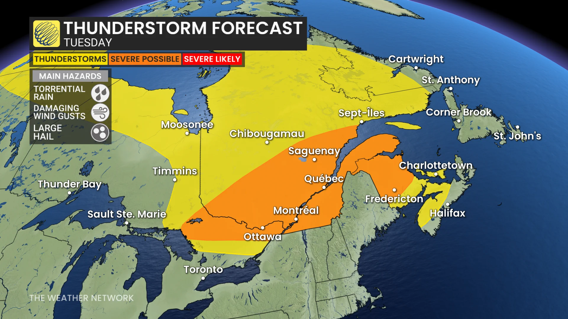
Active weather is anticipated to continue into Tuesday afternoon, with eastern Ontario, the St. Lawrence region, and southern Quebec—including Ottawa and Montreal—at risk for severe thunderstorms.
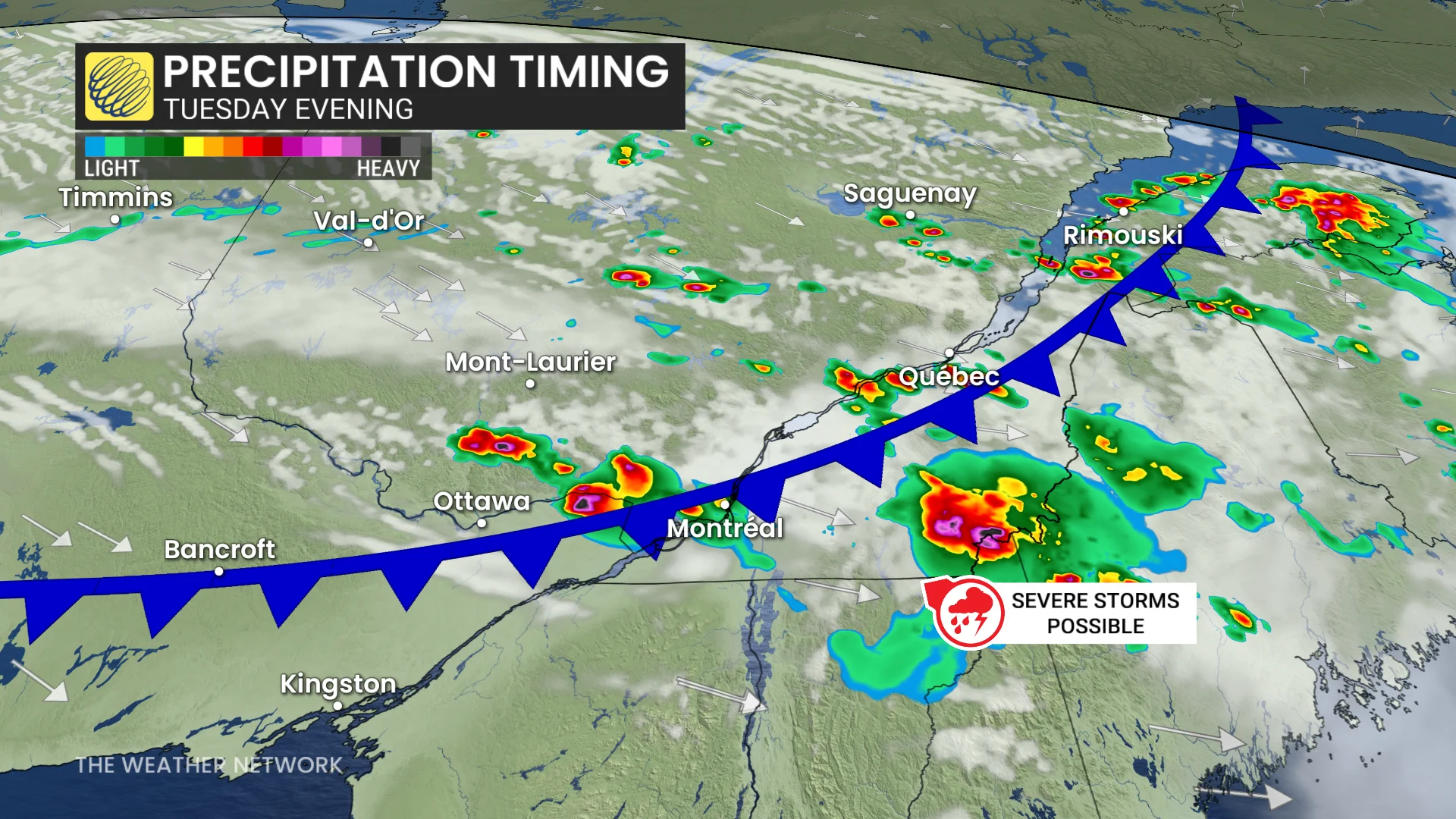
A frontal boundary is expected to trigger widespread storm development north of the St. Lawrence and the National Capital Region. These storms are forecast to spread into the Eastern Townships and parts of eastern Ontario by the evening.
Key risks include large hail, heavy downpours, and damaging wind gusts.
DON’T MISS: Tornado season is underway in Canada. Here’s what you need to know
The exact location of the most severe storm activity remains uncertain due to possible early morning convection and the evolving position of the frontal boundary.
Stay updated with the latest weather alerts and forecasts as conditions evolve throughout the next couple of days.