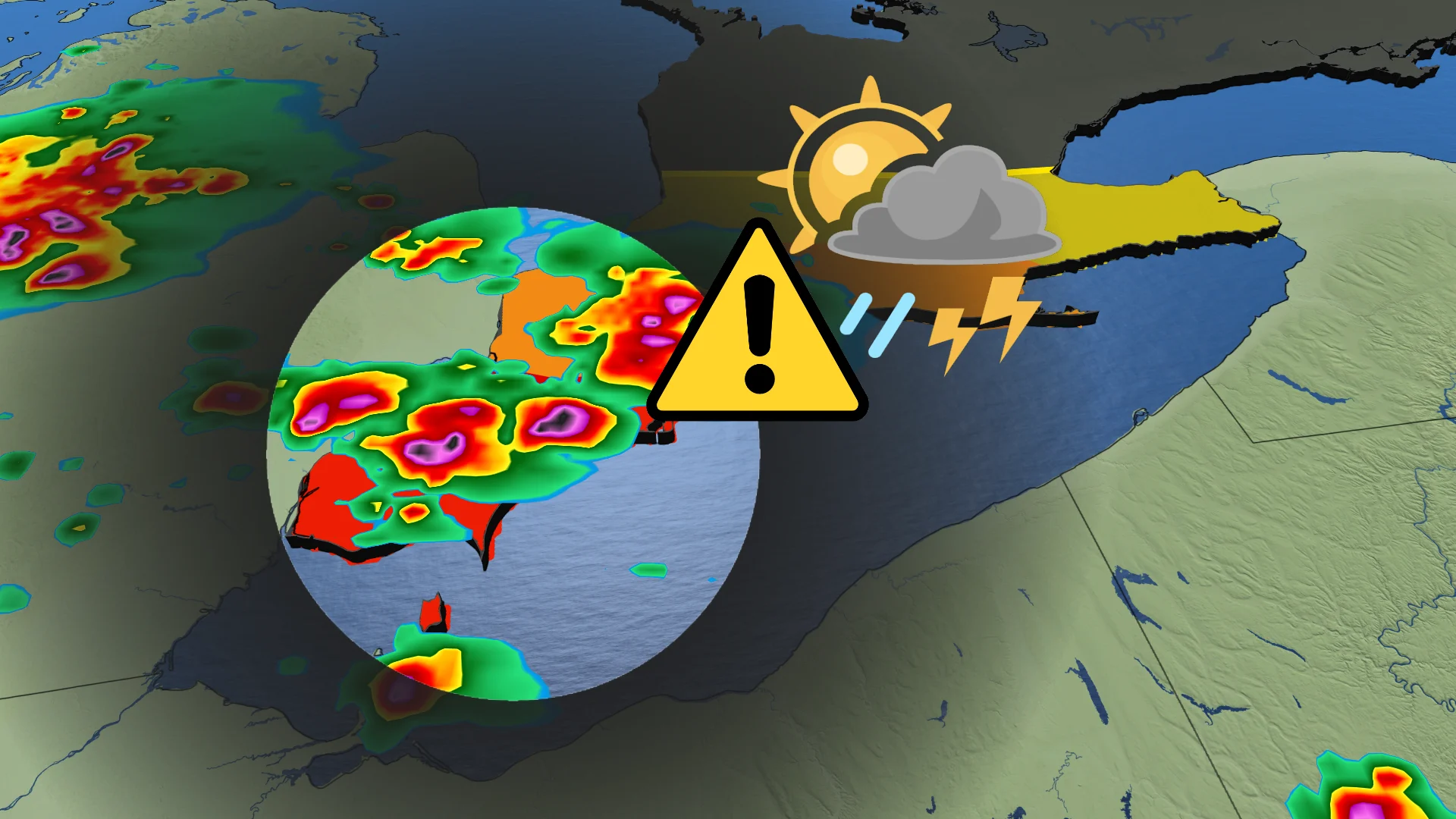
Severe storms, heavy rain hit southwestern Ontario Thursday

Renewed severe thunderstorm risk for southwestern Ontario on Thursday
After a stormy Wednesday in southern Ontario, highlighted by tornado alerts, large hail, flooding, and power outages, another round of severe thunderstorms is expected Thursday in parts of the region.
The primary focus will be on southwestern Ontario, with storm activity likely from late afternoon into the evening.
DON'T MISS: Vaughan: Road collapses into river after Wednesday's dangerous storms
Be sure to stay alert to the changing conditions, and check for any weather warnings in your area.
Severe storm risk spans the southwest Thursday afternoon and evening
A muggy and unstable air mass remains over southern Ontario, with daytime highs in the high 20s to low 30s. Humidex values will push temperatures into the mid-30s to mid-40s across southwestern areas.
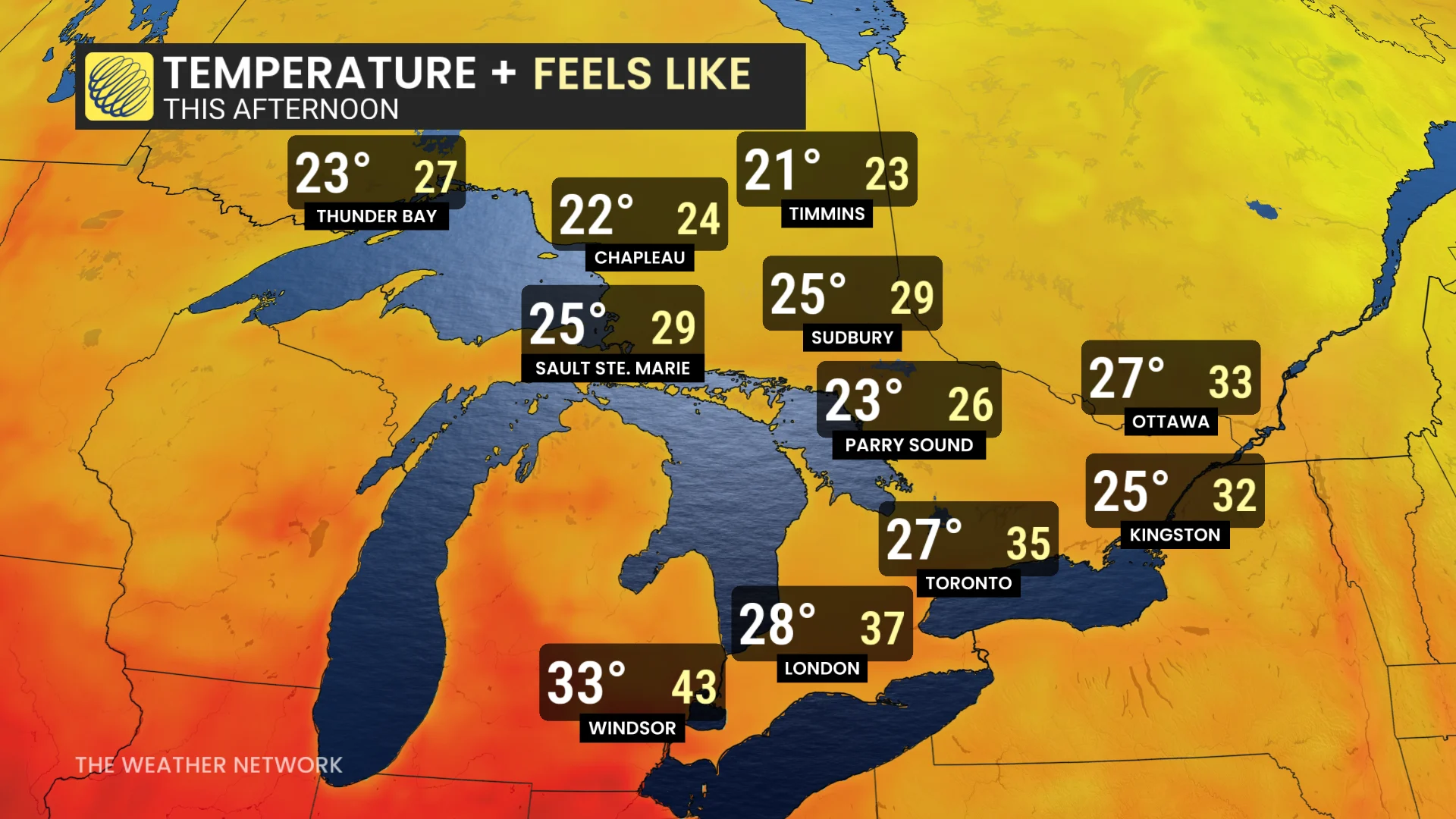
The presence of a stationary boundary over the southwest heightens the potential for severe storms.
Spotty thunderstorms could develop earlier in the day, but the most significant activity is expected during the evening, bringing strong winds, torrential rain, and small hail.
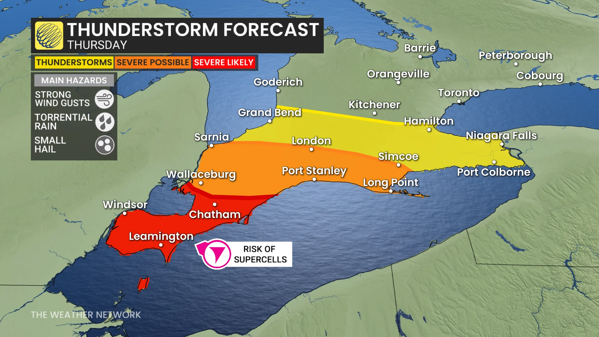
The highest risk of severe storms is from Windsor to London, including Sarnia and Long Point.
Storms may also extend toward the Niagara Peninsula and the west end of the Greater Toronto Area (GTA), though activity in these regions is less likely to reach severe levels.
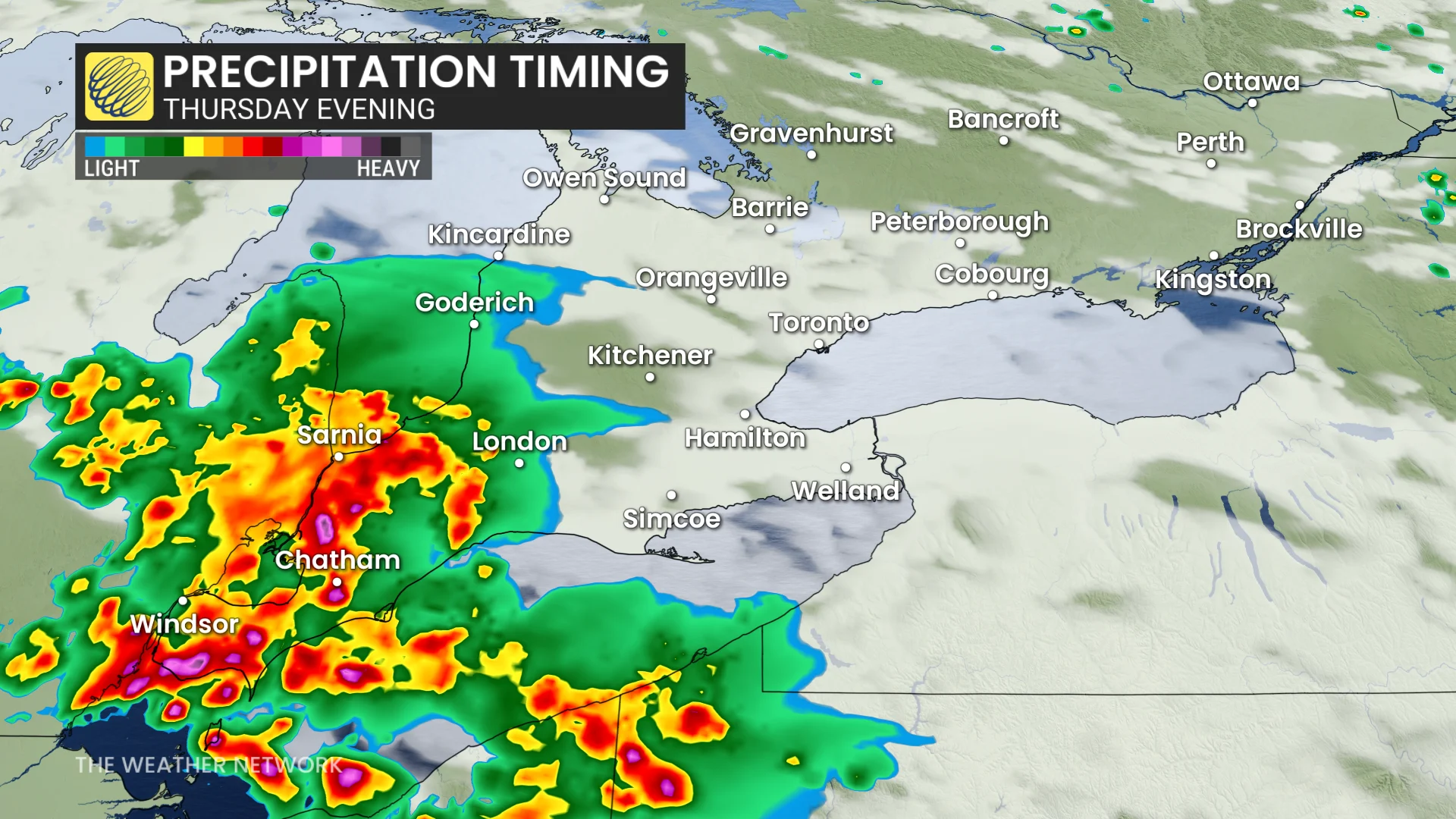
Residents in the affected areas should monitor weather alerts and be prepared for potential disruptions.