Ontario faces severe storms with damaging winds, heavy rain, and tornado risk

Severe storms continue to push through parts of southern Ontario on Wednesday evening. Stay alert and have plans in place
Severe weather conditions shaped up across southern Ontario Wednesday, driven by an unstable, humid atmosphere, and a sharp cold front from Michigan acting as the primary trigger.
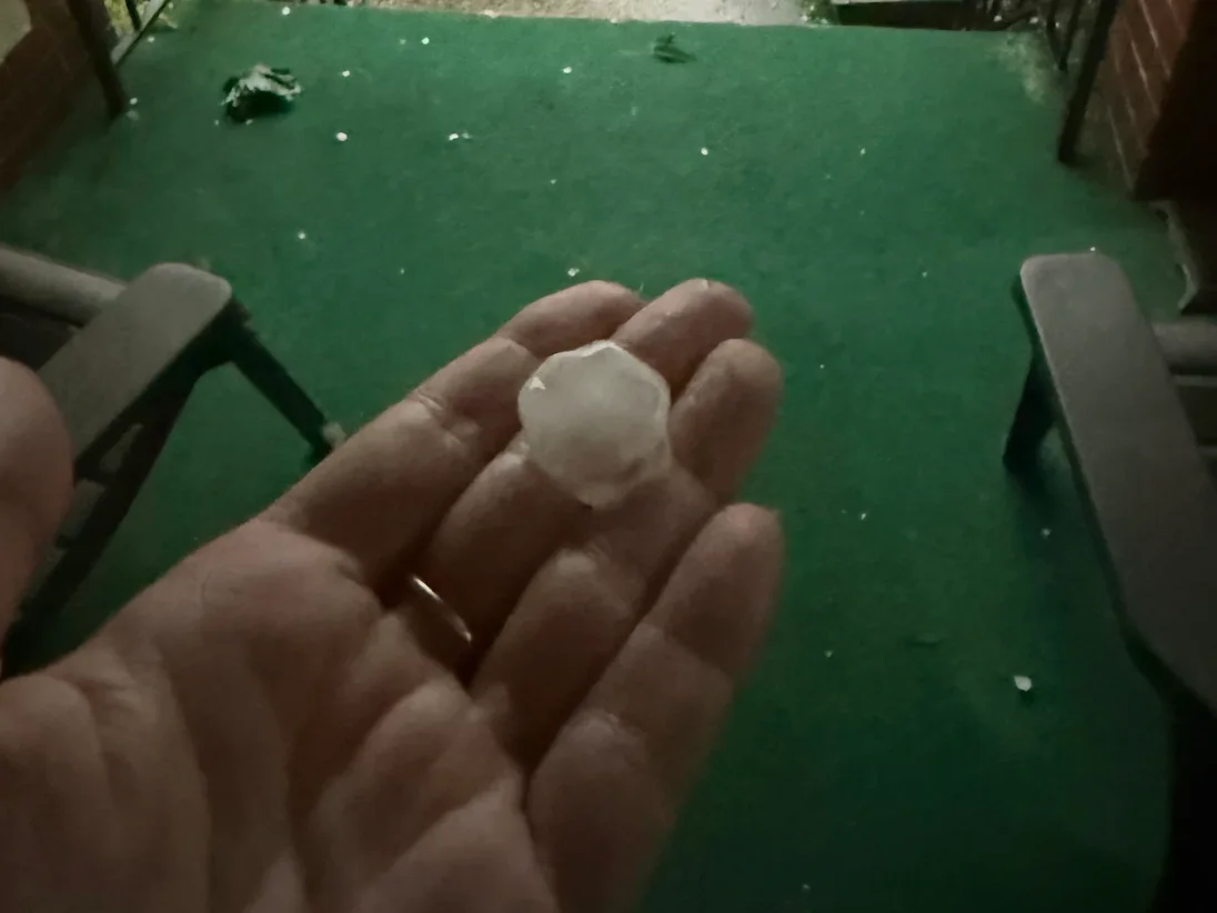
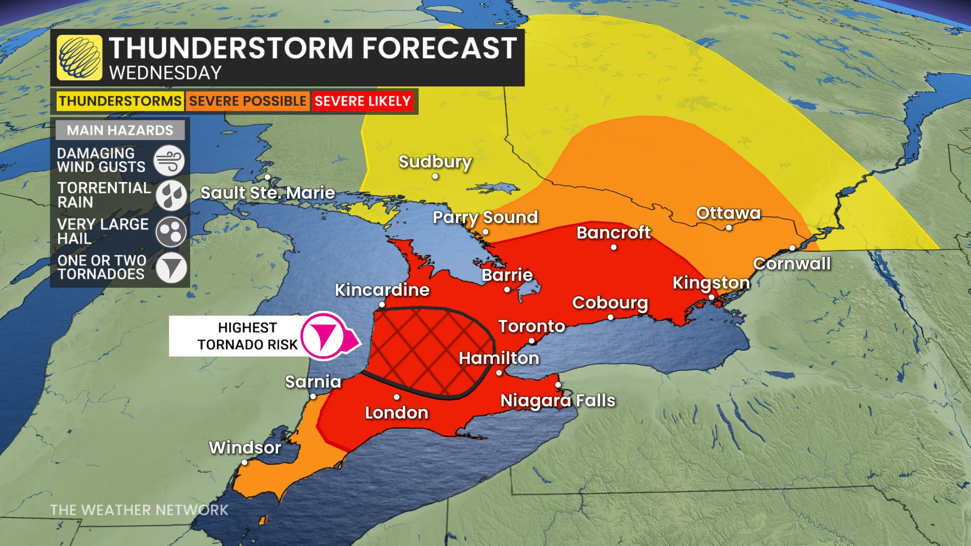
All severe hazards are possible this afternoon and evening, including torrential rain, damaging winds, and very large hail (larger than golf ball-size). There is also a potential for one or two tornadoes.
DON'T MISS: Summer lingers as warmth wins out across Canada in September
Be sure to stay alert to the changing conditions, and check for any weather warnings in your area.
Round 2: Severe and dangerous storm setup
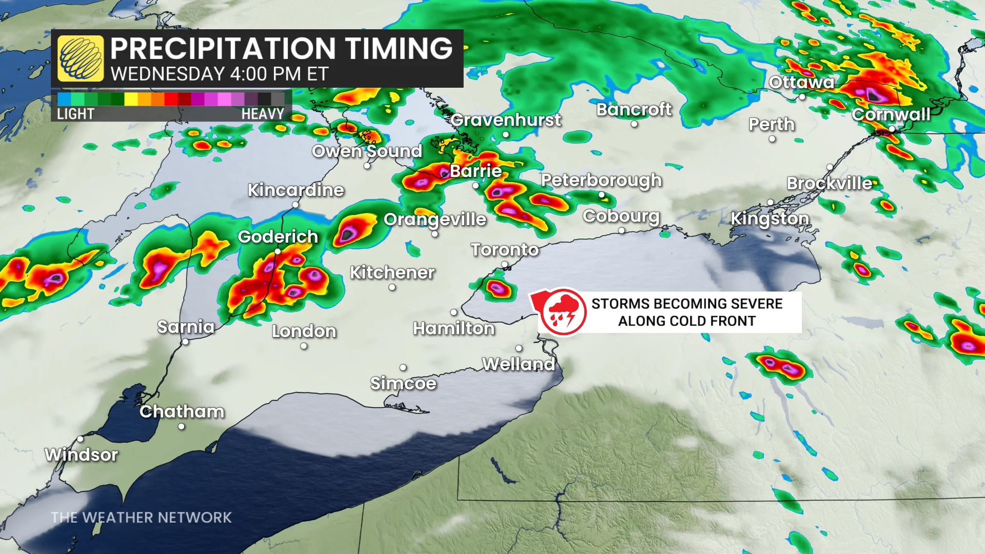
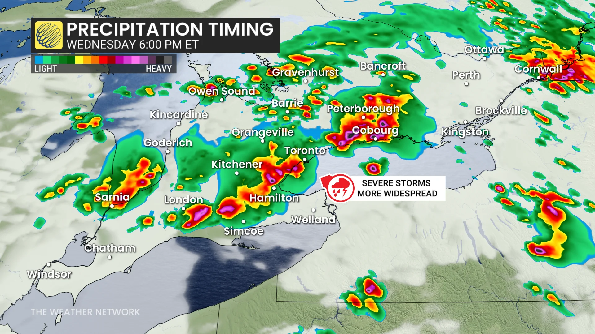
Severe storms intensified ahead of the cold front, sweeping from Barrie through the GTA and into eastern Ontario through 8 p.m.
STORM TRACKING: Scenes from Ontario's thunderstroms as they unfold
Risks include torrential rain, damaging winds, large hail (greater than golf ball-size), and isolated tornadoes. Areas west of Toronto to Lake Huron and east to Bancroft-Kingston show an elevated tornado risk.
Trailing storms are possible near London around the dinner hour.
Potential impacts:
Power outages and tree damage due to strong winds.
Localized flooding from heavy rain.
Potential property damage from hail and storms.
Stay updated with watches and warnings as timing remains uncertain.
WATCH: Severe thunderstorms with a non-zero tornado risk for Wednesday
Tornado warning safety: Here’s what you should do
A tornado warning is issued when a tornado has been spotted on the ground or rotation has been detected in your area by weather radar. Take shelter immediately if a tornado warning is issued for your area.
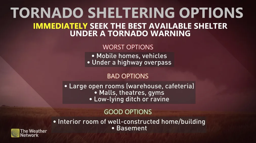
Your best option during a tornado warning is to take shelter in a basement or a storm cellar.
If you don’t have a basement, go to a small, windowless, interior room on the lowest floor of the building—such as a bathroom, a hallway, or a closet.
If you’re in a high-rise building, move to a hallway or interior room on the lowest floor possible.
MUST SEE: Stuck in your car during a tornado? Here’s what you should do
The goal of tornado safety is to put as many walls and barriers between you and flying debris as possible. Stay away from windows, doors, and exterior walls.
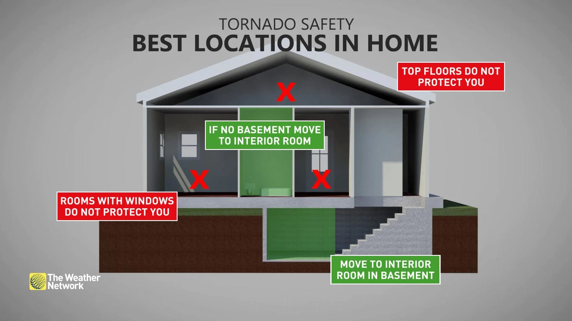
You can climb into a bathtub and crouch down low, or get under something sturdy like a heavy table or a workbench. Cover your head and neck with your arms. If you have a heavy blanket, mattress, or helmet, use it for extra protection.
If you’re in a mobile home, leave it immediately and go to the nearest sturdy building or storm shelter. If that’s not possible, lie flat in a low-lying area like a ditch, cover your head, and stay alert.
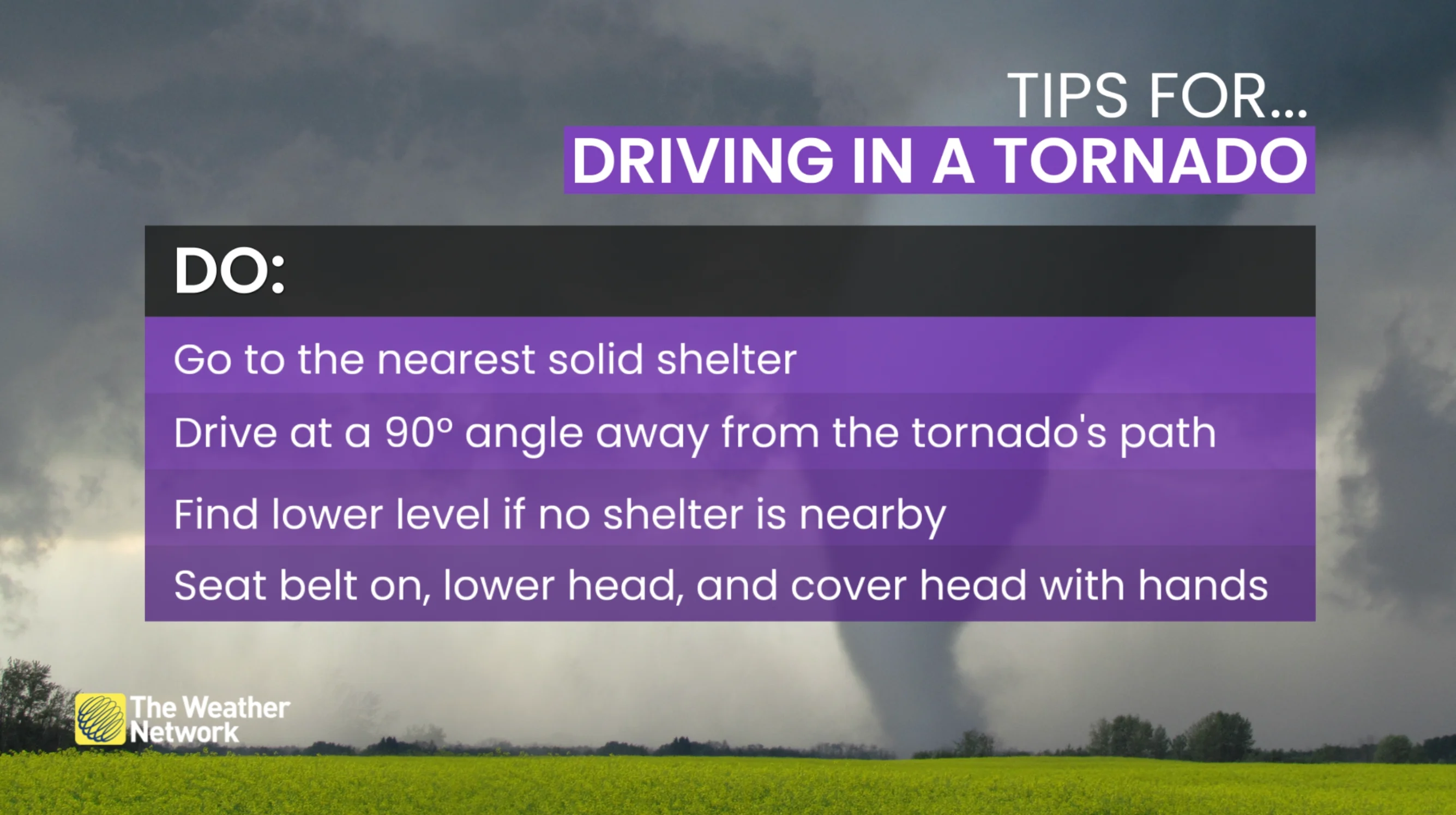
What to do when a tornado warning is issued while you're driving. (The Weather Network)
If you see a tornado while driving, do not try to outrun it. Get out of the vehicle and seek shelter in a nearby building, a ditch, or a low-lying area.
Remember: never hide under an overpass. These structures offer no protection from tornadic winds or flying debris, and they can actually make the winds worse.