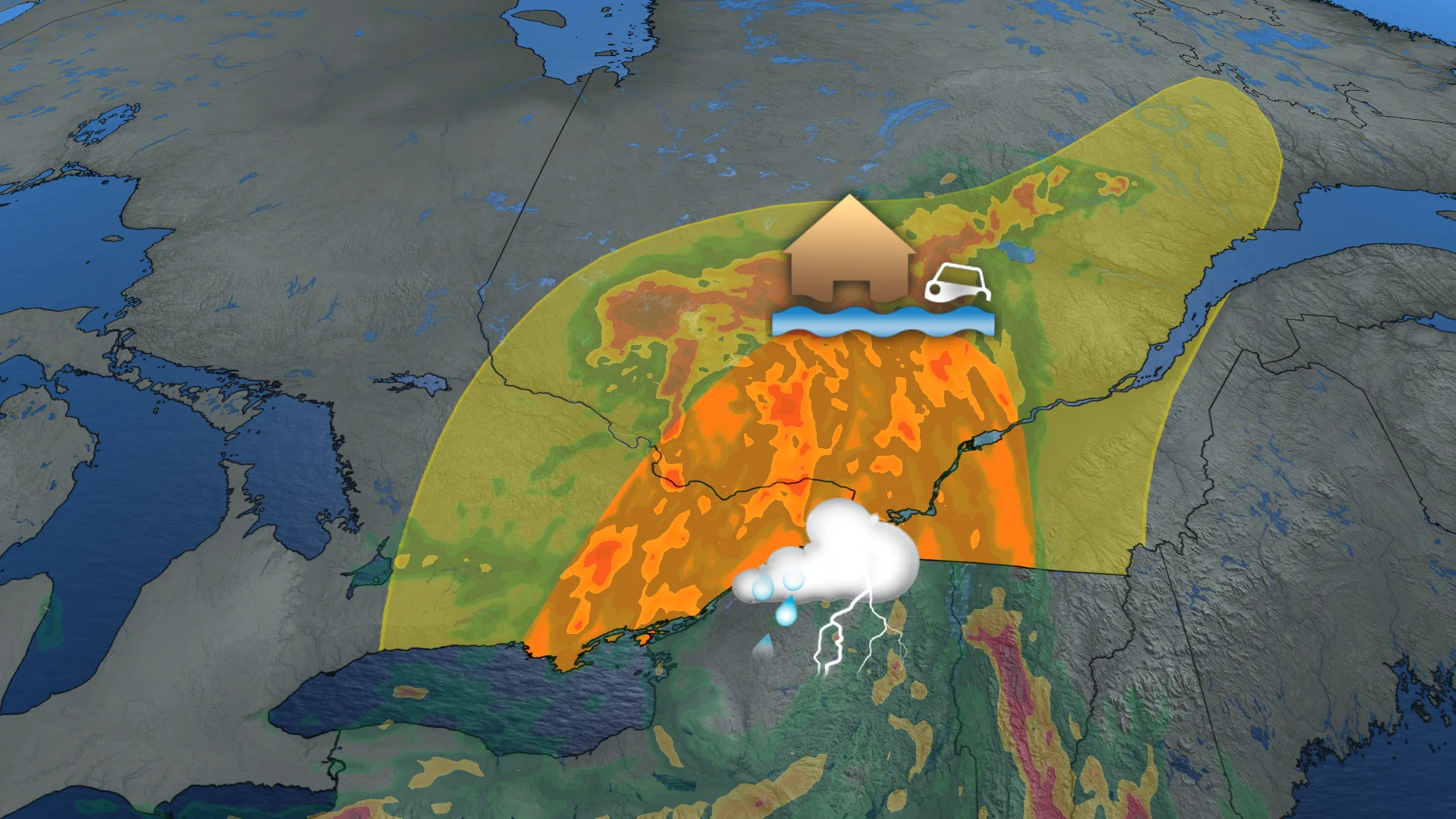
Severe storm, flood threat shifts into eastern Ontario, Montreal Tuesday

Ontario's storm risk shifts east into the Ottawa-Kingston region in Ontario on Tuesday, as well as the Montreal region in Quebec.
As the southern Ontario attempts to dry off, the storm risk will shift into eastern Ontario on Tuesday.
A stalled upper-level trough will bring a potential for severe, flooding storms to the Ottawa-Kingston region on Tuesday, as well as to Montreal. Some locales could see 50-80+ mm of rainfall from the slow-moving storms.
DON'T MISS: How the weather could be influencing your music taste
The most serious danger will be if storms frequently pass over the same locations, causing rainfall totals to rapidly rise. Localized flooding, low visibility and dangerous driving conditions are all conceivable.
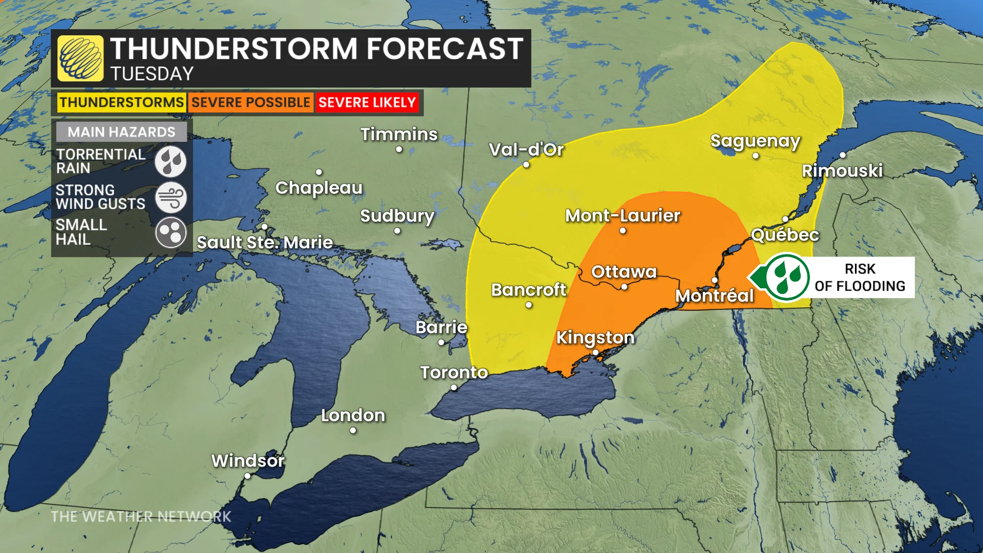
Flooding risk elevated with more thunderstorms on Tuesday
Showers begin Tuesday morning, with the severe thunderstorm potential increasing through the day as temperatures increase.
SEE ALSO: 5 astronomical events happening after we're gone
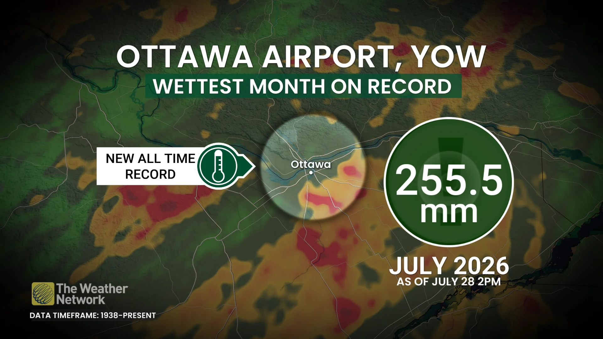
With the rainfall that has fallen in Ottawa so far this month, its airport has officially documented its wettest month ever since records began in 1938. With a forecast through July 27, the airport will be up to 255.5 mm of rain.
Its previous record for its wettest month was July 2017, with 249.8 mm of rainfall observed.
The severe risk will remain east of the low as it moves northward, putting the Laurentians and Ottawa Valley at the greatest risk of localized flooding as that is where we will likely see training thunderstorms drop the most rain.
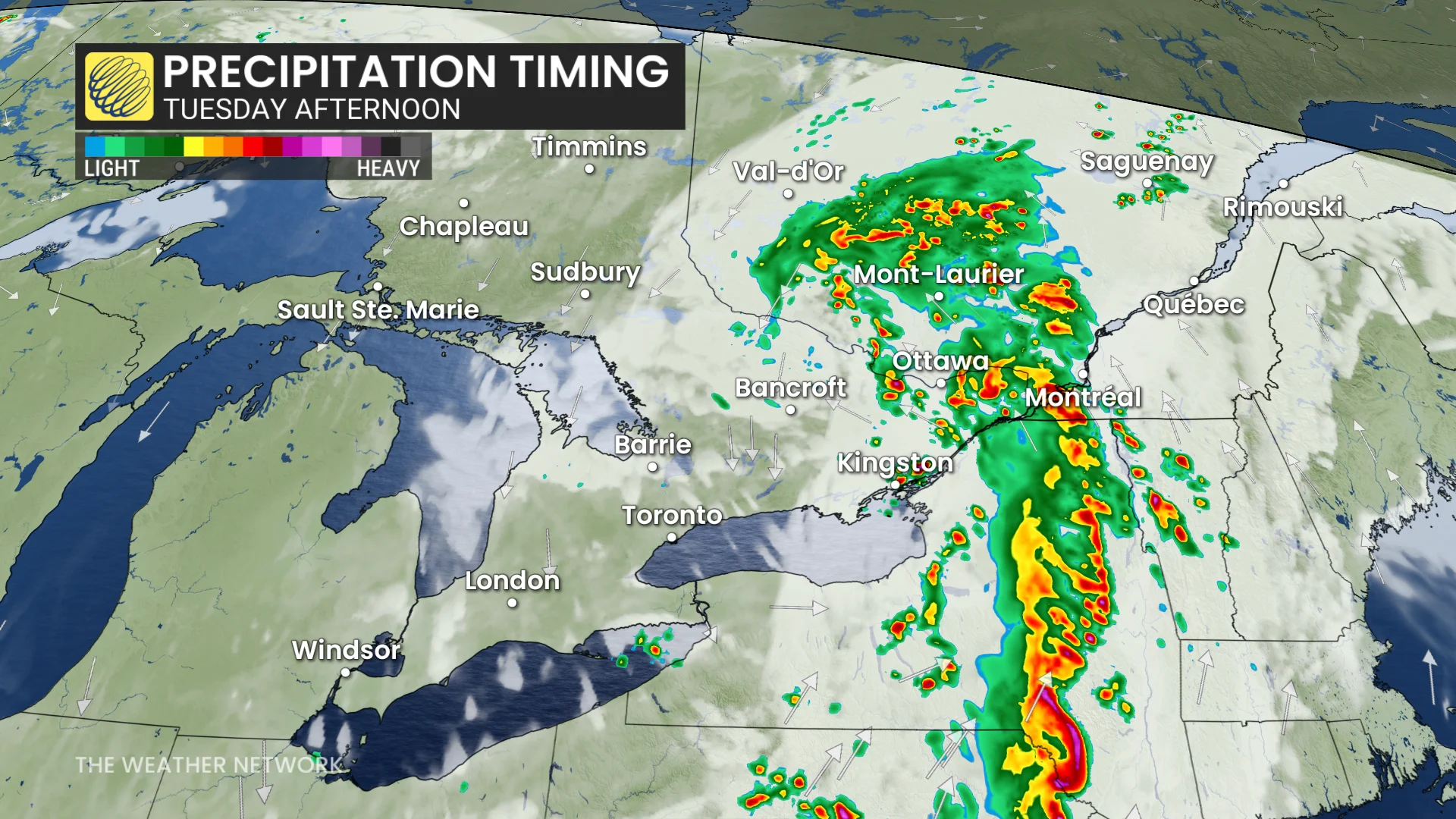
Showers and heavy downpours may continue overnight Tuesday into Wednesday, but the bulk of the storms will stay in Quebec.
WATCH: Three tips to protect against flooded basement damage
Stay with The Weather Network for the latest updates for Ontario.